
The ultimate guide to Quilotoa Lake / Exploring the emerald jewel of the Ecuadorian Andes
Quilotoa Lake travel guide / Hike the famous volcanic crater lake in Ecuador
Your guide to the wind-swept ridges of the Ecuadorian high páramo

BEN FINCH
The rugged backbone of the Ecuadorian Andes is home to some of the most dramatic landscapes on Earth, yet few spots capture the raw, untamed beauty of the region quite like Quilotoa Lake.
Situated in the wind-swept Cotopaxi province, roughly 179 kilometres south of Quito, this breathtaking body of water sits nestled inside a massive volcanic caldera. For the independent traveller who shuns the rigid schedules of tour buses and the collective rush of large groups, this region represents the absolute pinnacle of slow travel. It is a place where you can step off the well-trodden tourist track, breathe in the crisp mountain air at 3,900 metres above sea level, and immerse yourself in a landscape shaped by ancient geothermal forces and living indigenous traditions.
At Wheely Tyred, we believe that the best way to understand a destination is to explore it on your own terms, absorbing the finer details that standard itineraries leave behind. Whether you choose to base yourself in a quiet mountain village or wander across the ancient dirt tracks that weave through the deep canyons of the Central Andes, Quilotoa demands that you slow down. This comprehensive guide will equip you with everything you need to know to navigate this high-altitude paradise completely under your own steam.
High-altitude wonder / Essential encounters on the rim and loop
Navigating the dramatic craters and canyons of Cotopaxi requires an independent spirit and a steady, measured pace. Here are the defining elements of the Quilotoa experience for those exploring the high páramo under their own steam:
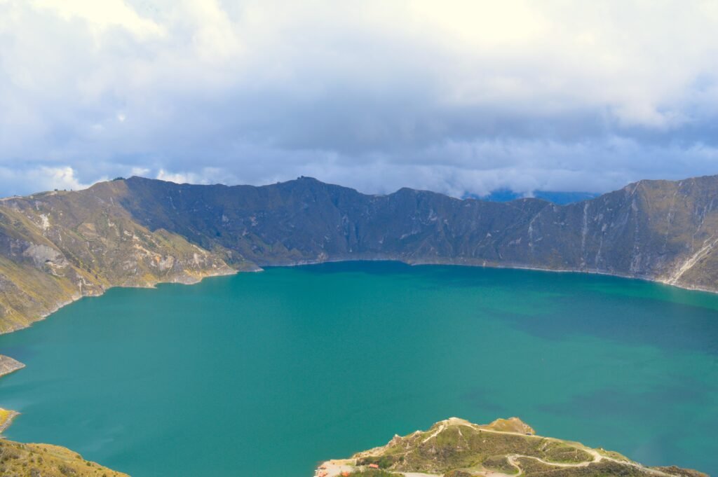
- The Emerald Caldera: A massive three-kilometre-wide crater lake formed by a cataclysmic volcanic collapse 800 years ago, renowned for its mineral-rich waters that shift from turquoise to deep green
- The Rim Hike: A rugged 7.5-kilometre trek along narrow, windswept ridges that provides uncompressed views of the Andean peaks and takes between three and five hours to complete
- The Shoreline Descent: A steep, 400-vertical-metre scramble to the water’s edge where the mountain wind falls silent, offering peaceful kayaking and a strenuous hike back to the top
- The Greater Quilotoa Loop: A self-guided network of ancient dirt tracks connecting remote communities such as Sigchos, Isinlivi, and Chugchilán across the deep Toachi River Canyon
- Zumbahua Market: An authentic Saturday morning gathering where locals from the high plains trade livestock, textiles, and produce, completely removed from the typical tourist trail
- Tigua Art Workshops: A vital cultural stopover celebrated for local artists who use chicken-feather brushes to paint vivid scenes of Andean folklore directly onto sheep hides
The Ecuadorian Sierra.
Get lost in the hills
The story behind the emerald caldera
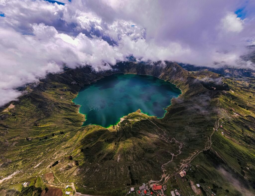
To truly appreciate the magnificence of the lake, one must understand its tumultuous geological past. Roughly 800 years ago, around the year 1280, the ancient Quilotoa volcano experienced a cataclysmic eruption. The sheer force of the explosion caused the entire volcanic cone to collapse inward, leaving a gaping caldera stretching three kilometres across. Over the centuries, this massive bowl gradually filled with water, creating the stunning crater lake that stands today.
The water itself is a shifting masterpiece of nature. Depending on the angle of the sun, the time of day, and the cloud cover drifting across the Andean sky, the lake transforms from a deep, glassy turquoise to a brilliant, phosphorescent emerald green. This remarkable colouration is caused by the heavy concentration of dissolved minerals, particularly sulphur and copper, trapped within the crater.
Local Kichwa-speaking communities have long held a deep spiritual connection to this water, and if you speak to the residents in the nearby village, they will often tell you that the lake has no bottom. While geologists have measured its depth at a staggering 250 metres, standing on the precipitous basalt rim looking down into the massive, silent expanse makes the local legend feel entirely plausible.
Conquering the Crater Rim Hike
For those who arrive at the caldera with a desire to test their boots and experience the landscape from every possible angle, the rim hike is an absolute masterclass in high-altitude trekking. The trail loops around the entire circumference of the crater, covering approximately 7.5 kilometres of rugged, undulating terrain. Unlike a standard valley walk, hiking the rim means navigating constant ascents and descents along narrow, windswept ridges, with the mirror-like water constantly visible on one side and the rolling farmland of the Cotopaxi backcountry on the other.
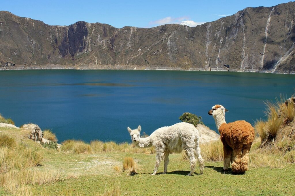
Completing the full loop typically takes between three and five hours, depending on your physical fitness and how often you pause to absorb the panoramic vistas. On a clear morning, the views extend far beyond the crater walls, offering glimpses of the snow-capped peaks of Cotopaxi and Iliniza Sur piercing the horizon. The true joy of undertaking this trek independently is the profound sense of solitude. On many weekdays, you can wander for hours passing no one else but the occasional stray mountain dog, a few hardy wildflowers swaying in the breeze, or a local farmer herding a small flock of sheep alongside a llama.
The thin air at this altitude makes every incline feel twice as steep, so it is essential to maintain a steady, measured pace. The path is subject to natural erosion, meaning certain sandy sections require careful footwork. However, the reward of conquering the highest viewpoints without a guide rushing you along is unmatched.
The Ecuadorian Amazon.
The most biodiverse place in the world
Descending to the water’s edge
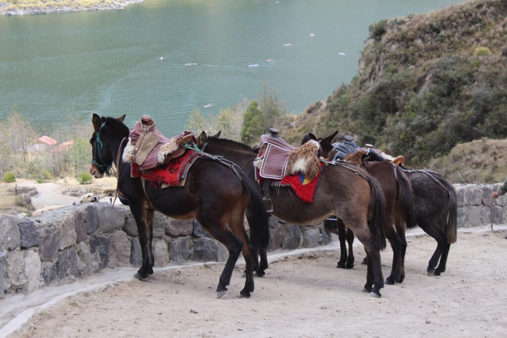
While looking down from the rim is a gasp-inducing experience, descending into the heart of the caldera offers an entirely different perspective. A well-worn trail leads from the main viewpoint near the village straight down to the shoreline, dropping roughly 400 vertical metres. The walk down is a relatively quick, gravity-assisted scramble taking between 30 and 45 minutes, though the sandy, loose earth requires a bit of concentration.
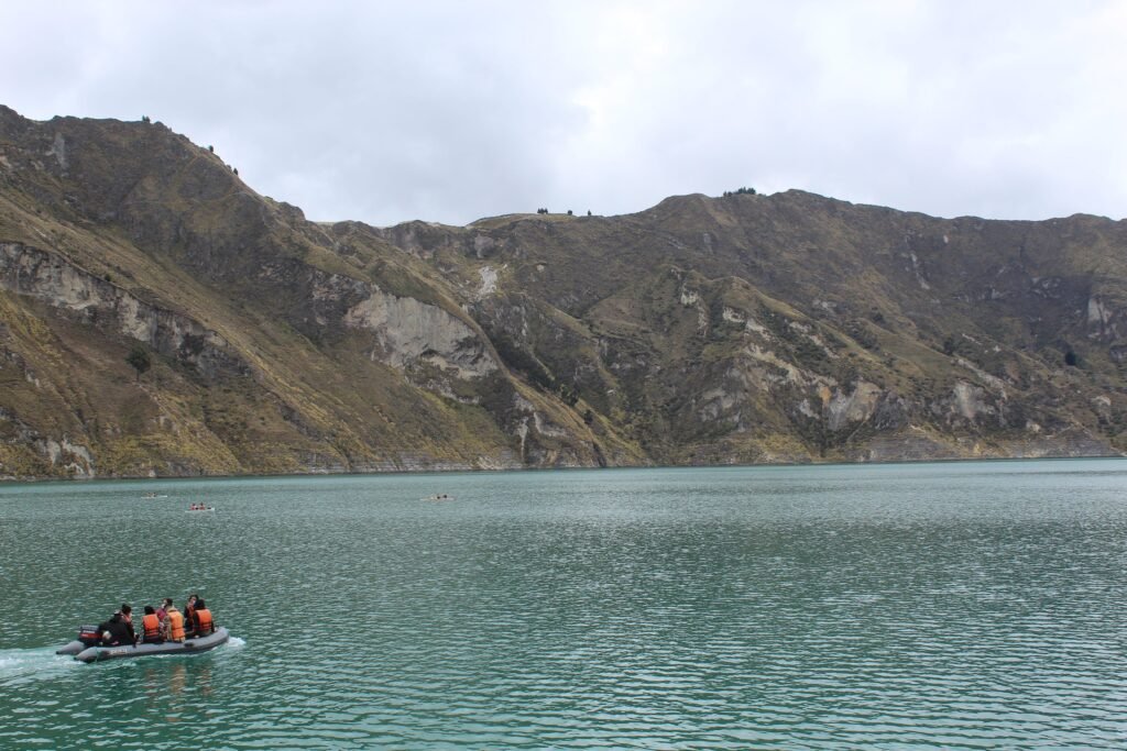
Once you reach the bottom, the ambient roar of the mountain wind completely vanishes, replaced by an eerie, tranquil stillness. The air down by the shore feels noticeably warmer, and the sheer scale of the surrounding basalt walls towering above you is humbling. Near the water’s edge, a small local cooperative offers basic kayak rentals, allowing you to paddle out onto the freezing, mineral-rich water. Just five minutes of gentle paddling reveals tiny bubbles of volcanic gas breaking the surface near the rocky edges, a subtle reminder of the geothermal energy still slumbering deep below.
The real challenge, of course, is the journey back up. Climbing out of the crater along the same steep, sandy track takes anywhere from an hour to ninety minutes of strenuous exertion. At nearly 4,000 metres of elevation, your lungs will be working overtime. For travellers who find the altitude too punishing, local indigenous handlers operate at the shore, offering the option to ride a mule back up to the rim for a small fee. Taking your time and climbing on your own feet, however, provides a profound sense of personal achievement that defines the independent travel experience.
Exploring the greater Quilotoa Loop
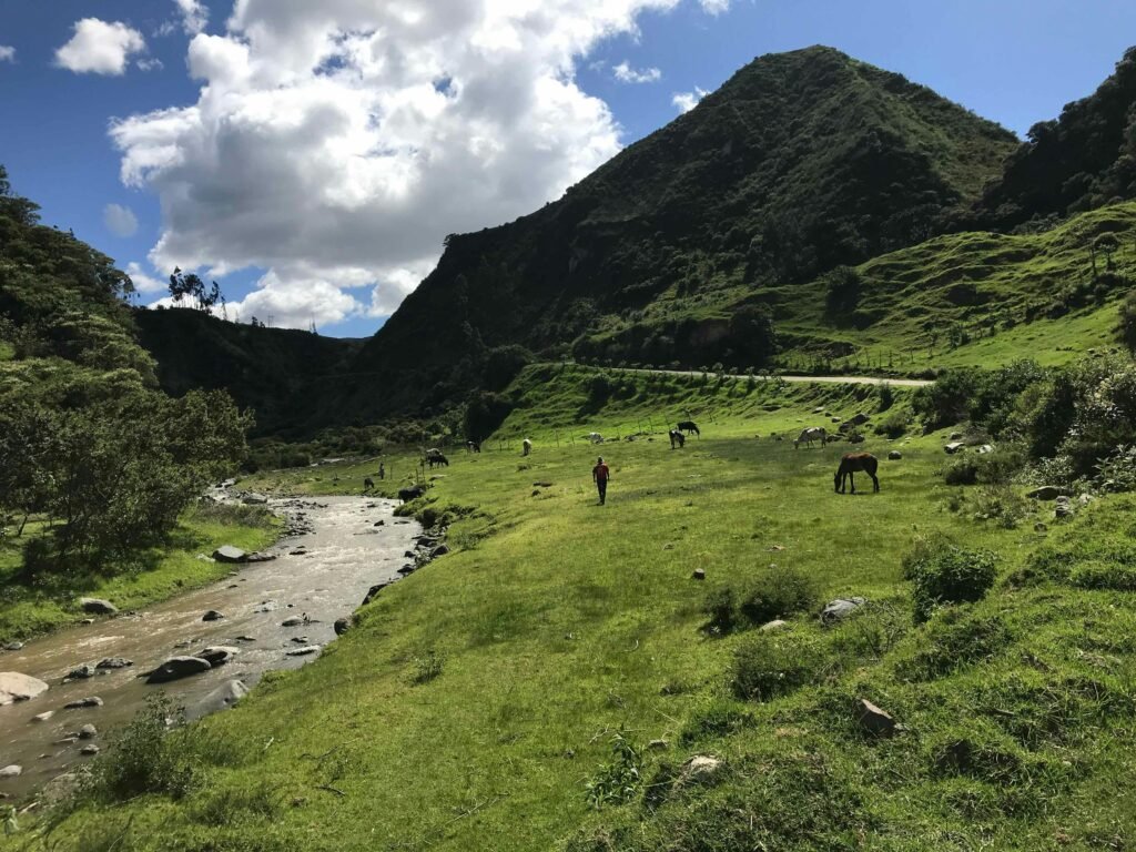
While the crater lake is undeniably the jewel in the regional crown, it represents just one chapter of a much larger story. The surrounding countryside is criss-crossed by a network of ancient dirt paths, single-track trails, and winding mountain roads collectively known as the Quilotoa Loop. This ring-shaped route connects several remote indigenous villages, carving its way through deep, dramatic canyons and traditionally cultivated hillsides where life has continued in much the same way for centuries.
For the independent traveller looking to experience true Andean authenticity, embarking on a multi-day trek along a section of the loop is highly recommended. A classic three-day self-guided itinerary typically begins in the larger town of Sigchos, located southeast of the lake. From here, you navigate a trail that drops down through lush patches of farmland and fields of mountain corn before crossing the concrete bridges that span the roaring river below.
The path then climbs steadily toward the peaceful village of Isinlivi, a tiny hamlet where you can stay in eco-friendly hostels, join a local cheese factory tour, or visit traditional wood-carving workshops. The following day, the trail leads you deeper into the dramatic Toachi River Canyon, offering spectacular views of rugged rock formations and windswept grasslands before arriving in Chugchilán. This slightly larger village serves as the final staging ground before the most challenging segment of the trek: a steep, dramatic scramble out of the canyon floor directly up to the crater rim of Quilotoa.
The beauty of exploring the loop independently is that it is not a wilderness backcountry trek requiring heavy camping gear. Instead, you can walk from village to village with a light pack, spending your evenings in locally run eco-lodges and hostels that provide a hot shower, a roaring wood fire, and a hearty highland meal for a remarkably modest price.
The Galápagos.
Ecuador’s Enchanted Isles
Immersing yourself in local Andean culture
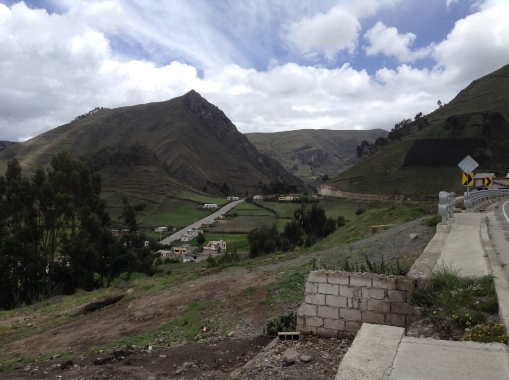
Beyond the physical geography, the Quilotoa region provides an unparalleled window into the vibrant cultural heritage of the Central Andes. The hillsides are dotted with traditional mud-brick homes and small patches of agricultural land, where indigenous Kichwa people cultivate potatoes, broad beans, and quinoa on impossibly steep slopes.
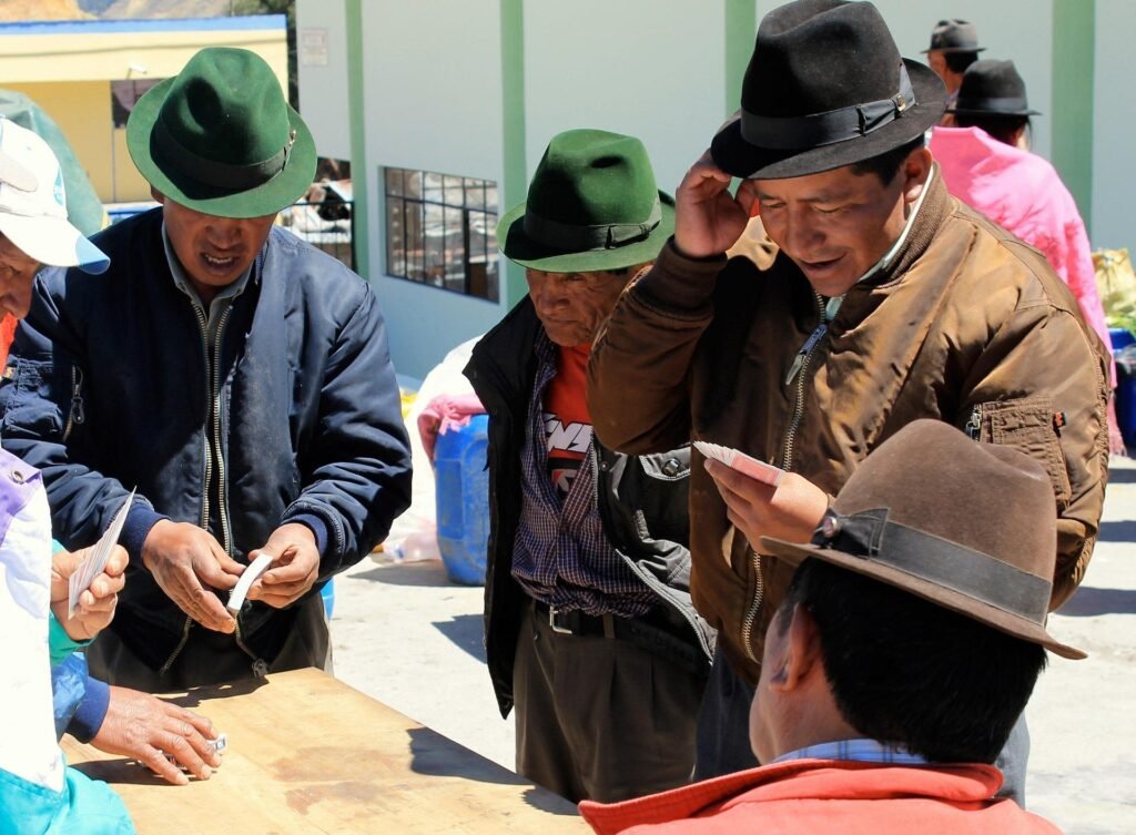
To experience the true pulse of rural Andean life, plan your journey to coincide with the local market days. Just a few kilometres from the crater sits the village of Zumbahua, which hosts a highly authentic Saturday morning market. This is not a souvenir bazaar designed for tourists; it is a genuine community gathering where locals from the surrounding high páramo arrive dressed in vibrant traditional ponchos and felt hats to trade livestock, mountain produce, hand-woven textiles, and essential supplies.
Another essential cultural stop along the loop is the tiny community of Tigua, situated on the road between Latacunga and Zumbahua. Tigua is world-renowned for its unique community of indigenous artists who paint vivid, colourful scenes of Andean folklore, festivals, and volcano landscapes directly onto sheep hides using brushes fashioned from chicken feathers. Stopping by a local workshop allows you to appreciate this self-taught art form firsthand and support the preservation of local history.
Practical mastery for the autonomous traveller
Navigating the high altitudes of the Ecuadorian highlands requires careful preparation to ensure your journey remains smooth and enjoyable. Here are the essential considerations for planning your self-guided adventure:
- Acclimatisation: Do not attempt to hike around Quilotoa immediately after arriving in Ecuador. Spend at least two or three days adjusting to the altitude in lower cities such as Quito or Latacunga. Drinking plenty of water and avoiding overexertion during your first few days is key to preventing altitude sickness
- Weather Volatility: The mountain weather in Cotopaxi province is notoriously unpredictable. A bright, sunny morning can instantly transform into a cold, misty afternoon with sudden downpours. Dress in versatile layers, including a breathable thermal base, a warm fleece, and a fully waterproof outer jacket. Do not forget sun cream and a wide-brimmed hat, as the equatorial sun is incredibly intense at 3,900 metres
- Financial Preparation: The rural villages along the Quilotoa Loop operate entirely on cash, and there are absolutely no cash machines or banks in the smaller towns like Isinlivi, Chugchilán, or Quilotoa village itself. Ensure you carry plenty of physical US dollars (the official currency of Ecuador) in small denominations, as local shopkeepers and hostel owners rarely have change for large notes
- Timing Your Visit: While the region can be visited all year round, the dry season for the Ecuadorian highlands runs from June to September. This window offers the highest probability of clear skies and crisp, panoramic mountain views. However, because this is also the peak travel season, it is wise to secure your eco-lodge accommodation in advance
The Ecuadorian Coast.
Where you’ll find the very best food
The freedom of the open trail
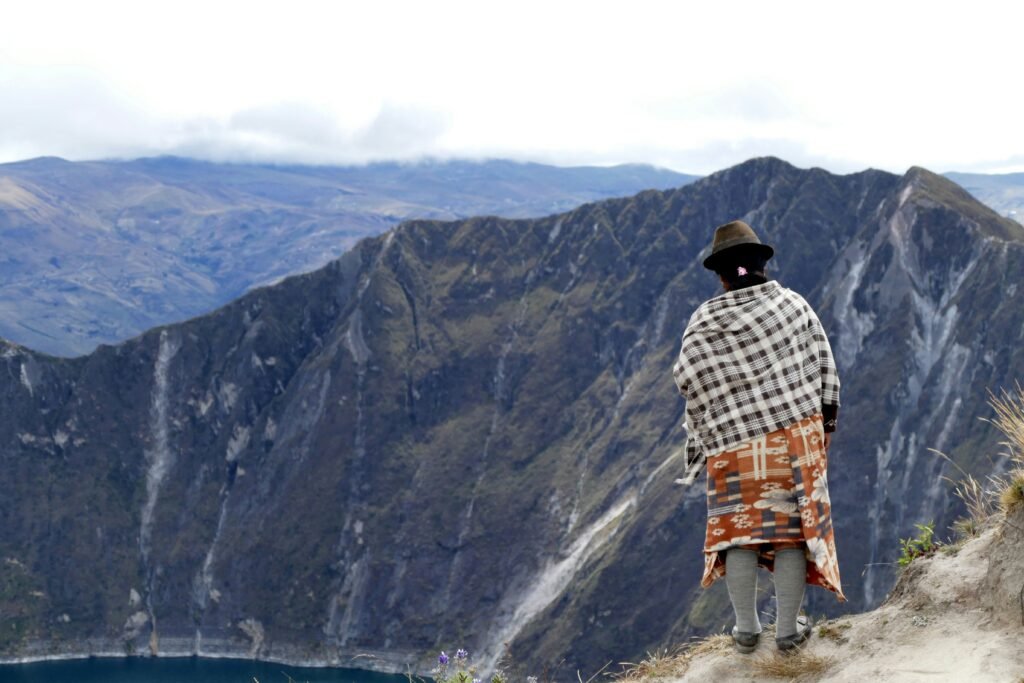
Quilotoa Lake is far more than just a beautiful photo opportunity to be ticked off a list; it is a profound reminder of the rewards that come from slow, autonomous travel. When you choose to explore this volcanic landscape at your own pace, you grant yourself the freedom to sit on the crater rim for hours watching the colours shift, to share a conversation with a local weaver, or to take a quiet detour through a dramatic river canyon.
By stepping away from the restrictions of group tours, you discover the true spirit of the Andes—a world of quiet majesty, ancient geology, and resilient communities. Pack your bags, leave the timetables behind, and let the winds of the high páramo guide your next great adventure.
Frequently asked questions about visiting Quilotoa
It is essential to spend at least two or three days acclimatising to the elevation in lower areas such as Quito or Latacunga before attempting any hiking around the lake. Staying well-hydrated and keeping a slow, deliberate pace during the ascents will help prevent altitude sickness.
The dry season in the Ecuadorian highlands runs from June to September. This window gives you the best chance of clear morning skies and crisp, panoramic mountain views, though it is also the busiest time for the local eco-lodges.
No, the rural villages along the loop operate entirely on cash. There are no cash machines or banks in Isinlivi, Chugchilán, or Quilotoa village. You must carry physical US dollars in small denominations, as local shopkeepers rarely have change for large notes.
The weather in Cotopaxi province is notoriously volatile. You should dress in versatile layers, including a breathable thermal base, a warm fleece, and a fully waterproof jacket. High-factor sun cream and a hat are also mandatory due to the intensity of the equatorial sun at 3,900 metres.
The 400-metre vertical climb back up the sandy track to the rim takes up to 90 minutes of heavy exertion. For travellers who struggle with the thin air, local indigenous handlers operate at the shoreline and offer mules to ride back up to the village for a small fee.
Ecuador.
Pure wonder on the equator.


