
Laguna de Cuicocha safety guide 2027 / Hiking, altitude, and transport in Imbabura
Complete 2027 Ecuador travel safety advice for hiking the Cuicocha crater rim, altitude sickness, and reliable transport from Cotacachi
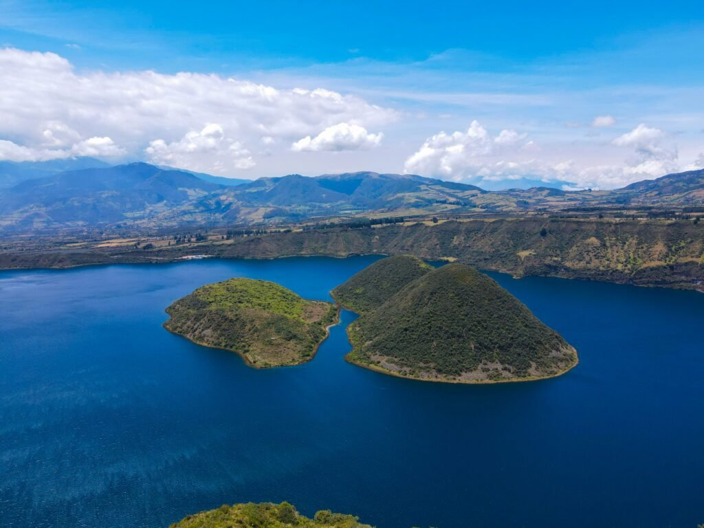
Paths wind around a volcanic caldera that demands respect and preparation

BEN FINCH
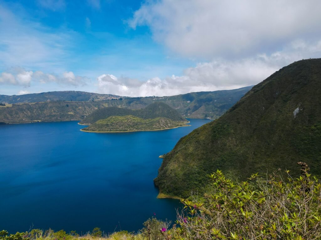
The glittering emerald water of Laguna de Cuicocha remains one of the most striking natural landmarks in northern Ecuador. Formed by a massive volcanic eruption roughly 3,100 years ago, this deep crater lake sits at the foot of Cotacachi volcano within the Reserva Ecológica Cotacachi-Cayapas.
The 14-kilometre rim loop offers panoramic vistas across Imbabura Province, taking walkers through high-altitude páramo vegetation, native dwarf forests, and ceremonial sites revered by local Kichwa communities.
As a self-guided day trek easily accessible from Otavalo or Cotacachi, the trail attracts hikers of all experience levels. Building upon our original 2026 safety overview, this updated 2027 guide provides refreshed, practical intelligence to help travellers navigate the physical challenges, unpredictable Andean microclimates, and logistical details required for a secure outing.
At Wheely Tyred, our focus is ensuring that every adventure on foot or two wheels is backed by solid, on-the-ground safety knowledge.
Key takeaways for hiking Laguna de Cuicocha
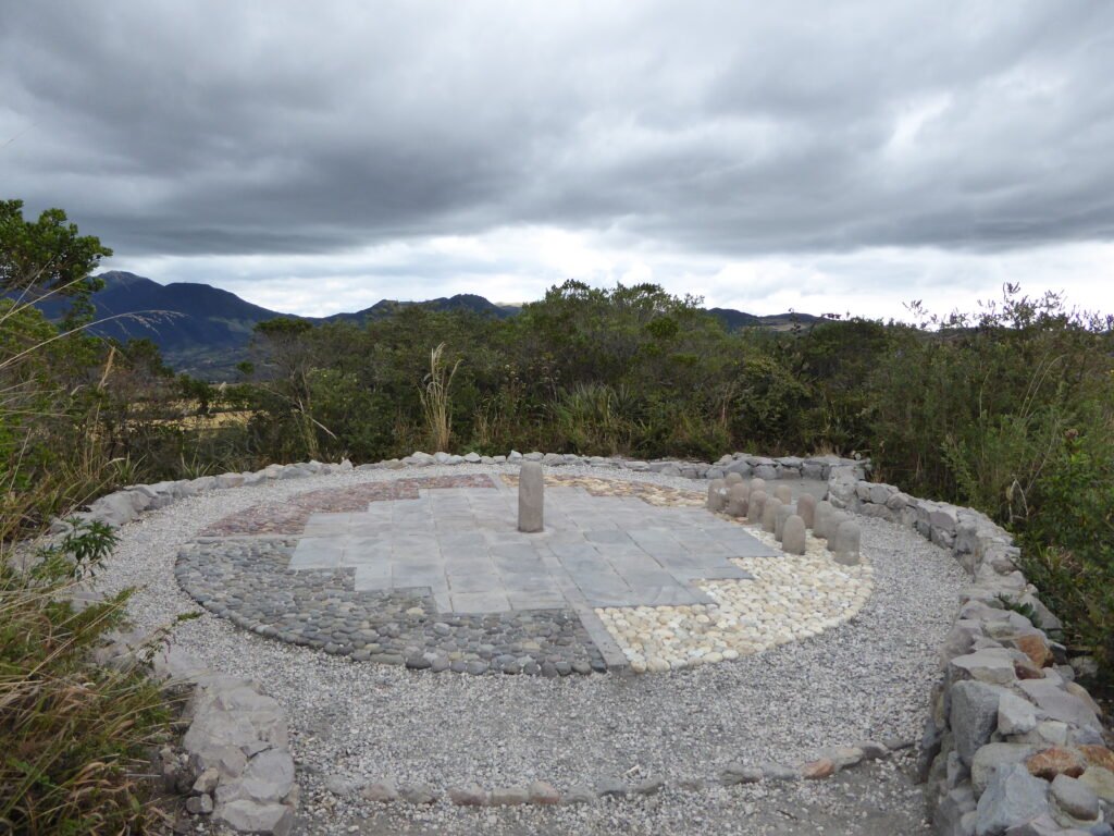
Exploring the high-altitude volcanic crater rim requires solid preparation, steady pacing, and clear return logistics. Here are the fundamental safety and operational details every independent hiker should know before setting off from Cotacachi.
- Crater trail registration: Hikers must register their full names and passport details at the ranger station upon arrival, establishing an essential safety log before embarking on the loop
- High-altitude preparation: Sitting between 3,100 metres and 3,512 metres above sea level, the rim path demands at least two full days of prior acclimatisation in Quito, Otavalo, or Cotacachi
- Return transport planning: Taxis do not wait at the remote visitor centre in the afternoon; hikers must arrange a specific return pick-up time and swap contact details with their driver in Cotacachi
- Ecuadorian weather strategy: Mountain weather shifts rapidly by early afternoon, making an early departure around 8am essential to avoid dense fog, sudden rain, and cold winds
- Cultural and environmental respect: The islands of Isla Teodoro Wolf and Isla Yerovi inside the caldera are sacred Kichwa sanctuaries and protected nature reserves that are strictly off-limits
- Equatorial sun protection: Thin air and intense high-altitude solar radiation make broad-spectrum sunscreen, protective eyewear, a wide-brimmed hat, and two litres of water mandatory
Laguna de Cuicocha.
Lake of the guinea pig
Safety landscape in Imbabura province and trail security
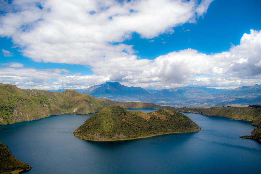
Imbabura Province remains one of the more tranquil regions for international visitors in Ecuador. While urban centres such as Quito or coastal transit hubs require heightened awareness due to elevated crime levels in recent years, the mountain communities surrounding Cotacachi and Otavalo maintain a strong tradition of local hospitality and safety.
Violent crime targeting hikers along the Laguna de Cuicocha rim trail is exceptionally rare. The perimeter of the lake falls within a protected reserve managed by environmental rangers.
Upon arrival at the main visitor area, all hikers are required to register their names and passport details at the ranger station. This registration serves as an essential safety log in case an individual or group fails to return before nightfall.
Opportunistic petty theft remains the primary security concern. Because the 14-kilometre trail covers remote terrain where you may walk for an hour without encountering another person, discreet personal security is recommended.
- Conceal valuables: Keep expensive DSLR cameras, smartphones, and extra cash stored inside your daypack when actively walking. Avoid hiking with visible gear dangling around your neck
- Secure pack zips: Always close zippers on external backpack pockets, especially when pausing at designated lookout shelters or resting near the park entrance
- Stay on marked tracks: Do not venture off the established path onto private agricultural property or steep inner crater walls, where loose volcanic rock creates severe fall hazards
The Ecuadorian Sierra.
Get lost in the hills
Considerations for solo, female, minority, and LGBTQ+ travellers
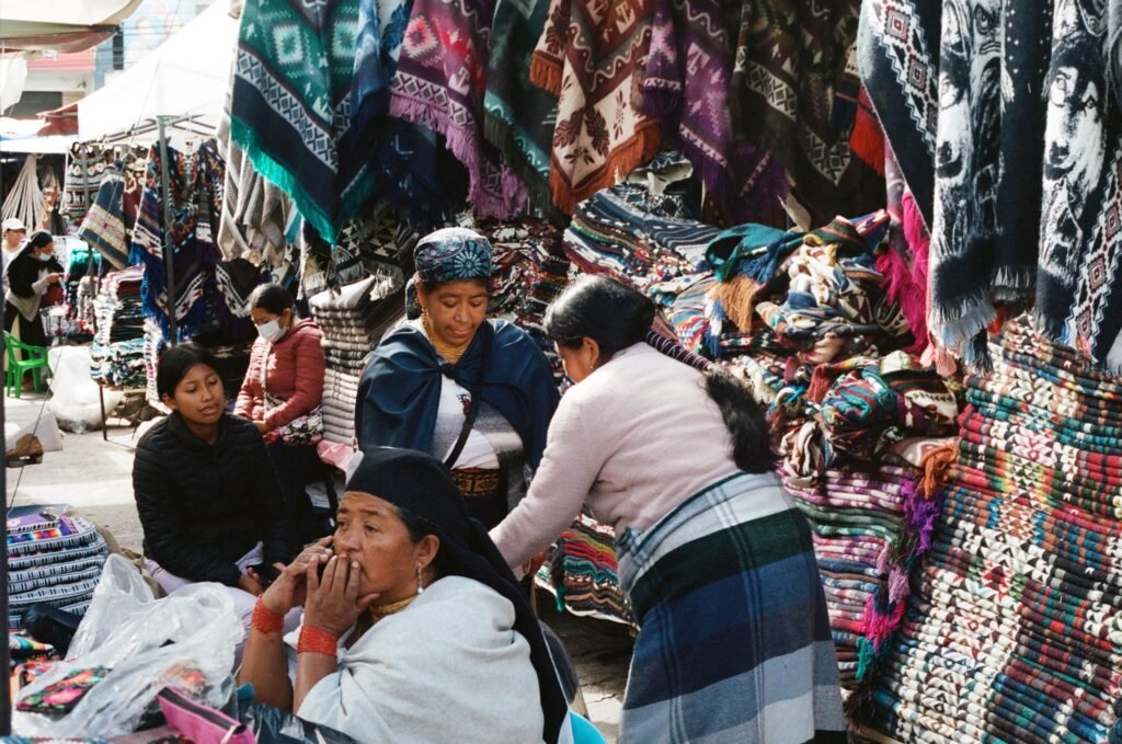
Navigating the Ecuadorian highlands as an independent traveller requires understanding both the regional social norms and the physical environment. Imbabura Province is generally considered one of the safer regions in the country for international visitors, but experiences can vary depending on individual identities and group dynamics.
Solo travellers
The single-track path around the crater rim is clear and well-defined, making navigation straightforward for solo walkers. However, because long stretches of the 14-kilometre loop are isolated, self-reliance is critical.
- Itinerary logging: Always inform your accommodation host or a trusted contact of your planned departure time and expected return. Registering at the Ministry of Environment ranger station at the trailhead is mandatory, providing a safety net if weather conditions deteriorate or an emergency occurs
- Communication and navigation: Mobile signal drops along the western and northern edges of the caldera. Carry a fully charged phone with offline topographical maps pre-loaded, alongside a portable power bank
- Trail pace: Walking alone means you set the pace, but elevation can cause fatigue faster than anticipated. Do not hesitate to turn back if early signs of altitude sickness or unexpected weather appear
Female travellers
Female hikers generally report a welcoming, low-hassle environment in Cotacachi and around the Cuicocha reserve. Street harassment (catcalling) is considerably less common in rural Andean towns than in major transit hubs such as Quito or Guayaquil, though standard safety precautions remain relevant.
- Transit security: When travelling between Otavalo, Cotacachi, and the lake, use official yellow taxis with visible municipal registration decals. Avoid accepting rides from unmarked private vehicles outside bus terminals or park gates
- Group pairing: While the trail is safe for solo female walkers during peak morning hours (08.00 to 12.00), pairing up with fellow travellers met at local hostels adds an extra layer of security on quiet afternoon descents
- Arrival timing: Plan your hike to ensure you return to the visitor centre before 15.00, well before dusk, when transport becomes sparse, and temperatures plummet
Indigenous and ethnic minority travellers
Imbabura is Ecuador’s indigenous heartland, home to the Kichwa nation. The relationship between local residents, Afro-Ecuadorian communities in the nearby Chota Valley, and international visitors is grounded in mutual commerce and cultural exchange.
- Cultural awareness: Laguna de Cuicocha is a sacred site. The two central islands, Isla Teodoro Wolf and Isla Yerovi, are off-limits sanctuaries where ritual bathings occur during the solstice festival of Inti Raymi in June. Visitors should treat the surrounding trail and ceremonial platforms with respect
- Local interactions: Direct racial hostility targeting international minority travellers is rare in this region. A respectful demeanour and standard Spanish greetings (buenos días or buenas tardes) facilitate positive interactions with park workers, artisans, and transport operators. Always request permission before photographing local residents, particularly elders and children
LGBTQ+ travellers
Ecuador made significant legal strides by legalising same-sex marriage in 2019 and maintaining constitutional anti-discrimination protections. However, social attitudes remain conservative across rural highland communities compared to urban centres such as Quito or Cuenca.
- Public displays of affection: While LGBTQ+ travellers face no legal risks or overt hostility in Imbabura Province, discreet behaviour regarding public displays of affection is recommended in small towns such as Cotacachi and within rural reserve areas to avoid unnecessary attention
- Accommodation and hospitality: Guesthouses, boutique hotels, and hostels in Cotacachi and Otavalo regularly host international LGBTQ+ travellers without issue. Booking through established independent platforms or recommended eco-lodges ensures an inclusive and welcoming environment
The Galápagos.
Ecuador’s Enchanted Isles
Respecting local customs
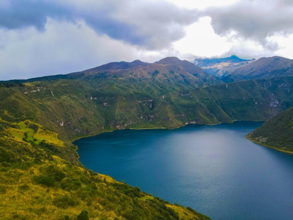
Respect for local indigenous customs is vital for all visitors. Laguna de Cuicocha is a sacred space for the Kichwa people, who gather here during the Inti Raymi festival in June for ritual bathing.
The two islands inside the lake, Isla Teodoro Wolf and Isla Yerovi, are protected sanctuaries and strictly off-limits to visitors. When passing local residents along rural access roads, a polite greeting in Spanish (buenos días or buenas tardes) fosters positive local interactions. Always ask permission before photographing residents, particularly children or elders.
Altitude sickness and physical hazards at high elevation
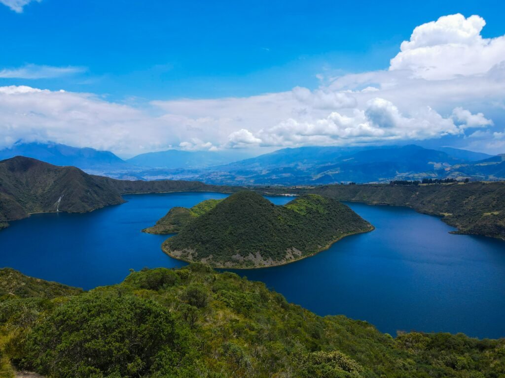
The primary obstacle at Laguna de Cuicocha is not trail technicality or crime; it is the elevation. The surface of the lake sits at approximately 3,100 metres above sea level, while the highest points of the crater rim path reach 3,512 metres. Walking a 14-kilometre loop with continuous short, steep ascents and descents at this altitude taxes the cardiovascular system significantly.
Acute Mountain Sickness (AMS) can affect anyone, regardless of physical fitness. Mild symptoms include headaches, lightheadedness, shortness of breath, and slight nausea.
Acclimatisation strategy
- Spend time at elevation first: Do not attempt to hike Cuicocha on the day you arrive in the highlands from sea level. Spend at least two full days acclimatising in Quito (2,850 metres), Otavalo (2,550 metres), or Cotacachi (2,400 metres)
- Pace yourself early: The trail begins with an immediate climb regardless of which direction you walk. Maintain an easy, conversational pace to avoid spiking your heart rate
- Know when to descend: If severe dizziness or persistent nausea develops, stop, rest in the shade, and turn back toward the visitor centre. Do not attempt to push through severe altitude symptoms on remote sections of the rim
Equatorial sun exposure and dehydration
At 0 degrees latitude and more than 3,000 metres above sea level, solar radiation is intense, even under full cloud cover. Sunburn and heat exhaustion can occur rapidly without proper protection.
Apply broad-spectrum sunscreen before departing, wear UV-blocking sunglasses, and cover up with a wide-brimmed hat or cap. Dehydration accelerates fast in thin mountain air.
Because there are no shops, water taps, or refreshment stalls along the 14-kilometre circuit, every hiker must carry at least two litres of water alongside energy-dense snacks such as nuts, dried fruit, or panela sweets.
The Ecuadorian Amazon.
The most biodiverse place in the world
Transport logistics and securing your return ride
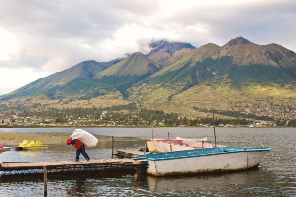
Logistical miscalculations are among the most common issues reported by independent travellers visiting the lake. While getting from Otavalo or Cotacachi to the trailhead is simple, securing return transport in the late afternoon requires advance planning.
Outbound travel
- Bus from Otavalo to Cotacachi: Local buses depart regularly from the main terminal in Otavalo to Cotacachi, taking roughly 20 minutes
- Taxi from Cotacachi to Cuicocha: From the central square or bus terminal in Cotacachi, hire an official taxi to take you up to the park entrance or visitor centre. The drive takes about 15 to 20 minutes
The return transport pitfall
Public buses do not run directly up to Laguna de Cuicocha. While taxis frequently drop visitors off in the morning, they do not park and wait at the visitor centre unless pre-arranged. Hikers who complete the 5-hour circuit late in the afternoon often find an empty parking area, leaving them facing an arduous 12-kilometre walk down a paved mountain road back toward Cotacachi.
To guarantee a safe, hassle-free return, arrange a fixed pick-up time with your driver when you arrive in the morning. Exchange WhatsApp details so you can message them if you complete the hike faster or slower than expected. Expect to pay a fair round-trip fare ($12 to $15 USD in total, depending on starting point).
Always use official, licensed taxis. In Ecuador, official taxis feature yellow paintwork, municipal registration decals displayed on the doors, and yellow licence plates. Avoid entering unmarked private vehicles offering rides outside park gates.
Carry small banknotes ($1, $5, and $10 notes). Taxi drivers and rural shop vendors near the reserve entrance rarely carry change for $20 or $50 bills.
Weather exposure and trail conditions along the caldera
Weather in the northern Ecuadorian Andes changes with little warning. Crisp, clear morning skies can turn into dense mountain fog, biting wind, and heavy rainfall by mid-afternoon.
Timing your hike
To avoid the worst of the weather, begin your trek early. Aim to arrive at the trailhead by 08:00 or 08:30. Starting early allows you to complete the 4.5- to 5.5-hour circuit before afternoon cloud cover rolls over Cotacachi volcano, obscuring views and dropping temperatures rapidly.
Circuit directions
The trail can be hiked in either direction, though starting anti-clockwise is generally recommended.
- Anti-clockwise: Begins near the park entrance gate. You tackle a series of steep, wooden steps immediately, gaining elevation quickly while your legs are fresh. The second half of the loop features a more gradual descent toward the visitor centre
- Clockwise: Begins behind the visitor centre gardens. The initial climb is gentler, but you face a steep, knee-jarring descent down slick wooden steps at the very end of your hike
Gear and clothing
Proper footwear is essential. The path consists of loose volcanic shale, exposed roots, and clay sections that become exceptionally slick when wet. Wear broken-in hiking boots or trail running shoes with aggressive tread.
Layering is the key to staying comfortable. Pack a breathable base layer, an insulating fleece mid-layer, and a reliable waterproof, windproof outer jacket. Pack a lightweight beanie and gloves; when cold winds sweep across the exposed rim at 3,500 metres, temperatures drop fast.
The Ecuadorian Coast.
Where you’ll find the very best food
Emergency readiness and navigation

Mobile phone coverage across the caldera is inconsistent. Signal is generally present on the eastern rim closer to Cotacachi, but drops off completely along the western and northern edges behind the lava domes.
Before leaving your accommodation, download an offline mapping application with topo layers covering Imbabura Province. The path around Cuicocha is well-defined, but offline maps provide peace of mind and exact distance checks.
Save emergency numbers on your phone:
- National Emergency Service: 911
- Cotacachi Ranger Station / Reserve Guard: Accessible via the visitor centre registration desk upon entry
If dense fog rolls in, reducing visibility to a few metres, stay on the main track and move slowly. The inner rim drops off steeply into the lake; remaining on the marked trail ensures you stay well clear of unstable edges.
Essential packing list for 2027
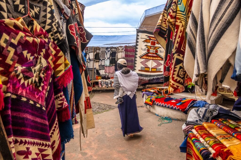
To ensure a safe and enjoyable day on the crater rim, review this checklist before departing:
- Passport or photo identification for the ranger registration desk
- Minimum 2 litres of drinking water per person
- High-calorie snacks or packed lunch
- Broken-in hiking boots with good grip
- Waterproof outer jacket and windproof layers
- Warm hat, sun hat, and broad-spectrum sunscreen
- Fully charged smartphone with offline maps downloaded
- Portable power bank and charging cable
- Sufficient small cash in US dollars ($1, $5, and $10 notes)
- Basic personal first aid kit containing blister plasters and rehydration salts
By taking time to prepare for high elevation, planning return transport, and respecting changing mountain weather, a trek around Laguna de Cuicocha offers one of the most rewarding day hikes in Ecuador.
Quito.
Explore the Middle of the World
Complete the Cuicocha crater rim with confidence
Read this far?
Walking the rim of Laguna de Cuicocha offers one of the most memorable single-day adventures in the Ecuadorian Andes. By pairing proper physical preparation with an understanding of local highland conditions, you ensure that your focus stays squarely on the extraordinary views across Imbabura Province rather than avoidable logistical snarls.
Whether you choose to hike the anti-clockwise trail to tackle the steepest climbs first or opt for a gentler initial ascent, respecting the environment remains paramount. Staying on established footpaths protects delicate páramo flora, prevents erosion along steep caldera drops, and maintains positive relations with nearby Kichwa communities who safeguard these ancestral lands.
With your return ride pre-arranged in Cotacachi, plenty of water in your pack, and early morning sunshine lighting up the turquoise lake, Cuicocha proves that independent travel in northern Ecuador is both accessible and immensely rewarding. Pack carefully, pace your steps at elevation, and enjoy the ride.
Affiliate Disclaimer: Some of the links on Wheely Tyred are affiliate links. If you click through and make a booking or purchase, we may earn a small commission at no extra cost to you. We only recommend gear, tours, stays, and services we genuinely use, trust, and stand behind — our editorial independence always comes first. These commissions help keep our independent cycling guides and travel stories free to read. You can also buy me a coffee here — thanks for supporting the ride!
Frequently asked questions about Laguna de Cuicocha safety
Take a short local bus from Otavalo bus terminal to Cotacachi, which takes around 20 minutes. From Cotacachi town centre or bus terminal, hire a licensed yellow taxi directly to the Cuicocha visitor centre entrance, which takes roughly 15 minutes and costs about $5 USD one way.
No guide or paid permit is required for the main 14-kilometre crater rim loop. However, all visitors must register their name and passport number at the Ministry of Environment ranger station at the trailhead for safety tracking before starting the hike.
The full circuit typically takes between four and six hours depending on your fitness and acclimatisation level. Hiking anti-clockwise is recommended as it allows you to conquer the steepest wooden staircases early in the trek while your legs are fresh.
Yes, elevation poses the main challenge along the rim, which reaches 3,512 metres above sea level. It is essential to spend two or three days acclimatising at high elevations such as Quito, Otavalo, or Cotacachi before attempting the walk, and to carry at least two litres of water per person.
Swimming or walking on the two islands, Isla Teodoro Wolf and Isla Yerovi, is strictly prohibited. These lava domes are ecological reserves and sacred indigenous sites for the local Kichwa people. Short boat tours around the islands operate from the main pier near the park entrance, but visitors cannot disembark.
Public transport does not serve the lake directly, and taxis rarely wait at the parking lot in the afternoon. You should always arrange a fixed return time and price with your taxi driver in the morning and swap phone numbers on WhatsApp so you can contact them when you finish.
Ecuador.
Pure wonder on the equator.


