
Laguna de Cuicocha safety guide / How to hike Ecuador’s volcanic crater lake without risk
Laguna de Cuicocha Ecuador hiking safety, altitude advice, and transport guide
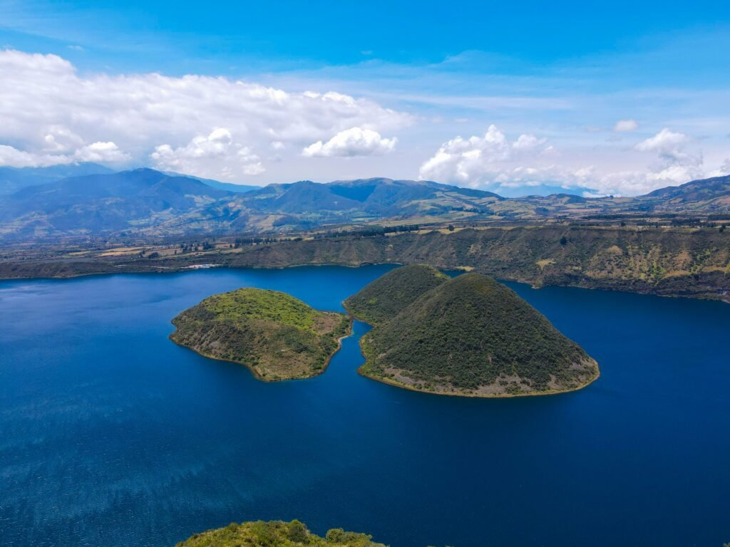
Rim trails, high altitudes, and unspoiled Andean vistas

BEN FINCH
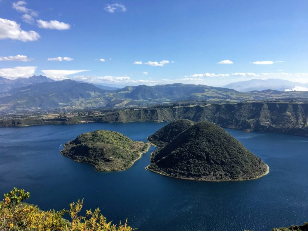
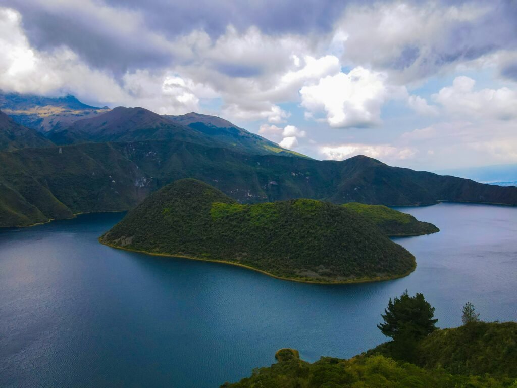
Tucked into the northern highlands of Ecuador beneath the shadow of Volcán Cotacachi, Laguna de Cuicocha is one of the most breathtaking geological wonders in South America. Formed by a massive eruption thousands of years ago, this 3 km-wide caldera holds a deep, highly alkaline lake surrounding two steep volcanic islets.
While many day-trippers only stop briefly at the main lookout after visiting the market town of Otavalo, taking on the full 14 km rim trek offers an unbeatable Andean experience.
However, trekking around a high-elevation crater rim brings distinct physical and environmental challenges. From managing altitude sickness to securing return transport along quiet mountain roads, staying informed ensures your journey remains rewarding and hassle-free.
Here is everything you need to know about staying safe around Laguna de Cuicocha.
Essential takeaways for the Cuicocha crater circuit
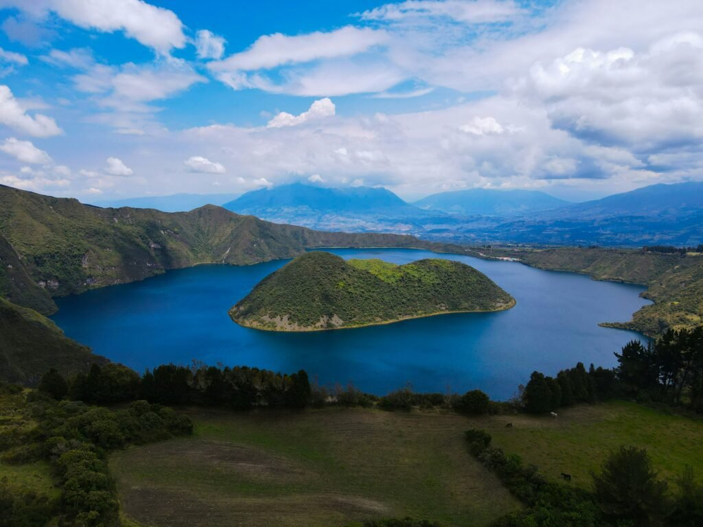
Trekking around the crater rim of Laguna de Cuicocha is an unforgettable Andean adventure, provided you respect the elevation and prepare for unpredictable mountain weather. Here are the core insights and practical takeaways from our safety guide to help you navigate the trail with complete peace of mind.
- Altitude Management: Spend at least two days acclimatising in nearby Quito, Otavalo, or Cotacachi to comfortably manage elevations reaching up to 3,512 metres along the crater rim
- Weather Preparation: Start your trek by 08:00 to complete the four-to-five-hour loop before dense afternoon fog and heavy rainfall roll across the caldera
- Return Transport Strategy: Pre-arrange a fixed pick-up time with a licensed Cotacachi or Otavalo taxi driver, as return vehicles rarely wait at the remote visitor centre parking area
- Footwear and Layers: Gear up with broken-in hiking boots, a waterproof outer shell, and warm accessories to handle loose shale, sudden mud, and sharp wind chills on exposed ridges
- Cultural Respect: Treat the volcanic lake as a sacred Indigenous site by refraining from swimming, leaving no trace along the path, and supporting local highland communities thoughtfully
- Personal Safety: Register at the ranger station on arrival, keep high-value electronics tucked inside your daypack, and maintain standard vigilance against opportunistic petty theft
Laguna de Cuicocha.
Lake of the guinea pig
Altitude and environment / Navigate high-elevation hazards
The primary challenge at Laguna de Cuicocha is not crime or complex trail technicality; it is the elevation. The surface of the lake lies at roughly 3,100 metres above sea level, with the highest points of the crater rim trail reaching 3,512 metres. At this altitude, the air contains significantly less oxygen, which can affect hikers who have recently arrived from lower elevations.
Acute Mountain Sickness, locally known as soroche, can manifest through mild headaches, nausea, dizziness, and sudden fatigue. To minimise risk:
- Spend at least two days acclimatising in Quito, Otavalo, or Cotacachi before attempting the full circuit
- Hydrate continuously with water or traditional coca tea, and avoid alcohol the evening before your trek
- Pace yourself on steep ascents; the trail starts with a firm incline through grassy meadows, which can quickly drain your stamina if taken too fast
- Carry high-energy snacks such as nuts, dried fruit, or panela to keep your blood sugar balanced
Solar radiation at this latitude and elevation is exceptionally strong, even on overcast days. Apply broad-spectrum sunscreen before setting off, wear UV-blocking sunglasses, and wear a broad-brimmed hat. Dehydration occurs much faster in thin mountain air, so carry a minimum of two litres of water per person, as there are no refreshment stalls along the 14 km path.
Trail navigation and terrain / Manage rim exposure and weather shifts
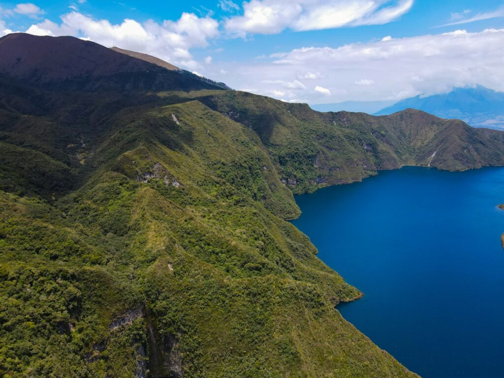
The circuit trail around Laguna de Cuicocha, often called Sendero Los Arrayanes, is generally well-maintained and marked, but it demands proper footing and awareness. Walking clockwise or anti-clockwise offers spectacular views, but the rim terrain features narrow dirt paths, loose gravel, and sudden drops on one side.
Weather in the Ecuadorian Andes can change rapidly. Bright morning sunshine can yield to dense mountain fog, locally called bruma, or heavy rainfall by midday. When low clouds roll across the crater, visibility can drop to less than 10 metres within minutes, making exposed sections of the rim trail treacherous.
To navigate the terrain safely:
- Wear sturdy, broken-in hiking boots with good tread to handle muddy sections and loose shale
- Dress in versatile layers. A breathable base layer, an insulating mid-layer, and a reliable waterproof outer shell are essential
- Pack a light pair of gloves and a fleece hat, as temperatures drop sharply when the wind picks up across the exposed ridges
- Download offline mapping applications before departing town, as mobile phone reception along the far side of the crater rim can be patchy or nonexistent
- Start your hike early, ideally by 08:00 or 09:00, to complete the 4 to 5 hour loop before afternoon rain and cloud cover set in
If dense fog obscures the trail, pause and wait for a break in the clouds rather than rushing near steep edges. Staying on the marked path protects both your personal safety and the fragile páramo ecosystem.
The Ecuadorian Sierra.
Get lost in the hills
Transport and logistics / Secure safe transit to and from the crater

One of the most overlooked safety aspects of visiting Laguna de Cuicocha is planning your return transport. The crater lake sits inside Reserva Ecológica Cotacachi-Cayapas, about 12 km from the leather-working town of Cotacachi and 25 km from Otavalo.
Getting to the lake is straightforward. You can take a local bus from Otavalo bus terminal to Cotacachi, then hire a licensed yellow taxi or private remisa from the central plaza in Cotacachi directly to the park entrance. Alternatively, a direct taxi from Otavalo takes roughly 30 to 40 minutes.
However, finding return transport in the late afternoon can be difficult. Taxis do not wait indefinitely at the visitor centre unless pre-arranged. Hikers who complete the circuit late in the day often find empty parking lots, leaving them stranded on a remote mountain road.
Follow these steps to ensure safe transit:
- Negotiate a round-trip rate with your taxi driver in Cotacachi or Otavalo, establishing a firm pick-up time 4 to 5 hours later at the visitor centre parking area
- Save your driver’s phone number or WhatsApp contact details so you can message them if you are running ahead of or behind schedule
- Always use official, licensed taxis with yellow bodywork, municipal registration numbers on the doors, and visible emergency cameras inside. Avoid accepting rides from unmarked private vehicles offering unofficial transport outside park gates
- Carry sufficient cash in small denominations ($1, $5, and $10 notes), as taxi drivers and local eateries near the entrance rarely accept credit cards or offer change for large banknotes
Crime, security, and personal safety on and off the trail
In comparison to major urban centres like Quito or Guayaquil, the Imbabura Province is generally peaceful, and violent crime targeting tourists at Laguna de Cuicocha is rare. The park is managed by environmental rangers, and visitors must register their names and passport details at the guard post upon arrival.
Nevertheless, opportunistic petty theft can occur in any popular natural area. The rim trail spans 14 km of rural, often empty terrain where you may not see another trekker for hours. Maintaining basic vigilance is essential:
- Keep high-value photography gear, expensive smartphones, and extra cash concealed inside your backpack when not in active use. Avoid walking with camera equipment hanging loosely around your neck
- Secure your backpack zips and never leave personal belongings unattended near lookout points or picnic shelters along the path
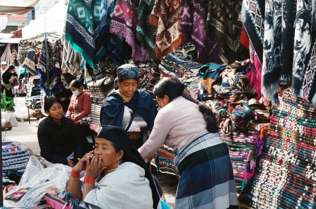
- If you plan to visit the Otavalo artisan market before or after your hike, remain extra cautious in crowded market aisles and bus stations where pickpocketing is common. Use a secure cross-body bag or money belt under your clothing
- Stray or farm dogs are occasionally encountered along rural roads leading to the park boundaries. Most are harmless, but keep your distance, avoid making sudden movements, and carry trekking poles, which can serve as a gentle deterrent if needed
The Galápagos.
Ecuador’s Enchanted Isles
Considerations for solo travellers, women, and diverse adventurers

Laguna de Cuicocha is a fantastic destination for independent explorers, including solo travellers and women. Local Indigenous Quichua communities in the surrounding villages are welcoming, respectful, and proud of their cultural heritage.
For solo female travellers, Ecuador is widely enjoyed, but isolated rural hikes require sensible precautions. Because the rim loop can feel secluded, solo hikers should inform their hotel or hostel staff in Otavalo or Cotacachi of their intended route and expected return time.
Key recommendations for solo and minority travellers:
- Pair up with fellow travellers from your hostel or travel group if you prefer company on quieter trail stretches
- Carry a fully charged mobile phone along with a portable power bank, keeping emergency numbers pre-saved
- Respect local cultural norms when passing through nearby rural communities. Asking permission before taking photos of local residents, especially elders and children, builds mutual trust and respect
- Learn basic Spanish phrases related to directions, transport, and emergencies, as English is not widely spoken outside major tourist hotels in Otavalo
Essential gear, emergency protocols, and cultural respect
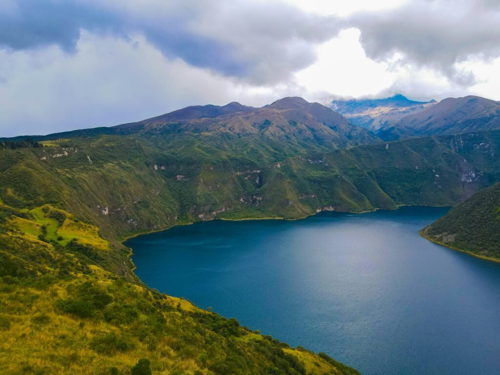
Proper preparation ensures a smooth, memorable excursion to Laguna de Cuicocha. The lake is held sacred by local Indigenous peoples, who celebrate traditional solstice rituals such as Inti Raymi along its shores each June. Swimming in the lake is prohibited due to dangerous underwater gas vents, cold temperatures, and strong alkaline currents, as well as respect for its sacred status. Small boat tours operate near the visitor centre for those wishing to view the islands from the water level.
In the event of an emergency on the trail:
- The universal emergency telephone number in Ecuador is 911, which dispatches police, medical assistance, and park rangers
- If you experience severe symptoms of altitude sickness or physical exhaustion, stop immediately, rest in a sheltered spot, and begin heading back down toward the visitor centre in the direction you came. Do not push forward onto isolated sections of the rim if you feel unwell
- Practise Leave No Trace principles. Carry all your rubbish back out, stay strictly on designated paths, and refrain from picking native highland flora
The Ecuadorian Amazon.
The most biodiverse place in the world
Essential safety checklist for Laguna de Cuicocha
Before setting out on your crater rim adventure, review this quick reference checklist:
- Acclimatisation: Spend 48 hours at altitude before taking on the hike
- Timing: Start the trail before 09:00 to avoid afternoon weather changes
- Footwear: Wear sturdy, grippy hiking boots
- Clothing: Pack waterproof layers, a warm hat, and gloves
- Sun Protection: Apply high-factor SPF sunscreen, wear sunglasses, and use a hat
- Hydration and Snacks: Carry at least two litres of water and calorie-dense snacks
- Offline Maps: Download trail maps on your phone in advance
- Transport: Arrange return taxi pick-up with your driver in advance
- Cash: Carry small US dollar notes for taxis and park refreshments
- Registration: Sign in at the ranger station upon arrival
By taking these straightforward steps, you can focus on enjoying the majestic scenery, quiet mountain trails, and rich cultural tapestry that make Laguna de Cuicocha one of Ecuador’s finest hiking destinations.
The Ecuadorian Coast.
Where you’ll find the very best food
Concluding your crater circuit / Adventure built on preparation
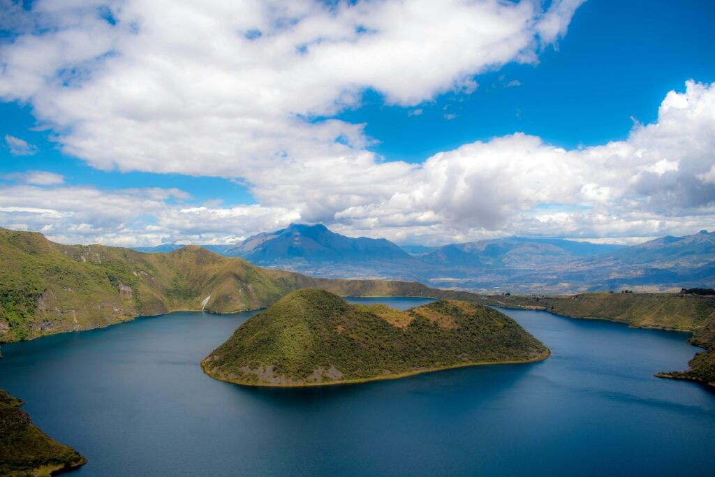
Laguna de Cuicocha is far more than just a quick photo stop on a tour bus schedule. It is an immersive highland trek that captures the wild, pristine spirit of the Ecuadorian Andes. Walking the rim above deep turquoise waters and volcanic islands offers an incredible connection to nature, but the real key to enjoying every step lies in simple, thorough preparation.
By respecting the high altitude, preparing for sudden Andean weather shifts, and arranging your return transport before setting off, you turn potential hazards into manageable details. Independent travel is at its best when you have the freedom to explore at your own pace without unnecessary risk.
Whether tackling the full 14 km Sendero Los Arrayanes loop on foot or exploring the surrounding gravel roads of Imbabura Province, thoughtful planning ensures your journey remains safe, rewarding, and inspiring. Pack your layers, give yourself time to adjust to the elevation, and step out onto the crater trail with complete confidence.
Affiliate Disclaimer: Some of the links on Wheely Tyred are affiliate links. If you click through and make a booking or purchase, we may earn a small commission at no extra cost to you. We only recommend gear, tours, stays, and services we genuinely use, trust, and stand behind — our editorial independence always comes first. These commissions help keep our independent cycling guides and travel stories free to read. Thanks for supporting the ride!
Frequently asked questions about Laguna de Cuicocha safety
Take a local bus from the main Otavalo terminal to Cotacachi, then hire a licensed yellow taxi or private remisa from the central plaza directly to the park entrance. Alternatively, you can hire a direct taxi from Otavalo, which takes roughly 30 to 40 minutes.
No, swimming is strictly prohibited. The lake holds sacred cultural status for local Indigenous Quichua communities, and dangerous underwater gas vents, frigid temperatures, and strong alkaline currents make entering the water unsafe. Small boat tours operating near the visitor centre offer a safe way to view the volcanic islets from water level.
The 14 km circuit generally takes between four and five hours to complete at a steady pace. Setting off early in the morning ensures you finish before afternoon cloud cover, cold winds, and rain set in.
Carry cash in small US dollar denominations ($1, $5, and $10 notes). Local taxi drivers, park vendors, and small eateries near the entrance rarely accept credit cards or hold change for larger banknotes.
Inform your hotel or hostel staff in Otavalo or Cotacachi of your planned route and expected return time. Ensure your mobile phone is fully charged, carry a power bank, download offline mapping applications in advance, and consider pairing up with fellow travellers for quieter stretches of the trail.
Spend at least 48 hours acclimatising at elevation in Quito or Otavalo before attempting the hike. Drink plenty of water or traditional coca tea, avoid alcohol the evening before your trek, pace your ascents carefully, and carry energy-dense snacks such as nuts or panela to keep your stamina stable.
Ecuador.
Pure wonder on the equator.


