
Ingapirca’s ancient stone fusion of Cañari and Inca history
A complete historical guide to the Ingapirca archaeological ruins, the Temple of the Sun, and Cañari culture in Cañar, Ecuador
Ecuador’s greatest Andean monument / A sanctuary born from two empires

BEN FINCH
High in the windswept southern highlands of Ecuador, perched at an altitude of 3,160 metres in Cañar province, lies Ingapirca. The name itself stems from Quichua, translating simply as Inca stone wall. Yet to view this complex merely as a frontier outpost of the Inca Empire is to overlook one of the most fascinating narratives of cultural synthesis in Andean history.
Unlike many archaeological complexes across South America where conquerors dismantled or buried the monuments of those they subdued, Ingapirca stands as a rare physical record of co-existence and strategic integration.
Long before imperial Inca armies marched north into present-day Ecuador, these green hills were the sacred heartland of the Cañari people. What visitors see today at Ingapirca is a shared sanctuary—an extraordinary site where Cañari lunar worship and Inca solar devotion fused together in mortarless masonry.
For travellers and cyclists journeying through the high páramo corridors between Cuenca and the central sierra, Ingapirca provides an indispensable window into the final decades of pre-Columbian South America.
Essential takeaways from South America’s elliptical sun temple
Standing high in the windswept Cañar province, Ingapirca is a masterclass in ancient diplomacy and architectural genius. Here are the defining elements that make this sacred high-altitude sanctuary an essential stop on any southern Ecuadorian journey.
- Cañari roots: Long before the Incas arrived, the site at Pilaloma served as a major spiritual centre for the indigenous Cañari people, who worshipped the moon and tracked lunar cycles across the surrounding peaks
- Elliptical architecture: El Castillo is the only oval Temple of the Sun built by the Inca Empire, cleverly shaped to enclose and honour a pre-existing Cañari sacred rock outcrop
- Mortarless joinery: Constructed using green andesite stone quarried nearby, the precision ashlar masonry has survived centuries of seismic activity due to its interlocking, mortarless engineering
- Astronomical precision: Trapezoidal windows and doorways were specifically aligned with the solstice sun, transforming the central temple into an accurate solar and agricultural calendar
- The Qhapaq Ñan connection: Ingapirca served as a critical administrative and spiritual waypoint along the vast mountain highway network connecting Cusco to Quito
- High-altitude logistics: Perched at 3,160 metres above sea level, visiting requires warm windproof layers, proper acclimatisation, and an appreciation for rapid Andean weather shifts
Ingapirca.
Where Cañari history meets the grandeur of the Inca
The original guardians / Cañari origins and lunar devotion
The story of Ingapirca begins roughly a millennium before the Incas arrived. From as early as 500 CE, the Cañari people established settlements across the fertile valleys and high plateaux of southern Ecuador. They were skilled farmers, metalworkers, and formidable warriors who organised their society around chieftainships rather than centralised imperial rule.
Central to Cañari spiritual life was the veneration of the moon and natural water systems. Their creation cosmology spoke of a miraculous flood that inundated the Andes, leaving only two brothers alive atop a sacred mountain.
Saved from starvation by mythic macaws who transformed into women, the brothers became the ancestors of the Cañari nation. Because of this deep connection to cosmic cycles and agricultural fertility, the Cañari constructed their principal religious sites around natural rock formations and high points where they could track lunar phases.
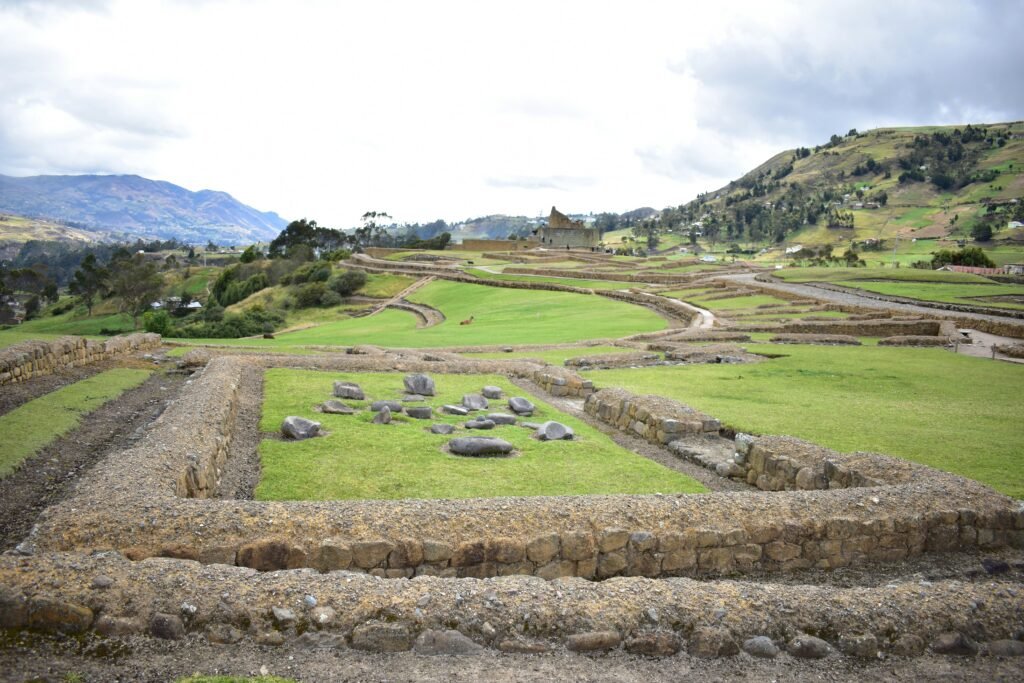
The oldest section of Ingapirca, known as the Pilaloma complex, sits on a low hill just south of the main temple. Here, rustic stone foundations reveal circular dwellings and communal storage areas characteristic of early Cañari settlement architecture.
It was within Pilaloma that archaeologists unearthed one of the site’s most profound discoveries: the collective tomb of a high-status Cañari priestess. Interred alongside ten attendants and surrounded by thousands of imported Spondylus shell beads, her burial demonstrates the reach of Cañari trade networks.
The thorny Spondylus shell, harvested from the warm coastal waters of the Pacific hundreds of kilometres away, was prized across the Andes above gold as a divine symbol of seawater and rain. Its presence in the high mountains of Cañar underlines the spiritual authority and economic weight of the pre-Inca sanctuary.
Imperial expansion / The Inca arrival and diplomatic alliance
By the mid to late 15th century, the expanding Inca Empire turned its ambitions northward under the military leadership of Túpac Yupanqui. As the imperial armies advanced into Cañari territory, they encountered fierce, stubborn resistance. The Cañari defence was so energetic that prolonged military campaigns failed to achieve a decisive subjugation.
Recognising the heavy toll of endless warfare and the strategic importance of securing the northern trade routes, the Inca leadership shifted tactics from total conquest to political diplomacy. A historic alliance was forged through state marriages, interweaving Inca royal lineage with prominent Cañari ruling families.
Rather than razing the sacred Cañari site at Pilaloma, the Incas chose to build their own administrative and religious centre alongside and directly over parts of the existing complex. This decision served a dual purpose: it honoured the local sacred geography (pacarina) while asserting imperial presence.
During the reign of Huayna Cápac in the late 15th and early 16th centuries, the sanctuary reached its zenith. Ingapirca became a vital hub along the Qhapaq Ñan—the vast mountain highway network connecting Cusco to Quito—functioning as a religious sanctuary, administrative centre, and military supply depot.
The Ecuadorian Sierra.
Get lost in the hills
Engineering in harmony / The unique architecture of El Castillo

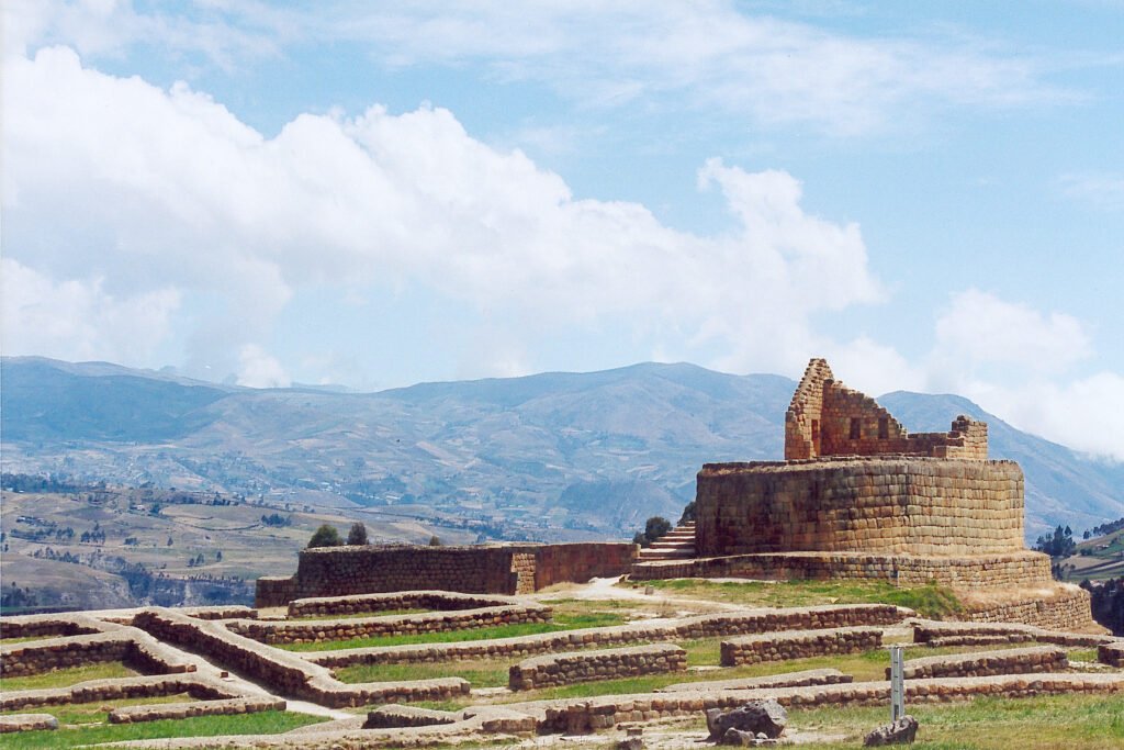
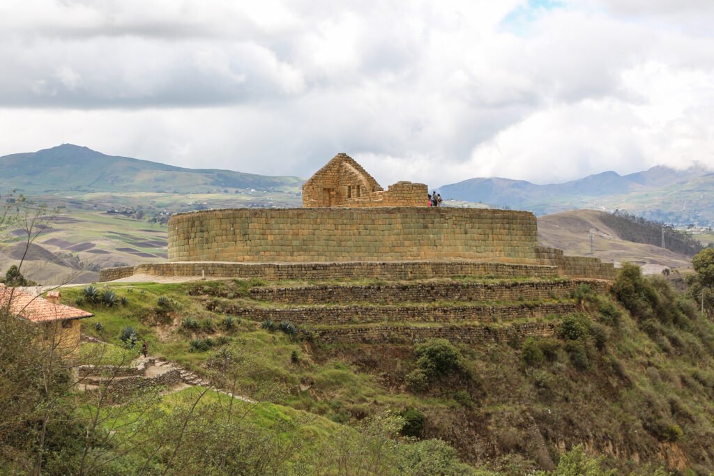
The undisputed masterpiece of Ingapirca is El Castillo, also known as the Temple of the Sun. Rising dramatically above the surrounding plazas, it is the only known elliptical Inca temple in the entire South American continent.
Standard Inca imperial architecture almost exclusively favoured rectangular plans. The unique oval shape of El Castillo is a direct concession to the landscape and pre-existing Cañari sacred geometry. The temple was built atop a large, naturally elevated rock outcrop that had long served as a Cañari lunar shrine.
To enclose this revered feature while honouring their own architectural traditions, Inca master stonemasons crafted an elegant curved wall that follows the natural contours of the bedrock.
The construction demonstrates the pinnacle of imperial Inca ashlar masonry. Quarried from nearby deposits at Hato de la Virgen, blocks of greenish andesite and volcanic stone were painstakingly hand-carved, shaped, and polished. The stones were assembled using dry-stone techniques, fitting together with such millimetre precision that no mortar was required. This mortarless joinery provided essential seismic flexibility, allowing the heavy walls to absorb the frequent earthquakes of the Andean ridge without collapsing.
El Castillo was engineered with precise astronomical functions. Its major axis aligns closely with an east-west trajectory. During the June solstice—a moment celebrated during the ancestral festival of Inti Raymi—the rising sun aligns with specific trapezoidal doorways and stone niches within the upper chambers. These light rays illuminated sacred ceremonial objects, allowing priests to calculate agricultural calendars and confirm solar cycles with exacting accuracy.
Throughout the structure, classic Inca design features remain clearly visible: trapezoidal doors and windows designed wider at the base to distribute structural weight, heavy stone lintels, and carefully sculpted water channels.
Life within the complex / Storage, water, and sacred spaces
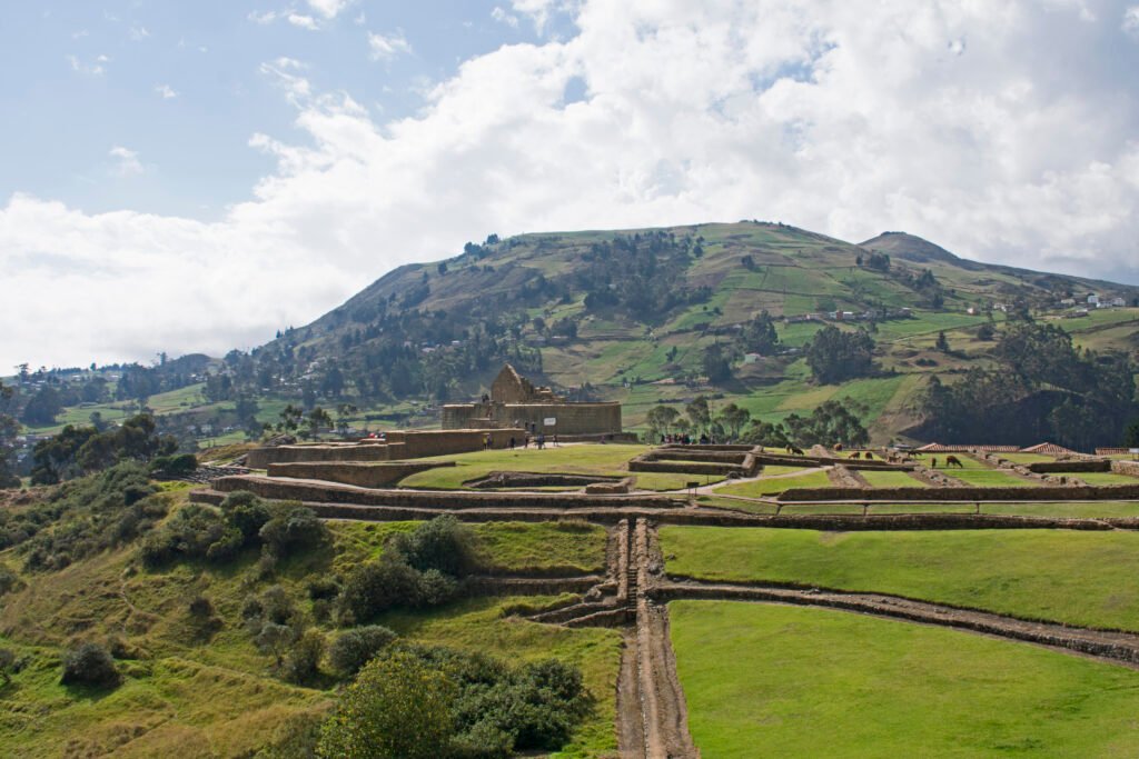
Surrounding the central Temple of the Sun, the remaining ruins reveal a meticulously planned civic and religious settlement that sustained a resident population of priests, nobles, and administrators.
Akllawasi / House of the Chosen Women
Positioned near the main temple, this multi-roomed structure housed women dedicated to the service of the Sun deity. Here, young women were trained in high-grade textile weaving, preparation of ceremonial chicha corn beer, and ritual duties.
Hatun Cancha and storage collcas
The broad courtyard areas served as administrative gathering points, flanked by circular and rectangular storage silos (collcas). These warehouses held dried maize, quinoa, tubers, and textiles, ensuring supply security for passing imperial officials and military garrisons along the Qhapaq Ñan.
Hydraulic engineering
The complex features sophisticated underground aqueducts and stone-carved drainage channels. Water was directed from nearby streams through finely polished stone conduits to feed ceremonial baths and supply residential quarters.
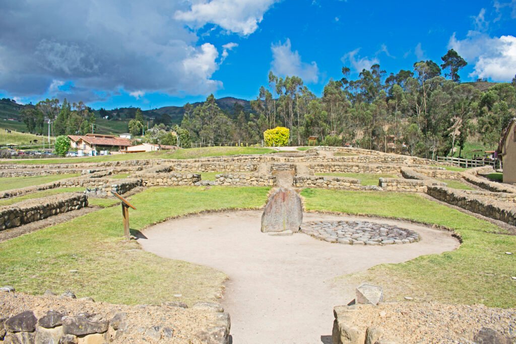
The Incan calendar stone
Located near the temple base lies a massive natural boulder perforated with 28 distinct circular depressions. Archaeologists believe these small basins were filled with water to reflect the night sky, operating as a lunar calendar that allowed Cañari astronomers to track the 28-day lunar cycle through stellar reflections.
The Ecuadorian Amazon.
The most biodiverse place in the world
The shadow of conflict and Spanish colonial dismantling
The golden era of Ingapirca as a flourishing joint sanctuary was remarkably brief, lasting roughly half a century. In the late 1520s, following the death of Emperor Huayna Cápac, a devastating civil war erupted between his sons Huáscar and Atahualpa for control of the Inca Empire.
Cañar province became a central battleground in this War of the Two Brothers. The Cañari people largely aligned themselves with Huáscar, prompting retaliatory campaigns by Atahualpa’s veteran armies. During these destructive conflicts, parts of the complex were damaged or abandoned.
Shortly thereafter, in the 1530s, Spanish conquistadors entered the Ecuadorian highlands. With the collapse of the Inca state infrastructure, the site fell into disuse. During the colonial era that followed, local landowners and colonial builders used the abandoned sanctuary as a convenient stone quarry.
Massive blocks of finely cut greenish andesite were dismantled and transported away to construct churches, haciendas, and public buildings in nearby towns and the city of Cuenca.
Despite this systematic quarrying, the core elliptical platform of El Castillo proved too robust to be destroyed completely. In 1739, the French scientist Charles Marie de La Condamine visited the site during the Geodesic Mission to South America, producing the first scientific descriptions and architectural sketches of the ruins.
His work introduced Ingapirca to European scholarship and preserved valuable documentation of walls that were later lost.
Riding through history / Access Ingapirca along the Andean corridor
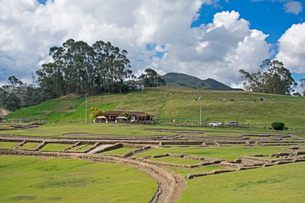
Today, the Ingapirca Archaeological Complex stands as Ecuador’s premier pre-Columbian site, carefully preserved under national protection. For travellers exploring the southern Ecuadorian Andes, it offers an unmissable destination that combines deep history with breathtaking highland scenery.
For cyclists and bikepackers tackling the paved and dirt routes of the Ecuadorian Andes, the journey to Ingapirca provides spectacular riding. Situated roughly 85 kilometres north of Cuenca and 16 kilometres from the town of Cañar, the roads winding up to the complex climb through terraced agricultural valleys, small rural villages, and high mountain pastures.
A popular historical route follows sections of the ancient Qhapaq Ñan trek starting from Achupallas, taking adventurers across mountain passes, past the sacred Culebrillas Lagoon, and directly toward the stone gates of the complex.
Whether approaching by bicycle, on foot, or by road, arriving at this high-altitude sanctuary offers a profound feeling of connection to the ancient travellers who walked these same stone roads five centuries ago.
When planning a visit, keep the following travel context in mind:
- Location and Elevation: Situated in Cañar province at an elevation of 3,160 metres. Warm, windproof layers are essential due to quick weather changes and strong Andean winds
- Cultural Celebrations: Visiting during the June solstice allows travellers to witness Inti Raymi celebrations, where local Cañari communities gather at the ruins for traditional music, dance, and ancestral ceremonies
- On-Site Museum: The complex includes an informative site museum displaying ceramics, metal artefacts, textiles, and forensic details from the Pilaloma priestess burial
By standing before the curved, mortarless walls of El Castillo, visitors do not merely gaze upon ancient masonry. They stand at the precise intersection of two great mountain cultures, carved forever into the stone landscape of the Ecuadorian Andes.
The Galápagos.
Ecuador’s Enchanted Isles
Stand at the crossroads of two mountain civilisations
Read this far?
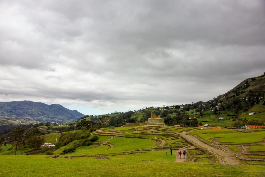
To walk across the windswept plazas of Ingapirca is to experience a rare moment of Andean history where two distinct cultures chose synthesis over obliteration. The blending of Cañari lunar shrines with Inca solar architecture created a monument unlike any other along the spine of the continent.
It stands not merely as an archaeological ruin, but as a living testament to diplomatic alliance, astronomical mastery, and structural ingenuity.
Whether arriving on foot along the historic Qhapaq Ñan trail from Achupallas or ascending the steep paved switchbacks from Cuenca on two wheels, the approach to the sanctuary remains unforgettable.
As the high-altitude mists roll across the Cañar valley, revealing the curved, mortarless green walls of El Castillo, the sheer scale of ambition required to quarry and shape these stones becomes vividly clear.
For independent travellers and bikepackers exploring southern Ecuador, Ingapirca offers far more than a convenient day trip from Cuenca. It provides a quiet, introspective space to contemplate how pre-Columbian societies observed the cosmos, adapted to extreme mountain environments, and shaped the landscape.
As you prepare your route north or south through the Andes, leaving time to linger amongst these ancient stones ensures a richer understanding of the land beneath your tyres.
Affiliate Disclaimer: Some of the links on Wheely Tyred are affiliate links. If you click through and make a booking or purchase, we may earn a small commission at no extra cost to you. We only recommend gear, tours, stays, and services we genuinely use, trust, and stand behind — our editorial independence always comes first. These commissions help keep our independent cycling guides and travel stories free to read. You can also buy me a coffee here — thanks for supporting the ride!
The Ecuadorian Coast.
Where you’ll find the very best food
Frequently asked questions about the history of Ingapirca
Direct buses run daily from Cuenca’s Terminal Terrestre directly to the entrance of the ruins, taking roughly two hours. Alternatively, local buses depart frequently from Cuenca to the nearby town of Cañar, where regional buses or taxis complete the remaining 16-kilometre climb to the archaeological site.
The site sits at an elevation of 3,160 metres above sea level. It is advisable to spend at least two days acclimatising in Cuenca or another high-altitude town prior to visiting. Stay well hydrated, walk at a measured pace, and pack warm, windproof layers, as temperatures can drop suddenly when cloud cover rolls over the páramo.
Plan to spend two to three hours at the site. This provides ample time to tour the main El Castillo temple, walk through the circular Cañari foundations at Pilaloma, explore the short loop trail down to the natural rock formation known as El Inga Pirca (Face of the Inca), and view the forensic and archaeological displays in the site museum.
Yes, riding to the site is a rewarding challenge. The primary route from the town of Cañar features a steady, paved climb with extensive views across terraced agricultural valleys. Bikepackers tackling dirt routes can also follow sections of the ancient Qhapaq Ñan network from Achupallas down toward the complex, though this requires high-clearance gravel or mountain bikes and full self-sufficiency.
The dry season, which runs from June through September, offers the clearest morning skies and most stable riding conditions. Visiting in mid-June allows travellers to witness Inti Raymi (the Festival of the Sun), when local Kichwa and Cañari communities gather at the ruins for ancestral ceremonies, live music, and traditional dancing.
Local guides are available near the ticketing office and are included with the price of admission. Taking a guided tour is highly recommended, as the guides offer essential context regarding the astronomical alignments, Cañari burial sites, and subtle masonry differences that are easily overlooked when exploring independently.
Ecuador.
Pure wonder on the equator.


