
Is Ingapirca safe in 2027? A travel safety guide to the Cañari ruins
Ingapirca, Ecuador, travel safety 2027 / Crime trends, altitude advice, solo travel tips, and bike route security
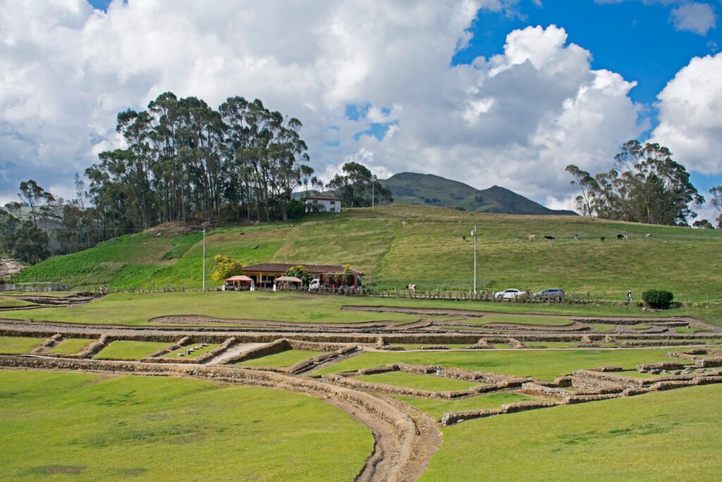
Navigate Andean roads, transit security, to find highland tranquillity

BEN FINCH
Visiting the archaeological complex of Ingapirca in southern Ecuador remains one of the most rewarding high-altitude cultural journeys in the Sierra. Perched at 3,160 metres above sea level in Cañar province, this historical monument stands as an extraordinary testament to pre-Columbian architecture, where Cañari stonework meets Incan design under the shadow of the Temple of the Sun.
Following up on our original 2026 safety analysis of the Cañari ruins, safety in Ecuador continues to be a top-of-mind subject for international visitors. Headlines regarding the coastal corridors can create apprehension, yet the high Andean countryside operates under a markedly different social and security climate.
For independent road trippers, bus riders, and cyclists routing through southern Ecuador in 2027, understanding the actual conditions on the ground ensures a smooth, stress-free expedition.
This detailed 2027 guide breaks down current local safety dynamics, regional crime trends, considerations for solo and minority travellers, transit hazards, mountain weather realities, and crucial route-planning advice for those on two wheels.
The essentials for the Andean trail
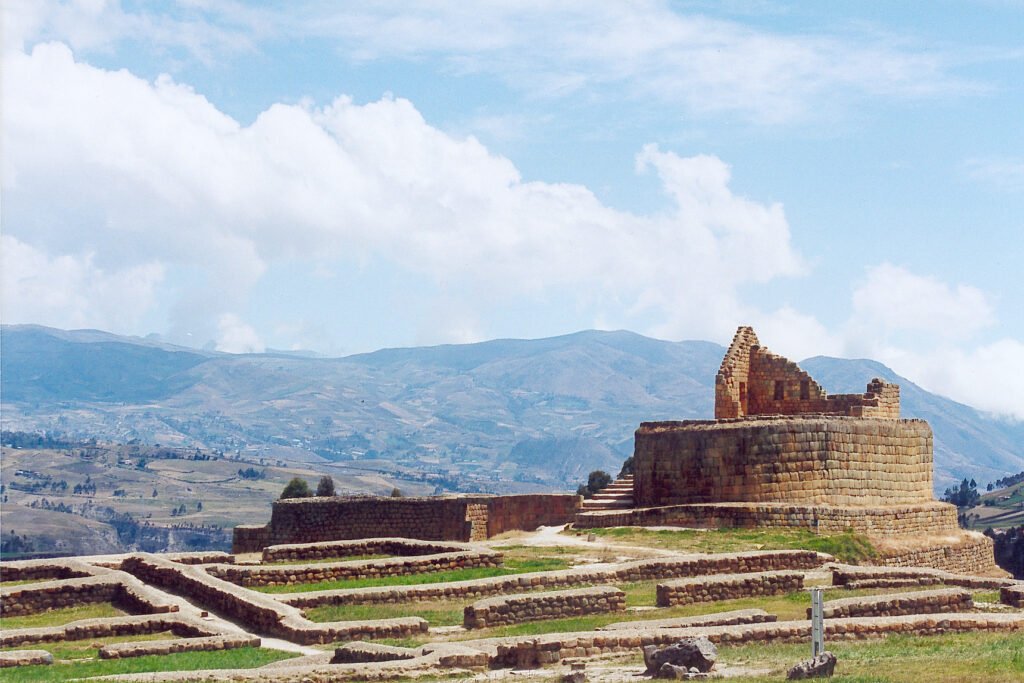
Ingapirca combines high-altitude history, rural tranquillity, and essential practical awareness for every independent traveller, cyclist, and route planner heading into the southern Ecuadorian highlands.
- Tranquil Setting: Violent crime within the archaeological park and rural Cañar province remains extremely low, ensuring a secure environment for visitors
- Transit Vigilance: Public buses and station transfer points carry the highest risk of petty theft; keep daypacks secured on your lap and avoid overhead luggage racks
- Altitude Respect: Situated at 3,160 metres, taking 24 to 48 hours to acclimatise in Cuenca prevents severe altitude sickness (soroche)
- Solo and Female Travel: Direct bus connections and well-marked paths make solo exploration straightforward, provided you complete return journeys before mid-afternoon
- Mountain Roads: Driving and cycling routes feature steep gradients, narrow shoulders, sharp hairpin turns, and sudden heavy fog or rain
- Páramo Microclimates: Weather in the high grasslands shifts rapidly from intense UV exposure to freezing rain, demanding versatile waterproof layers
- Cash Economy: ATMs do not exist around the ruins, making small-denomination US dollar notes essential for entry fees, local taxis, and meals
Ingapirca.
Where Cañari history meets the grandeur of the Inca
Security overview / Cañar province vs. national perceptions
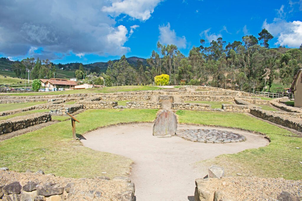
Understanding safety in Ingapirca requires drawing a clear line between Ecuador’s coastal urban zones and the southern agricultural highlands. While national security measures and state-of-emergency updates occasionally cover specific transport corridors or coastal regions, rural Cañar remains notably tranquil.
The community of Ingapirca, along with nearby El Tambo and Cañar town, depends on agricultural traditions, livestock farming, and heritage tourism. The local indigenous Cañari communities maintain a strong social structure, resulting in remarkably low rates of violent crime near the archaeological site itself.
However, safety during a visit to Ingapirca is less about staying safe at the ruins and more about exercising standard vigilance while in transit. Reaching the site involves moving through transit nodes such as Terminal Terrestre in Cuenca or transfer junctions along the Pan-American Highway. Paying attention to personal items during these transit phases is key to an uncomplicated journey.
Crime realities / Violent threats vs. transit petty theft
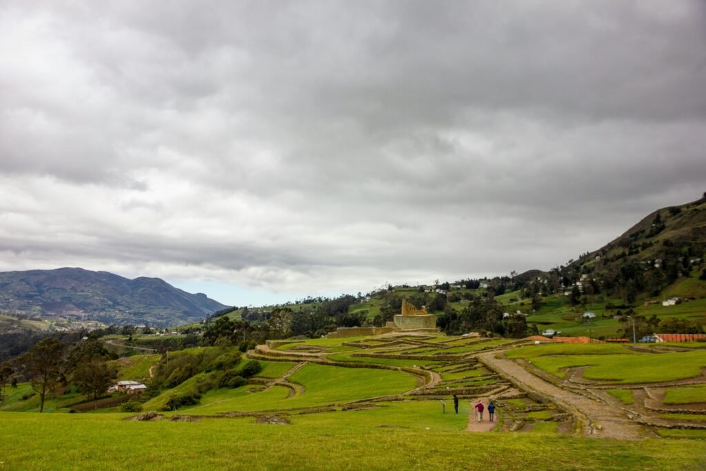
Evaluating personal security around Ingapirca requires distinguishing between physical safety and opportunistic theft.
Violent crime
Violent crime directed at foreign tourists in the parish of Ingapirca is almost non-existent. Official park personnel, local guides, and community park rangers maintain order within the archaeological sanctuary.
Families, walking groups, and solo explorers can wander the official paths of the complex without concern for personal safety.
Petty theft and distraction scams
Opportunistic crime remains the single largest nuisance for visitors, almost entirely localised to public transport and transit stations.
Common scenarios include:
- Overhead Storage Losses: Bags stowed in overhead racks on long-distance buses heading along the Cuenca–Cañar corridor can be accessed by individuals sitting behind you or exiting at intermediate rural stops
- Distraction Plays: Classic techniques involve someone dropping coins, spilling a liquid, or asking for map directions nearby while an accomplice quietly retrieves a daypack left on the floor
- Unregistered Station Touts: Individuals offering unverified private transport options outside official terminal bays
To protect gear, keep small daypacks on your lap with straps looped around your arm during bus journeys. Keep wallets, mobile devices, and passports secured inside zipped jacket pockets or internal travel belts.
The Ecuadorian Sierra.
Get lost in the hills
Safety advice for solo travellers, women, and minorities
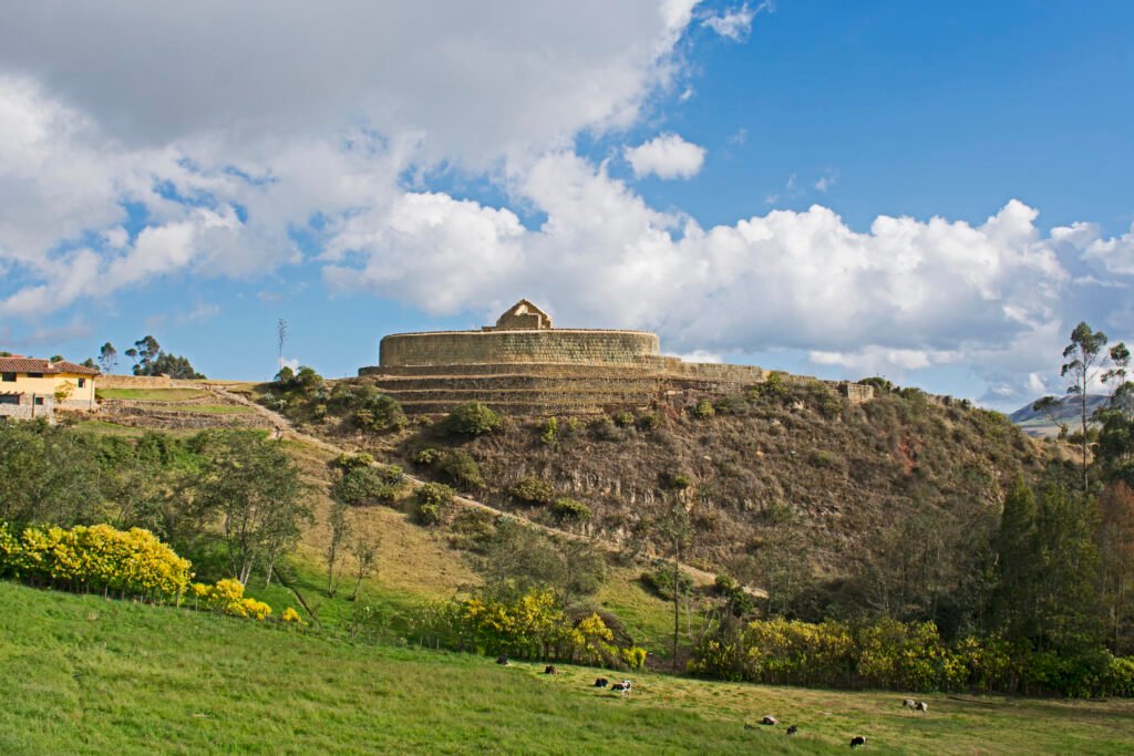
Ingapirca welcomes diverse visitors year-round. Taking note of local cultural standards ensures respectful and safe interactions across the region.
- Solo Explorers: Straightforward access; avoid late afternoon isolation on tracks
- Female Travellers: Low physical danger; firm, polite disinterest deters catcalls
- Minorities: Highly welcoming; modest dress aligns with rural cultural norms
- LGBTQ+: Culturally conservative area; social discretion is advisable
Solo travellers
Navigating to the ruins alone is straightforward via direct buses from Cuenca or organised transport. The primary risk for solo visitors is getting isolated on remote, unmarked walking tracks surrounding the parish late in the afternoon.
Mist can roll over the ridges rapidly, lowering visibility. Stick to marked routes around the complex, and ensure return transport is locked in before 14:00.
Solo female travellers
Female travellers generally experience a safe, hassle-free visit to Cañar. Traditional gender roles remain common in rural communities, which can occasionally lead to unwanted glances or catcalling around busy transport hubs.
- Transit Seating: On intercity buses, choosing seats near families, other women, or close to the driver helps maintain a comfortable environment
- Daylight Timing: Plan journeys to arrive and depart during daylight hours, avoiding solitary waits at unlit rural highway intersections
- Registered Taxis: When taking taxis from transfer towns such as El Tambo or Cañar, use vehicles displaying official orange licence plates and registration decals
- Firm Boundaries: Exhibiting calm, polite disinterest effectively resolves unwanted conversations
Minorities and cultural respect
The local population is predominantly Indigenous Cañari and mestizo. Foreign visitors of all racial and ethnic backgrounds receive a polite, welcoming reception.
Because local culture is socially conservative and centred on agricultural life, dressing modestly—such as long trousers and practical layers—aligns well with community norms. Always ask for permission before taking close-up photographs of local residents, particularly elders and children.
For LGBTQ+ travellers, public displays of affection are uncommon in rural highland villages. Exercising discretion in public spaces helps avoid unwanted attention.
The Galápagos.
Ecuador’s Enchanted Isles
Transit dynamics, road safety, and cycling considerations
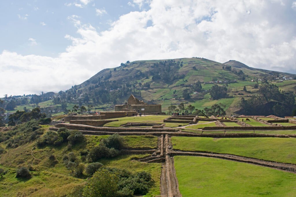
Whether navigating the southern Andes on public buses, in a rental car, or on a touring bike, mountain roads present distinct technical challenges.
Public transport and local taxis
Direct public buses depart from Cuenca’s Terminal Terrestre straight to the entrance of Ingapirca, taking approximately 2.5 to 3 hours. Alternatively, catching an intercity bus bound for Quito allows you to alight at El Tambo or the Cañar turn-off, where local taxis or regional mini-buses cover the remaining 15 kilometres to the site entrance.
- Confirm the final return bus departure time directly with your driver upon arrival, as afternoon options returning directly to Cuenca are limited
- Always check that secondary taxis hired at rural junctions carry official registration
Highway driving realities
Driving to Ingapirca provides flexibility, but mountain highway conditions require focused attention:
- Terrain and Hazards: Roadways feature steep gradients, tight hairpin turns, and localised rock falls during rainy stretches
- Fog and Visibility: Dense fog can settle over the high passes within minutes, reducing visibility significantly. Drive with dipped headlights
- Local Driving Customs: Overtaking on narrow blind curves is common practice among local drivers. Maintain conservative following distances and avoid night driving when unlit farm vehicles or livestock might be on the road
Cycling safety and route planning
Riding a bicycle up to Ingapirca at 3,160 metres is a memorable challenge, but it demands thorough preparation:
- Traffic Margins: The main arterial climb along the highway carries heavy commercial lorry and intercity bus traffic. Road shoulders can be narrow or uneven and require steady line choice
- Elevation Strain: The sustained climb involves significant elevation gain in thin air. Pacing, frequent hydration, and electrolyte intake are necessary to prevent total exhaustion
- Descent Temperature Drops: Fast mountain weather changes can turn a warm climb into a freezing, wet descent. Bright front and rear lights, windproof gloves, and a reliable waterproof jacket are non-negotiable safety items
The Ecuadorian Amazon.
The most biodiverse place in the world
Health precautions / Altitude sickness and páramo microclimates
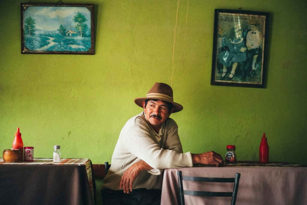
Environmental hazards pose a greater daily challenge to visitors at Ingapirca than personal safety issues.
Altitude sickness (soroche)
Sitting well over 3,000 metres above sea level, Ingapirca can induce altitude symptoms—including throbbing headaches, mild nausea, dizziness, and shortness of breath—for travellers arriving directly from coastal regions.
- Acclimatise First: Spend a minimum of 24 to 48 hours in Cuenca (2,560 metres) before making the ascent to Ingapirca
- Hydration and Diet: Drink plenty of water, limit alcohol intake, and stick to light meals prior to exertion. Traditional coca tea or local herbal infusions can help soothe mild symptoms
Unpredictable páramo microclimates
Highland weather in Cañar shifts rapidly. Clear equatorial sun can vanish behind cold rainstorms and gusty winds in under half an hour.
- Layering System: Wear a moisture-wicking base layer, an insulating fleece mid-layer, and a fully seam-sealed waterproof outer shell
- Equatorial Sun Protection: Thin mountain air increases UV intensity significantly, even on overcast days. Apply broad-spectrum high-factor sun cream, wear UV-blocking sunglasses, and pack a wide-brimmed hat
Practical safety checklist for Ingapirca

Before setting off toward the Cañari ruins, run through this practical pre-trip checklist:
- Document Copies: Leave your original passport locked in your hotel safe in Cuenca. Carry a clear, laminated colour copy of your passport photo page and entry stamp
- Carry Small Cash Notes: High-denomination US dollar bills ($20, $50, $100) are almost impossible to break at small rural stalls, taxi stops, or local eateries near the ruins. Bring plenty of $1, $5, and $10 notes. There are no ATMs at the archaeological park
- Offline Navigation Maps: Download offline mapping areas covering Cuenca, El Tambo, Cañar, and Ingapirca, as mobile signal strength drops along mountain valleys
- Check Transport Updates: Review local news or consult your lodging hosts in Cuenca regarding weather warnings or road maintenance before departing
- Save Emergency Numbers: Program local emergency services (911 in Ecuador) into your phone alongside contact details for your accommodation
The Ecuadorian Coast.
Where you’ll find the very best food
Master the historical mountain pass of Ingapirca
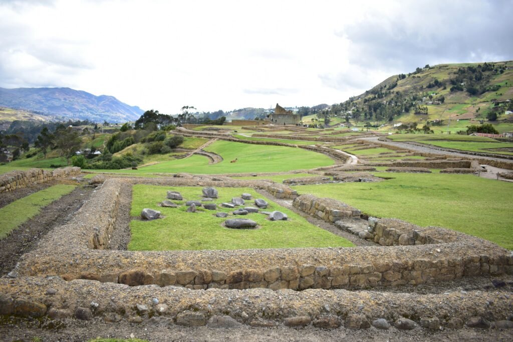
Read this far?
Exploring Ingapirca reveals much more than a striking photo opportunity at the Temple of the Sun. It offers an authentic encounter with layered pre-Columbian histories set against the dramatic topography of the southern Andes, rewarding those who approach the region with preparation and respect.
Whether you choose to tackle the steep switchbacks on a loaded touring bike, catch the early morning local bus from Cuenca, or drive through the winding passes of Cañar province, staying mindful of high-altitude weather and transit logistics pays off immediately. The warmth of local rural communities paired with the quiet solitude of the ancient stone ruins makes every logistical detail worthwhile.
As with any journey through highland South America, flexibility remains your greatest asset. Respecting local cultural norms, pacing your physical effort against the thin mountain air, and keeping your possessions secure during transit ensures your focus stays where it belongs: on the magnificent masonry and panoramic mountain vistas.
Pack your layers, secure your cash in small notes, set off early, and enjoy one of Ecuador’s most remarkable archaeological treasures with complete peace of mind.
Affiliate Disclaimer: Some of the links on Wheely Tyred are affiliate links. If you click through and make a booking or purchase, we may earn a small commission at no extra cost to you. We only recommend gear, tours, stays, and services we genuinely use, trust, and stand behind — our editorial independence always comes first. These commissions help keep our independent cycling guides and travel stories free to read. You can also buy me a coffee here — thanks for supporting the ride!
Frequently asked questions about travel safety at Ingapirca
Direct buses run daily from Cuenca’s Terminal Terrestre straight to the entrance of the archaeological site, taking around 2.5 to 3 hours. Alternatively, take any intercity bus heading toward Cañar or El Tambo, alight at the main highway turn-off, and hire a local licensed taxi for the final 15-kilometre stretch to the ruins.
At 3,160 metres above sea level, altitude sickness (soroche) can affect visitors coming directly from lower elevations. Spending 24 to 48 hours acclimatising in Cuenca, staying well-hydrated, and avoiding heavy meals before your trip helps mitigate symptoms such as headaches and dizziness.
Card payment facilities are limited or non-existent at rural stalls and small eateries surrounding the archaeological site. Always bring sufficient cash in small US dollar notes ($1, $5, and $10) as local vendors rarely carry change for larger bills such as $20 notes.
Weather in the páramo changes rapidly from bright sun to cold rain. Pack moisture-wicking base layers, a fleece or insulated jacket, and a reliable waterproof outer shell. High-factor sun cream, a wide-brimmed hat, and sunglasses are also essential due to intense equatorial UV levels at altitude.
Cycling to the site is deeply rewarding but physically demanding. Road shoulders along the main highway are narrow, with heavy commercial bus and lorry traffic. Functional lights, a well-fitted helmet, and strong climbing legs are necessary to manage the sustained elevation gain safely.
Return buses directly from the ruins are infrequent, often departing in the early afternoon around 13:30 or 14:00. Always confirm the exact departure time with your bus driver upon arrival, or plan to take a local taxi back to El Tambo to catch a frequent intercity bus.
Ecuador.
Pure wonder on the equator.

