Bikepacking the Avenue of the Volcanoes / A 7-day Humboldt itinerary through Ecuador
Self-supported bikepacking guide to Ecuador’s Humboldt route and high páramo
Retrace Humboldt’s 1802 Andean expedition
BEN FINCH
In June 1802, Prussian polymath Alexander von Humboldt rode south through the inter-Andean rift valley, surveying massive volcanic peaks including Volcán Pichincha, Volcán Cotopaxi, Volcán Tungurahua, and Volcán Chimborazo.
At the time, Chimborazo was widely believed to be the highest mountain on Earth. Humboldt’s systematic measurements of barometric pressure, temperature, and plant geography along these slopes laid the foundation for modern biogeography, culminating in his celebrated Naturgemälde illustration—a cross-sectional diagram mapping how ecological zones shift with altitude.
For the modern bikepacker, traversing this valley is an immersive journey through living geography and evolving ecology. Moving from dense cloud forest and pine plantations to windswept alpine páramo, riding over historic cobblestones laid across centuries of trade, you experience the same shifting microclimates Humboldt catalogued over two hundred years ago.
The air thins rapidly as you climb out of agricultural basins into tussock-covered highlands, where weather conditions can transform from blazing high-altitude equatorial sun to freezing rain within minutes.
At Wheely Tyred, we champion this form of self-guided travel: unhurried, self-supported, and deeply connected to the terrain. Leaving behind rigid tour buses and scripted travel itineraries, this seven-day route provides an authentic test of high-altitude gravel cycling through South America’s most dramatic mountain corridor.
Every climb demands physical resilience, but the reward is total autonomy amidst landscapes that reshaped humanity’s understanding of the natural world.
Route essentials / High-altitude Ecuador on two wheels
Seven days traversing Ecuador’s central inter-Andean corridor delivers an unforgettable self-supported gravel adventure through dramatic ecological zones. From high volcanic plateaus to deep canyon plunges, here are the core highlights of this historic route.
- Historical Grounding: Trace the exact 1802 expedition route of Alexander von Humboldt across the high Andes, where modern biogeography and ecological mapping were born
- Massive Elevation: Tackle 8,500 metres of cumulative climbing over 420 kilometres, topping out at 4,800 metres near the ice line of Volcán Chimborazo
- Diverse Surfaces: Navigate a challenging mix of hand-laid basalt cobblestones, fine volcanic ash, rocky doubletrack, and fast alpine tarmac
- Iconic Landscapes: Camp near the symmetrical snow cone of Volcán Cotopaxi and gaze over the emerald waters of Laguna Quilotoa’s massive volcanic crater
- Canyon Plunges: Technical descents through the rugged Sigchos and Chugchilán canyon networks leading into remote Kichwa-speaking mountain villages
- Ultra-Low Gearing Essential: Equipping a 1:1 or lower gear ratio alongside 47 mm to 50 mm tubeless tyres is vital for tackling 20% high-altitude gradients
- Páramo Survival: Prepare for drastic microclimate shifts where blazing equatorial sunshine can vanish into sub-zero nights and sudden alpine hailstorms
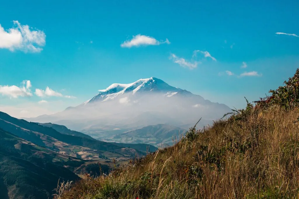
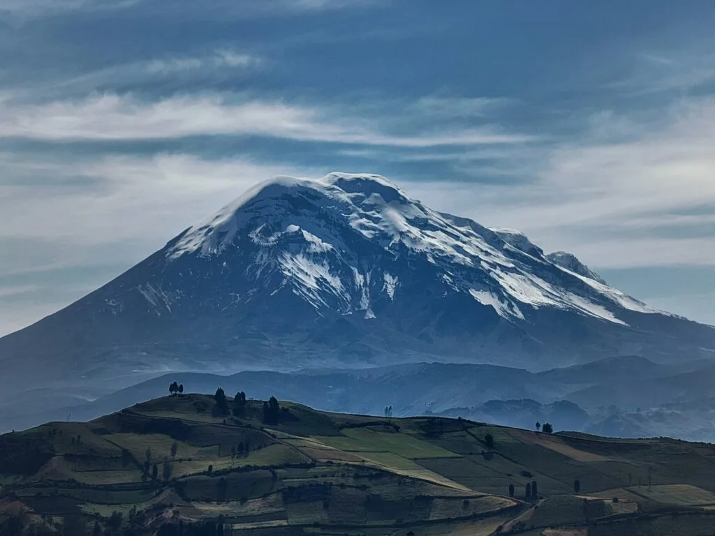
Volcán Chimborazo.
Stand at the furthest point from the centre of the Earth
Route overview & essential metrics
The Avenue of the Volcanoes bikepacking route covers 420 kilometres and 8,500 metres of climbing over seven days. Expect extreme elevation changes, technical gravel, volcanic ash, historic cobblestones, and peak altitudes exceeding 4,800 metres near Volcán Chimborazo.
| Total Distance | 420 km |
| Cumulative Elevation Gain | 8,500 m |
| Peak Elevation | 4,800 m (Reserva de Producción de Fauna Chimborazo) |
| Lowest Elevation | 2,450 m (Ambato Valley) |
| Recommended Duration | 7 Days |
| Recommended Tyre Width | 47 mm – 50 mm (2.0 inches minimum advised) |
| Terrain Profile | 35% Cobblestone, 40% Unpaved Dirt/Gravel, 15% Volcanic Ash/Sand, 10% Tarmac |
| Primary Ecosystems | Inter-Andean Scrub, Cloud Forest, Alpine Páramo |
Riding this corridor demands respect for altitude and weather. Gradients regularly exceed 15% to 20% on backroad climbs where traction on loose stone is paramount. A self-supported approach requires steady pacing, careful climate management, and mechanical self-reliance.
Navigating this terrain means understanding that surface conditions shift constantly. A single afternoon can involve rattling over centuries-old hand-laid basalt cobblestones, floating through deep volcanic dust, and picking lines down loose, rain-furrowed dirt tracks. Equipment choices must balance comfort over harsh surfaces with ultra-low gearing for steep high-altitude ascents.
Day-by-day bikepacking itinerary
Day 1 / Quito to Cotopaxi National Park entrance
- Distance: 65 km
- Elevation Gain/Loss: +1,600 m / -800 m
- Max Gradient: 16%
- Longest Climb: 18.5 km
Starting in the historic centre of Quito at 2,850 metres, the route climbs south out of the urban basin under the looming shadow of Volcán Pichincha. Leaving city traffic behind, tarmac gives way to century-old basalt cobblestones that hum beneath wide gravel tyres. The initial climb out of the capital forces an immediate rhythm of steady pedalling as urban density thins into steep highland valleys.
Pushing through highland agricultural communities, the gradient tilts steadily upward as you enter pine forests and approach the northern gate of Parque Nacional Cotopaxi. The basalt lanes require constant line selection to avoid tire-wedging gaps, while rural farming enclaves provide early glimpses of everyday Andean life. Local residents tend livestock along narrow dirt verges as dogs bark encouragement from adobe gates.
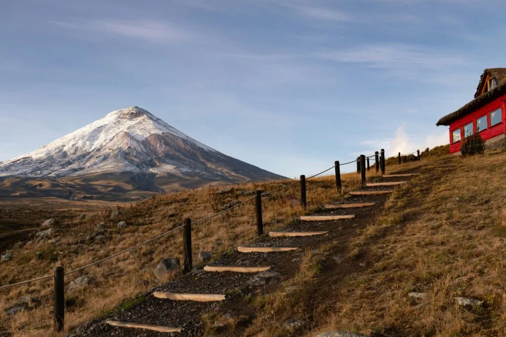
Views of Cotopaxi’s perfectly symmetrical snow-capped cone (5,897 metres) dominate the horizon as you set camp near the park boundary. As the equatorial sun drops quickly behind the Western Cordillera, temperatures fall rapidly, offering a foretaste of high-altitude night conditions. You prepare gear for the morning’s gravel traverse while watching clouds drift across the icefields above.
Day 2 / Cotopaxi Plateau traverse to Machachi backroads
- Distance: 55 km
- Elevation Gain/Loss: +1,100 m / -1,300 m
- Max Gradient: 14%
- Longest Climb: 8.2 km
Rolling out onto the high-altitude plateau of Cotopaxi at 3,800 metres, the track morphs into fine volcanic ash and deep sand where wide tyres pay immediate dividends. The vast, treeless plain stretches toward distant peaks, giving an overwhelming sense of scale. The air is noticeably thinner here, requiring disciplined breathing and an even pedal stroke to maintain momentum through soft washboard sections.
You track past ancient Inca ruins at Pucará de Salitre, crossing wide grasslands grazed by wild horses and hardy highland cattle. Humboldt spent days in this vicinity observing atmospheric phenomena and collecting botanical specimens suited to high atmospheric pressure drops. The stark beauty of the plateau is matched by its wind exposure; strong crosswinds regularly sweep across the open plain, testing bike stability on loaded setups.
Descending off the plateau via rough doubletrack, you trace pastoral valley backroads toward the agricultural hub of Machachi, framed by Volcán Corazón and Volcán Rumiñahui. The descent drops through changing ecological bands, moving from alpine grasses to rich dairy farmland. Arriving in Machachi, the air feels noticeably denser, providing welcome relief before tackling the western ridge climbs of day three.
The Ecuadorian Sierra.
Get lost in the hills
Day 3 / Machachi to Latacunga via the Western Ridge
- Distance: 60 km
- Elevation Gain/Loss: +950 m / -1,100 m
- Max Gradient: 15%
- Longest Climb: 10.4 km
Bypassing the heavy commercial transport of the main Panamericana highway, this stage weaves through the elevated western flank of the inter-Andean valley. Farm tracks bisect patchwork agricultural terraces clinging to steep hillsides at improbably sharp angles. Morning light illuminates fields of quinoa, potatoes, and broad beans that have sustained local communities for centuries.
You climb through rural enclaves where indigenous farmers tend crops using traditional methods alongside working animals. Cobblestone climbs are frequent and relentless, demanding smooth cadence and core stability to prevent the rear wheel from slipping on slick, rounded stones. Small village stores offer opportunities to resupply on fresh fruit, sweet panela, and local cheeses.
The day finishes with a long, sweeping descent into historic Latacunga at 2,750 metres, a town rebuilt multiple times following major historical eruptions of Cotopaxi. The lower elevation brings warmer afternoon temperatures and bustling market streets filled with local vendors. Ending the stage here allows for thorough bike checks and proper recovery before embarking on the demanding ascent into the Western Cordillera.
Day 4 / Latacunga to Quilotoa Crater
- Distance: 65 km
- Elevation Gain/Loss: +1,950 m / -500 m
- Max Gradient: 19%
- Longest Climb: 22.1 km
This is the defining climbing stage of the northern sector, ascending out of the central valley into the rugged Western Cordillera. The road climbs relentlessly toward the famous Quilotoa region, leaving tarmac behind early in the day. Gradients hover between 10% and 19% as unpaved dirt tracks twist around dramatic ravines carved by seasonal mountain torrents.
As altitude increases, agricultural fields give way once more to hardy alpine tussock grass and low-lying shrubs. Oxygen levels drop noticeably above 3,500 metres, turning every steep pitch into a test of mental fortitude and gear selection. The sheer isolation of these mountain tracks highlights the raw beauty of independent travel, far removed from standard tourist routes.
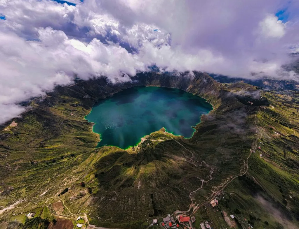
The reward for almost 2,000 metres of elevation gain is breathtaking: cresting at 3,914 metres, you arrive at the rim of the massive volcanic caldera of Laguna Quilotoa. Emerald water fills a crater formed by a cataclysmic eruption eight centuries ago, changing colour as shifting light passes overhead. Staying near the rim provides an unforgettable evening spent watching fog roll across the volcanic lake.
Day 5 / Quilotoa to Ambato via Chugchilán Canyon
- Distance: 72 km
- Elevation Gain/Loss: +1,200 m / -2,400 m
- Max Gradient: 17%
- Longest Climb: 12.8 km
Dawn reveals sunlight burning off mist over the crater lake as you prepare for a day dominated by dramatic canyon topography. Rolling away from the crater rim, the route plunges down a technical, winding dirt track into the vast canyon system surrounding Chugchilán and Sigchos. Precision handling and careful braking are required to negotiate tight switchbacks cut directly into sheer rock faces.
Crossing river channels at the canyon floor, you begin a stiff climb out through remote mountain hamlets where Kichwa remains the primary language. The gradient bites hard on unpaved switchbacks, but the scenery is extraordinary: vertical canyon walls rise above, while small family farms cling to narrow ledges. Local children often wave from roadside homesteads as you grind upward through the dust.
Reaching the high ridge above the canyon, a final fast tarmac descent leads into the commercial valley of Ambato, tucked between high walls of the central depression at 2,450 metres. The sudden transition from quiet mountain hamlets to a vibrant urban valley offers a dramatic shift in environment. Ambato provides excellent amenities for a thorough mid-trip overhaul and a hearty evening meal.
Day 6 / Ambato to the Chimborazo high páramo
- Distance: 50 km
- Elevation Gain/Loss: +1,850 m / -400 m
- Max Gradient: 18%
- Longest Climb: 24.3 km
Today represents the physical and symbolic climax of the expedition. Leaving Ambato, you climb steadily southwest toward the massive flanks of Volcán Chimborazo (6,263 metres). The initial tarmac climb transitions to dirt as you gain altitude, leaving the valley floor behind and entering the high-altitude world of the central Andes.
Entering the Reserva de Producción de Fauna Chimborazo, you rise well above the treeline into the desolate, majestic high páramo. This exact ecosystem inspired Humboldt’s Naturgemälde mapping zone, where he recorded plant species adapted to extreme solar radiation and low temperatures. Herds of wild vicuñas graze among giant chuquiragua shrubs and cushion plants, unbothered by passing cyclists.
Passing 4,000 metres, altitude makes every pedal stroke intentional, demanding low gearing and steady focus. The massive glaciers of Chimborazo loom directly above, capping the mountain whose summit represents the closest point on Earth’s surface to the sun due to the equatorial bulge. You seek shelter at high-altitude refugios or established campsites beneath the ice line as sub-zero temperatures settle over the plateau.
Day 7 / Chimborazo Reserve to Riobamba
- Distance: 53 km
- Elevation Gain/Loss: +350 m / -1,900 m
- Max Gradient: 11%
- Longest Climb: 4.1 km
After a cold night on the high plateau, the final day delivers a high-speed descent off the shoulders of Chimborazo. Early morning frost coats the tussock grass as you roll past icy streams under clear blue skies. The initial section follows fast, loose gravel doubletrack across the high reserve, where the sheer scale of the landscape continues to awe.
Dropping off the high reserve, the track transitions into smooth backcountry roads as you lose nearly 2,000 metres of elevation over thirty kilometres. Atmospheric pressure increases rapidly, bringing warmer air and richer oxygen levels with every kilometre descended. The desolate páramo yields once more to fertile pastureland, eucalyptus groves, and vibrant agricultural villages.
Dropping through highland communities, the journey concludes in the historic city of Riobamba at 2,750 metres, completing a 420-kilometre traverse of Ecuador’s iconic volcanic spine. Standing in the central plaza with Chimborazo visible on the northern horizon, you reflect on a journey that connected historic exploration with modern, self-supported adventure.
The Galápagos.
Ecuador’s Enchanted Isles
Technical logistics & equipment choices
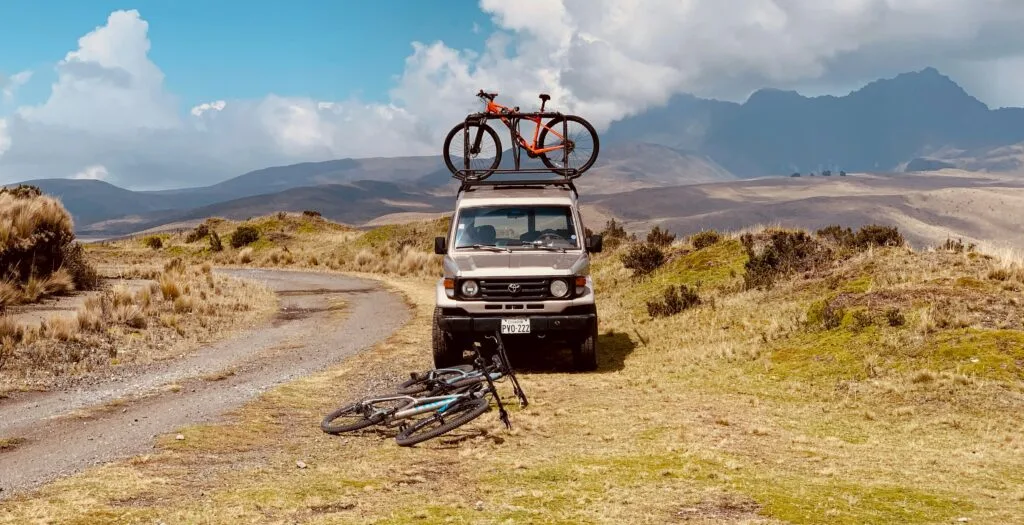
Successful completion of the Avenue of the Volcanoes requires tubeless gravel tyres at least 47 mm wide, ultra-low gearing, comprehensive thermal layers for sub-zero páramo nights, water filtration systems, and reliable resupply planning across remote indigenous Andean villages.
Bike setup & gearing
A rigid or hardtail bikepacking setup is ideal for this route. Low gear ratios are non-negotiable for riding loaded bikes up 20% cobblestone or dirt gradients at high altitude. A 1:1 gear ratio is the absolute minimum; a setup with a 28T or 30T chainring paired with a 10-52T cassette is strongly recommended. Tubeless tyres between 47 mm and 50 mm (or 2.1-inch mountain bike tyres) provide critical traction, pinch-flat protection, and comfort over loose volcanic ash and harsh basalt cobblestones.
Weather & altitude protocols
Acclimatisation is vital before turning a pedal. Spend at least two to three days in Quito (2,850 metres) taking easy rides or hikes before departing. Weather in the high Andes changes rapidly: mornings are typically clear, followed by afternoon rain, hail, or dense fog. Waterproof outer shells and high-loft thermal layers are essential, as temperatures in the páramo frequently plunge below 0°C at night.
Resupply strategy & water
Village tiendas stock basic staples such as rice, oats, eggs, canned tuna, biscuits, and panela (unrefined cane sugar, excellent for water bottles). Hot meals like locro de papas (hearty potato soup) are widely available in small settlements for very reasonable prices. Water sources in pastoral zones are susceptible to agricultural runoff; carry a reliable microfilter or purification tablets, and maintain at least 3 litres of carrying capacity during long páramo stages.
The Ecuadorian Amazon.
The most biodiverse place in the world
Ride Ecuador’s volcanic spine
Read this far?
Riding Ecuador’s Avenue of the Volcanoes is far more than a physical test of endurance over rugged basalt cobblestones and high passes. It is an invitation to slow down and experience the northern Andes as they truly are—unfiltered, unpredictable, and deeply majestic. Carrying your own kit across windswept páramo plateaus restores a sense of self-reliance that commercial tour buses simply cannot replicate.
As you pedal through quiet mountain hamlets where Kichwa traditions endure, and smoke rises from kitchen chimneys, you connect directly with the living geography Humboldt catalogued over two centuries ago. Every long ascent rewarded with a sweeping canyon view reinforces why independent travel remains so transformative. You are not merely passing through a landscape; you are participating in its rhythm stroke by stroke.
Preparation, respect for high altitude, and the right gearing will turn this demanding 420-kilometre expedition into one of the defining journeys of your cycling life. Pack your thermal layers, mount wide tubeless rubber, and embrace the freedom of the open dirt road beneath the highest peaks on Earth.
At Wheely Tyred, we believe the best stories are written away from the main highways, powered by your own legs and guided by curiosity. The high passes of Cotopaxi, Quilotoa, and Chimborazo are waiting—it is time to load your bikepacking bags and ride.
Affiliate Disclaimer: Some of the links on Wheely Tyred are affiliate links. If you click through and make a booking or purchase, we may earn a small commission at no extra cost to you. We only recommend gear, tours, stays, and services we genuinely use, trust, and stand behind — our editorial independence always comes first. These commissions help keep our independent cycling guides and travel stories free to read. You can also buy me a coffee here — thanks for supporting the ride!
The Ecuadorian Coast.
Where you’ll find the very best food
Frequently asked questions about bikepacking the Avenue of the Volcanoes
The dry season from June to September offers the most predictable weather, with clearer morning skies and drier trail conditions across the high páramo. However, high-altitude winds can be strong during these months, and afternoon rain showers remain possible year-round in the tropical Andes.
Plan to spend a minimum of two to three full days resting and exploring in Quito at 2,850 metres before setting off loaded. Take easy walking tours or short spin rides up nearby hills like El Panecillo to help your body adapt to thinner air before tackling 1,000-metre climbing days.
A rigid steel or titanium bikepacking rig, or a hardtail mountain bike with a lock-out front fork, is ideal. Drop-bar gravel bikes work well, provided they have clearance for tyres between 47 mm and 50 mm to cushion against rough basalt cobblestones and float through volcanic ash.
Water is abundant in mountain streams and village supply taps, but all water gathered in agricultural or pastoral zones must be treated. Carry a reliable hollow-fibre microfilter or purification tablets, and ensure you have at least 3 litres of carrying capacity for remote stretches across Cotopaxi National Park and the Chimborazo Reserve.
Small village tiendas stock basic staples such as oats, rice, canned fish, bananas, and blocks of panela, an unrefined cane sugar perfect for dissolving in water bottles. In local eateries, look for locro de papas, a thick potato and cheese soup served hot, which provides ideal fuel for high-altitude riding.
Basic conversational Spanish is essential for navigating village stores, ordering meals, and asking for directions in remote areas. While Kichwa is widely spoken in indigenous highland communities, local residents are patient, welcoming, and accustomed to helping travellers who approach with courtesy and respect.
Ecuador.
Pure wonder on the equator.