
Laguna de Cuicocha, Ecuador / The first-timer guide to hiking Imbabura’s volcanic crater lake
Everything first-time travellers need to know about visiting Laguna de Cuicocha independently
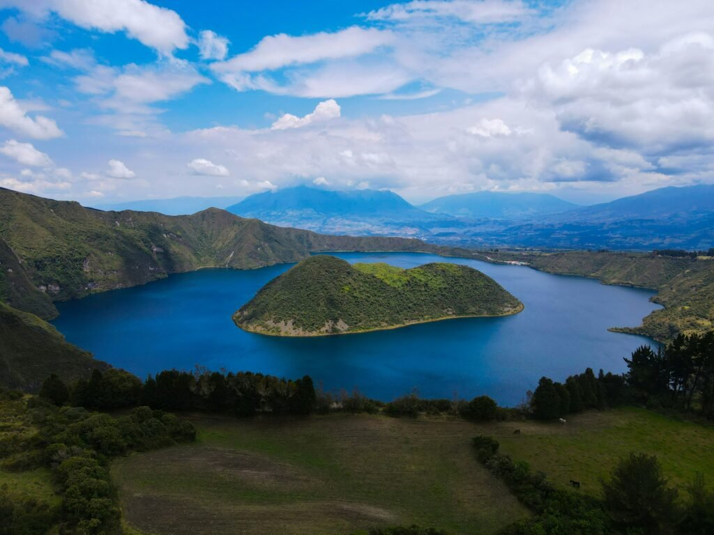
Uncover Imbabura’s crown jewel

BEN FINCH
Rising above the northern highlands of Ecuador, the province of Imbabura is widely celebrated for its rich indigenous culture and bustling artisanal markets. Yet, just a short journey beyond the popular market squares of Otavalo lies one of the most striking natural landscapes in the northern Andes: Laguna de Cuicocha.
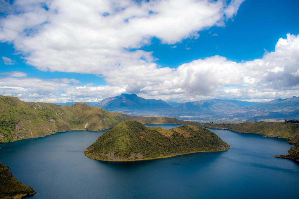
Formed during a cataclysmic eruption roughly 3,100 years ago, this massive volcanic caldera sits at the foot of Volcán Cotacachi. The resulting crater lake stretches three kilometres across, its deep, highly alkaline waters cradling two densely forested volcanic domes that rise dramatically from the basin.
For the independent traveller, Laguna de Cuicocha represents the ideal Ecuadorian day trip. Unlike other high-altitude attractions that require expensive guided packages or restrictive group schedules, Cuicocha is eminently accessible by public transport and local trucks.
Whether you intend to hike the full ridge circuit, take a calm boat excursion around the inner islets, or simply soak in the vistas from the crater edge, this guide provides the practical foundation needed to experience the site on your own terms.
Essential insights for Laguna de Cuicocha
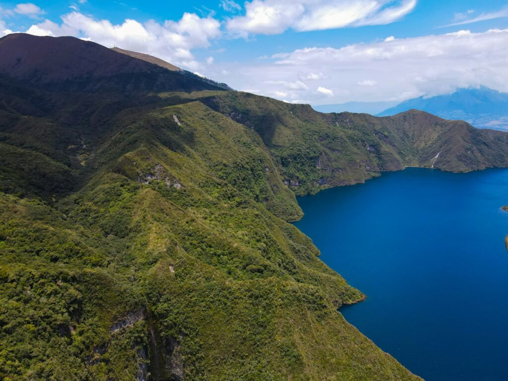
Uncover the dramatic volcanic beauty and living Kichwa heritage of Imbabura province at your own pace. These key highlights capture the essential nature, logistics, and culture of visiting Ecuador’s premier crater lake.
- Volcanic Origin: A striking three-kilometre-wide caldera lake formed roughly 3,100 years ago, featuring two densely forested volcanic islets, Isla Teodoro Wolf and Isla Yerovi, rising from its deep, alkaline waters
- Kichwa Sacrality: Named after the local word for guinea pig (kuy), the lake remains a sacred site where indigenous shamans conduct ritual purification baths (baños rituales) during the annual Inti Raymi solstice celebrations
- Sendero Las Orquídeas: A rewarding 14-kilometre rim trail offering uninterrupted 360-degree views of the caldera, Volcán Cotacachi, and high-altitude polylepis paperbark forests over a four- to five-hour trek
- Independent Transport: Easily accessible via frequent local buses from Otavalo or Ibarra to Quiroga, followed by a short pickup truck (camioneta) ride directly to the reserve entrance
- Caldera Boat Tours: A low-impact, 20-minute small boat excursion available at the visitor centre dock, navigating the narrow channel between the islets to view active sub-surface volcanic gas vents
- High-Altitude Weather: Sitting between 3,100 and 3,500 metres, the site demands layered clothing, strong sun protection, and sturdy footwear to navigate rapid shifts from morning sunshine to afternoon mountain mist
- Regional Culinary Delights: Perfect for post-hike refuelling in nearby Cotacachi, featuring local specialities like carne colorada (achiote-marinated pork) and chochos con tostado (Andean lupini beans with toasted corn)
Laguna de Cuicocha.
Lake of the guinea pig
Geology, Kichwa heritage, and sacrality
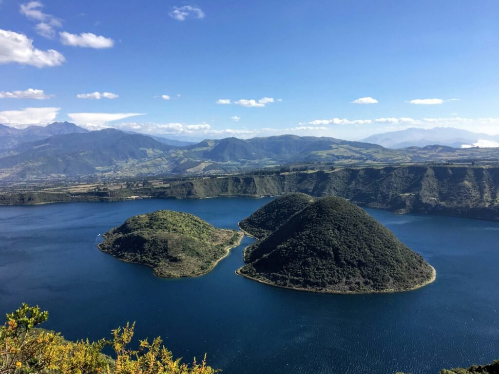
To appreciate Laguna de Cuicocha, one must understand both its geological power and its cultural significance to the indigenous Kichwa communities of the northern sierra. The name Cuicocha derives from the Kichwa words kuy meaning guinea pig and kucha meaning lake.
Local tradition holds that the larger of the two volcanic islets, Isla Teodoro Wolf, resembles the profile of a guinea pig floating on the water surface. The smaller islet, Isla Yerovi, sits nearby. Both domes are ecological reserves where public landing is strictly prohibited to protect endemic plant and bird species.
The lake reaches depths of over 200 metres, and because volcanic gases continue to vent from the caldera floor, the water remains mineral-rich and strongly alkaline. Little aquatic life survives inside the lake, resulting in extraordinarily clear, mirror-like water that shifts in tone from bright turquoise to dark navy depending on the angle of the equatorial sun.
For the surrounding Kichwa people, Laguna de Cuicocha is a sacred space rather than merely a geological anomaly. Every summer solstice during the celebration of Inti Raymi, local shamans and community members gather at the lake edge for ritual purification baths (baños rituales).
The waters are believed to wash away negative energy and bestow vitality for the coming agricultural cycle. Visitors should approach the area with quiet respect, acknowledging that this natural wonder remains an active place of worship and spiritual reflection.
Manage high-altitude microclimates
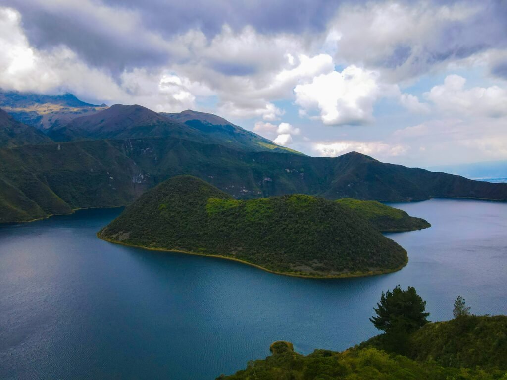
One of the most frequent miscalculations made by first-time visitors to the Ecuadorian Andes is underestimating the weather. Laguna de Cuicocha sits at an elevation ranging between 3,100 metres at the visitor centre and over 3,500 metres along the highest points of the caldera rim.
The microclimate here is notoriously changeable. Early mornings often bring bright, clear blue skies with intense high-altitude ultraviolet light. However, as the equatorial sun warms the valley floor, moist air rises from the western cloud forests, generating sudden thick mists, chilly mountain winds, and localised rain showers by early afternoon.
To ensure a comfortable excursion, independent travellers must prepare for rapid temperature shifts.
- Sun Protection: The atmosphere at 3,500 metres offers minimal protection against UV rays. Wear a broad-brimmed hat, apply high-factor sunscreen, and carry protective eyewear even on overcast mornings
- Layered Clothing: Thermal base layers, a fleece mid-layer, and a reliable windproof and waterproof outer jacket are essential. You may begin your walk in a light shirt and end it shivering against a sudden Andean ridge wind
- Footwear: The trail along the crater rim consists of loose soil, gravel, and exposed tree roots. Sturdy hiking boots or trail running shoes with aggressive tread are strongly recommended over standard trainers
- Hydration and Fuel: The combination of high altitude and dry air accelerates dehydration. Carry at least two litres of water per person alongside high-energy snacks such as dried fruit, nuts, and local panela cane sugar sweets
The Ecuadorian Sierra.
Get lost in the hills
The 14-kilometre rim trail / Sendero Las Orquídeas
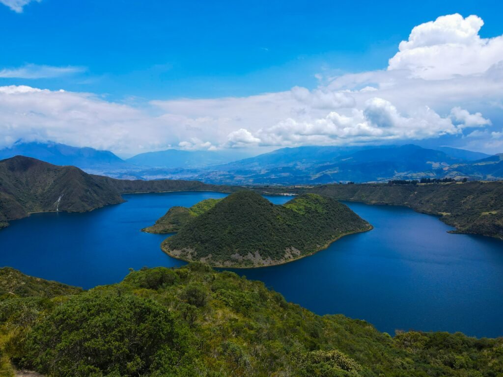
For active travellers, the primary draw of Laguna de Cuicocha is the full perimeter hike known as Sendero Las Orquídeas. This 14-kilometre trail traces the jagged rim of the caldera, offering uninterrupted 360-degree views of the lake interior, the massive peak of Volcán Cotacachi to the north, and the distant silhouette of Volcán Imbabura to the east.
The circuit takes between four and five hours to complete at a moderate pace. While the trail is clearly marked and impossible to lose, the elevation gain and repeated steep ascents and descents make it a moderate to challenging effort for those who have not fully acclimatised to the altitude.
Choosing your direction / Clockwise versus counter-clockwise
There are two distinct ways to tackle the loop, each offering a different distribution of physical exertion.
- Clockwise (Recommended for steady pacing): To hike clockwise, walk or take a brief ride roughly two kilometres up the paved access road past the visitor centre to the upper trailhead entrance. Starting here allows you to tackle the steepest uphill sections early in the day while your legs are fresh and the morning weather is stable. The second half of the hike then provides a gentler descent back down toward the lake level visitor centre
- Counter-Clockwise (Immediate views, steeper finish): Starting directly behind the visitor centre and hiking counter-clockwise gives immediate, dramatic views of the lake and islets. However, this direction saves several long, steep climbs through grassy páramo meadows for the final third of the journey, when afternoon heat or rain is more likely to settle in
Along the trail, hikers pass through diverse ecological zones, transitioning from high-altitude scrubland filled with wild orchids, bromeliads, and silver-leaved chuquiragua flowers to dense polylepis paperbark forests. Small wooden miradores (viewpoints) and covered rest shelters are positioned at key intervals along the ridge, offering ideal spots to pause, catch your breath, and take in the scale of the landscape.
Independent logistics / How to arrive and return
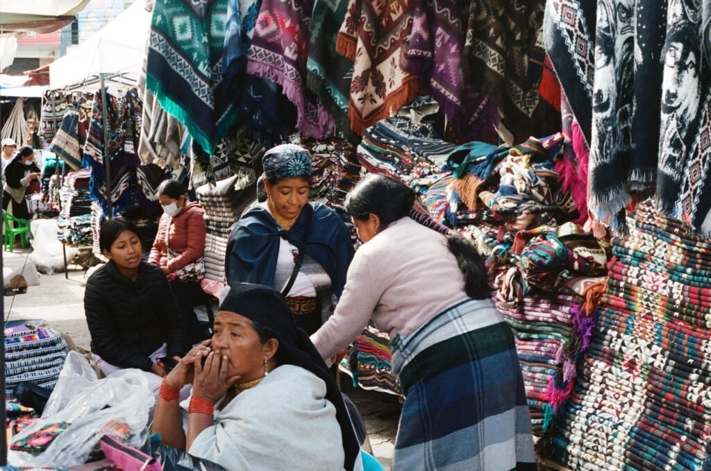
Navigating public transport in Imbabura province is straightforward, inexpensive, and places you in direct contact with daily local life. You do not need an organised tour bus to reach Laguna de Cuicocha.
Step one / From Otavalo or Ibarra to Quiroga
If you are staying in Otavalo or the regional capital of Ibarra, head to the local bus terminal (Terminal Terrestre). Board any regional bus bound for the town of Cotacachi or the smaller village of Quiroga. Buses depart every 15 to 20 minutes, cost less than one US dollar, and take approximately 20 to 25 minutes from Otavalo.
Inform the driver or conductor that you wish to disembark at the central plaza in Quiroga.
Step two / Quiroga to the lake entrance
From the central square in Quiroga, local transport transitions to green-and-white camionetas (double-cab pickup trucks) operated by local transport driver cooperatives. These trucks act as rural taxis and are parked along the side of the plaza.
A private ride in a camioneta from Quiroga to the Cuicocha visitor centre costs between four and five US dollars per vehicle. If you are travelling solo, you can often share the fare with other travellers or locals heading up the mountain. The drive takes around 15 minutes along a winding, paved mountain road.
Crucial return logistics / Avoiding transit delays
While getting to Laguna de Cuicocha is simple, securing transport back at the end of the day requires forethought. There is no permanent bus terminal or taxi rank at the crater lake. While camionetas occasionally drop off new visitors near the entrance, waiting for an unreserved truck in the late afternoon can result in long delays.
To guarantee a smooth return trip:
- Exchange Phone Numbers: When your camioneta driver drops you off at the park entrance in the morning, ask for their cell phone number or WhatsApp contact details
- Set a Pick-Up Time: Estimate the duration of your hike or visit (typically four to five hours for the trail, plus time for lunch) and arrange a fixed pick-up time at the visitor centre parking area
- Keep Cash Handy: Driver transactions in rural Ecuador are strictly cash-only. Carry small banknotes (one, five, and ten dollar bills) as drivers rarely have change for twenty dollar notes
The Galápagos.
Ecuador’s Enchanted Isles
Cultural etiquette and first-timer pitfalls

Visiting protected natural areas in Ecuador involves a few administrative details and cultural norms that first-time visitors often overlook.
Park entrance and registration
Laguna de Cuicocha is part of the broader Parque Nacional Cotacachi Cayapas ecosystem. Entrance to the reserve is free of charge. However, all visitors must present a passport or local identification document at the control booth near the entrance gate to register their name, nationality, and time of entry. This system ensures safety monitoring for hikers on the trail.
Trail rules and wildlife protection
Domestic animals and pets are strictly prohibited inside the reserve to protect native bird life and delicate soil structures. Camping along the crater rim is not permitted without specialised forestry permits.
Leave no trace
There are no rubbish bins positioned along the 14-kilometre trail loop. Every piece of fruit peel, food wrapper, and plastic bottle must be packed out in your daypack and disposed of back at the visitor centre or your hotel.
Acclimatisation hierarchy
Do not attempt the full Cuicocha rim trail on your first day after arriving in the Andes from sea level. Spend at least two days adapting to the altitude in Quito (2,850 metres) or Otavalo (2,550 metres) before undertaking strenuous hiking above 3,000 metres.
Family options, boat excursions, and easy viewpoints
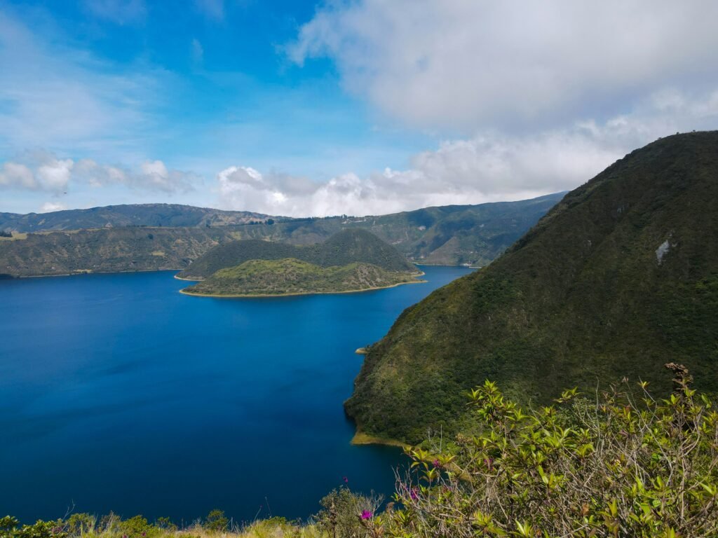
Not every traveller wishes to complete a four-hour rim hike, and Laguna de Cuicocha caters exceptionally well to families, children, and visitors seeking a more relaxed pace.
The 20-minute caldera boat tour
For a nominal fee of roughly four US dollars per person, small motorised boats depart regularly from the dock located below the main visitor centre. These guided boat rides take passengers out into the caldera basin, passing through the narrow channel between Isla Teodoro Wolf and Isla Yerovi.
During the trip, local boat captains explain the volcanic history of the crater, point out aquatic bubbling caused by sub-surface gas vents, and highlight unique flora clinging to the cliff faces. The boats are equipped with safety life jackets, making this an ideal, low-impact activity for children and older family members.
Short viewpoint walks
If you want to experience the flora and views without undertaking the full loop, walk the first 1,500 metres of the trail from the visitor centre to the first primary mirador. This gentle, well-maintained gravel path winds through garden areas showcasing native Andean plants and offers panoramic views over the lake in under 20 minutes.
The Ecuadorian Amazon.
The most biodiverse place in the world
Where to stay / Otavalo versus Cotacachi
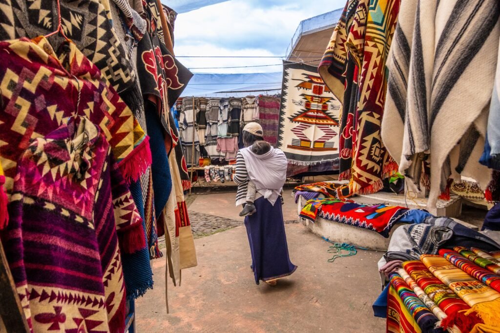
When deciding where to establish your base camp for exploring northern Imbabura, independent travellers generally choose between two neighbouring towns, each offering a distinct atmosphere.
Cotacachi / Tranquil, artisanal, and mountain-framed
Located just 12 kilometres from the lake entrance, Cotacachi is a quiet, clean, and charming town famous across South America for its leather craft. The central thoroughfare, Calle 10 de Agosto, is lined with family-owned workshops producing high-quality leather boots, jackets, bags, and belts.
Staying in Cotacachi places you closer to Laguna de Cuicocha, allowing for an early morning start before weather systems develop. The town features peaceful boutique inns, quiet plazas, and a relaxed mountain pace that appeals to travellers seeking solitude after a long day outdoors.
Otavalo / Vibrant, cultural, and well-connected
Situated 20 minutes south of Cotacachi along the Panamericana highway, Otavalo is the cultural capital of the region. Home to the world-famous Plaza de los Ponchos market, Otavalo offers a wide range of family-run guesthouses, historic haciendas, craft bakeries, and transport links to nearby lakes like Laguna de San Pablo.
Choosing Otavalo gives you immediate access to evening dining options, cultural events, and direct bus connections back south to Quito or north to Ibarra and Tulcán.
Regional culinary highlights
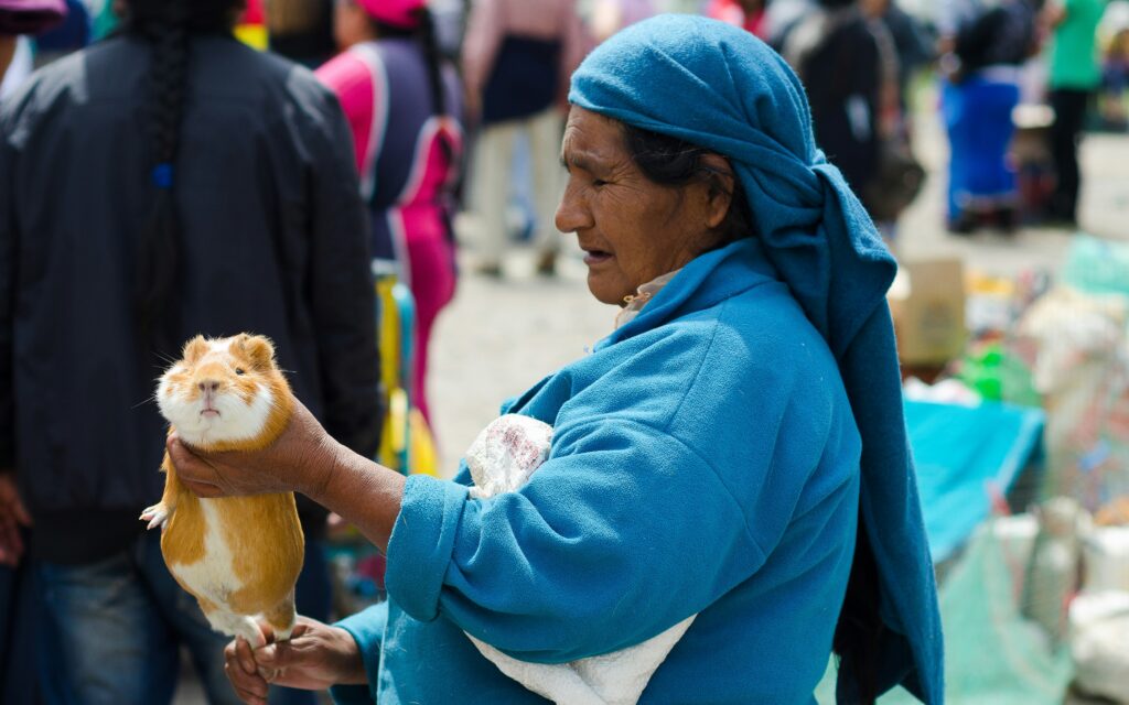
No trip to Imbabura is complete without sampling the distinct highland cuisine of northern Ecuador. After completing your hike or boat ride, seek out local eateries in Cotacachi or Quiroga to recharge with traditional dishes.
- Carne Colorada: The signature culinary dish of Cotacachi, consisting of tender pork marinated in achiote spice, garlic, and herbs, served alongside yellow corn hominy (molo or llapingachos potato cakes), avocado, and fried plantains
- Chochos con Tostado: A ubiquitous, highly nutritious Andean street snack made from cooked lupini beans (chochos) mixed with crispy toasted corn kernels (tostado), diced onions, cilantro, and a squeeze of fresh lime juice
- Fritada Imbabureña: Crispy, slow-braised pork chunks cooked in brass cauldrons, accompanied by boiled corn, cheese, and sweet plantains
- Chicha de Jora: A traditional fermented corn beverage seasoned with warm spices, often served during regional festivals and local gatherings
The Ecuadorian Coast.
Where you’ll find the very best food
The freedom of independent exploration
Laguna de Cuicocha captures the core appeal of self-directed travel in South America. It combines magnificent volcanic geography, deep indigenous heritage, and incredible hiking routes with straightforward, affordable transport options. By stepping away from rigid tour itineraries, taking the time to ride local camionetas, and moving at your own pace along the caldera rim, you gain an authentic connection to the highland landscapes of Imbabura.
Pack your windbreaker, secure your return transport driver, give yourself time to acclimatise, and discover one of Ecuador’s most captivating natural sanctuaries on your own terms.
Affiliate Disclaimer: Some of the links on Wheely Tyred are affiliate links. If you click through and make a booking or purchase, we may earn a small commission at no extra cost to you. We only recommend gear, tours, stays, and services we genuinely use, trust, and stand behind — our editorial independence always comes first. These commissions help keep our independent cycling guides and travel stories free to read. Thanks for supporting the ride!
Frequently asked questions about visiting Laguna de Cuicocha
Board any regional bus bound for Cotacachi or Quiroga from the local terminal in Otavalo. Disembark at the central plaza in Quiroga, where green-and-white camionetas (pickup truck taxis) wait to take passengers up the mountain directly to the Cuicocha visitor centre.
There is no fixed taxi rank at the crater lake. When your camioneta driver drops you off in the morning, request their cell phone number or WhatsApp contact details and agree on a fixed pick-up time at the parking area for your return journey. Always carry small cash banknotes for the fare.
No permit or paid guide is required to walk the Sendero Las Orquídeas perimeter trail. However, all visitors must register their name, nationality, and entry time with park authorities at the control booth near the entrance gate for safety monitoring. Entrance to the reserve is free of charge.
Hiking clockwise is generally recommended for steady pacing. By walking up the paved road to the upper trailhead first, you tackle the steepest ascents early in the morning while your energy is high and the mountain weather is clear, leaving a gentler descent for the afternoon.
No. Swimming is not recommended due to high alkalinity, cold water temperatures, and mineral content. Furthermore, the two volcanic islets are protected ecological reserves, and public landings are strictly prohibited to preserve native wildlife and rare plant species.
Pack a minimum of two litres of water, high-energy snacks, a broad-brimmed hat, high-factor sunscreen, and a windproof waterproof jacket. Weather conditions at 3,500 metres shift quickly, so sturdy hiking footwear with good tread and warm clothing layers are essential.
Ecuador.
Pure wonder on the equator.


