
Laguna de Cuicocha / The ultimate guide to Ecuador’s secret volcanic rim
A complete self-guided guide to hiking the Laguna de Cuicocha crater rim in Ecuador
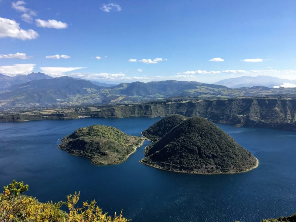
Circular horizons, volcanic stillness, and the quiet freedom of Ecuador’s high Andes

BEN FINCH
Rising above the northern Andean valleys of Imbabura province, Laguna de Cuicocha presents one of the most striking natural landscapes in South America. While thousands of visitors flood into the highland town of Otavalo every weekend to browse the bustling textile markets, only a small fraction venture 15 km further west into the foothills of Volcán Cotacachi.
What awaits those who do is a dramatic, deep-blue caldera lake framed by sweeping páramo grasslands, jagged mountain ridges, and steep volcanic slopes.
For the independent traveller, Laguna de Cuicocha is an ideal destination. It offers the raw beauty of Andean high-altitude hiking without the need for technical climbing gear, expensive guides, or restrictive tour packages.
The entire crater rim can be traversed on a well-maintained 14 km loop trail, granting panoramic vistas across northern Ecuador. Travelling here under your own steam allows you to experience the landscape at your own rhythm, pausing when the cloud cover parts over neighbouring peaks or when the sun hits the water to reveal its vivid turquoise hue.
At Wheely Tyred, we champion this style of autonomous travel. Whether you choose to explore on foot or combine your hike with a regional road ride through the artisan villages of Imbabura, this guide provides everything you need to navigate Laguna de Cuicocha independently.
Circular horizons / Key moments on the Cuicocha rim
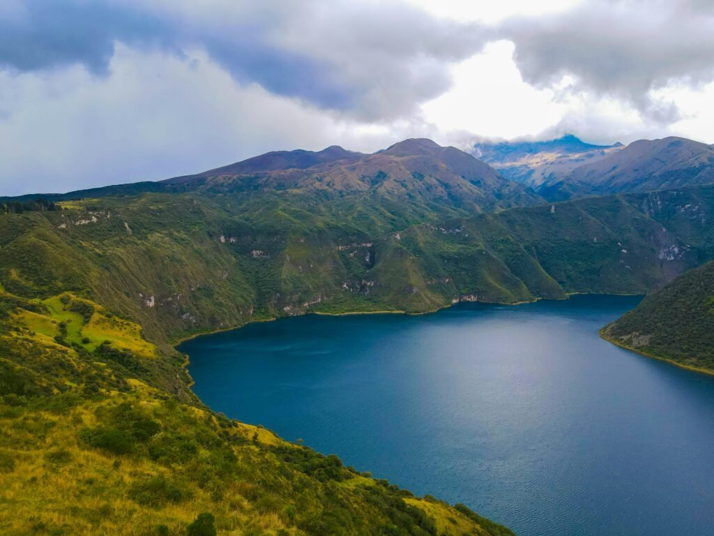
Traversing the rim of a massive volcanic caldera offers one of northern Ecuador’s most rewarding day hikes. Here are the essential highlights, route details, and practical insights for exploring Laguna de Cuicocha under your own steam.
- Volcanic origins: A dramatic 3 km-wide caldera formed roughly 3,100 years ago following an explosive eruption of Volcán Cotacachi, creating a deep-blue lake around two emerging lava domes
- The guinea pig connection: Named from the indigenous Kichwa words cuy (guinea pig) and cocha (lake), inspired by the shape of the largest central island, Isla Teodoro Wolf, which resembles a resting guinea pig
- Sacred solstice waters: An enduring spiritual location for local Kichwa communities, who gather along the shoreline during the annual Inti Raymi festival to perform sacred cleansing baths
- The Sendero Grijalva circuit: A high-altitude 14 km rim loop reaching a peak elevation of 3,512 metres, surrounded by native páramo grasses, orchids, and sweeping valley views
- Flexible hiking directions: Walk anti-clockwise from the visitor centre to tackle steep paved steps early, or opt for a clockwise route for a gentler initial incline along dirt access roads
- Artisan roots in Cotacachi: Combine your crater hike with a visit to the nearby town of Cotacachi, celebrated across Ecuador for its independent leathercraft workshops and quiet cafes
- Self-guided transit: Easily reached via a short local bus from Otavalo to Cotacachi followed by a local taxi, allowing you to bypass rigid tour bus schedules completely
Laguna de Cuicocha.
Lake of the guinea pig
Understanding Laguna de Cuicocha / Geology, mythology, and guinea pigs
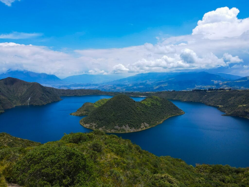
To fully appreciate the landscape, it helps to understand how this remarkable landform came to be. Laguna de Cuicocha rests inside a 3 km-wide caldera situated at an elevation of 3,246 metres.
Roughly 3,100 years ago, a massive explosive eruption from the flank of the massive Volcán Cotacachi collapsed the surrounding terrain, forming a deep basin. Subsequent volcanic activity created two massive lava domes that emerged from the lake floor, forming the uninhabited islands seen today: Isla Teodoro Wolf and Isla Yerovi.
The lake water is highly alkaline and rich in volcanic minerals, reaching depths of over 200 metres. Because of the gas vents on the crater floor, small bubbles occasionally rise to the surface, and the water remains too cold and mineral-dense for swimming.
The name Cuicocha originates from the Kichwa language, combining cuy (guinea pig) and cocha (lake). Local tradition holds that the shape of the larger island, Isla Teodoro Wolf, resembles the back of a guinea pig resting in the water.
Beyond its geography, the lake holds deep spiritual significance for the indigenous Kichwa people of the northern Andes. Every year during the June solstice festival of Inti Raymi, shamans and community members gather at the water’s edge to perform sacred cleansing baths, harnessing the energy of the volcanic spring waters.
Comparing the crowds / Why independent travellers skip the tour buses
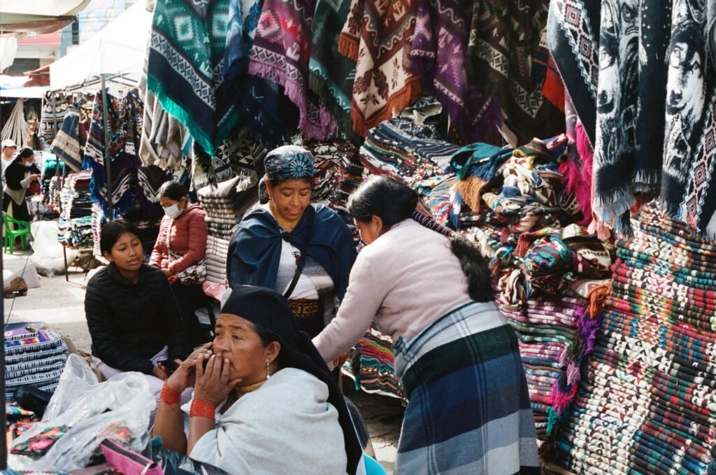
Most organised group tours from Quito or Otavalo treat Laguna de Cuicocha as a brief, secondary stop. Tour buses usually arrive late in the morning, discharge passengers at the visitor centre for a quick photo at the lower overlook, offer a 20-minute motorised boat trip around the islands, and then hurry everyone back onto the vehicle to reach a pre-arranged lunch buffet.
This rigid itinerary misses the true essence of the location. The beauty of Cuicocha lies along its high ridge, where the landscape opens up into vast Andean vistas far removed from the parking area. By setting out early on a self-guided trek, you leave the tour groups behind within the first 10 minutes.
You gain total control over your schedule—stopping to observe high-altitude bird species, admiring wild orchids blooming in the scrub, or sitting quietly on a grassy mound to watch the mist roll over Volcán Imbabura in the distance.
The Ecuadorian Sierra.
Get lost in the hills
Hike the Cuicocha rim trail / A step-by-step route breakdown
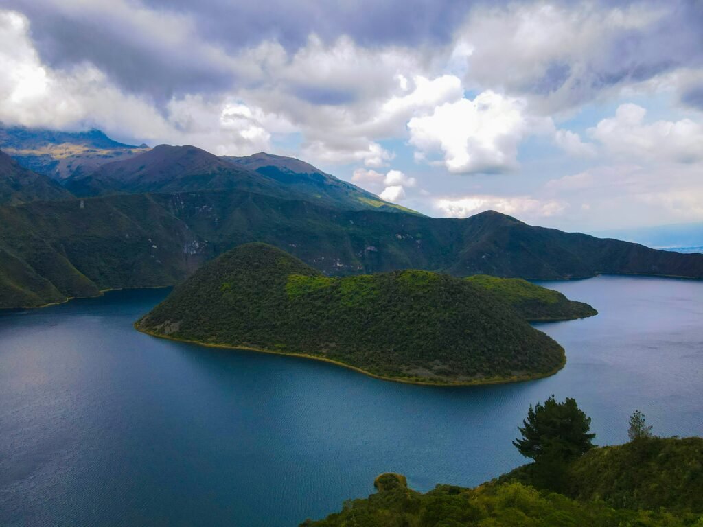
The full circuit around the caldera rim, known locally as the Sendero Grijalva, is one of the finest day hikes in northern Ecuador. Here is what to expect along the route.
Trail overview
- Distance: 14 km loop
- Time required: Four to five hours at a steady pace
- Starting elevation: 3,100 metres
- Maximum elevation: 3,512 metres
- Difficulty: Moderate; requiring good cardiovascular fitness due to the altitude
Which direction to hike / Clockwise or anti-clockwise?
The trail can be hiked in either direction, but each offers a distinct experience:
- Anti-clockwise / Standard route: Starting directly from the main park entrance near the visitor centre, you begin with a steady, steep ascent up paved steps and dirt paths onto the eastern ridge. This route gets the hardest climbing out of the way early while your legs are fresh. As you walk, the lake remains on your left, offering continuous views that evolve with every turn. The final three kilometres descend gradually down a dirt access road back to the park entrance.
- Clockwise / Alternative route: Some hikers choose to walk up the paved access road first, entering the trail from the higher western side. This offers a gentler initial incline through open meadows before joining the main ridge, though it leaves the steeper descents for the end of the day when knees may be tired.
The Galápagos.
Ecuador’s Enchanted Isles
Key landmarks along Cuicocha rim
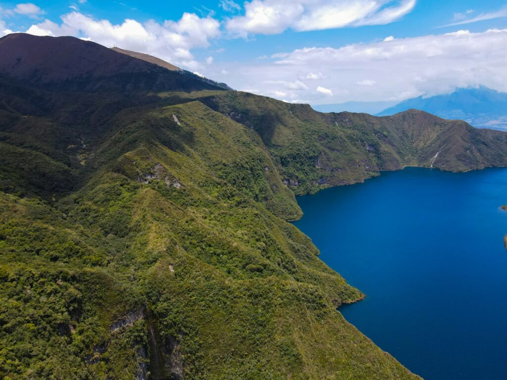
El Arrayán Visitor Centre
The official trailhead where all visitors register their entry. There are small display rooms outlining local flora and fauna, alongside public facilities.
The Sun and Moon Altars
Shortly after beginning the anti-clockwise trail, you will pass ceremonial stone structures built to honour traditional indigenous cosmology.
The High Ridges
Between kilometres four and eight, the trail reaches its highest points. Here, you walk along narrow dirt paths bordered by bromeliads, lupines, and native polylepis trees. On clear days, looking outward away from the lake reveals sweeping views across the agricultural mosaic of the Cotacachi valley towards the peak of Volcán Imbabura.
Mirador Cuicocha
Located on the far northern curve of the rim, a covered wooden gazebo offers shelter from sudden mountain breezes and serves as the perfect midpoint spot for a packed lunch.
The Ecuadorian Amazon.
The most biodiverse place in the world
Essential practicalities for the independent explorer
Getting there and away
Reaching Laguna de Cuicocha without an organised tour group is straightforward and economical.
- From Otavalo: Take a local bus from the central bus terminal to the nearby town of Cotacachi (approx 20 minutes). From the main square or bus stop in Cotacachi, hire a local yellow taxi to drive you directly to the Cuicocha park entrance (approx 15 minutes). Alternatively, taxis can be hired directly from Otavalo for a fixed rate
- Returning: Taxis are sometimes waiting near the visitor centre in the afternoon. If none are present, the staff at the park office can call a cab from Cotacachi for you
- Self-drive or bicycle transport: If travelling with your own vehicle or hire car, parking at the main entrance is free and secure. Cyclists tackling the high-altitude routes of Imbabura can ride the paved road from Cotacachi up to the crater rim, securing bikes at the visitor centre before taking to the footpaths
Altitude, weather, and trail conditions
Because the entire hike takes place above 3,100 metres, altitude is the primary factor to respect. If you have just arrived in the Andes from sea level, spend at least two days acclimatising in Quito or Otavalo before attempting the full circuit. Take a steady pace, drink plenty of water, and carry high-energy snacks.
Weather in the Ecuadorian Andes changes rapidly. Mornings are typically bright, dry, and clear, offering the best visibility. By early afternoon, clouds frequently roll in over the crater rim, bringing cooler temperatures and occasional rain showers. Setting off between 08:00 and 09:00 ensures you complete the majority of the hike under clear skies.
What to pack for a high-altitude day hike
- Sturdy footwear: Trail running shoes or light hiking boots with good grip for loose dirt paths
- Layered clothing: A breathable base layer, an insulating fleece mid-layer, and a windproof, waterproof jacket
- Sun protection: High-factor sunscreen, sunglasses, and a wide-brimmed hat—the equatorial sun at 3,200 metres is intense even on overcast days
- Hydration and food: At least two litres of water per person and enough food for a full half-day outing
- Cash: Small denomination US dollar notes for taxi fares and small purchases at local stalls
The Ecuadorian Coast.
Where you’ll find the very best food
Pairing Cuicocha with Cotacachi and active exploration
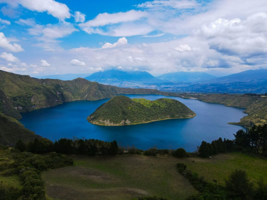
After completing your circuit of the crater rim, extend your day by exploring the surrounding region on your own terms.
Just down the mountain sits Cotacachi, celebrated across Ecuador for its rich tradition of leathercraft. The main street, Calle 10 de Agosto, is lined with family-run workshops producing handmade boots, jackets, and bags. It is a quiet, pleasant town with excellent local cafes serving traditional Andean coffee and regional dishes.
For active travellers who prefer two wheels, the quiet, paved backroads connecting Cotacachi, Quiroga, and the surrounding agricultural communities offer outstanding riding routes.
Cycling through these valleys provides an intimate view of rural life in the Andes—passing maize fields, historic haciendas, and small village squares framed by volcanic peaks.
Affiliate Disclaimer: Some of the links on Wheely Tyred are affiliate links. If you click through and make a booking or purchase, we may earn a small commission at no extra cost to you. We only recommend gear, tours, stays, and services we genuinely use, trust, and stand behind — our editorial independence always comes first. These commissions help keep our independent cycling guides and travel stories free to read. Thanks for supporting the ride!
Frequently asked questions about Laguna de Cuicocha
Board a local bus from the central bus terminal in Otavalo to the town of Cotacachi, which takes around 20 minutes. From the main square or bus stop in Cotacachi, hire a local yellow taxi for the final 15-minute drive to the park visitor centre. When you finish your hike, ask the staff at the park entrance office to call a return cab from Cotacachi.
The 14 km loop trail takes between four and five hours at a steady pace. While the trail is well-maintained, the primary difficulty comes from the high elevation, which ranges from 3,100 metres to 3,512 metres above sea level. Good cardiovascular fitness is required, and spending at least two days acclimatising in Quito or Otavalo beforehand is strongly advised.
Most independent hikers choose the anti-clockwise direction starting behind the main visitor centre. This route puts the steepest climbing over paved steps and dirt tracks at the beginning of the trek when your energy is highest. Walking clockwise offers a gradual initial incline up a dirt road, but leaves steep descents for the end of the day.
In the native Kichwa language, cuy means guinea pig and cocha means lake. The name comes from the shape of Isla Teodoro Wolf, the largest of the two volcanic lava domes inside the caldera, which looks like the rounded back of a guinea pig sitting in the water.
Swimming is not permitted in the lake. The water is extremely cold, highly alkaline, and filled with volcanic minerals, with gas vents constantly bubbling up from the caldera floor. Motorised boat trips around the central islands operate from the lower docks, but hiking the high rim provides a far better vantage point.
Weather in the high Andes can change within minutes. Wear layered clothing including a breathable base layer, an insulating fleece, and a windproof, waterproof jacket. Pack sturdy trail shoes, high-factor sunscreen, a hat, at least two litres of water per person, high-energy snacks, and small US Dollar cash notes for local transport.
Ecuador.
Pure wonder on the equator.


