
Unearth the highland routes of Parque Nacional Cajas / Ecuador’s ancient páramo sanctuary
Discover the complete history, hiking trails, and ecological heritage of Cajas National Park in Ecuador
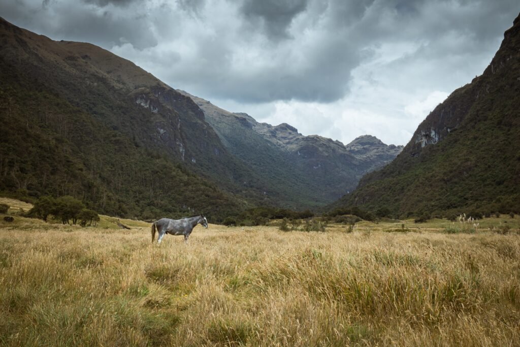
Inca stone highways weave a timeless tale of mountain endurance

BEN FINCH
West of the historic colonial city of Cuenca in southern Ecuador, the Andean cordillera undergoes a dramatic transformation. Unlike the towering volcanic peaks that dominate the northern landscape around Quito, the mountains here present an older, heavily weathered geography.
This is Parque Nacional Cajas, an extraordinary high-altitude expanse spanning nearly thirty thousand hectares at elevations ranging from 3,100 to 4,450 metres above sea level.
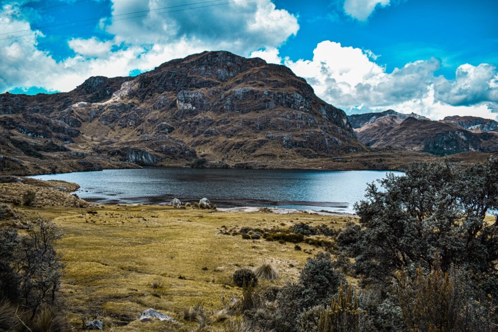
To cross this terrain is to step into a landscape shaped by ice, water, and human necessity. The name itself stems from regional history. One prominent theory derives the title from the Kichwa word kahas, meaning gateway to the snowy mountains. Another points to the distinct topography: a vast plateau where hundreds of glittering glacial tarns are encased within deep mountain valleys like jewels resting in wooden boxes.
Far from being an uninhabited wilderness, this tundra-like wetland has served as a vital bridge between distinct geographic worlds for thousands of years. It is a place where pre-Columbian trade, imperial conquest, colonial commerce, and delicate ecology converge.
The highlights of Parque Nacional Cajas
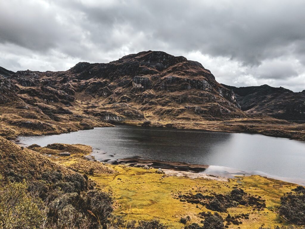
High in the southern Andes, Parque Nacional Cajas weaves ancient Incan stone highways, sacred Cañari lakes, and a rare high-altitude wetland into a vast mountain sanctuary. Here is what every independent traveller needs to know before venturing into Ecuador’s mist-shrouded páramo.
- Sacred Cañari waters: Long before the Incas arrived, the indigenous Cañari revered the dark glacial tarns of Cajas as spiritual pilgrimage sites and vital trading hubs between the Andes and the Pacific coast
- The Incan highway: A well-preserved stretch of the Qhapaq Ñan runs through the park, featuring the stone ruins of Paredones—an ancient imperial resting station where chasqui messengers and trade caravans once sheltered
- The spongy páramo: Spanning elevations from 3,100 to 4,450 metres, this high-altitude wetland ecosystem acts as a giant natural sponge, supplying most of the drinking water for nearby Cuenca
- Paperbark forests: Rare Polylepis trees, known locally as quinoa, cling to high ravines, shedding paper-thin layers of reddish bark to insulate themselves against freezing mountain temperatures
- Laguna Toreadora: Serving as the principal access point and interpretation centre, this central lake offers accessible trailheads leading deep into ancient Polylepis groves and surrounding valleys
- Tres Cruces viewpoint: Sitting directly on the continental divide at over 4,000 metres, this dramatic pass splits rainfall between the Pacific Ocean and the Amazon River basin
- Independent access: Located under thirty kilometres west of Cuenca, the park is easily reached by local public buses running along the highway toward Molleturo and Guayaquil
Cajas National Park.
The most beautiful national park
Sacred waters of the Cañari
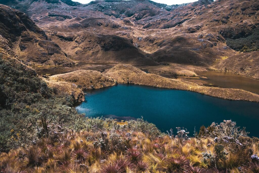
Long before European explorers set foot in the Americas or the Incas marched north from Cusco, the high valleys of Cajas were settled and revered by the Cañari people. For the Cañari civilisation, water was the central pillar of spiritual life and cosmos origin stories. The dark, cold lagunas that dot the Cajas massif were not merely sources of sustenance; they were sacred sites of pilgrimage and ritual worship.
The geography of Cajas formed a natural geographic pass connecting the Andean highlands around the ancient settlement of Guapondelig—which would later become the Incan city of Tomebamba and eventually modern-day Cuenca—with the humid coastal plains along the Pacific.
Cañari traders established footpaths across the exposed ridges and boggy valleys, bringing highland obsidian, tubers, and textiles down to trade for coastal seashells, salt, and cacao.
Archaeological surveys within Parque Nacional Cajas have identified at least twenty-eight distinct pre-Hispanic sites, proving that these remote, mist-shrouded heights sustained active human movement and seasonal habitation for generations.
Imperial stone / The Qhapaq Ñan across the páramo
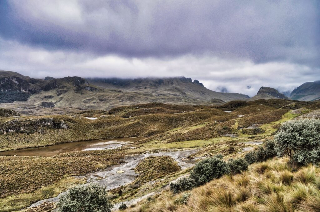
In the late fifteenth century, the expanding Inca Empire under Emperor Túpac Inca Yupanqui moved into southern Ecuador. Following decades of fierce resistance, the Cañari territory was absorbed into Tawantinsuyu. Recognising the strategic importance of the mountain pass, Incan engineers integrated the existing Cañari footpaths into the grand Qhapaq Ñan—the legendary network of stone-paved highways that spanned the length of South America.
The Cajas portion of the Qhapaq Ñan served as the primary arterial link between the major royal city of Tomebamba and the coastal outpost of Molleturo. Paved with meticulously laid stones designed to withstand torrential rains and frost heave, the trail allowed imperial messengers, known as chasquis, to sprint across the mountains carrying quipus and fresh news.
Along this route lie the ruins of Paredones. Situated near the western edge of the park boundary, Paredones consists of stone foundations and administrative walls that functioned as a major tambo, or imperial resting station. Here, Inca armies, trade caravans, and noble travellers found shelter, food, and security before attempting the steep descent toward the Pacific lowlands.
Today, walkers traversing sections of the Inca Trail inside Parque Nacional Cajas can still place their boots directly upon the very stones placed by Incan stonemasons five centuries ago.
The Ecuadorian Sierra.
Get lost in the hills
Smugglers, merchants, and the republican road
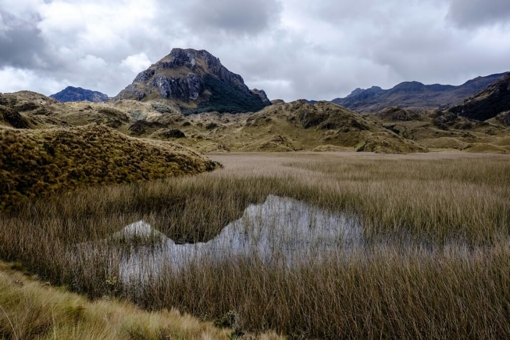
With the arrival of Spanish conquistadors and the establishment of colonial rule, the high-altitude pass across Cajas retained its crucial role as a commercial artery. However, navigating the unpredictable mountain weather remained a dangerous undertaking. Sudden freezing rains, dense fogs, and disorienting winds often trapped merchants and livestock.
During the nineteenth century and the early years of the Ecuadorian Republic, the trail gained notoriety as a route for contrabandists. Spirit smugglers, illicit liquor traders, and merchants seeking to avoid high government tariffs on goods passing between Guayaquil and Cuenca used the isolated valleys of Cajas to move undetected. Places like the Cueva de los Muertos—the Cave of the Dead—earned their haunting names during this era, serving as rough shelters where travellers caught in sudden blizzards succumbed to hypothermia.
Recognising the urgent need for a reliable connection between the southern highlands and the coast, President Gabriel García Moreno initiated the construction of an improved commercial highway across Cajas in the mid-nineteenth century.
Known as the Camino de García Moreno, this cobbled track updated the old Incan alignment to accommodate mule trains and heavy goods, solidifying Cajas as the definitive lifeline of southern Ecuador until modern civil engineering introduced asphalt highways in the late twentieth century.
The living sponge / Glaciers and the páramo ecosystem
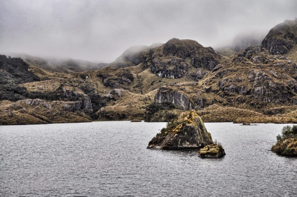
Beyond its human history, Parque Nacional Cajas is a marvel of natural evolution and hydrology. The park lies within the tropical alpine grassland ecosystem known as the páramo. Found only in the high northern Andes between Venezuela and northern Peru, the páramo has fascinated naturalists since Alexander von Humboldt explored the region in the early nineteenth century.
The landscape of Cajas was sculpted during the last ice age, when massive glaciers carved out deep U-shaped valleys and left behind more than two hundred and thirty distinct lakes and tarns. These water bodies are connected by a vast network of subterranean streams and spongy, peat-rich soil. The thick layers of moss, cushion plants, and bunchgrasses act as a gigantic natural sponge, trapping moisture from passing Pacific clouds and releasing it slowly and continuously into the river systems below.
This natural hydrological regulation is vital to human life in southern Ecuador. The waters flowing from Parque Nacional Cajas supply the majority of the drinking water for the city of Cuenca and feed major hydroelectric stations that generate power for the entire nation.
The Galápagos.
Ecuador’s Enchanted Isles
Ancient paperbark forests and highland biodiversity
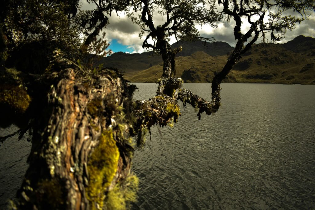
Walking through Cajas reveals specialised flora and fauna adapted to severe daily temperature swings, intense solar radiation, and thin alpine air. Among the most remarkable botanical treasures are the forests of Polylepis, locally known as quinoa or paperbark trees.
Belonging to the rose family, these gnarled, twisting trees possess reddish bark that peels off in delicate, paper-thin layers—an evolutionary mechanism designed to insulate the trunk against freezing temperatures.
Polylepis forests are among the highest-altitude natural woodlands on Earth, growing in sheltered valleys and ravines at elevations exceeding four thousand metres. These dwarf forests create unique microclimates that support rare wildlife, including the Andean condor, the spectacled bear, the giant hummingbird, and numerous endemic bird species found nowhere else on the planet.
From recreation area to UNESCO biosphere reserve
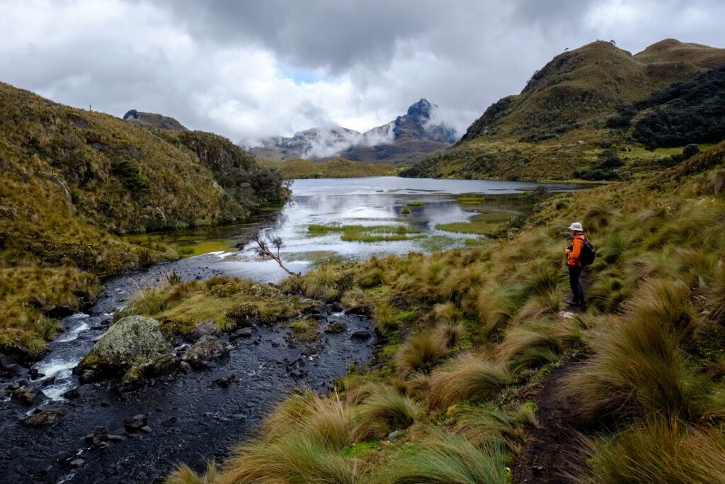
The recognition of Cajas as a critical natural and historical treasure developed gradually over the late twentieth century. In 1977, the Ecuadorian government officially declared the region a National Recreation Area. As ecological awareness grew and the international importance of the páramo ecosystem became clear, its status was elevated in 1996 to a full National Park.
In 2013, UNESCO designated the region as a core component of the Massif Biosphere Reserve of El Cajas. This international recognition highlighted not only the ecological necessity of protecting its high-altitude water catchment systems, but also the cultural importance of preserving the ancient archaeological heritage embedded within its valleys.
The Ecuadorian Amazon.
The most biodiverse place in the world
Explore Cajas at your own pace
At Wheely Tyred, we advocate for slow, authentic, self-guided exploration that honours the history and character of every destination. Visiting Parque Nacional Cajas offers a rare opportunity to connect directly with the geography that shaped southern Ecuador.
For travellers basing themselves in Cuenca, the park lies less than thirty kilometres away, easily reached via the scenic highway winding toward Molleturo and Guayaquil. Key access points allow explorers of all abilities to experience this remarkable landscape:
- Laguna Toreadora: Home to the main park interpretation centre, this central hub offers accessible walking routes around the lake perimeter, passing through small Polylepis groves and providing clear views of the surrounding peaks
- Laguna Llaviucu: Situated at a slightly lower elevation surrounded by dense upper montane cloud forest, this tranquil valley offers excellent birdwatching and gentle walking trails around an ancient lake bed
- Tres Cruces: Located along the main pass at over 4,000 metres, this dramatic viewpoint sits precisely on the continental divide. Here, water falling on the western slope drains into the Pacific Ocean, while water falling on the eastern slope begins a long journey to the Amazon River and the Atlantic
- The Qhapaq Ñan Hike: For experienced trekkers, following the preserved multi-kilometre section of the stone Inca trail from Laguna Toreadora down toward the lower valleys provides an unforgettable link to the past
Whether you are retracing ancient trade paths, studying rare high-altitude flora, or taking in the solitude of a fog-veiled lake, Parque Nacional Cajas stands as a monument to the enduring interplay between human history and the natural world.
Affiliate Disclaimer: Some of the links on Wheely Tyred are affiliate links. If you click through and make a booking or purchase, we may earn a small commission at no extra cost to you. We only recommend gear, tours, stays, and services we genuinely use, trust, and stand behind — our editorial independence always comes first. These commissions help keep our independent cycling guides and travel stories free to read. Thanks for supporting the ride!
The Ecuadorian Coast.
Where you’ll find the very best food
Frequently asked questions about the history of Cajas National Park
Local buses bound for Puerto López or Guayaquil leave regularly from the main bus terminal in Cuenca and pass directly through the park via the main highway. Simply inform the driver to drop you at the Laguna Toreadora visitor centre or the Laguna Llaviucu turn-off.
Weather in the high páramo shifts rapidly, with dense fog, freezing rain, and strong winds frequently rolling in by early afternoon. Setting out early in the morning offers the clearest views, mildest weather, and safest conditions for navigating mountain trails.
While marked paths around Laguna Toreadora can be walked independently, hiring a local guide is strongly recommended for longer routes such as the stone Inca trail or deep backcountry loops. Sudden mountain mist can obscure landmarks and make trail finding challenging.
The park ranges between 3,100 and 4,450 metres above sea level, making altitude sickness a real factor. Spend at least two days acclimatising in Cuenca first, carry plenty of water, pace yourself steadily, and pack warm, windproof layers.
Polylepis forests are among the highest-altitude woodlands on Earth. Locally called paperbark or quinoa trees, their gnarled trunks are wrapped in thin, peeling bark that insulates them against freezing temperatures and protects vital microclimates for endemic birds.
Standard entry to mainland Ecuadorian national parks, including Cajas, is free for both domestic and international visitors. However, all hikers must register their personal details and planned route at the park ranger stations upon arrival for safety purposes.
Ecuador.
Pure wonder on the equator.


