
First-timer guide to Cajas National Park / explore the Ecuadorian páramo on your own terms
Practical travel tips, public bus logistics from Cuenca, hiking trails, and high-altitude advice for visiting Parque Nacional Cajas independently
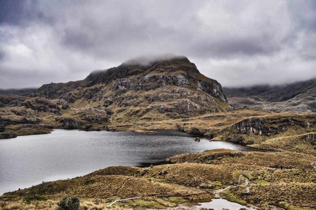
High-Andean landscape of glacial lakes and paper-tree forests

BEN FINCH
There is a moment, about 40 minutes west of Cuenca, where the leafy valleys of the southern Ecuadorian Andes give way to something altogether wilder. As the road winds upwards along the highway, the trees thin out, the air turns crisp and thin, and a vast, undulating expanse of bronze tussock grass and dark granite peaks fills the horizon. Welcome to Parque Nacional Cajas, a high-altitude tundra ecosystem known locally as the páramo.
Spanning more than 29,000 hectares and holding over 200 glacial lakes, El Cajas is one of the most ecologically significant wet highlands in South America. For independent travellers, it offers an extraordinary playground. Unlike many national parks that lock visitors into rigid group itineraries or expensive private shuttles, Cajas is remarkably accessible for those who prefer to set their own schedule, move at their own rhythm, and linger by a windswept lagoon without a guide pointing at a wristwatch.
Whether you travel by regional bus, local bicycle, or on foot, visiting Cajas on your own terms requires a bit of preparation. From navigating unpredictable microclimates to catching return buses on mountain passes, here is everything first-time visitors need to know to experience this high-Andean sanctuary independently.
High-Andean solitude / Key takeaways for independent explorers
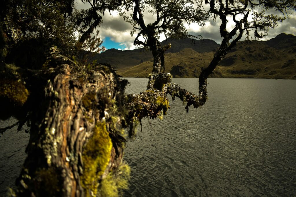
Parque Nacional Cajas is a wild, high-altitude sanctuary where glacial tarns meet ancient paper-tree forests. Here is what you need to know to experience the Ecuadorian páramo entirely on your own schedule.
- Busting the tour group myth: Reaching the park independently by public bus from Cuenca takes under an hour and costs less than $3 each way, giving you full control over your itinerary
- Respecting the páramo microclimate: Temperatures drop swiftly, and dense fog rolls across mountain passes by early afternoon, making early morning starts essential for clear views and safe trekking
- Acclimatising in Cuenca: Sitting between 3,900 and 4,400 metres above sea level, trailheads require prior preparation; spending two or three days exploring Cuenca first helps prevent altitude sickness
- Ancient paper-tree forests: Ruta 1 leads hikers through haunting groves of twisted Polylepis trees and preserved stone paths of the historic Qhapaq Ñan Inca highway
- Lower-altitude alternative: Laguna Llaviucu offers a serene cloud-forest lake walk surrounded by bromeliads, native birdlife, and abandoned brewery ruins at a milder 3,150 metres
- Offline navigation is mandatory: Mobile signal drops to zero past the visitor centre, making pre-downloaded offline GPS maps and photos of ranger trail boards vital for safety
- Highland culinary rewards: Round off your high-country hike with freshly caught rainbow trout and a steaming glass of spiced canelazo at a local roadside eatery
Cajas National Park.
The most beautiful national park
Understand the high-altitude páramo and microclimates
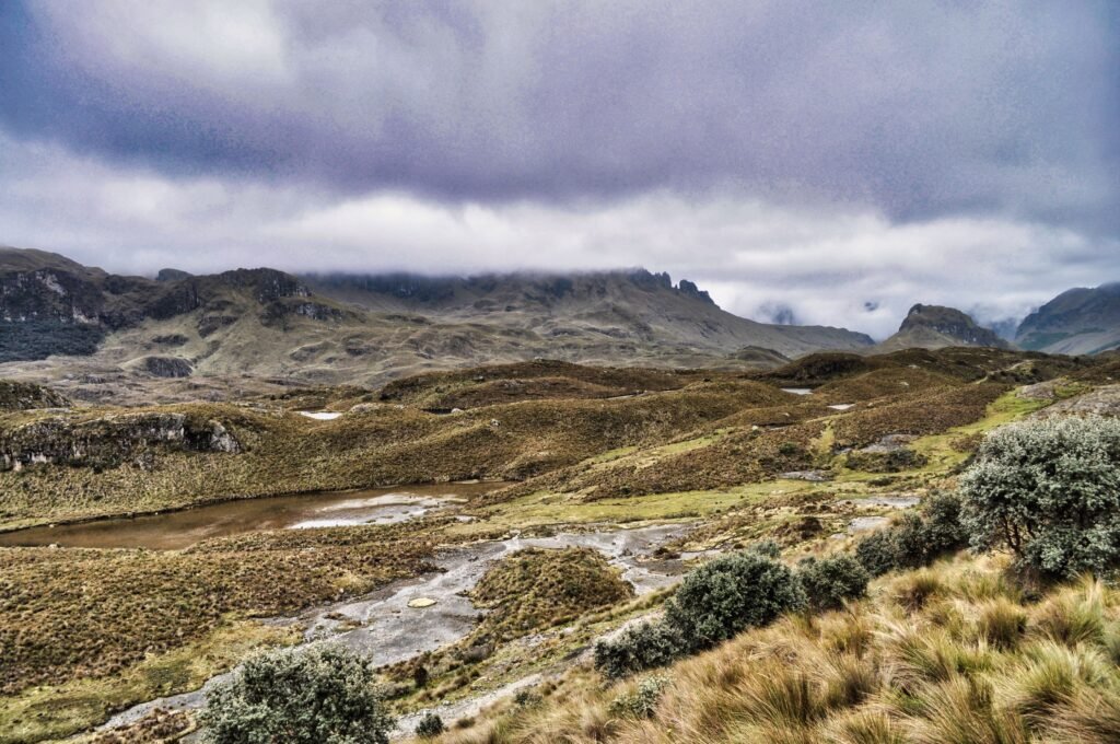
The defining feature of Cajas National Park is its altitude and moisture. The park ranges from roughly 2,800 metres to over 4,400 metres above sea level. This extreme elevation creates a unique sponge-like ecosystem where mosses, peat bogs, and endemic polylepis trees capture moisture blown in from the Amazon basin and the Pacific Ocean.
For the traveller, this translates into two vital considerations: altitude and rapidly shifting weather.
1. Give yourself time to acclimatise
Do not head into Cajas on your very first day in southern Ecuador. Cuenca sits at approximately 2,560 metres above sea level, which is already high enough to cause mild breathlessness for coast-dwellers.
Spend two or three days exploring the cobblestone streets, architectural heritage, and river paths of Cuenca first. This short buffer allows your body to adjust before you ascend to trailheads that start above 3,900 metres.
Drink plenty of water, limit heavy alcohol consumption during your first 48 hours, and consider carrying coca tea or sugary snacks to keep your energy steady on the trail.
2. Respect the páramo microclimate
Weather in Cajas is notoriously volatile. It is entirely possible to experience bright equatorial sunshine, freezing rain, dense fog, and biting winds all within a single two-hour window.
Morning hours are almost universally drier and clearer. By 13:00 or 14:00, thick banks of fog routinely roll across the mountain passes, dropping temperatures to near freezing and reducing visibility to just a few metres.
Plan to arrive early in the morning and aim to finish major trail segments before early afternoon.
Getting there and back independently / The practical logistics
Many tour agencies in Cuenca sell half-day and full-day excursions to Cajas, often priced between $50 and $80 per person. While a guided tour offers simple door-to-door transport, it deprives you of the freedom to hike at your own speed or take spontaneous detours.
Reaching the park on public transport is straightforward, reliable, and costs a fraction of an organised tour.
Taking the public bus from Cuenca
Public buses bound for Guayaquil depart regularly throughout the day from Cuenca’s main bus terminal, Terminal Terrestre. Companies such as Transportes Occidental and Alianza operate frequent departures starting as early as 06:00.
Alternatively, if you are staying closer to the western side of Cuenca, smaller local green buses depart from the Terminal Interparroquial El Arenal, situated directly behind the bustling Feria Libre market.
When purchasing your ticket at the counter or boarding the bus, simply inform the driver or conductor that you are dropping off at Parque Nacional Cajas at Laguna La Toreadora.
- Journey time: Approximately 50 to 60 minutes
- Cost: $2.50 to $3.00 each way
- Pro tip: Always carry small bills and exact change in United States dollars. Ticket conductors on early morning routes frequently struggle to break $10 or $20 notes
Returning to Cuenca without stress
Getting back to Cuenca requires a small dose of patience and self-reliance. Because there is no formal bus station inside the park, you will catch return transport along the main E58 highway outside the visitor centres.
Stand on the Cuenca-bound side of the road near the ranger station at Laguna La Toreadora. As buses approach from the direction of Guayaquil, wave your hand clearly to signal the driver. Most inter-provincial buses will stop if they have empty seats available. Buses pass by roughly every 30 to 45 minutes until late afternoon.
In southern Ecuador, hitchhiking (pedir jalón) is also a socially accepted practice among locals and hikers, particularly along the national park corridor. If a local family or park worker stops to offer a ride back towards the city, it is customary to offer a few dollars towards fuel upon arrival.
The Ecuadorian Sierra.
Get lost in the hills
Park entry, ranger registration, and trail safety
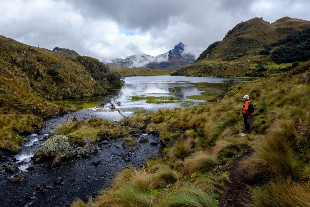
One of the great pleasures of visiting Cajas National Park is that entry is entirely free. However, independent travellers must follow strict administrative and environmental regulations to preserve the park and maintain personal safety.
1. Mandatory ranger check-in
All visitors are required to register at one of the official park control points upon arrival. The primary control point for day hikers is the administrative centre at Laguna La Toreadora. You will need to present your passport or national identity document and record your name, nationality, planned hiking route, and estimated return time in the ranger logbook.
2. Navigation without mobile signal
Once you step past the visitor centre, mobile phone coverage drops to zero across almost the entire park. Do not rely on live cellular data or streaming maps. Before leaving Cuenca, download offline mapping applications such as Maps.me or Wikiloc, along with pre-loaded GPS tracks for your intended route.
When registering at the ranger station, take a clear photo with your phone of the master trail map displayed on the wall. Park staff are happy to offer advice on current trail conditions and suggest routes based on visibility, but physical paper maps are rarely available.
3. Environmental etiquette
The páramo is an exceedingly fragile ecosystem. The deep peat mosses and cushion plants act as a natural water purification system for the entire region of Azuay.
- Stick strictly to marked trails to prevent soil erosion and habitat destruction
- Carry out every scrap of rubbish you bring in, including biodegradable items like fruit peels, which decompose very slowly in cold alpine temperatures
- Camping is permitted only in designated areas with prior registration at the ranger office
The Galápagos.
Ecuador’s Enchanted Isles
Top self-guided hiking routes for first-timers
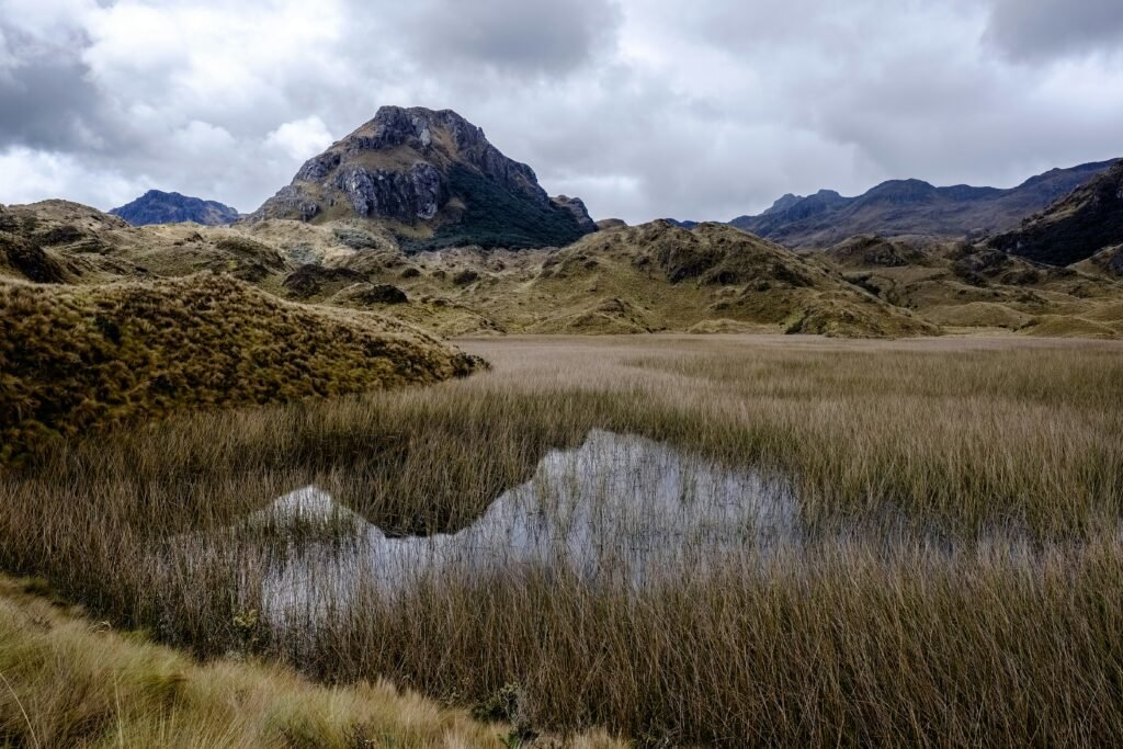
El Cajas offers routes ranging from gentle lakeside walks to multi-day alpine treks. For a first visit, three primary areas stand out for independent exploration.
| Route | Distance / Time | Difficulty | Key Highlights |
| Laguna Llaviucu (Lower Elevation) | 1.7 km / 1 hour | Easy | Birdwatching, Polylepis forest, abandoned brewery ruins |
| Laguna La Toreadora Loop | 2.2 km / 1.5 hours | Easy to Moderate | Glacial lake views, visitor centre access |
| Ruta 1 (Toreadora Circuit) | 6 km / 3–4 hours | Moderate | Qhapaq Ñan Inca road, paper-tree forests |
| Tres Cruces Lookout | Viewpoint stop | Easy (High altitude) | Continental divide pass, high-altitude panoramas |
1. Laguna Llaviucu / Lower park entrance
Located at a lower altitude of approximately 3,150 metres, Laguna Llaviucu is an exceptional option if you want a gentler introduction to the park or if higher passes are shrouded in rain.
A flat, well-maintained 1.7-kilometre loop circles the lake, passing through damp cloud forests draped in bromeliads and mosses. It is a world-class spot for birdwatching, where you can spot toucanets, giant hummingbirds, and highland waterfowl. Near the lake shore sit the haunting ruins of an abandoned 1950s brewery, adding a touch of industrial history to the natural scenery.
To reach Llaviucu, ask the bus driver to set you down at the Llaviucu turn-off, followed by a pleasant three-kilometre walk down an access road to the ranger post.
2. Laguna La Toreadora Loop
For those arriving at the main visitor centre at 3,900 metres, the loop around Laguna La Toreadora is the classic day hike. This circuit takes roughly 90 minutes to two hours, guiding you along wooden boardwalks, over rocky outcrops, and through small patches of native vegetation. It delivers immediate, sweeping views of the dark waters framed by rugged Andean summits.
3. Ruta 1: The paper-tree forest and Inca Road
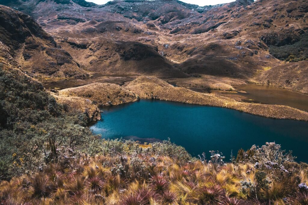
If you possess a decent level of fitness and proper hiking boots, Ruta 1 is the quintessential Cajas experience. Departing from the Toreadora visitor centre, this six-kilometre trail descends into a dramatic glacial valley before looping past secondary tarns including Laguna Totoras and Laguna Patoquinuas.
The highlight of Ruta 1 is passing directly through a Bosque de Polylepis (known locally as árboles de papel or paper trees). These ancient, twisted trees feature flaky, papery red bark that insulates them against freezing night temperatures. Further along, the trail intersects preserved stone sections of the Qhapaq Ñan, the vast Royal Inca Road network that once connected Cusco to Quito.
4. Tres Cruces lookout
Located further up the E58 highway at over 4,100 metres above sea level, Tres Cruces is historically recognised as the continental divide. Water falling on the western side of this pass drains towards the Pacific Ocean, while water falling on the eastern slope begins a long journey to the Atlantic via the Amazon River basin. A short walk to the viewpoint offers panoramic vistas over vast lake basins.
The Ecuadorian Amazon.
The most biodiverse place in the world
What to pack for a self-reliant day trip
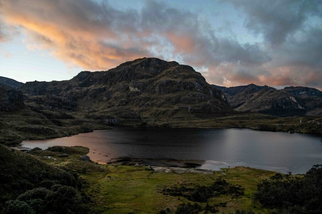
Because weather conditions can transform dramatically within minutes, packing correct clothing and gear is essential for an enjoyable visit.
- Layered clothing strategy: Avoid heavy cotton. Wear a moisture-wicking base layer, a warm fleece or lightweight down mid-layer, and a high-quality windproof and waterproof outer jacket
- Footwear: Sturdy waterproof hiking boots with deep tread are strongly recommended. Trail paths in Cajas are frequently muddy, boggy, and uneven
- Sun protection: Despite cold temperatures, the equatorial sun at 4,000 metres is extraordinarily intense. Pack broad-spectrum sunscreen (SPF 50+), UV-blocking sunglasses, and a wide-brimmed hat or beanie
- Warm accessories: A lightweight woollen hat, scarf, and thin waterproof gloves will make a massive difference if cold winds pick up during midday
- Food and water: Bring at least 1.5 litres of water per person alongside energy-dense snacks such as dried fruit, nuts, and chocolate. While the Toreadora visitor centre houses a small cafe (which may or may not be closed), options on the trail are non-existent
Local gastronomy / Trout and warming canelazo
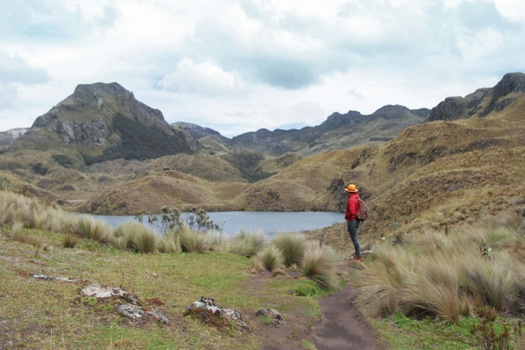
No trip to Cajas National Park is complete without indulging in the traditional mountain fare served at independent eateries dotted along the highway outside the park boundary.
Fresh mountain trout (trucha)
The cold, oxygen-rich glacial waters of Cajas provide ideal conditions for rainbow trout farming. Local roadside huecas (small, authentic family-run eateries) and traditional mountain inns serve freshly caught trout prepared in a variety of styles.
Order trucha a la plancha (grilled trout) or trucha al ajillo (trout in garlic sauce). It is traditionally served alongside mote (hominy corn), crispy fried llapingachos (potato cakes stuffed with cheese), avocado, and fresh lime.
Hostería Dos Chorreras
For a memorable meal in a rustic setting, stop at Hostería Dos Chorreras, located a short distance down the mountain from the park boundary. This historic establishment is famous throughout the Azuay province for its warm timber interiors, stone fireplaces, and exceptional trout dishes.
Warm up with canelazo
To shake off the high-altitude chill after hours on the trail, sip a hot cup of canelazo. This traditional Andean highland drink is prepared by boiling water with cinnamon sticks, star anise, panela (unrefined cane sugar), and local fruit juice such as naranjilla or passionfruit. It is frequently spiked with a splash of aguardiente (sugarcane spirit), offering instant warmth from the inside out.
The Ecuadorian Coast.
Where you’ll find the very best food
Embrace the quiet magic of El Cajas
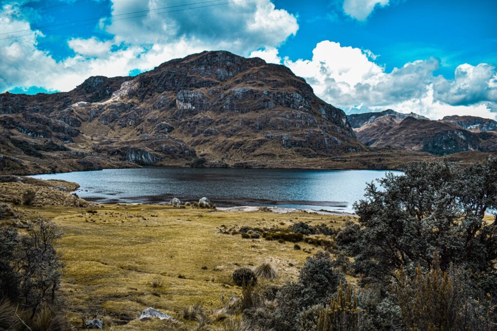
Visiting Parque Nacional Cajas independently is far more than a simple day trip from Cuenca; it is an invitation to experience the high Andes on nature’s schedule rather than a tour operator’s timetable.
When you step off the local bus into the quiet expanse of the páramo, listening only to the wind through the tussock grass and the rustle of ancient polylepis leaves, you gain a sense of place that guided groups rarely encounter.
By taking charge of your own logistics, packing carefully for unpredictable mountain weather, and taking the time to sample local dishes at family-run roadside spots, you turn a mountain hike into an authentic travel memory. Cajas rewards curious travellers who prefer space, autonomy, and the freedom to explore every windswept ridge at their own rhythm.
Affiliate Disclaimer: Some of the links on Wheely Tyred are affiliate links. If you click through and make a booking or purchase, we may earn a small commission at no extra cost to you. We only recommend gear, tours, stays, and services we genuinely use, trust, and stand behind — our editorial independence always comes first. These commissions help keep our independent cycling guides and travel stories free to read. Thanks for supporting the ride!
Frequently asked questions about visiting Cajas National Park
Catch an early morning Guayaquil-bound bus from Cuenca’s main bus terminal, Terminal Terrestre, or from the Terminal Interparroquial El Arenal behind the Feria Libre market. Ask the conductor to set you down at Laguna La Toreadora inside Parque Nacional Cajas. The journey takes around 50 to 60 minutes and costs between $2.50 and $3.00 each way.
No, entry to the national park is completely free. However, all independent visitors must check in with park rangers at the administrative office at Laguna La Toreadora, present a passport or identity document, and log their planned hiking route in the official register before setting off.
Wear non-cotton moisture-wicking layers, a warm mid-layer, a windproof and waterproof jacket, and sturdy waterproof hiking boots. Equatorial sun at 4,000 metres is intense, so pack high-SPF sunscreen, sunglasses, a warm beanie, lightweight gloves, and at least 1.5 litres of water with energy-dense snacks.
Stand on the Cuenca-bound side of the E58 highway near the ranger station at Laguna La Toreadora and flag down any approaching inter-provincial bus heading towards Cuenca. Buses pass roughly every 30 to 45 minutes until late afternoon. Carrying small change in US dollars is strongly advised.
For a gentle walk, the loop around Laguna La Toreadora or the lower-elevation cloud-forest trail at Laguna Llaviucu are ideal. For a more immersive experience with varied terrain, Ruta 1 takes three to four hours and brings you through ancient paper-tree forests and along historic Inca paths.
Roadside family eateries along the park boundary specialise in fresh rainbow trout, served grilled or with garlic sauce alongside hominy corn (mote) and crispy potato cakes (llapingachos). To warm up after hours on the trail, try canelazo, a hot spiced drink made with cinnamon, sugar cane, fruit juice, and local spirit.
Ecuador.
Pure wonder on the equator.


