
How to cycle the Quilotoa Loop / The complete Andean gravel and road guide
Everything you need to know about route profiles, altitude preparation, and bike setup for cycling the Quilotoa Loop in Ecuador
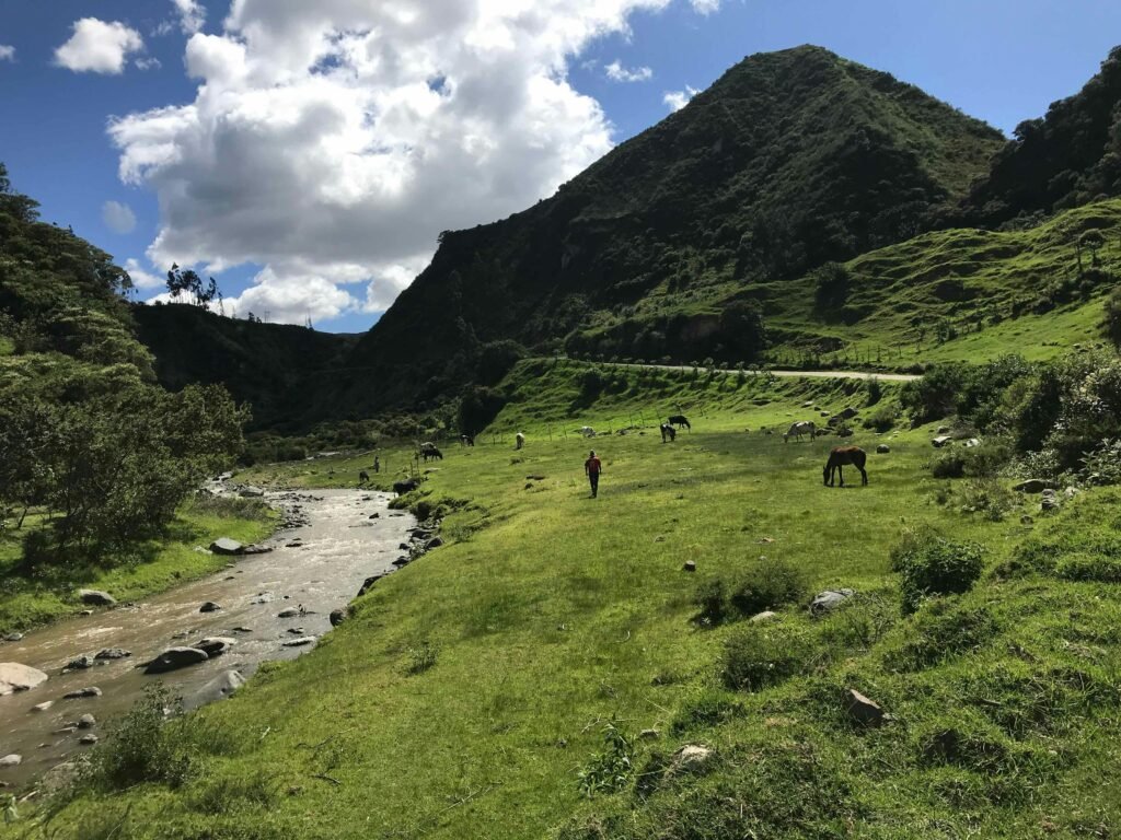
Trade paved mainlines for high-altitude ridges and volcanic craters

BEN FINCH
Riding a bike through Cotopaxi province offers one of the most rewarding mountain journeys in South America. The Quilotoa Loop meanders through rugged terrain southwest of Quito, weaving past Kichwa farming villages, deep canyons, and windswept grasslands. While most travellers tackle this circuit on foot over three to four days, exploring the loop on two wheels unlocks an exhilarating mix of grinding climbs, technical dirt descents, and breathtaking mountain vistas.
Pedalling through this corner of the Andes immerses you in a landscape where traditional life moves at its own steady pace. Woodsmoke drifts from hillside homes, farmers tend patchwork crops on slopes that defy gravity, and the scent of eucalyptus fills the cool morning air. Taking a bike along these high tracks grants absolute freedom to stop at remote mountain passes, connect with local communities, and experience the raw beauty of Ecuador far beyond standard tourist routes.
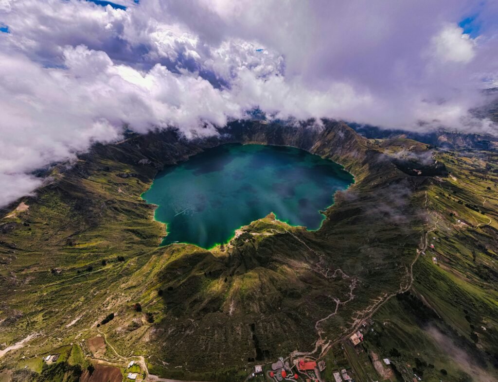
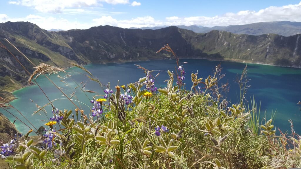
The highlight of the route is Laguna Quilotoa, an emerald-green crater lake sitting inside a sunken volcanic caldera at nearly 3,900 metres above sea level. However, reaching the crater rim requires respect for both the terrain and the thin air. The circuit presents steep gradients, smooth cobblestones, loose volcanic gravel, and sudden weather shifts. With proper planning, low gearing, and adequate acclimatisation, cycling the Quilotoa Loop is an unforgettable achievement for any adventure rider.
Essential high-pass milestones
Riding the Quilotoa Loop demands thorough preparation, steady physical endurance, and deep respect for the high Andean climate.
These key locations and technical principles define an unforgettable dirt-track journey through Cotopaxi province.
- Latacunga: The primary logistical base camp for organising gear, gathering supplies, and completing initial high-altitude acclimatisation before hitting the gravel
- Toachi Canyon: A demanding, technical descent onto loose dirt tracks where precise line choices and modulated disc braking keep you upright
- Isinliví: A peaceful mountain hamlet offering welcoming eco-lodges, warm wood stoves, and an ideal recovery spot after the first day on the trail
- Chugchilán: A high-altitude agricultural hub perched at 3,200 metres, serving as the final staging point before tackling the steepest volcanic climbs
- Laguna Quilotoa: The magnificent turquoise caldera rim at 3,914 metres, marking the breathtaking physical and visual pinnacle of the entire circuit
- Ultra-Low Gearing: A vital mechanical requirement featuring a 1:1 gear ratio or lower to conquer sustained 15 pper centunpaved inclines
- Pacing and Altitude: Strategic effort management, consistent hydration, and 48 hours of pre-ride acclimatisation to negotiate thin mountain air safely
Quilotoa.
The emerald crater lake
Route overview and technical profile
The traditional circuit begins and ends in the transportation hub of Latacunga, using paved access roads to reach the start of the dirt trail at Sigchos before climbing through the canyon villages of Isinliví and Chugchilán, culminating at Laguna Quilotoa, and descending back towards Zumbahua and Pujilí.
Navigating the loop requires a mix of digital GPS tracks and keen spatial awareness. While the main dirt roads between villages are reasonably clear, mountain weather can obscure visibility rapidly, and junction signage is sparse.
Preparing offline routing maps prior to departure is essential, as cellular coverage vanishes inside the deeper river valleys. The dry season between June and September generally provides the firmest track conditions, though high-altitude winds remain a constant companion along the ridgelines.
| Route Parameter | Detail / Specification |
| Total Distance | Approximately 160–200 kilometres (depending on paved transfers) |
| Off-Road Distance | 40–60 kilometres of dirt, cobblestone, and gravel tracks |
| Total Elevation Gain | 3,800+ metres |
| Highest Elevation | 3,914 metres (Quilotoa Crater Rim) |
| Recommended Duration | 3 to 4 days |
| Terrain Type | Asphalt, compacted dirt, loose volcanic gravel, steep cobblestone ramps |
| Recommended Bike | Wide-clearance gravel bike or hardtail mountain bike |
Choosing the right bike and gear
Selecting the appropriate equipment is critical when tackling high-altitude Andean tracks. The gradients on the Quilotoa Loop regularly exceed 12 per cent, and surface conditions fluctuate rapidly between smooth asphalt, broken cobblestones, and rutted dirt.
Riding fully loaded in the high mountains puts extra demands on both the bike and rider. Keeping your gear setup lightweight and streamlined using modern bikepacking luggage—such as frame bags, handlebar rolls, and seat packs—helps maintain natural bike handling over technical gravel and steep climbs.
Heavy panniers on traditional racks tend to bounce on rough cobblestone descents and add unnecessary drag when pushing through loose volcanic ash. Self-sufficiency is paramount, as bicycle repair shops do not exist once you leave Latacunga.
Bike choice and gearing
A hardtail mountain bike or a wide-clearance gravel bike provides the ideal balance of climbing efficiency and technical control over mixed terrain.
- Gearing: Ultra-low ratios are mandatory. A 1:1 gear ratio is the absolute minimum; a 1x setup with a 30T or 32T chainring and a 10-52T cassette will keep your knees intact on 15 per cent gravel climbs above 3,000 metres
- Tyres: Tubeless tyres measuring at least 45mm (1.8 inches) on a gravel bike, or 2.1–2.35 inches on a mountain bike, offer vital traction and pinch-flat protection over sharp rocks and cobblestones. Lower your tyre pressure slightly to improve grip on loose climbs
- Brakes: Quality hydraulic disc brakes with 160mm or 180mm rotors are non-negotiable for long, steep descents into Toachi Canyon
Finding the sweet spot for tyre pressure makes a massive difference to comfort and control on Andean tracks. Softening your tyres allows the rubber to mould over slick cobblestones and floating gravel rather than skittering across the top. On long descents into deep river valleys, remember to modulate your braking effort, alternating between front and rear levers to prevent disc rotors from overheating on sustained 10 per cent drops.
The Ecuadorian Sierra.
Get lost in the hills
Packing essentials
Bikepacking light is essential when every gram must be hauled up several thousand metres of elevation.
- Layering System: Temperatures drop near freezing at night on the crater rim. Pack a lightweight down jacket, windproof riding jacket, thermal base layers, full-finger gloves, and a neck gaiter
- Rain Gear: Weather in the Andes turns quickly, particularly during afternoon rain showers. A waterproof jacket with taped seams is mandatory
- Spares and Tools: High-altitude villages do not have bike shops. Carry spare inner tubes, tubeless repair plugs, a high-volume hand pump, spare brake pads, a multi-tool with a chain breaker, and quick links
- Cash: Bring sufficient Ecuadorian dollars in small denominations ($1, $5, and $10 notes). ATMs are non-existent between Latacunga and Quilotoa
Extreme daily temperature fluctuations are a defining feature of riding at this altitude. A bright, sunny morning climbing out of a valley can swiftly transition into a freezing afternoon downpour or dense fog along the ridgelines.
Packing versatile layers that can be unzipped easily during heavy climbing efforts and layered up rapidly for cold descents keeps your core body temperature stable and prevents hypothermia. Cold temperatures also drain electronic batteries quickly, so keep your phone and GPS unit stored in an inside pocket close to your body heat.
Day-by-day stage breakdown
Stage 1 / Latacunga to Sigchos and Isinliví
- Distance: 55 kilometres
- Elevation Gain: 1,200 metres
- Terrain: Asphalt ascent followed by dirt and cobblestone rolling roads
Departing Latacunga early in the morning, the ride begins with a steady paved climb towards Saquisilí and Toacaso before descending into the agricultural valleys surrounding Sigchos. Sigchos serves as the official gateway to the dirt section of the Quilotoa Loop.
After stopping in Sigchos for a warm soup or fresh fruit, leave the main road and branch southeast onto the dirt track towards Isinliví. The route drops towards the Toachi River before climbing up winding dirt roads framed by patchwork fields.
This opening leg provides a gentle introduction to Andean riding, transitioning you away from city traffic into quiet agricultural life. As you turn off the main tarmac onto dirt tracks, the rhythm of the ride shifts immediately. Schoolchildren wave from roadside paths, and the smell of damp earth and woodsmoke fills the air.
Arriving in Isinliví, eco-lodges welcome tired riders with hearty multi-course family meals and warm wood stoves, providing an ideal setting to rest before the tougher terrain ahead.
The Galápagos.
Ecuador’s Enchanted Isles
Stage 2 / Isinliví to Chugchilán
- Distance: 18 kilometres
- Elevation Gain: 850 metres
- Terrain: Compact dirt, steep canyon descents, and sustained cobblestone climbing
Do not let the short distance fool you; Stage 2 is a physical test of power and bike handling. The trail drops dramatically down into the depths of Toachi Canyon.
Take caution on loose switchbacks and monitor speed to avoid overheating disc brakes. At the bottom of the canyon, cross the river bridge and prepare for a relentless climb towards Chugchilán. The track transitions between hard-packed earth and uneven cobblestones, requiring steady cadence and consistent rear-tyre traction.
Negotiating traditional empedrado (cobblestone) ramps requires a smooth, seated pedalling technique to prevent your rear wheel from spinning out on smooth stones. The canyon walls act as a natural amphitheatre, echoing the rush of the river below as you grind upward out of the valley floor.
As you gain height, the vegetation shifts into lush cloud-forest flora, with bromeliads clinging to trees along the roadside. Reaching Chugchilán at 3,200 metres brings a deep sense of accomplishment and cosy guesthouses equipped with hot showers.
Stage 3 / Chugchilán to Laguna Quilotoa
- Distance: 22 kilometres
- Elevation Gain: 1,100 metres
- Terrain: Steep dirt tracks, sandy volcanic ash, and crater rim singletrack
This is the queen stage of the circuit. Leaving Chugchilán, the road descends once more into a tributary canyon before beginning the main assault on the volcanic massif.
The gradients are stiff, and the thinning air at 3,500 metres will test your lungs. As you approach the upper slopes, the soil turns into fine volcanic ash and sand, making traction challenging on steep pitches. Pushing your bike for short sections is entirely normal and expected.
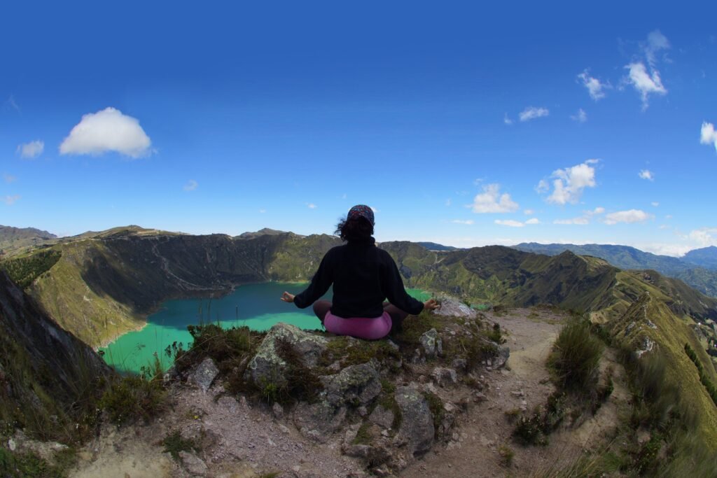
Climbing above 3,500 metres turns pedalling into an exercise in focused breathing and mental resilience. Every pedal stroke requires deliberate effort as the air thins out. The final switchbacks through loose, grey volcanic dust yield to an unforgettable climax: cresting the final rise, the ground drops away abruptly to reveal the vast emerald cauldron of Laguna Quilotoa sitting silently inside its crater walls.
Spend time resting along the crater rim, taking in the panoramic views before rolling into Quilotoa village for a hot meal.
The Ecuadorian Amazon.
The most biodiverse place in the world
Stage 4 / Laguna Quilotoa to Zumbahua, Pujilí, and Latacunga
- Distance: 65 kilometres
- Elevation Gain: 300 metres (predominantly descending)
- Terrain: Smooth asphalt with fast, sweeping mountain descents
The final day rewards your hard climbing with a thrilling descent. From Quilotoa village, join the paved highway heading south toward Zumbahua. The road swoops through dramatic mountain valleys, offering expansive views of the páramo landscape. From Zumbahua, the route follows a smooth, fast asphalt descent down through Pujilí and back into the central valley at Latacunga.
Dropping nearly 1,200 vertical metres on smooth asphalt feels like flying after days of grinding over gravel and stones. The high, windswept páramo grasslands gradually yield to terraced farmland, warmer air, and busier valley towns.
Watching the towering peaks recede into your rear-view mirror brings a tremendous feeling of satisfaction, completing a full circuit through some of Ecuador’s most dramatic topography.
Essential logistics, altitude tactics, and local etiquette
Altitude acclimatisation strategy
Riding above 3,000 metres demands proper preparation to avoid acute mountain sickness.
- Spend 2 days at height before starting: Spend at least 48 hours acclimatising in Quito (2,850m) or Latacunga (2,750m) prior to tackling the loop
- Pace your effort: Keep your heart rate in check during steep climbs. Sudden spikes in effort at high altitude deplete energy reserves rapidly
- Hydration and nutrition: Drink plenty of water and an electrolyte mix. High altitude accelerates dehydration. Eat carbohydrate-rich meals such as locro de papa (traditional potato and cheese soup) in local villages
Understanding how high altitude affects muscle recovery is vital for multi-day bikepacking. Digestion slows down at high elevations, making easy-to-digest carbohydrates and warm soups far better options than heavy, greasy foods during riding days.
Listen closely to your body; if you experience persistent headaches, dizziness, or nausea, pause your ascent, rest, and prepare to descend to a lower altitude if symptoms do not improve.
Local rules and community respect
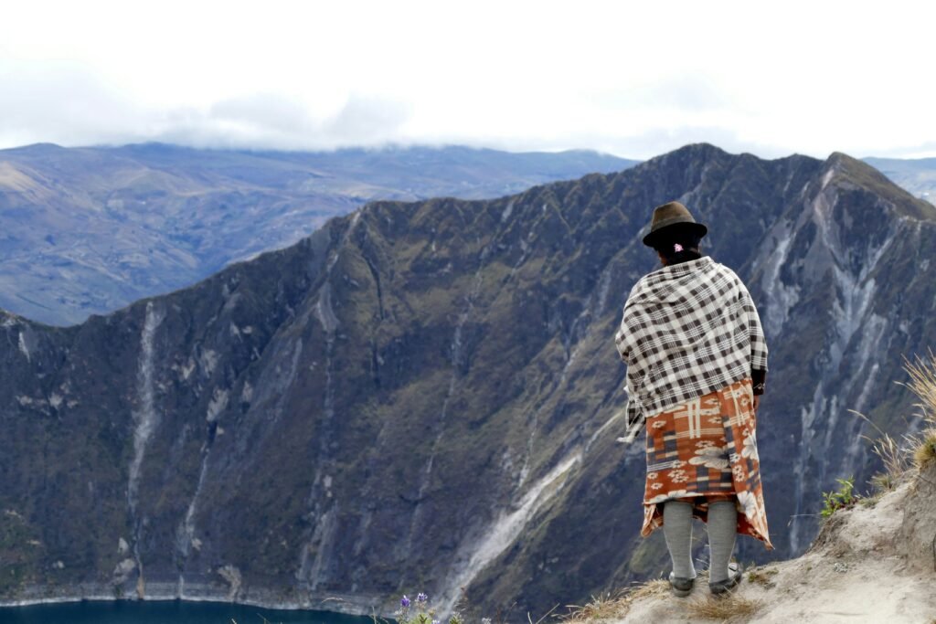
The communities along the Quilotoa Loop maintain traditional Kichwa customs and agricultural ways of life.
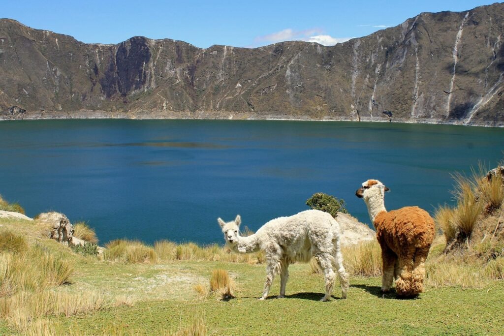
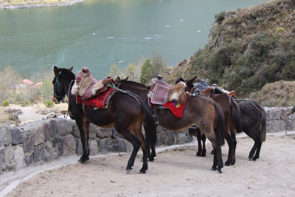
- Yield to livestock: Donkeys, sheep, and cattle share the dirt roads. Slow down and give animals a wide berth when passing
- Greeting locals: A friendly greeting in Spanish (Buenos días or Buenas tardes) goes a long way when riding through rural hamlets
- Support local businesses: Purchase supplies, meals, and lodging directly from family-run guesthouses and small village shops to ensure your visit benefits the local economy directly
Cycling through rural indigenous communities provides a unique window into high-altitude mountain life. Always ask for permission before taking photographs of local residents, especially elders and children in traditional dress.
By purchasing snacks from small village tiendas and staying in locally owned lodges, your ride directly supports micro-economies that keep these remote mountain tracks accessible and welcoming to independent cyclists.
The Ecuadorian Coast.
Where you’ll find the very best food
Claim your place on the volcanic rim
Read this far?
Conquering the Quilotoa Loop on two wheels is far more than a physical test of endurance; it is an authentic pilgrimage through the living heart of the Ecuadorian Andes. Trading the speed of motorised transport for the deliberate cadence of a bicycle lets you absorb every gradient shift, every change in soil colour, and every sharp mountain breeze.
The raw friction of dirt beneath your tyres and the slow progress up canyon walls cultivate a profound connection with this rugged terrain that walking or driving simply cannot match.
Apart from the dramatic topographies and technical descents, the true magic of the circuit lies in its quiet human moments. Rolling through mountain hamlets means sharing the road with local farmers, hearing traditional Kichwa greetings across patchwork fields, and resting outside village shops over hot sweet tea.
Choosing to travel independently by bike ensures that your financial footprint stays directly within these upland communities, supporting small guesthouses, local bakeries, and family-run eateries along the trail.
When you finally crest the final crater wall at Laguna Quilotoa and peer down into the shimmering emerald caldera, the lung-burning climbs and rough cobblestones instantly fade into quiet triumph. The sense of freedom earned on these remote high passes stays with you long after the fast asphalt descent back to Latacunga is complete. Pack your bags light, gear your bike down low, and step out onto the high dirt tracks of the Andes.
Affiliate Disclaimer: Some of the links on Wheely Tyred are affiliate links. If you click through and make a booking or purchase, we may earn a small commission at no extra cost to you. We only recommend gear, tours, stays, and services we genuinely use, trust, and stand behind — our editorial independence always comes first. These commissions help keep our independent cycling guides and travel stories free to read. You can also buy me a coffee here — thanks for supporting the ride!
Frequently asked questions about how to cycle the Quilotoa Loop
Regular interprovincial buses depart from Quito’s Quitumbe terminal to Latacunga every 15 minutes. Most bus operators will load your bicycle into the luggage hold beneath the coach for a fee of two to three dollars, provided you remove the front wheel and secure any loose accessories.
Latacunga has limited specialised hire shops, so it is best to hire a high-quality hardtail mountain bike or gravel bike in Quito before heading south. Ensure the rental bike includes a multi-tool, pump, spare inner tubes, and robust tubeless or puncture-resistant tyres.
Mountain villages offer hearty, carbohydrate-rich meals that suit tired riders well. Look for locro de papa (a thick potato and cheese soup served with avocado), caldo de gallina (chicken broth with tubers), and fresh maize tortillas sold at small roadside stalls.
The rural communities along the loop are generally peaceful, welcoming, and safe for independent travellers. The primary hazards stem from sudden mountain weather changes, loose track surfaces, and free-roaming farm dogs, so keep a calm demeanour and carry a small bike pump or bell to deter canine attention.
The dry season runs from June to September, offering the firmest dirt track conditions and clearer mountain vistas. However, high winds along ridge lines can be strong during these months, so early morning starts are recommended to avoid afternoon gusts and rain showers.
Cash is the only accepted payment method between Latacunga and Quilotoa. Withdraw sufficient US dollars in small bills ($1, $5, and $10 notes) before leaving Latacunga, as local shopkeepers and guesthouse owners rarely have change for $20 notes and ATMs do not exist on the loop.
Ecuador.
Pure wonder on the equator.


