
Volcán Chimborazo / Stand at the closest point on Earth to the sun
Complete self-guided travel guide and high-altitude route planning for Volcán Chimborazo, Ecuador
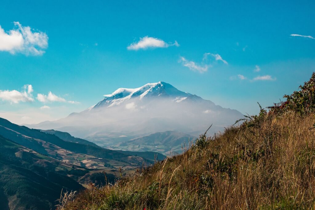
Where Earth meets the stars on the equator

BEN FINCH
Rising dramatically above the high Andean plateau, Volcán Chimborazo is a monument of giant proportions. Standing at 6,310 metres above sea level, this inactive stratovolcano holds a world-renowned title. Because the Earth bulges at the equator, the peak of Chimborazo is the furthest point from the centre of the Earth, making its summit the closest place on the planet to the sun and stars.
For the independent traveller, Chimborazo represents one of the most accessible high-altitude mountain environments in South America. You do not need to be an elite mountaineer attempting a technical summit climb to experience the stark beauty of this colossal peak.
The surrounding Reserva de Producción de Fauna Chimborazo offers sweeping páramo landscapes, wild camelid herds, and pristine mountain air, all accessible at your own pace without the constraints of a rigid tour schedule.
Essential landmarks and high-country insights
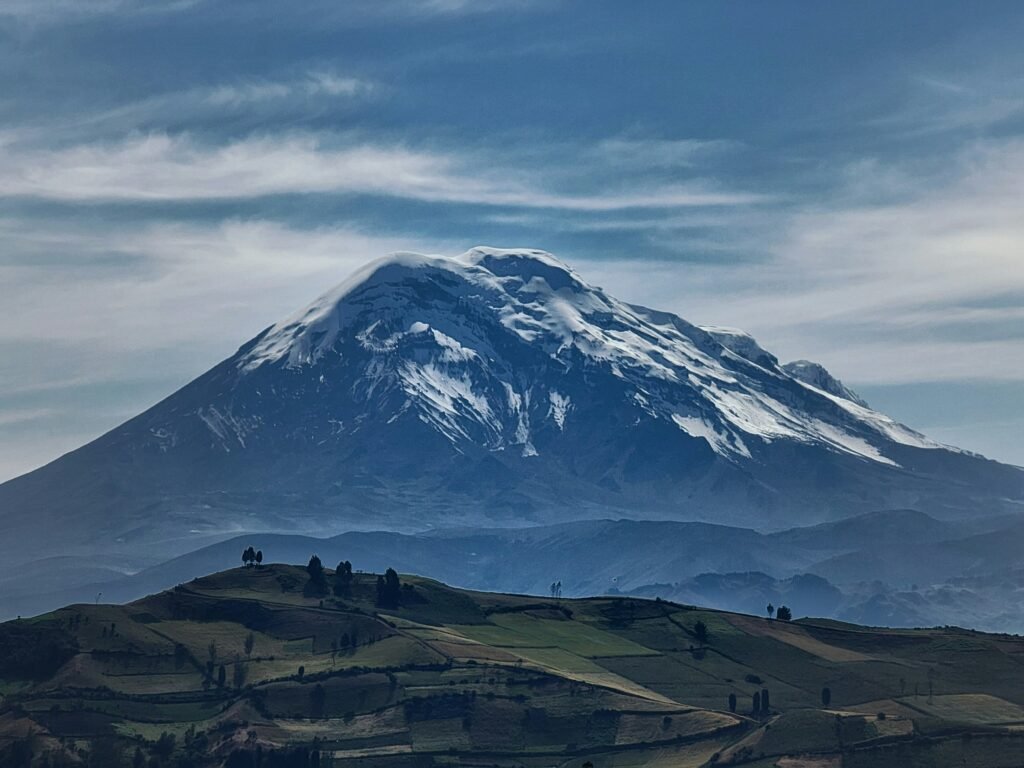
Standing amidst the vast Andean plateau, Chimborazo offers an unforgettable high-altitude landscape defined by equatorial ice, ancient trekking routes, and resilient wildlife. Here are the core highlights every independent traveller should know before setting out across the páramo.
- The Furthest Point from Earth’s Centre: Owing to the equatorial bulge of our planet, the summit of this giant stratovolcano extends furthest into space, making it the closest terrestrial location to the sun
- Wildlife of the Páramo: The surrounding protected reserve serves as a sanctuary for wild vicuñas, Andean caracaras, foxes, and the rare Andean condor soaring high above the tussock grass
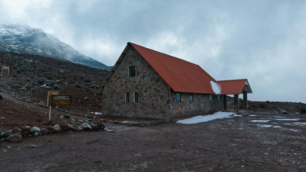
- Refugio Hermanos Carrel: Situated at 4,845 metres above sea level, this mountain hut marks the highest point accessible by paved road or motor vehicle in Ecuador
- Refugio Edward Whymper: Reached via a steep foot trail from the lower lodge, this historical mountain refuge sits at 5,042 metres and is named after the famed British climber who achieved the first recorded ascent in 1880
- Laguna Cóndor Cocha: Positioned at 5,100 metres, this icy glacial tarn lies just fifteen minutes above the upper refuge, directly beneath towering walls of glacial ice
- High-Altitude Cycling Descent: Winding down from the high mountain car park toward Riobamba, the smooth asphalt highway offers one of the most thrilling self-guided road descents in South America
Volcán Chimborazo.
Stand at the furthest point from the centre of the Earth
The landscape of the páramo and wild vicuñas
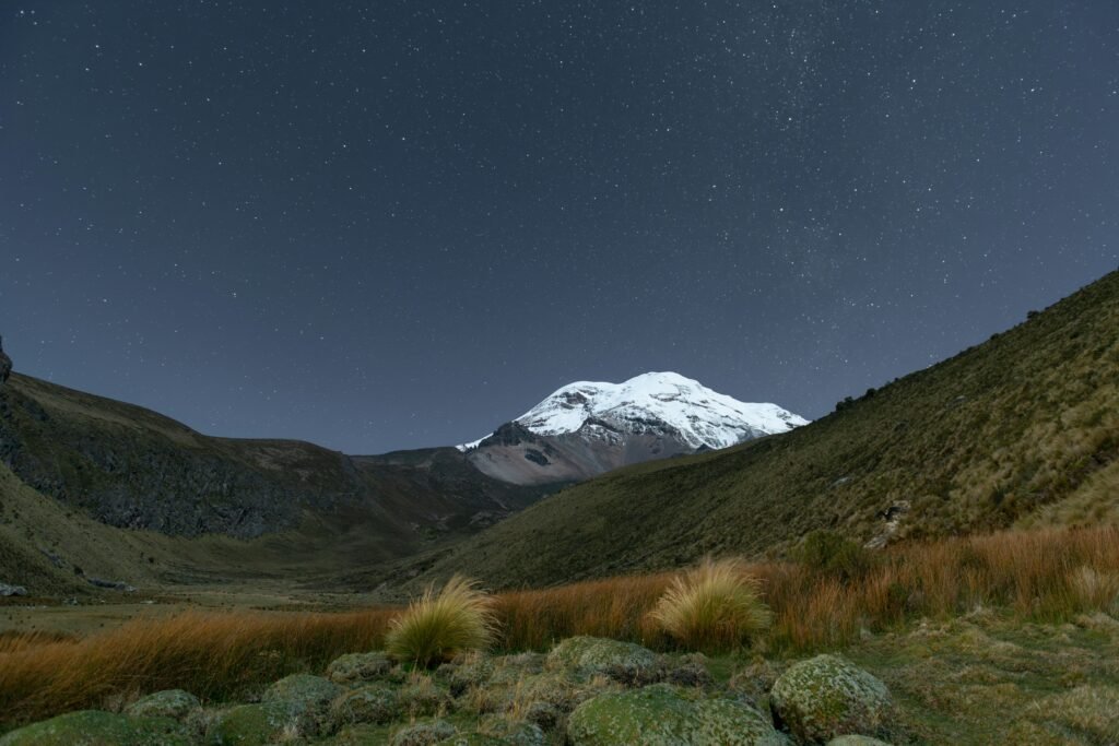
The journey toward Chimborazo takes you through the unique high-altitude ecosystem known as the páramo. Characterised by golden tussock grasses, cushion plants, and low-lying shrubs, this delicate landscape acts as a giant natural sponge, capturing moisture from passing clouds and supplying water to the valleys far below.
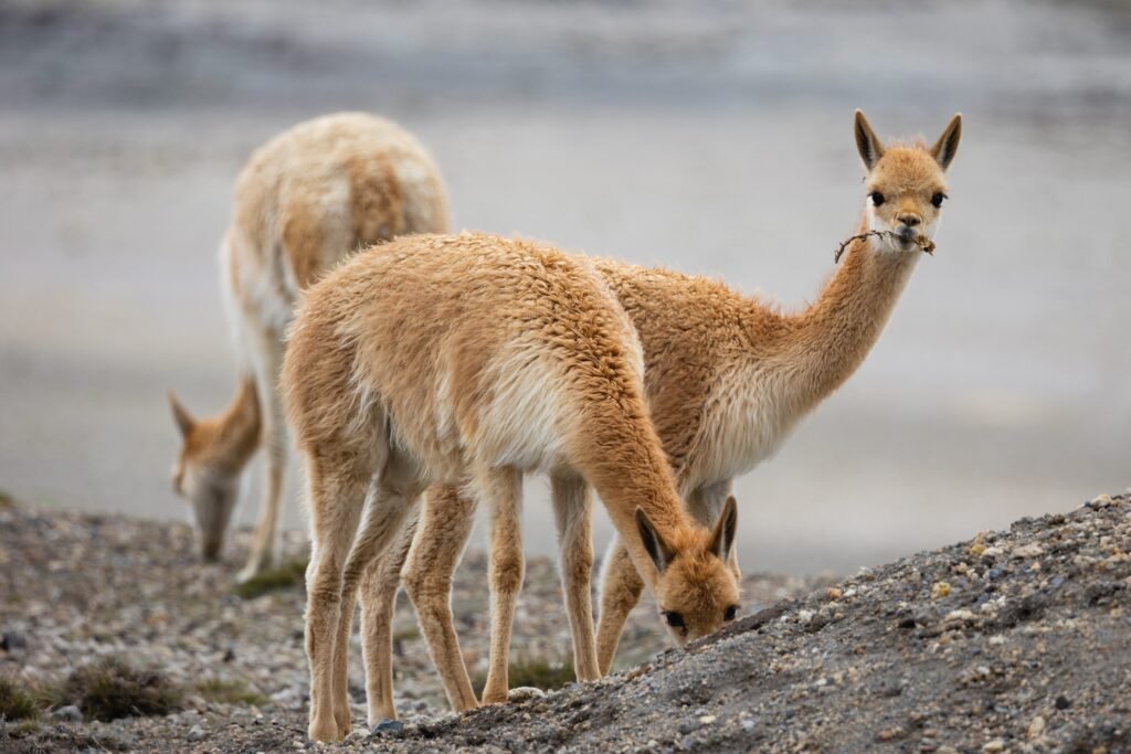
As you ascend into the reserve, keep your eyes trained on the sweeping slopes flanking the asphalt road. This is the primary sanctuary for the vicuña, a wild relative of the llama and alpaca. Once hunted to near extinction across the Andes, vicuñas were successfully reintroduced to the slopes of Chimborazo in the late twentieth century.
Today, thousands of these elegant creatures graze freely along the road edges and high plains. Observing a herd of vicuñas against the backdrop of glaciated volcanic peaks is an unforgettable sight for any nature lover.
Alongside vicuñas, watchful eyes may spot the caracara, the Andean fox, or even the majestic Andean condor soaring on thermal currents high above the crater rim. Among the low vegetation, search for the bright orange blooms of the chuquirahua plant, known locally as the flower of the mountaineer due to its resilience in harsh sub-glacier conditions.
Reach the high refuges / Step-by-step logistics
Accessing Chimborazo independently is surprisingly straightforward, whether you base yourself in the nearby historic city of Riobamba or the lush valley town of Baños de Agua Santa.
1. The entrance and base highway
The main access road winds smoothly through the Reserva de Producción de Fauna Chimborazo. Modern asphalt leads directly from the main highway up to the park entry checkpoint. Entry to the reserve is free, though park rangers log visitor details for safety monitoring.
2. Refugio Hermanos Carrel / 4,845 metres
The paved road climbs steadily up the flank of the mountain, terminating at Refugio Hermanos Carrel at an altitude of 4,845 metres above sea level. This is the highest point accessible by motor vehicle or bicycle on a paved road in Ecuador. The refuge provides basic shelter, warm drinks, and restrooms, offering a comfortable staging point to take in the vast views of the surrounding highlands.
3. Hike to Refugio Edward Whymper / 5,042 metres
From Refugio Hermanos Carrel, a well-marked foot trail climbs roughly 900 metres up a stony ridge to Refugio Edward Whymper, named after the famed British climber who made the first recorded ascent of Chimborazo in 1880. Although the physical distance is short, the steep gradient and extreme altitude mean this hike typically takes between 45 and 60 minutes. Pace yourself carefully, take small steps, and listen to your body as oxygen levels drop significantly above 5,000 metres.
4. Laguna Cóndor Cocha / 5,100 metres
For those who feel well-acclimatised at Refugio Edward Whymper, a further 15-minute trail continues upward to Laguna Cóndor Cocha. Resting at 5,100 metres, this small glacial tarn sits beneath the towering ice walls of the volcano. Standing at the edge of this high-altitude lake, surrounded by raw stone and ice, offers a profound sense of solitude and achievement.
The Ecuadorian Sierra.
Get lost in the hills
Descend Chimborazo on two wheels
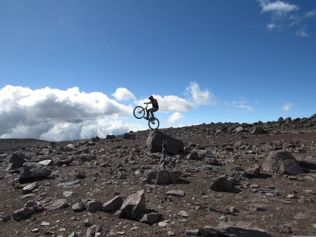
While mountaineers gear up for midnight summit attempts, independent cyclists and MTB enthusiasts find a different thrill on Chimborazo. The long road winding from Refugio Hermanos Carrel down toward Riobamba or Guaranda represents one of the most exhilarating mountain descents in the northern Andes.
Descending nearly 2,000 vertical metres over tens of kilometres, riders glide through shifting climate zones—transitioning from frigid alpine gravel and windswept páramo down into fertile agricultural valleys dotted with colourful indigenous villages.
For those planning a self-guided ride:
- Bicycle Prep: Ensure your brakes, tyres, and steering are in perfect working condition before starting your descent. High speeds combined with sudden mountain winds require total control
- Layering: Temperatures at 4,845 metres hover near freezing, even on sunny days. Cold winds on downhill descents quickly chill the body. Wear windproof outerwear, thermal base layers, full-finger gloves, and eye protection
- Road Conditions: While the main road is fully paved and generally well-maintained, fog, rain, or wandering livestock such as vicuñas can appear suddenly around sharp bends. Ride attentively and adjust your speed to visibility
At Wheely Tyred, we advocate for independent exploration that respects both terrain and local pace. Carrying your own gear or arranging a custom self-guided route gives you the freedom to stop whenever a photo opportunity or a sweeping panorama demands your attention.
Essential altitude and acclimatisation tips
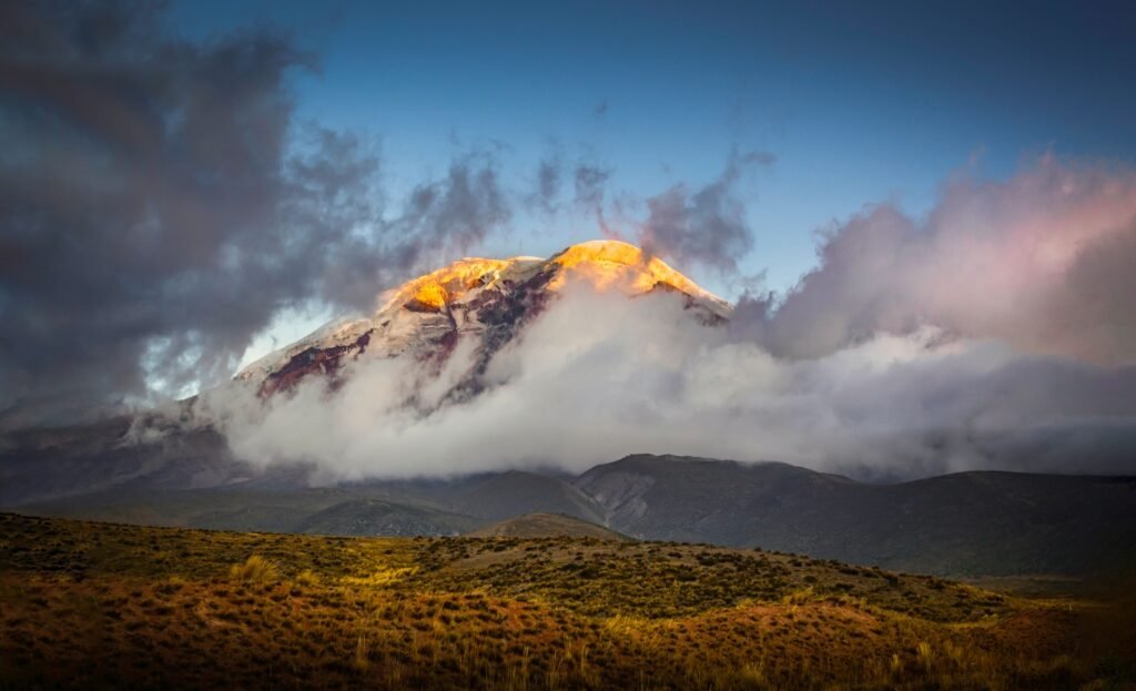
Visiting an environment that exceeds 5,000 metres in altitude requires preparation and respect. Altitude sickness, known locally as soroche, can affect anyone regardless of general fitness.
- Acclimatise Gradually: Spend at least two to three days at intermediate altitudes such as Quito (2,850 metres), Cuenca (2,560 metres), or Riobamba (2,750 metres) before attempting the trek to the refuges on Chimborazo
- Stay Hydrated: High altitude accelerates dehydration. Carry plenty of fresh water and drink continuously throughout your visit. Warm herbal infusions, particularly coca tea or mate de coca, are traditional remedies popular across the Andes
- Eat Light: Digestion slows down at high elevations. Opt for light, high-carbohydrate snacks such as dried fruit, nuts, or energy bars rather than heavy meals before hiking
- Know Your Limits: If you experience severe headache, nausea, dizziness, or confusion, turn back immediately and descend to lower elevations
The Ecuadorian Amazon.
The most biodiverse place in the world
Practical information for the independent visitor
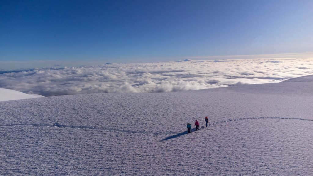
- Base Cities: Riobamba is the primary springboard for visiting Chimborazo, located roughly 49 kilometres from the park entrance. Baños de Agua Santa is also a common base, located approximately two hours away by road
- Opening Hours: The Reserva de Producción de Fauna Chimborazo is generally open to visitors daily from 08:00 to 16:00
- What to Pack: Sturdy hiking boots, thermal base layers, a fleece sweater, a waterproof and windproof outer jacket, warm hat, gloves, high-SPF sun cream, sunglasses, and a refillable water flask
- Respect the Environment: The páramo is a fragile ecosystem. Always stay on designated trails, take all litter back down the mountain with you, and maintain a respectful distance from grazing vicuñas
The Galápagos.
Ecuador’s Enchanted Isles
Embrace the solitude of the high Andes
Read this far?
Exploring Volcán Chimborazo independently reveals the true majesty of the Ecuadorian Andes. Away from crowded tour buses and rigid group itineraries, setting your own pace across the high páramo allows you to absorb the raw silence, watch herds of vicuñas move across golden grasslands, and feel the sheer scale of an equatorial mountain environment.
Whether you choose to hike between the high refuges, test your legs on the steep trail to Laguna Cóndor Cocha, or experience the exhilarating two-wheeled descent down paved mountain roads, Chimborazo delivers an unmatched sense of freedom. The key to a memorable journey lies in giving yourself time to acclimatise, respecting the extreme altitude, and preparing for rapidly shifting alpine weather.
With historic base cities like Riobamba within easy reach, planning a self-guided trip to Chimborazo is both rewarding and straightforward. Standing beneath the glaciated peaks at the closest point on Earth to the sun is a quiet testament to why we travel independently in search of authentic, unforgettable landscapes.
Affiliate Disclaimer: Some of the links on Wheely Tyred are affiliate links. If you click through and make a booking or purchase, we may earn a small commission at no extra cost to you. We only recommend gear, tours, stays, and services we genuinely use, trust, and stand behind — our editorial independence always comes first. These commissions help keep our independent cycling guides and travel stories free to read. You can also buy me a coffee here — thanks for supporting the ride!
The Ecuadorian Coast.
Where you’ll find the very best food
Frequently asked questions about visiting Volcán Chimborazo
The most convenient base for visiting Chimborazo is the city of Riobamba, located approximately 49 kilometres from the park entrance. From Riobamba, public buses heading toward Guaranda can drop passengers directly at the reserve turnoff. Alternatively, travellers can hire a private taxi or transport service for the day, allowing complete freedom to explore the paved access road up to Refugio Hermanos Carrel.
General entry to the Reserva de Producción de Fauna Chimborazo is free of charge, and independent visitors can freely explore the access road, visitor areas, and the foot trails connecting Refugio Hermanos Carrel, Refugio Edward Whymper, and Laguna Cóndor Cocha without a certified guide. However, if you intend to climb above the snowline or attempt a summit ascent of the volcano, hiring a licensed mountain guide is mandatory under national park regulations.
Because Refugio Hermanos Carrel sits at 4,845 metres and Laguna Cóndor Cocha reaches 5,100 metres, the air contains significantly less oxygen than at sea level. To minimise the risk of altitude sickness, spend at least two to three days acclimatising in mid-altitude cities such as Quito, Cuenca, or Riobamba before visiting. Stay well hydrated, walk at a slow and steady pace, eat light meals, and carry warm, windproof clothing layers.
The main access road leading up to Refugio Hermanos Carrel is unpaved but maintained to a high standard, offering an exceptional downhill route for those with a mountain or gravel bike. Cyclists can arrange transport to drop them and their bikes at the upper refuge car park before enjoying a continuous descent through changing climate zones. Ensure your brakes are fully serviced, wear high-visibility thermal gear, and watch out for sudden gusts of wind or wild vicuñas near the carriageway. You will prefer to have at least some suspension.
High mountain weather in the Andes changes rapidly throughout the day. Clear skies are most common during early morning hours, between 08:00 and 11:00. By early afternoon, dense mountain fog and cloud cover frequently roll across the páramo, obscuring the peak and dropping temperatures sharply. Arriving early gives you the best chance of witnessing unobstructed views of the glacier.
The most prominent animal in the reserve is the vicuña, a wild Andean camelid known for its fine wool and graceful build. Herds of vicuñas graze alongside the main road and across the open plains. Patient observers may also spot the Andean fox, mountain caracaras, and, on rare occasions, the Andean condor flying high above the volcanic ridges.
Ecuador.
Pure wonder on the equator.


