
Overland travel in the Ecuadorian Sierra / A complete guide
Complete guide to overland travel in the Ecuadorian Sierra / Routes, transit, and altitude logistics
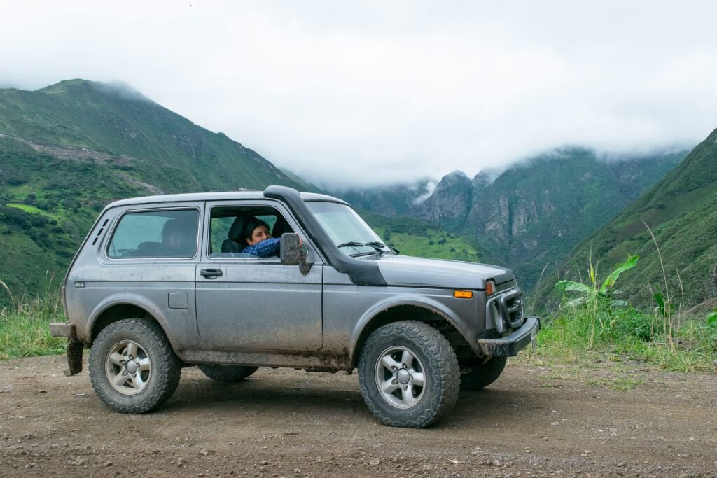
Steel, cobbles, and high-altitude dirt / Navigating Ecuador’s volcanic spine

BEN FINCH
Overland travel in the Ecuadorian Sierra involves traversing a narrow, high-altitude mountain corridor flanked by dozens of volcanic peaks. Ranging between 2,500 and 3,500 metres above sea level, the highland region connects major urban centres and rural agricultural communities via a mix of modern paved highways, cobblestone arterial tracks, and remote dirt roads. Traversing this region demands careful preparation for sudden elevation gains, volatile weather, and complex mountain topography.
The Sierra forms the backbone of mainland Ecuador, running roughly 600 kilometres from the northern border with Colombia down to the southern boundary with Peru. Despite its relatively compact geography compared to neighbouring Andean nations like Colombia or Peru, Ecuador presents one of the densest topographies on the South American continent. Within a single day of travel, an overlander can climb from tropical cloud forests up into the frigid, windswept grasslands of the páramo before descending into fertile, inter-Andean valleys.
For overlanders of all disciplines—whether navigating in a fully equipped four-wheel-drive vehicle, travelling between regional towns on inter-provincial buses, or self-propelling along gravel passes on a loaded touring bicycle—the Sierra requires a tailored operational strategy.
Navigating this landscape successfully depends on understanding road classifications, terminal protocols, vehicle import regulations, and high-altitude environmental factors.
Peak logistics / Essential rules of the Ecuadorian road
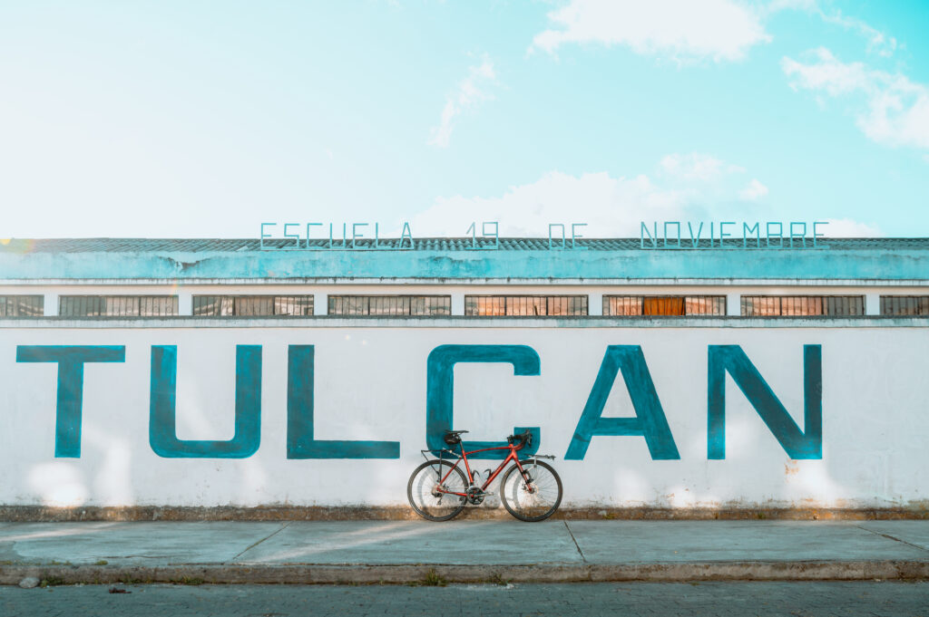
Traversing the Ecuadorian Andes requires a balance of self-reliance, mechanical readiness, and respect for vertical geography. Here is everything you need to keep in mind before setting off across the high-altitude spine of the Sierra.
- Arterial corridors: The E35 Highway (Troncal de la Sierra) serves as your main north–south backbone, linking high-altitude logistics hubs from Tulcán down to Loja
- Transit on a budget: Inter-provincial buses run constantly between municipal Terminales Terrestres, costing roughly $1.50 to $2.50 USD per hour of travel without requiring advance bookings
- Dirt-road cycling: The Trans-Ecuadorian Dirt Road Route (TEMBR) offers world-class bikepacking across high páramo, demanding wide tubeless tyres and ultra-low mountain gearing
- Fuel and altitude: Naturally aspirated engines lose roughly 3% of their power for every 300 metres gained; choose turbocharged setups and carry spare filters for high-sulfur diesel
- Customs compliance: Vehicle Temporary Import Permits (TIP) strictly match the duration of your tourist visa stamp—never let your paperwork expire while in Ecuador
- Acclimatisation rules: Staged progression is vital when climbing above 2,500 metres; spend two nights at intermediate elevations before tackling passes over 3,500 metres
The Ecuadorian Sierra.
Get lost in the hills
Primary overland corridors and geography
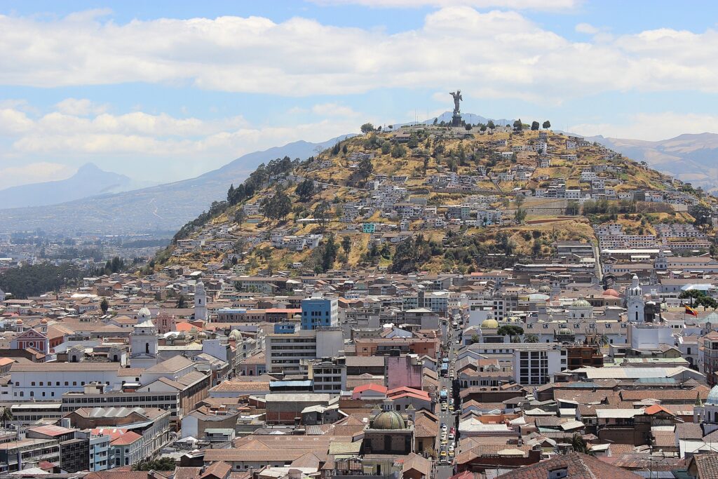
The primary transit artery through the Ecuadorian highlands is the E35 Highway, officially known as the Troncal de la Sierra and forming the Ecuadorian segment of the Pan-American Highway. This multi-lane paved corridor connects the northern border city of Tulcán to the southern city of Loja, passing directly through or alongside key urban staging hubs including Ibarra, Otavalo, Quito, Latacunga, Ambato, Riobamba, and Cuenca.
The geometry of the Sierra is defined by two parallel mountain ranges—the Cordillera Occidental (Western Range) and the Cordillera Oriental (Eastern Range). Between these giant wall structures lies the high inter-Andean depression, historically dubbed the Avenue of the Volcanoes. This corridor hosts the majority of the region’s paved road infrastructure and primary logistics services.
Secondary feeder routes branch off the E35 to scale the outer flanks of both ranges. To the west, paved and unpaved mountain passes plunge down toward the Pacific coastal plains through cloud forest ecosystems.
Key routes include the highway from Quito down to Mindo, the scenic Quilotoa Loop linking Latacunga to Pujilí, Zumbahua, and Sigchos, and the descent from Cuenca through Parque Nacional Cajas toward the coastal port of Guayaquil.
To the east, steep roads drop directly into the Amazon Basin. The most heavily trafficked eastern artery is the Pastaza River corridor connecting Ambato and Baños de Agua Santa to Puyo. These lateral transits transition rapidly from high alpine ecosystems to dense sub-tropical vegetation, subjecting road surfaces to intense rainfall, mudslides, and recurring engineering repairs.
Cobblestone roads (empedrados) remain extremely common throughout rural agricultural zones. Built using hand-laid volcanic stone, these surfaces provide durable, all-weather traction for heavy farm vehicles, but generate severe vibration for light touring bicycles, motorcycles, and passenger cars. Unpaved dirt tracks dominate secondary mountain passes above 3,500 metres, where seasonal freezing and thawing degrade asphalt rapidly.
Bus travel across the highlands

Long-distance bus travel in Ecuador is one of the most comprehensive, frequent, and cost-effective public transport networks in South America. Inter-provincial and intra-provincial buses connect every major city, mountain village, and highway junction across the Sierra daily.
Terminal operations and logistics
In major cities, bus transport is centralised within large municipal transport hubs called Terminales Terrestres. These facilities house dozens of independent bus cooperatives (cooperativas), each operating specific regional routes authorised by the national transit authority (Agencia Nacional de Tránsito).
Quito operates two distinct long-distance terminals separated by the city’s vast urban footprint:
- Terminal Terrestre Carcelén: Positioned in the far north of the city. Serves all northbound routes toward Otavalo, Ibarra, Tulcán, and the Colombian border at Rumichaca
- Terminal Terrestre Quitumbe: Positioned in the far south of the city. Serves all southbound highland destinations (Latacunga, Ambato, Baños de Agua Santa, Riobamba, Cuenca, Loja) as well as coastal and Amazonian destinations
In medium-sized regional centres like Cuenca, Ambato, and Riobamba, a single Terminal Terrestre handles all arriving and departing traffic. Smaller mountain villages may not possess a formal terminal building; instead, buses stop at central plazas or designated curbside ticket offices.
Bus categories and service tiers
Four distinct tiers of public passenger transport operate across the Sierra network:
- Ejecutivo and Interprovincial Coaches: Large, modern 40-to-50-passenger coaches equipped with reclining seats, onboard toilets, air conditioning, and luggage compartments below deck. These handle long-distance arterial routes along the E35 (such as Quito to Cuenca or Quito to Guayaquil)
- Selecto / Directo Buses: Point-to-point express services that omit intermediate rural stops, reducing travel times between major provincial capitals by up to 20%
- Local and Centinela Buses: Regional vehicles stopping continuously along main highways to pick up and drop off rural passengers. These buses often carry agricultural cargo, bicycles, and household items
- Rancheras (Chivas): Traditional open-sided wooden buses built on heavy truck chassis. Operating primarily in remote rural areas and lower-altitude valleys, rancheras handle steep, unpaved routes connecting isolated farming communities to market towns
Ticketing, luggage, and costs
Bus tickets in Ecuador are priced predictably based on distance and duration. The standard rule of thumb for inter-provincial fare calculation is approximately $1.50 to $2.50 USD per hour of travel time.
| Route | Distance (km) | Average travel time | Estimated fare (USD) |
| Quito (Carcelén) to Otavalo | 95 km | 2 hours | $3.00 – $4.00 |
| Quito (Carcelén) to Tulcán | 240 km | 5 hours | $7.00 – $9.00 |
| Quito (Quitumbe) to Latacunga | 90 km | 1.5 hours | $2.50 – $3.50 |
| Quito (Quitumbe) to Baños de Agua Santa | 170 km | 3.5 hours | $5.00 – $6.50 |
| Quito (Quitumbe) to Cuenca | 460 km | 8 to 9 hours | $12.00 – $16.00 |
| Cuenca to Loja | 210 km | 4.5 to 5 hours | $8.00 – $10.00 |
Advance online booking is rarely necessary or even available for standard bus lines. Travellers simply arrive at the designated Terminal Terrestre, purchase a ticket at the individual cooperative’s ticket window (ventanilla), pay a small municipal terminal departure tax (typically $0.10 to $0.25 USD cash at a turnstile), and proceed to the boarding bay (andén).
Advance booking is only recommended during major national holiday periods, such as Semana Santa (Easter), Independence holidays, or Carnival, when terminals experience extreme passenger volume.
Luggage intended for the hold below deck is tagged by terminal handlers or the driver’s assistant (controlador). You will receive a matching claim stub. Keep high-value personal effects, passports, electronics, and cash in a small daypack on your lap or between your feet inside the cabin.
Never place high-value bags in the overhead racks above passenger seats, as theft by distraction can occur on inter-city routes.
The Ecuadorian Amazon.
The most biodiverse place in the world
Bikepacking and cycle touring the Andes

The Ecuadorian Sierra is world-renowned among bikepackers and adventure cyclists for its dramatic vertical relief, remote high-altitude dirt tracks, and accessible supply networks. Cycling across the country offers an intimate experience of Andean geography, but demands high physical fitness and specialised equipment setups.
Route selection / Paved vs dirt
Cycle tourists generally select between two distinct routing philosophies when crossing the Ecuadorian highlands:
- The Paved Avenue of the Volcanoes (E35 Route): Following the main paved highway corridors. This option minimises mechanical wear and offers predictable gradients (rarely exceeding 6% to 8%). However, it subjects cyclists to high motor vehicle density, diesel exhaust from heavy freight trucks, and industrial suburban stretches surrounding major cities
- Smooth asphalt highway (E35)
- Elevation: 2,200m–3,000m
- Moderate gradients (4%–8%)
- Heavy commercial truck & bus traffic
- Suitable for 32mm–45mm touring tyres (28mm worked for me)
- The Trans-Ecuadorian Dirt Road Route (TEMBR): Developed by pioneering adventure cyclists, the TEMBR is a network of interconnected backroads, cobblestone lanes, dirt tracks, and high-altitude singletrack paths. The route runs along the crests of both the Western and Eastern Cordilleras, minimising contact with highway traffic while maximising wilderness exposure
- High dirt/gravel content (70%+)
- Elevation: 3,000m–4,500m
- Extreme gradients (up to 15%–18%)
- Low vehicle traffic; high wilderness
- Requires 2.2″–2.6″ tubeless tyres
Equipment, gearing, and bike setup
The extreme vertical nature of the Andes makes weight distribution and mechanical leverage critical considerations:
- Gearing: Sustained climbing gradients on rural dirt roads regularly exceed 12%, reaching up to 18% on loose cobble ramps. A gear-inch range down to 18–20 inches is highly recommended (for example, a 28T or 30T front chainring paired with an 11-50T or 11-52T rear cassette on a 1x setup, or a traditional ultra-compact double/triple crankset)
- Tyres: For paved highway touring, high-volume road or gravel tyres (40mm to 50mm) offer adequate comfort over rough asphalt and cobbles. For off-road routes like the TEMBR, mountain bike tyres measuring 2.2 to 2.6 inches with aggressive tread and reinforced sidewalls are essential to prevent punctures from sharp volcanic rock. Tubeless setups are strongly recommended due to abundant thorn-bearing flora (espinos) in dry inter-Andean valleys
- Braking Systems: Long, steep descents spanning 1,500 vertical metres will rapidly overheat small brake rotors. Hydraulic disc brakes with 180mm rotors front and rear are the industry standard for safe control under heavy luggage loads
- Luggage Systems: Soft bikepacking bags (seatpacks, frame bags, and top-tube bags) attached directly to the frame tubes are superior to traditional rack-and-pannier setups on unpaved routes. Panniers are prone to rattling loose on harsh cobblestones and add unwanted width when negotiating narrow singletrack or cattle paths
Resupply, water, and alpine survival
Unlike remote wilderness routes in northern Canada or southern Patagonia, the Ecuadorian highlands are densely populated in rural areas. Small agricultural villages (pueblos) are typically spaced 20 to 40 kilometres apart along secondary dirt tracks.
Basic staples—including fresh fruit, rice, eggs, potatoes, canned tuna, packaged biscuits, and bottled water—can be purchased at small village grocery stores (tiendas). Warm meals like soup (caldo de gallina) and set lunch plates (almuerzos) are widely available in village centres for $2.50 to $4.00 USD.
Water purification requires strict discipline. Rivers and streams throughout the Sierra flow through high-altitude cattle pastures and agricultural plots. All surface water, even in seemingly pristine mountain watersheds, must be treated using a high-grade microfilter, chemical purification tablets, or a sterilising ultraviolet device to remove bacterial pathogens and protozoan cysts like Giardia.
Hypothermia is a genuine risk above 3,500 metres. Temperatures on the páramo can fall from 20°C in sunny conditions down to near freezing within minutes if rain, hail, or high-altitude fog (neblina) rolls in. A complete layered clothing system—including a waterproof outer shell, thermal merino base layers, and insulated gloves—is mandatory equipment even for short day rides in the high country.
Self-drive overlanding / 4x4s, campervans, and motorcycles
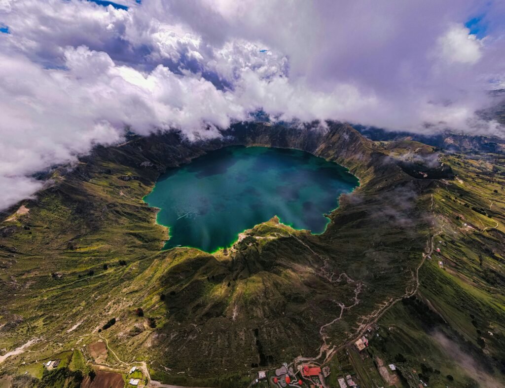
Navigating the Ecuadorian Sierra in an imported or rented vehicle provides complete operational independence, allowing access to remote national parks, rural campsites, and secondary mountain passes impossible to reach via public transit.
Road infrastructure and vehicle requirements
Highway conditions in the Sierra vary substantially depending on regional administrative funding and geography. The main E35 multi-lane highway is generally well-maintained, featuring smooth asphalt, clear line markings, and toll plazas (peajes) spaced roughly every 80 to 120 kilometres.
Toll fees for standard two-axle passenger vehicles, 4x4s, and small campervans are fixed at $1.00 USD per plaza (payable strictly in cash).
Once leaving the primary E35 arterial network, road conditions degrade rapidly:
- Landslides and Washouts: During the rainy season, steep road cuts along mountain passes are prone to earth movements (derrumbes). High-clearance vehicles are necessary to negotiate rockfalls and temporary mud bypasses
- Cobblestone Highways: Rural mountain corridors often consist of hand-laid stone. Over several hours of driving, these surfaces generate severe vibrations that can loosen suspension bolts, damage roof-rack mounts, and cause interior cabinet latches on campervans to fail
- High-Altitude Power Loss: Naturally aspirated petrol and diesel engines experience a noticeable drop in power at high elevation due to reduced atmospheric oxygen density. Expect a power loss of approximately 3% for every 300 metres of elevation gained above sea level. Turbo-charged engines handle high-altitude driving far more effectively
Four-wheel-drive (4WD) with low-range capability is not mandatory for staying on paved highways, but is essential if you intend to wild camp on high páramo tracks, explore remote sectors of Parque Nacional Cotopaxi or Parque Nacional Llanganates, or climb steep agricultural tracks in wet weather.
Fuel infrastructure and grades
Fuel stations (gasolineras) operated by state enterprise Petroecuador alongside private franchises (such as Primax, Terpel, and Mobil) are abundant along main highways and inside urban boundaries. Station frequency drops considerably in remote rural valleys; maintain a minimum quarter-tank buffer at all times.
Ecuador uses three primary fuel classifications:
- Extra (85 Octane): State-subsidised unleaded petrol. Widely available across all stations. Suitable for low-compression engines, older carburettor vehicles, and basic small-capacity motorcycles. Modern high-compression engines may experience pre-ignition knock when running on Extra at lower altitudes
- Súper (92/95 Octane): Unsubsidised high-octane unleaded petrol. Offered at higher prices than Extra, but essential for modern turbocharged imported engines and performance motorcycles requiring clean fuel
- Diésel Premium: Highly subsidised automotive diesel. Available at virtually all fuel stations nationwide. Modern Euro 5/6 diesel engines fitted with delicate Diesel Particulate Filters (DPF) and AdBlue systems can suffer long-term injector fouling due to variable sulfur content in regional supplies; carrying spare fuel filters and water separators is prudent for foreign overlanders
| Fuel Type | Octane / Spec | Operational Notes |
| Extra / Ecopaís | 85 Octane | Subsidised; standard grade across Ecuador |
| Súper Premium | 92–95 Octane | Unsubsidised; recommended for modern engines |
| Diésel Premium | Standard Auto Spec | Highly subsidised; check fuel filters |
Overnight parking, camping, and iOverlander
Finding secure overnight accommodation or vehicle camping options requires a flexible strategy combining established campsites, eco-lodges, and secure urban parking structures:
- National Park Campsites: Public reserves like Parque Nacional Cotopaxi, Parque Nacional Cajas, and Reserva Ecológica El Ángel provide designated camping areas with basic toilet facilities and access to hiking trails. Nights are extremely cold; sub-zero temperatures are common
- Haciendas and Eco-Lodges: Historic agricultural estates (haciendas) across the Avenue of the Volcanoes frequently welcome overlanders. For a small fee ($5.00 to $15.00 USD per night), travellers can park campervans securely on the grounds while retaining access to hot showers, water hookups, and restaurant facilities
- Urban Safe Parking (Parqueaderos): Overnight wild camping on urban public streets inside major cities like Quito, Cuenca, or Ambato is strongly discouraged due to security risks. Instead, use gated, 24-hour commercial parking structures (parqueaderos guardados), which charge between $5.00 and $10.00 USD for overnight vehicle storage
- iOverlander App: The crowdsourced mapping application iOverlander is the single most valuable digital tool for overlanders in Ecuador. It provides up-to-date user reviews on wild camping spots, mechanics specialising in foreign vehicles, LPG cooking gas refill locations, and water fill points
The Galápagos.
Ecuador’s Enchanted Isles
Border logistics and temporary vehicle permits
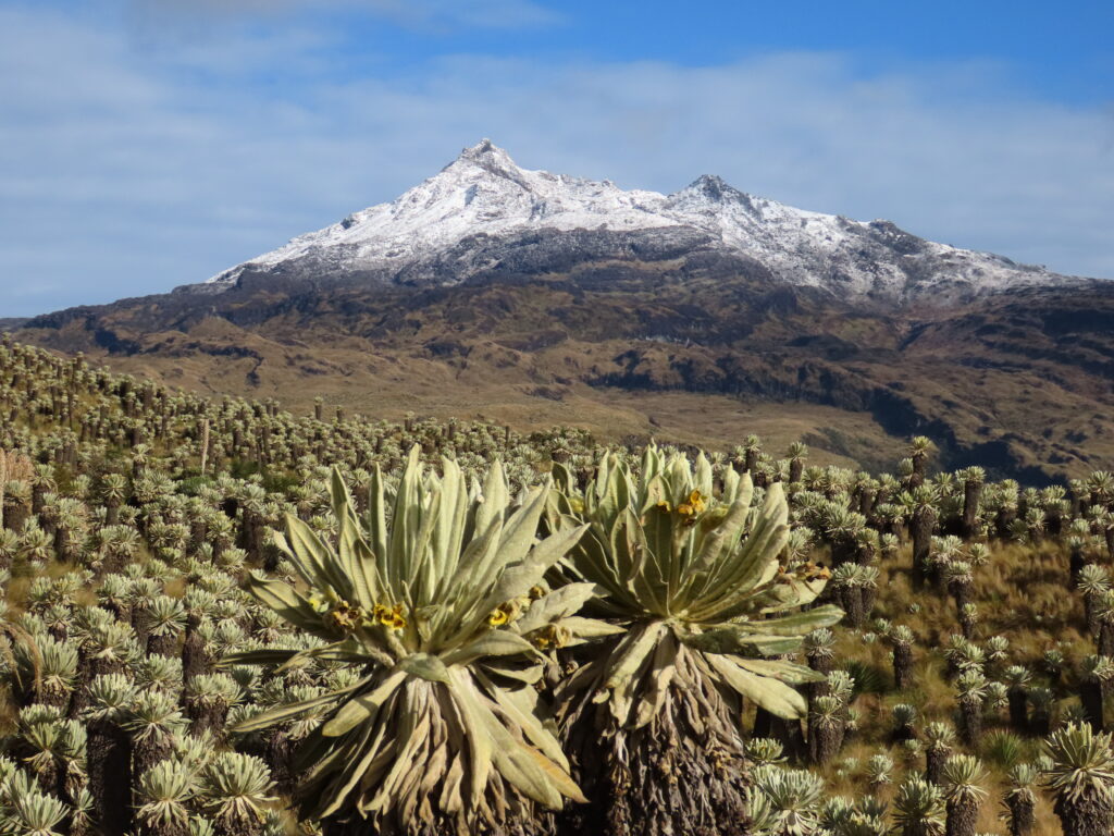
Crossing an overland border into Ecuador with a foreign-registered private vehicle requires strict compliance with customs procedures to obtain a Temporary Import Permit (Permiso de Importación Temporal de Vehículos or TIP).
Key border crossings
Overlanders typically access the Ecuadorian Sierra through three primary international land ports:
- Rumichaca / Northern Border with Colombia: Connects Ipiales (Colombia) to Tulcán (Ecuador). This is the busiest overland crossing on the Pan-American Highway. Facilities are centralised, but long queues can develop during peak hours
- Huaquillas / Southern Coastal Border with Peru: Connects Tumbes (Peru) to Machala/Cuenca (Ecuador). Features a joint border control facility (CEBAF – Centro Binacional de Atención en Frontera) where immigration and customs officers from both nations operate under one roof
- Macará / Southern Highland Border with Peru: Connects Piura/Sullana (Peru) directly to Loja (Ecuador). A far quieter and less stressful inland highland crossing compared to the chaotic coastal route at Huaquillas
Temporary Import Permit (TIP) document checklist
To import a private car, campervan, or motorcycle without paying import duties, the legal registered owner of the vehicle must present original physical copies of the following documentation to Ecuadorian Customs (SENAE – Servicio Nacional de Aduanas del Ecuador):
- Valid Original Passport: Must have at least six months of remaining validity and contain the fresh Ecuadorian immigration entry stamp obtained immediately prior to visiting the customs window
- Original Vehicle Registration and Title: Proving legal ownership. The name on the registration document must match the passport holder exactly. (If driving a borrowed or corporate vehicle, a notarised power of attorney authenticated by an Ecuadorian embassy or apostilled in the country of origin is mandatory)
- Valid Driver’s Licence: An original driver’s licence from your home country. An International Driving Permit (IDP) is recommended as a supporting document, though not always demanded by customs officials
- Compulsory Mandatory Third-Party Insurance (SOAT / SPAT): While insurance regulations fluctuate, drivers are required to carry mandatory third-party liability coverage while operating on national roads. Policy coverage can be purchased from authorised insurance offices in border towns like Tulcán or Huaquillas
The TIP document is typically issued for a duration matching the vehicle owner’s tourist visa stamp (standardly 90 days for most European, North American, and Australasian nationalities).
Never allow your vehicle’s TIP to expire while inside Ecuador. Overstaying a vehicle permit carries severe statutory financial penalties from SENAE, reaching up to several thousand dollars USD, and can result in the impoundment or permanent confiscation of the vehicle.
Altitude, weather, and seasonal planning
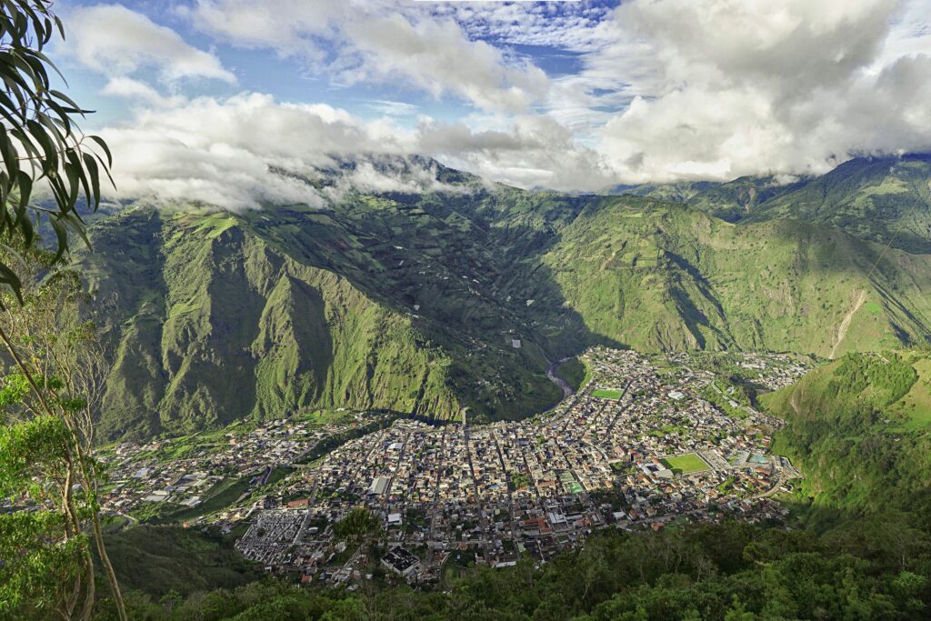
The weather in the Ecuadorian Sierra is characterised by microclimates dictated by altitude, valley orientation, and proximity to adjacent moisture sources (the Pacific Ocean to the west and the Amazon Basin to the east). Rather than standard summer and winter seasons, the region experiences wet and dry periods.
Seasonal precipitation patterns
- Dry Season / Verano / June to September: Characterised by clearer morning skies, reduced rainfall, and strong mountain winds. This is the optimal window for high-altitude bikepacking, dirt-road driving, and alpine trekking. However, daytime solar radiation is intense, and high-altitude night temperatures drop rapidly
- Wet Season / Invierno / October to May: Marked by increased cloud cover and predictable afternoon rain showers. Heavy localised downpours can trigger flash flooding in narrow canyons, wash out unpaved dirt passes, and cause landslides along steep highway corridors. April is historically the wettest month of the year across the central highlands
Altitude acclimatisation strategy
Altitude sickness (soroche) is a primary medical consideration for overlanders entering the Sierra. Capital city Quito sits at 2,850 metres above sea level, while surrounding highway passes regularly top 4,000 metres.
Symptoms of acute mountain sickness include dull headaches, nausea, fatigue, dizziness, and shortness of breath during mild exertion.
To acclimatise safely:
- Stage Your Ascent: If entering Ecuador from sea level (via the coastal borders or flying into Guayaquil), avoid ascending directly to high-altitude mountain passes over 3,500 metres on day one. Spend two nights at intermediate altitudes (such as Baños de Agua Santa at 1,800 metres or Ibarra at 2,200 metres) before proceeding to higher elevations
- Hydration and Diet: Consume three to four litres of water daily. Increased respiratory rates in dry mountain air lead to rapid fluid loss. Eat light, high-carbohydrate meals, as digestion slows at high altitude
- Physical Exertion: Bikepackers and hikers should limit physical exertion for the first 48 hours after arriving above 2,800 metres
- Descent Protocol: The only definitive cure for severe altitude sickness is immediate descent to a lower elevation. If symptoms progress to vomiting, severe confusion, or difficulty walking, transport the affected person down to a lower altitude valley immediately
The Ecuadorian Coast.
Where you’ll find the very best food
Safety, security, and practical navigation
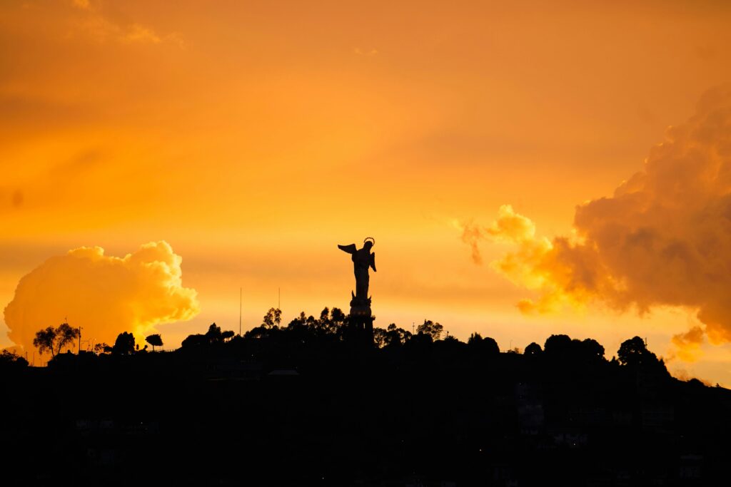
Navigating the Ecuadorian highlands safely requires an understanding of road hazards, security conditions, and offline digital navigation utilities.
Recommended navigation tools
Cellular network coverage provided by national carriers (Claro, Movistar, and Tuenti) is generally reliable along main multi-lane highways and inside urban boundaries. However, coverage drops off completely inside deep river gorges, national park interiors, and remote high páramo dirt tracks.
Never rely exclusively on online mapping applications:
- Gaia GPS / iPhiGenie: Ideal for high-altitude adventure cyclists, off-road 4×4 drivers, and wilderness hikers requiring detailed topographic contour lines, elevation profiles, and satellite imagery offline
- Organic Maps / Maps.me: Excellent free offline vector mapping tools built on OpenStreetMap (OSM) data. They clearly show small rural footpaths, cobblestone lanes, village supply stores, and water sources missed by standard highway maps
- Google Maps (Offline Download): Useful for urban vehicle navigation, street names, and real-time highway traffic updates along the primary E35 arterial network. Ensure you pre-download offline map sectors for the entire Sierra corridor before leaving urban centres
Safety protocols and driving practices
- Avoid Night Transit: Driving, riding, or cycling on rural highland roads after dark is strongly discouraged. Unlit farm vehicles, stray livestock, missing manhole covers, unannounced speed bumps (chapa acostado or vigilantes), and sudden fog banks present severe hazards when visibility is low
- Mountain Fog (Neblina): Thick, moisture-laden cloud layers can drop visibility to less than five metres along high passes (particularly on the road between Quito and Papallacta, and the descent through Parque Nacional Cajas). Use low-beam headlights or specialised fog lamps, reduce speed, and use road edge reflectors for guidance
- Speed Bumps: Speed humps are used extensively throughout Ecuador as a traffic-calming measure when entering any town or village. They are often unpainted and poorly signed; hitting a high-aspect speed bump at speed can destroy vehicle suspension components or throw a cyclist from their bike
- Urban Security and Parking: While the Sierra historically experiences lower rates of violent crime than low-altitude coastal port regions, opportunistic theft and property crime occur in crowded urban environments. Park vehicles in secure, enclosed lots overnight, leave no bags or valuable items visible inside parked passenger cabins, and monitor luggage closely at busy bus terminals
By respecting altitude constraints, selecting the appropriate gear for mountain geography, maintaining vehicle documentation, and adhering to established route planning guidelines, overlanders can experience one of the world’s most spectacular mountain travel corridors efficiently and safely.
Own the road across the Avenue of the Volcanoes
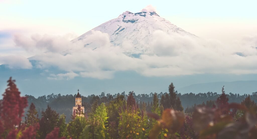
Overland travel across the Ecuadorian Sierra is defined by a sense of perpetual verticality. Few places on earth compress such drastic changes in climate, ecology, and culture into such short physical distances.
Within a single morning of riding or driving, the dense humidity of the cloud forest gives way to the silent, golden expanses of the páramo, framed by the icy ramparts of active volcanoes. It is a landscape that rewards patience, careful preparation, and a willingness to slow down.
Whether you are navigating cobblestone mountain tracks on a loaded bikepacking rig, leaning against the window of a local cooperativa bus as it winds through deep river gorges, or steering a 4×4 across windswept volcanic plateaus, the Sierra demands flexibility.
Roads will occasionally be blocked by sudden landslides, mountain fog will reduce your horizon to a few paces, and the thin air will test your physical reserves. Yet, these moments of friction are precisely what render independent travel here so deeply memorable.
Aside from the technical challenges of border crossings and altitude management lies an exceptionally welcoming high country. Small mountain tiendas stocked with hot soup and fresh fruit, quiet campsites tucked beneath towering basalt walls, and the quiet camaraderie of fellow travellers all contribute to the rhythm of the road.
Equip yourself properly, respect the unpredictable Andean weather, and allow the road to dictate your pace. The Ecuadorian highlands remain one of South America’s most rewarding overland journeys.
Affiliate Disclaimer: Some of the links on Wheely Tyred are affiliate links. If you click through and make a booking or purchase, we may earn a small commission at no extra cost to you. We only recommend gear, tours, stays, and services we genuinely use, trust, and stand behind — our editorial independence always comes first. These commissions help keep our independent cycling guides and travel stories free to read. Thanks for supporting the ride!
Frequently asked questions about overland travel in the Ecuadorian Sierra
No, advance bookings are rarely necessary for standard inter-provincial buses. You can simply turn up at the municipal Terminal Terrestre, purchase a ticket at the cooperative’s window (ventanilla), and board the next available departure. The only exceptions are major national holidays such as Semana Santa (Easter), Independence holidays, or Carnival, when terminals experience extreme passenger volume and purchasing tickets one or two days early is recommended.
Wild camping in high-altitude national reserves like Cotopaxi or Cajas is generally safe and peaceful, provided you prepare for freezing night temperatures and sudden rainstorms. However, near urban boundaries or low-altitude valleys, it is safer to park campervans or pitch tents at established haciendas, eco-lodges, or gated parqueaderos guardados (24-hour guarded parking lots) to prevent opportunistic theft.
A mountain bike equipped with wide tubeless tyres (2.2 to 2.6 inches) and hydraulic disc brakes with 180mm rotors is ideal. Dirt tracks and ancient cobblestone lanes (empedrados) feature loose rock, thorns, and sustained climbing gradients exceeding 12%. Ensure your drivetrain has an ultra-low gear ratio (such as a 28T or 30T chainring with a 50T or 52T cassette) to handle heavy luggage at high altitude.
Fuel stations are frequent along the main E35 highway and near provincial capitals, but scarce in deep rural valleys. Standard Extra petrol (85 octane) and Diésel Premium are heavily subsidised and widely available, but modern high-compression or turbocharged engines benefit from unsubsidised Súper petrol (92/95 octane). If driving a modern Euro 5/6 diesel vehicle, carry spare fuel filters and water separators to protect against variable sulfur levels.
Allowing your TIP to expire while inside the country is a serious offence under customs regulations (SENAE). It results in heavy daily fines running into thousands of dollars and risks vehicle impoundment or confiscation. Always ensure your vehicle permit validity aligns with your personal tourist visa duration, and apply for an official extension at a regional customs office before it expires if you plan to stay longer.
Acclimatise gradually by staging your elevation gain. If arriving from sea level, spend at least 24 to 48 hours resting at an intermediate altitude (such as Baños at 1,800 metres or Ibarra at 2,200 metres) before ascending to Quito (2,850 metres) or high mountain passes over 3,500 metres. Drink three to four litres of water daily, avoid heavy physical exertion during your first two days, and descend immediately if severe symptoms develop.
Ecuador.
Pure wonder on the equator.

