
The living caldera of Laguna de Cuicocha / Geology, sacred ritual, and high-altitude hiking in Ecuador
An essential historical and travel guide to Ecuador’s most famous volcanic crater lake and sacred Kichwa sanctuary
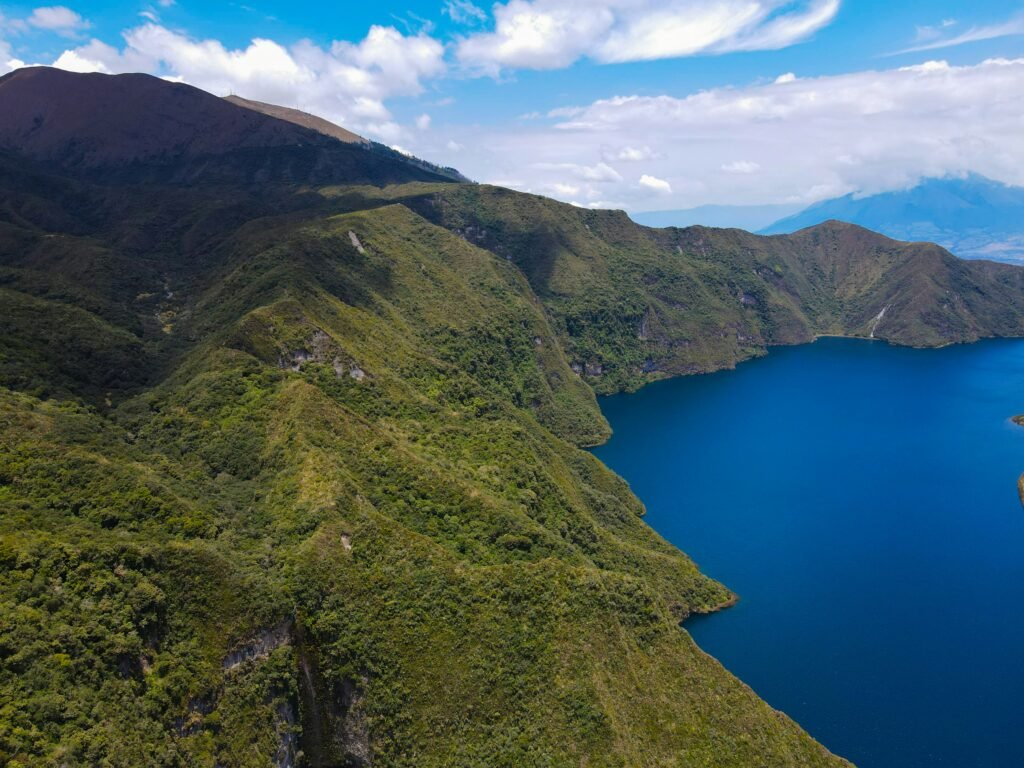
The sacred mirror beneath Volcán Cotacachi

BEN FINCH
High in the western cordillera of the Ecuadorian Andes, resting silently at an elevation of 3,246 metres above sea level, lies one of South America’s most striking geological and cultural landscapes. Laguna de Cuicocha is far more than an impressive backdrop for photographs; it is a living crater lake born of cataclysmic volcanic events, a sanctuary deeply woven into the spiritual traditions of the indigenous Kichwa people, and a fragile ecological haven.
For travellers exploring the northern Andean highlands of Imbabura province, Cuicocha represents the ideal intersection of independent exploration, deep history, and natural beauty. While many visitors flock to the world-famous market town of Otavalo just 25 kilometres to the south-east, those who venture upwards into the foothills of Volcán Cotacachi discover a landscape shaped by thousands of years of geological evolution and human devotion.
At Wheely Tyred, the focus remains on slow, meaningful travel that respects local heritage and offers true context to every journey. Understanding Laguna de Cuicocha requires peering beneath its turquoise surface to explore the volcanic forces that carved the caldera, the indigenous beliefs that keep it sacred, and the practicalities of navigating its breathtaking perimeter trail.
Highlights of the Cuicocha caldera / Sacred waters and high-altitude trails
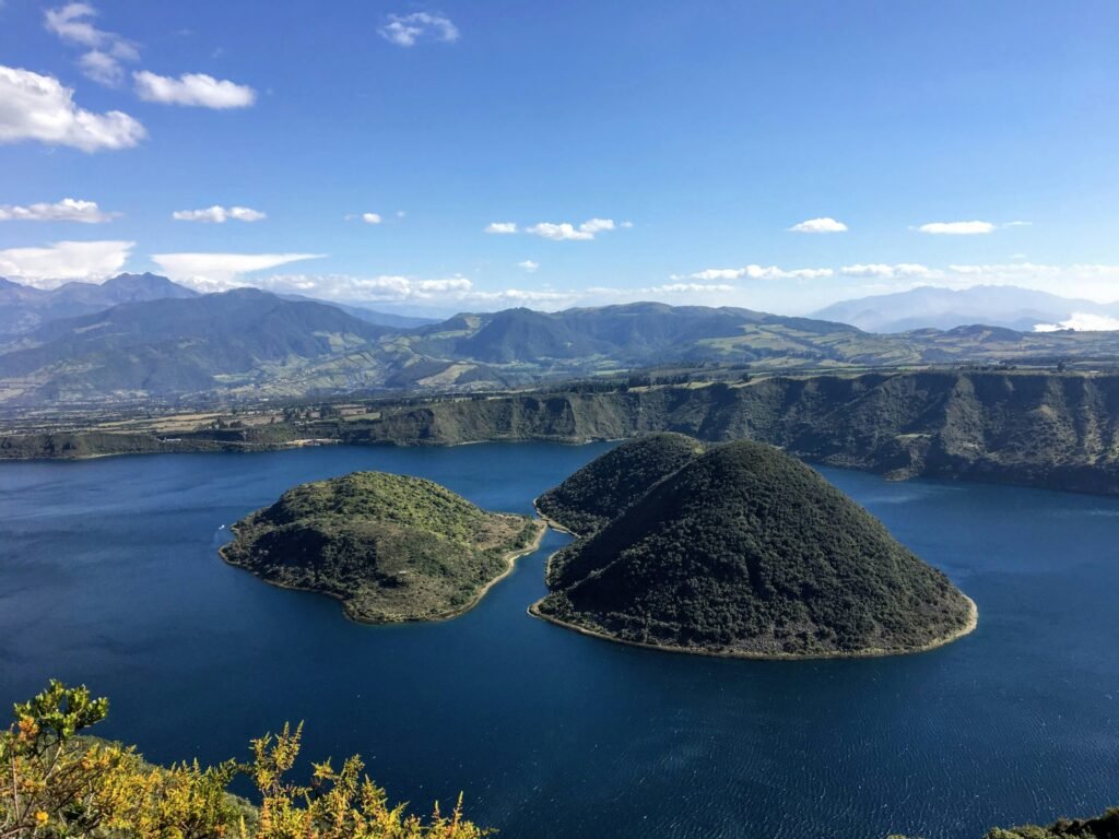
Perched beneath the volcanic crown of Volcán Cotacachi, Laguna de Cuicocha combines violent geological heritage with deep Kichwa spiritual tradition. Here is a concise overview of the key themes, practical details, and cultural history that define this remarkable Andean sanctuary.
- Cataclysmic volcanic origins: Created approximately 3,100 years ago following a massive phreatomagmatic eruption and structural collapse that formed a three-kilometre-wide caldera reaching depths of 150 metres
- The guinea pig islands: Takes its name from the Kichwa words kuy (guinea pig) and kucha (lake), describing how the main lava dome, Islote Teodoro Wolf, resembles the rounded back of a guinea pig
- Sacred Kichwa sanctuary: Serves as an ancestral portal to Pachamama (Mother Earth), where local communities gather during the June solstice festival of Inti Raymi for midnight ritual purification bathing (Armay Chishi)
- The Sendero G3 rim trail: Features a rewarding 14-kilometre circuit along the crater rim, taking hikers between elevations of 3,100 and 3,450 metres with panoramic views across the Imbabura province
- Protected Andean biodiversity: Provides a refuge for high-altitude wildlife, including the rare silvery grebe nesting in shoreline reeds, highland orchids, and Andean condors riding thermal currents above the ridge
- Surrounding artisan culture: Sits minutes from Santa Ana de Cotacachi, Ecuador’s capital of handmade leather craftsmanship, and the world-renowned textile markets of Otavalo
- Independent travel accessibility: Easily reached using low-impact local transport, combining regional buses with local pick-up trucks (camionetas) or a steady road climb for cycle-tourists
Laguna de Cuicocha.
Lake of the guinea pig
Cataclysm and creation / The volcanic history of the Cuicocha caldera
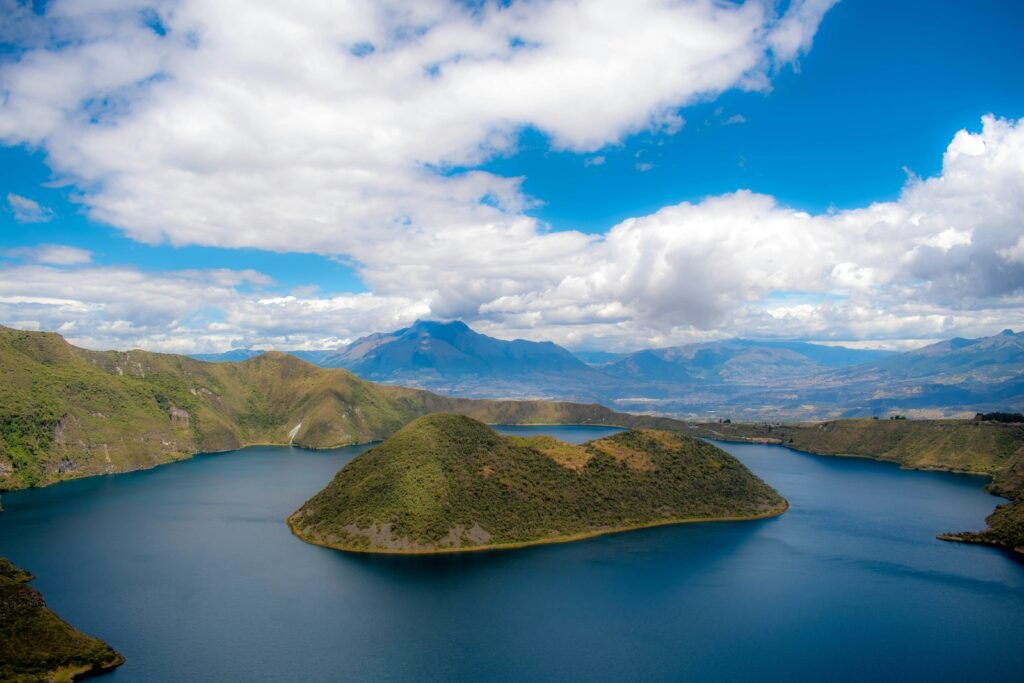
The geological narrative of Laguna de Cuicocha began approximately 3,100 years ago during the late Holocene epoch. Before the lake existed, the massive, snow-capped Volcán Cotacachi dominated the horizon as a dominant Pleistocene complex. A series of violent phreatomagmatic eruptions occurred along the southern flank of the volcano, triggered when rising magma came into contact with deep subterranean water reservoirs.
This explosive force discharged roughly five cubic kilometres of pyroclastic material into the atmosphere, blanketing the surrounding valleys in layers of volcanic ash up to 20 centimetres thick. The rapid emptying of the underground magma chamber caused the volcanic summit to collapse inward, creating a massive bowl-shaped depression, or caldera, measuring over three kilometres in width.
Subsequent eruptive activity around 650 CE pushed thick, viscous dacitic lava through the floor of the caldera. This lava built four distinct domes, two of which rose high above the accumulating water to form the steep, heavily forested islands seen today: Islote Yerovi and Islote Teodoro Wolf.
Cuicocha caldera chronology
- ~1100 BCE: Cataclysmic eruption and caldera collapse
- ~650 CE: Dacitic lava dome eruptions form Yerovi & Wolf
- 1930s–Present: Formation of Reserva Ecológica Cotacachi-Cayapas
- 2022: Named an IUGS Global Geological Heritage Site
Today, the lake reaches depths of up to 150 metres. It possesses no natural surface stream outlets, relying on subterranean seepage and precipitation to maintain its water levels. The water itself is highly alkaline and rich in dissolved minerals such as sodium carbonate, calcium, and manganese. Deep beneath the surface, volcanic degassing continues. Continuous streams of carbon dioxide bubbles rise from active hydrothermal vents in the western basin of the lake, offering silent proof that the subterranean chamber remains alive.
Owing to its international scientific significance, the International Union of Geological Sciences included the Cotacachi-Cuicocha volcanic complex in its prestigious registry of 100 Global Geological Heritage Sites.
The Ecuadorian Sierra.
Get lost in the hills
The Lake of the Guinea Pig / Kichwa etymology and indigenous worldview
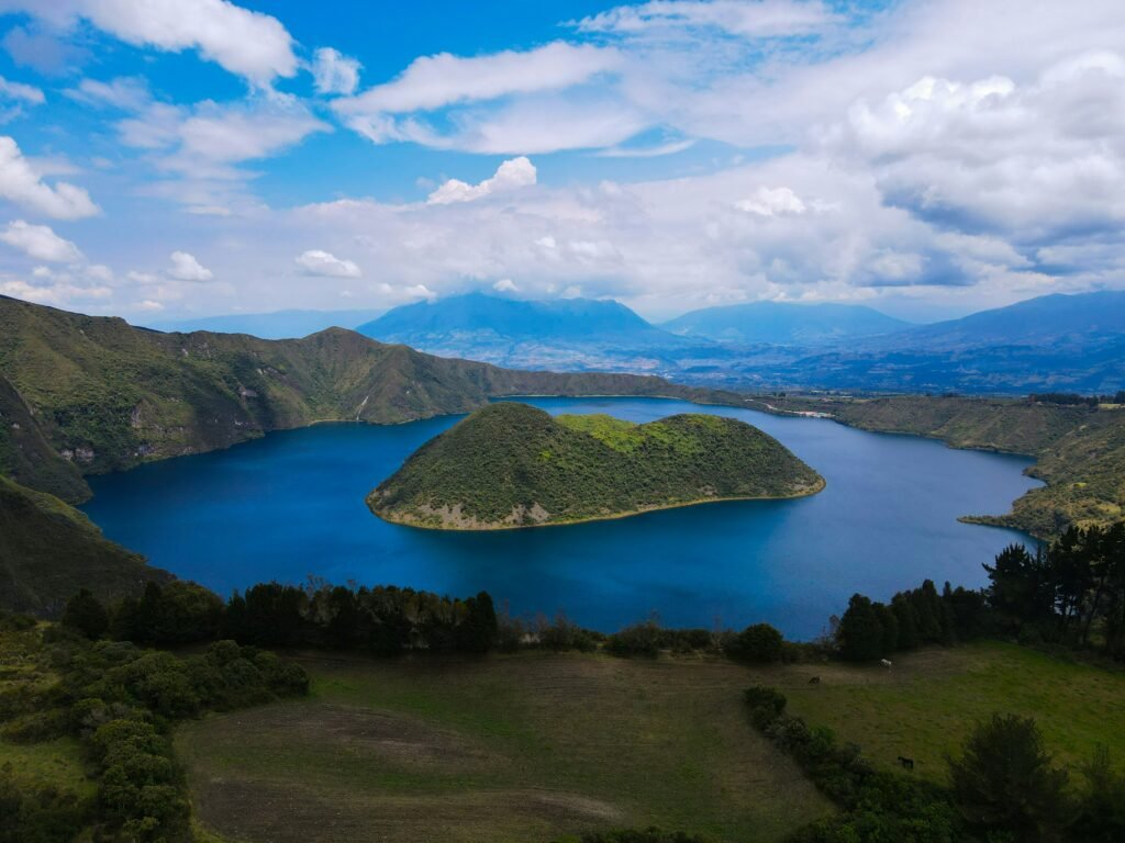
To understand the cultural weight of Laguna de Cuicocha, one must look through the lens of the native Kichwa people who have inhabited the Imbabura region for centuries. The name Cuicocha derives from the Kichwa language, specifically from the words kuy (guinea pig) and kucha (lake).
Local tradition attributes this name to the distinctive shape of the largest island inside the crater, Islote Teodoro Wolf, which resembles the rounded back of a guinea pig when viewed from the northern rim. In Andean culture, the cuy holds immense domestic and ceremonial value, making the animal a natural point of reference. An alternative linguistic interpretation traces the name to kuychikucha, meaning lake of the rainbow, reflecting the brilliant, shifting mineral hues displayed across the water under highland sunlight.
In the ancestral Andean cosmovision, natural elements are not merely physical objects; they are sacred entities endowed with spirit and authority. The volcano Cotacachi is venerated as Mama Cotacachi, a nurturing maternal guardian who works in harmony with Tayta Imbabura, the father mountain across the valley. Laguna de Cuicocha is understood as a sacred womb formed at the base of Mama Cotacachi, acting as a portal between the terrestrial realm (Kay Pacha) and the spiritual world below.
The concept of Pachamama, or Mother Earth, governs all interactions with the lake. The water is considered a living entity capable of giving life, nourishing crops across the fertile agricultural benches of Otavalo and Cotacachi, and cleansing those who approach it with pure intentions.
Ritual purification and Inti Raymi / Cuicocha as a sacred sanctuary
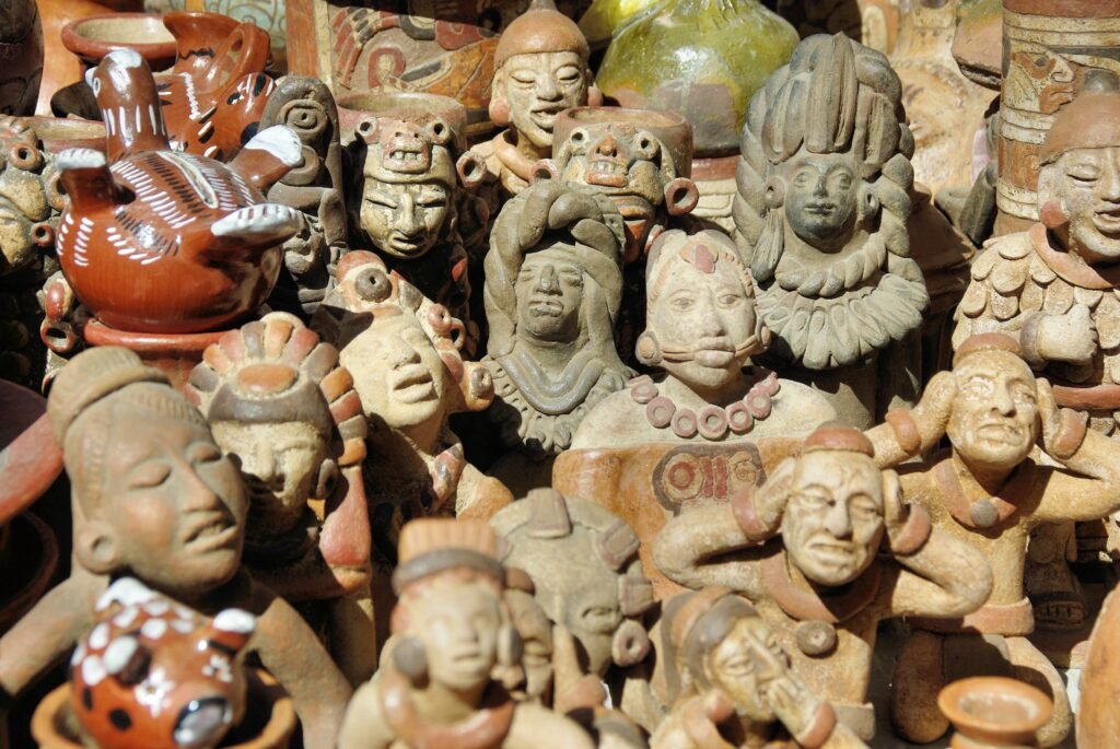
The spiritual significance of Laguna de Cuicocha reaches its peak during the annual solstice celebrations of Inti Raymi, the traditional Sun Festival held every June. Inti Raymi marks the completion of the agricultural cycle, expressing gratitude to the sun and earth for the harvest while preparing the community for the upcoming year.
Central to this festival is the ancient rite of Armay Chishi, or spiritual purification bathing. During the solstice period, indigenous communities from surrounding villages trek up the mountain slopes to the edge of Cuicocha. Led by local spiritual leaders known as yachaks, worshippers enter the frigid, mineral-heavy waters of the lake during the dark hours of midnight or early dawn.
The icy bath serves several profound purposes:
- Spiritual cleansing: Ridding the mind, body, and spirit of negative energy accumulated over the past year
- Recharging energy: Absorbing the raw, volcanic power (fuerza) stored within the sacred caldera
- Reconnection: Renewing the sacred pact between the human community, Mama Cotacachi, and Pachamama
Following the purification ritual, participants gather around fires on the crater rim where yachaks perform blessing rites using smoke, native herbs, and condor feathers. The celebrations then expand into regional music, rhythmic dancing, and communal feasts across the towns of Cotacachi and Otavalo.
Because of this profound ongoing cultural connection, visitors are urged to approach Laguna de Cuicocha with the utmost respect. The central islands of Yerovi and Teodoro Wolf are strictly off-limits to landing or foot travel, acting as protected ecological and spiritual sanctuaries.
The Galápagos.
Ecuador’s Enchanted Isles
The crater rim trail / Sendero G3 and páramo ecology
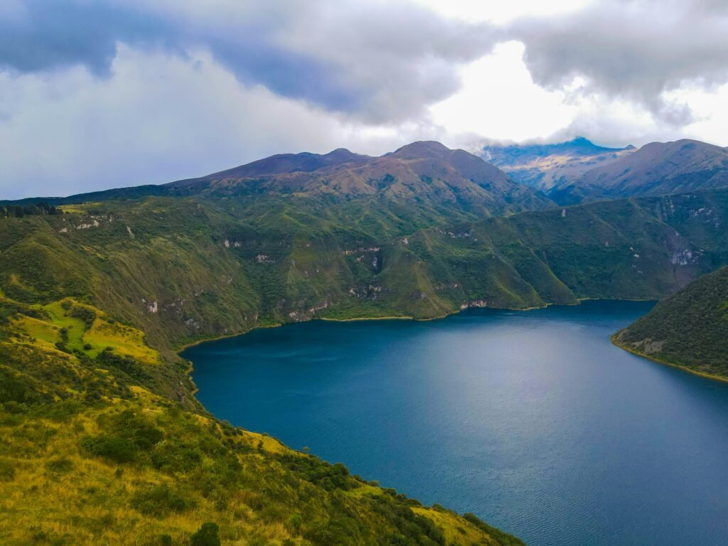
For active travellers, hikers, and cycle-tourists exploring Imbabura, hiking the perimeter of the crater rim is the finest way to experience Cuicocha. The official circuit, known as Sendero G3 or the Cuicocha Loop, offers a challenging 14-kilometre trek along the elevated ridges surrounding the water.
Cuicocha Loop route characteristics and logistics
- Distance: Approximately 14-kilometre loop
- Duration: Four to five hours depending on pace and acclimatisation
- Elevation range: Starts at 3,100 metres near the park entrance, reaching high points of roughly 3,450 metres along the western ridge
- Trail difficulty: Moderate to demanding, primarily due to steep ascents, narrow ridge paths, and altitude effects
The loop can be completed in either direction, though hiking clockwise is often preferred by seasoned walkers. This route places the steepest climbing early in the trek while offering sweeping vistas of Volcán Imbabura and the valley of Otavalo in front of you as you return.
Flora and fauna along the trail
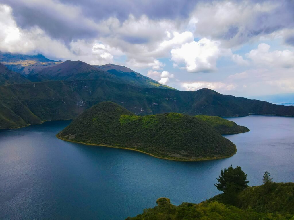
The trail passes through diverse Andean ecosystems, transitioning from high-altitude scrubland into true páramo grass environments.
Biodiversity of La Cuicocha
- Páramo Flora: Polylepis (paper tree), Puya hamata, Wild Orchids
- Avian Species: Silvery Grebe, Andean Condor, Black-tailed Trainbearer
- Mammals: Culpeo Fox, Andean Spectacled Bear (rare, high rim)
The lake itself supports a delicate population of silvery grebes (Podiceps occipitalis). These small waterbirds nest in the dense reed belts surrounding the undisturbed islands, diving for aquatic insects and crustaceans in the shallow bays. Overhead, the thermal updrafts created by the deep caldera often attract giant Andean condors and eagles, which soar effortlessly across the sky.
The Ecuadorian Amazon.
The most biodiverse place in the world
Explore the Cotacachi-Cayapas region / Leather, culture, and slow travel
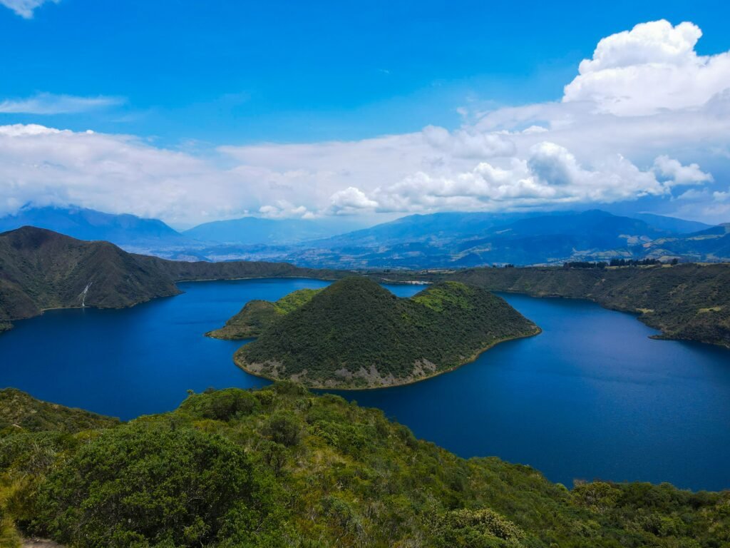
Laguna de Cuicocha sits at the southern entrance of the Cotacachi-Cayapas Ecological Reserve, one of the most ecologically diverse protected zones in South America, stretching from high Andean peaks down to lowland rainforests in Esmeraldas province.
A visit to the crater lake naturally integrates into a broader exploration of Imbabura province:
- Santa Ana de Cotacachi: Located just 12 kilometres down the mountain from the lake entrance, Cotacachi is famous throughout Ecuador for its artisanal leatherworking. The quiet streets are lined with workshops producing handmade jackets, boots, and bags. Cotacachi is also recognised for its laid-back pace, culinary traditions, and vibrant musical culture.
- Otavalo: Famous for hosting the largest indigenous market in South America at Plaza de los Ponchos. Otavalo serves as an ideal base for travellers seeking low-impact transport, cultural immersion, and regional bus connections.
- San Antonio de Ibarra: A short distance north, this small town is renowned for woodcarving master artisans who preserve colonial and indigenous techniques.
For cyclists touring the Ecuadorian Sierra, the paved climb from Cotacachi up to the Cuicocha visitor centre offers a rewarding altitude challenge, ascending roughly 700 vertical metres over steady gradients amidst Andean farmland.
Practical advice for visiting Laguna de Cuicocha
To ensure a seamless and responsible visit to Laguna de Cuicocha, keep these essential planning considerations in mind:
Acclimatisation is vital
Do not attempt the full 14-kilometre rim hike on your first day arriving from low elevations. Spend at least two days acclimatising in Quito (2,850m) or Otavalo (2,550m) before tackling the trail above 3,400 metres.
What to pack
Weather in the High Andes changes within minutes. Pack layerable wool or synthetic garments, a waterproof windbreaker jacket, sturdy hiking boots with good tread, sun protection (high-altitude UV light is intense), and at least two litres of water per person.
Respect local rules
Registration at the Ministry of Environment guard post near the park entrance is mandatory, though general entry is free of charge. Stay strictly on marked trails to prevent soil erosion along the fragile crater rim. Drone flying and entering the central islands are strictly prohibited to safeguard wildlife and cultural heritage.
How to get there
From the Otavalo bus terminal, local buses run frequently to Cotacachi. From Cotacachi’s main square, pick-up truck taxis (camionetas) provide direct transport to the Cuicocha entrance for a fixed fare. Alternatively, cycle-tourists can ride directly along the paved E35 feeder road via Cotacachi.
The Ecuadorian Coast.
Where you’ll find the very best food
Experience the quiet power of Ecuador’s sacred caldera
Laguna de Cuicocha stands as a testament to the remarkable forces that shape our planet and the enduring spirit of the communities who call these highlands home. It is a place where violent subterranean origins have given rise to serene, mirror-like waters, and where ancient traditions remain as active and vibrant as the volcanic vents beneath the lake floor.
Whether you tackle the full perimeter of the Sendero G3, immerse yourself in the rich artisan heritage of nearby Cotacachi, or simply pause at the crater edge to watch the afternoon mist roll over the water, Cuicocha demands a slower, more deliberate pace. Exploring this corner of Imbabura province rewards those who look beyond the surface, offering a deeper connection to Ecuador’s natural and cultural tapestry.
At Wheely Tyred, the goal is always to equip you with the depth, context, and practical insight needed to turn a great trip into an unforgettable journey. As you plan your adventure through the northern Andes, remember to tread lightly, honour local customs, and leave time to let the mountain landscape unfold at its own rhythm.
Affiliate Disclaimer: Some of the links on Wheely Tyred are affiliate links. If you click through and make a booking or purchase, we may earn a small commission at no extra cost to you. We only recommend gear, tours, stays, and services we genuinely use, trust, and stand behind — our editorial independence always comes first. These commissions help keep our independent cycling guides and travel stories free to read. Thanks for supporting the ride!
Frequently asked questions about the history of Laguna de Cuicocha
Board a local bus from Otavalo’s central terminal to the nearby town of Cotacachi (roughly a 20-minute journey). From Cotacachi’s main plaza, hire a local pick-up truck taxi (camioneta) directly to the reserve entrance gate. For cycle-tourists, a paved climb ascends roughly 700 vertical metres from Cotacachi up to the crater rim.
The name comes from the indigenous Kichwa words kuy (guinea pig) and kucha (lake), earned because the largest island inside the crater resembles the shape of a guinea pig. An alternative Kichwa derivation, kuychikucha, translates as lake of the rainbow, inspired by the shifting mineral tones of the water under highland sunlight.
General recreational swimming is not permitted, though traditional spiritual purification baths take place during the Inti Raymi solstice festival. The two central islands, Islote Yerovi and Islote Teodoro Wolf, are strictly protected ecological and spiritual sanctuaries; landing on them or walking across their terrain is forbidden.
The 14-kilometre loop takes four to five hours and is rated as moderately demanding due to steep ascents, narrow ridge paths, and elevations reaching 3,450 metres. A professional guide is not strictly necessary as the path is well-marked, but taking time to acclimatise in Quito or Otavalo for a couple of days beforehand is strongly advised.
General entry to the Cotacachi-Cayapas Ecological Reserve is free of charge for all visitors. However, you must register your personal details at the Ministry of Environment office near the main park gate before starting any trail or boat tour.
Laguna de Cuicocha remains an active volcanic site. Thermal vents on the floor of the western basin continuously release carbon dioxide gas, creating visible streams of bubbles that rise through the alkaline water to show that subterranean activity continues deep underground.
Ecuador.
Pure wonder on the equator.


