
The emerald eye of the Andes / A history of Quilotoa Lake
Uncovering the Quilotoa Lake history, volcanic eruptions, and indigenous folklore of Cotopaxi
High-altitude echoes, ancient lava domes, and the quiet power of Ecuador’s most dramatic caldera

BEN FINCH
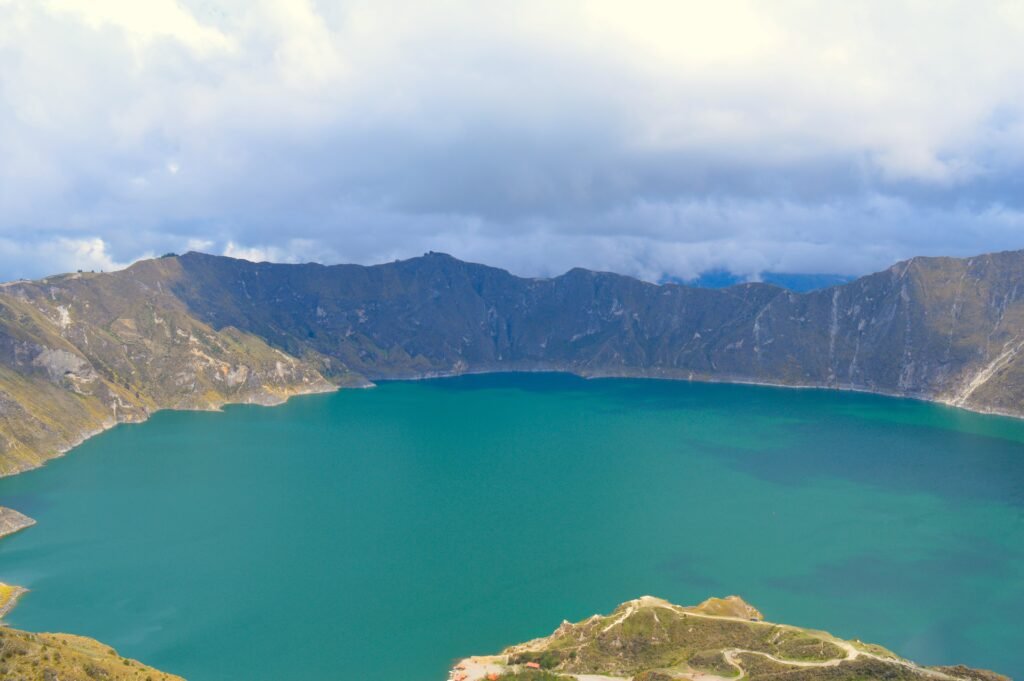
Standing at the windswept lip of the Quilotoa caldera, nearly 4,000 metres above sea level, it is easy to feel as though you have reached the edge of the world. Below lies an immense, three-kilometre-wide bowl filled with water so vibrantly turquoise it looks entirely unnatural against the jagged, ash-grey rock of the Andean highlands.
For independent travellers, cyclists tackling the brutal high-altitude climbs of Cotopaxi Province, and hikers completing the legendary loop, this crater lake represents one of the most visually arresting spectacles in South America. Yet, to truly appreciate Quilotoa, one must look far beyond the immediate aesthetic reward.
This serene expanse of green water is actually a scar left behind by one of the most violent geological cataclysms in human history, a volcanic event that altered the climate of the northern Andes and left an indelible mark on the collective memory of the people who call these mountains home.
At Wheely Tyred, we believe that slow travel requires deep understanding. By unravelling the complex tapestry of explosive eruptions, academic discoveries, and ancient folklore that defines Quilotoa, we can transform a simple sightseeing stop into a profound encounter with the raw, active forces of our planet.
Deep roots and emerald waters
Beyond the striking turquoise surface of Ecuador’s most famous volcanic crater lies a complex history of geological devastation and enduring indigenous culture. For the independent traveller, understanding this terrain transforms a challenging high-altitude journey into a profound encounter with the raw forces of nature.
- The cataclysm of 1280: A massive Volcanic Explosive Index 6 eruption shattered the ancient dacite dome, shooting ash 35 kilometres into the stratosphere and causing the peak to collapse into the current three-kilometre-wide caldera
- The Toachi River Canyon: Superheated mudflows and debris from the medieval eruption scoured the landscape, carving out a dramatic canyon that presents a formidable challenge for self-supported cyclists today
- A 266,000-year ancestry: Advanced geological dating proves that the magmatic system beneath Quilotoa has been active for over a quarter of a million years, spanning at least eight distinct eruptive cycles
- Toxic chemical architecture: Volcanic gases leaking from underwater fumaroles keep the 250-metre-deep lake highly acidic, creating a mineral environment that scatters sunlight into its trademark shifting green hues
- The silent threat of 1797: A powerful earthquake near Tungurahua triggered a limnic eruption at Quilotoa, releasing a suffocating cloud of carbon dioxide that swept down the slopes and devastated local livestock
- Living oral archives: Local Kichwa folklore regarding the bottomless nature of the lagoon and the fiery battles between the lake god Quilotoa and the river god Toachi beautifully mirror real historical outgassing and seismic events
- The high-altitude loop: Navigating the 45-kilometre circuit through remote villages like Tigua and Chugchilán demands rigorous preparation for steep gravel gradients and unpredictable Andean weather
The Ecuadorian Sierra.
Get lost in the hills
The cataclysm of 1280 / The day the mountain fell
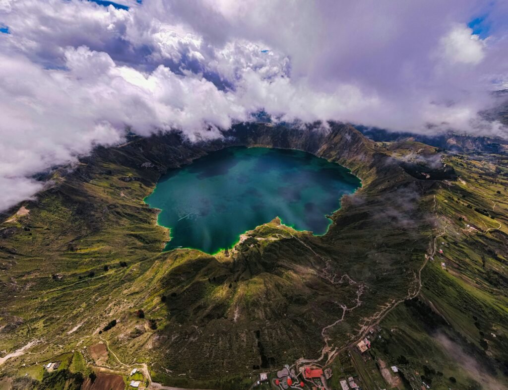
The peaceful illusion of the modern lake belies a terrifying past. Roughly 800 years ago, around the year 1280, the mountain that stood here was not a hollowed-out rim but a massive, imposing dacite volcanic dome complex. After a period of dormancy lasting upwards of 14,000 years, the volcano awoke with unimaginable violence. Geologists classify this event as a Volcanic Explosive Index 6 eruption, placing it in the same league as the infamous 1883 eruption of Krakatoa. The explosion generated a Plinian eruptive column that shot an astonishing 35 kilometres into the stratosphere, plunging much of central and northern Ecuador into pitch-black darkness as millions of tonnes of ash and pumice blanketed the landscape.
The physical mechanics of the eruption were devastating. As the magma chamber beneath the volcano rapidly emptied, the immense weight of the mountain’s peak could no longer be supported. In a matter of hours, the entire upper cone collapsed inward on itself, creating the deep, cavernous caldera we see today. The eruption expelled roughly 18 cubic kilometres of volcanic material. Superheated pyroclastic density currents rushed down the outer slopes, while massive mudflows, known as lahars, scoured the eastern flanks.
These torrents of debris entered the Toachi River valley, carving out the dramatic Grand Canyon of the region and carrying volcanic sediment all the way to the Pacific Ocean, hundreds of kilometres to the west. The airborne ash was carried by winds across the northern Andes, leaving a distinct stratigraphic marker that modern archaeologists still use to date pre-Columbian settlements across Ecuador.
Deep time in Cotopaxi / A 266,000-year geological canvas
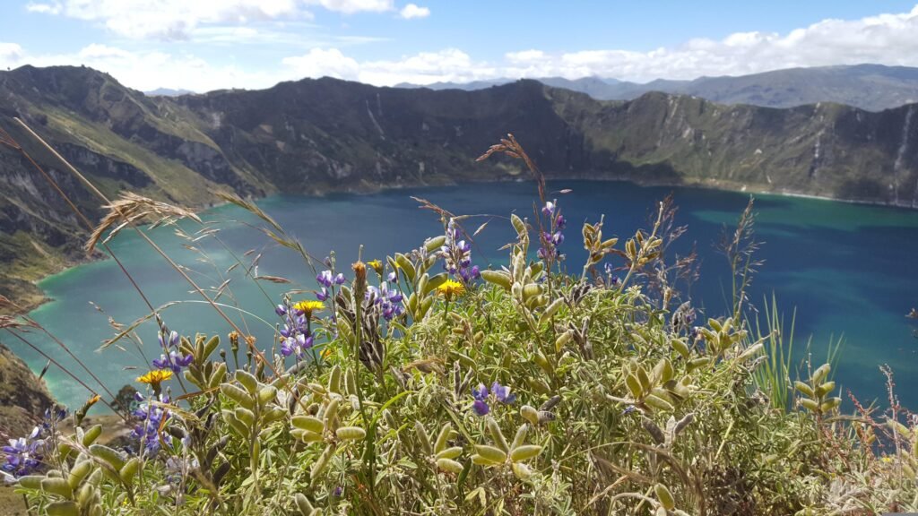
While the 1280 eruption is the defining event that formed the current lake basin, academic research reveals that Quilotoa’s volatile history stretches back hundreds of thousands of years. Geological surveys utilising advanced potassium-argon and argon-argon dating techniques on groundmass and plagioclase crystals have allowed scientists to map the ancient ancestry of this volcanic front. The data indicates that magmatic processes have been consistently active beneath Quilotoa for at least 266,000 years, operating under remarkably uniform conditions of pressure, temperature, and chemical composition.
Long before the current caldera took shape, the site was defined by at least eight distinct eruptive cycles, each separated by thousands of years of deceptive quiet. By analysing the irregular topography of the modern rim, which reaches its highest elevations of 3,914 metres at distinct lava domes on the northern, northwestern, and southeastern edges, geologists have identified the remnants of at least two older, truncated caldera structures.
One of these ancient calderas is estimated to have collapsed around 100,000 years ago. This cyclical pattern of dome building, violent collapse, long dormancy, and subsequent rebirth highlights the deceptive nature of the Andean landscape. The very ridges that modern cyclists pedal along are not permanent fixtures, but transient monuments built by a quarter of a million years of volcanic construction and destruction.
The Ecuadorian Amazon.
The most biodiverse place in the world
The chemistry of the green water / Fumaroles and forgotten explosions
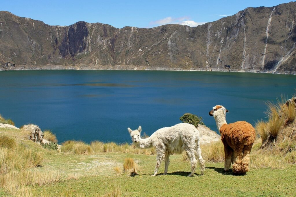
The defining feature of Quilotoa is, of course, its water, which reaches depths of approximately 250 metres, making it one of the deepest crater lakes in the world. The striking emerald and turquoise hues that shift continuously throughout the day are not merely reflections of the equatorial sky, but a direct consequence of the volcano’s ongoing, quiet activity. Though the volcano has been technically dormant since its medieval cataclysm, it remains a highly potent and closely monitored system.
On the southern and southwestern shorelines of the lake floor, active hydrothermal vents and underwater fumaroles continuously discharge volcanic gases, primarily carbon dioxide and hydrogen sulfide, into the deep water body. These gases dissolve into the water, creating a highly mineralised, hyper-acidic environment with a pH hovering around 4.5. This high acidity prevents large-scale aquatic life, such as fish, from surviving in the lagoon, allowing unique populations of specialised algae and mineral micro-precipitates to thrive undisturbed. It is this specific chemical cocktail that scatters sunlight so distinctively, producing the brilliant green colouration.
However, this chemical isolation carries its own historical hazards. During the 18th century, Lake Quilotoa experienced a series of dangerous limnic disturbances, where carbon dioxide accumulated in the cold, high-pressure depths of the lake before spontaneously releasing at the surface. The most severe of these events occurred on 4 February 1797. Triggered by a powerful earthquake originating near the neighbouring Tungurahua volcano, a massive pocket of suffocating gas escaped from the lake surface. Historical accounts from early scientific monographs record that the eruption generated brief flames and dense, toxic clouds that swept down the outer slopes, destroying entire herds of cattle grazing on the volcanic pastures.
Between myth and memory / Indigenous folklore of the bottomless lagoon
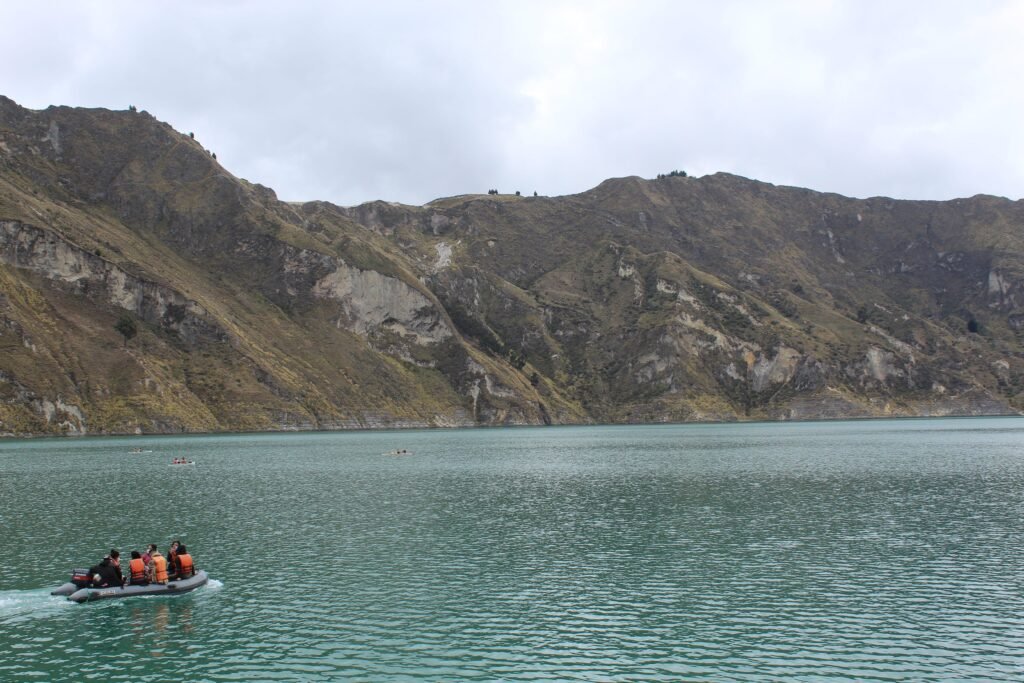
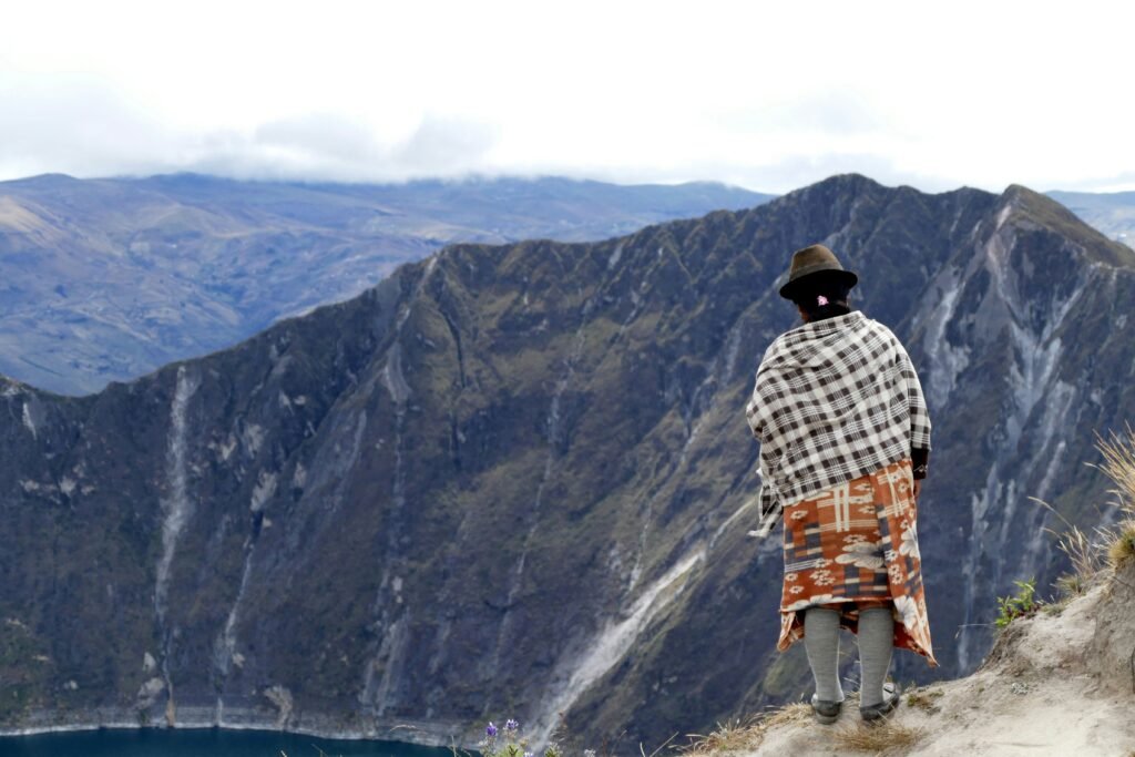
For the indigenous Kichwa-speaking communities of the Pujilí and Sigchos cantons who have farmed and ranched these high-altitude slopes for centuries, Quilotoa has always been a place of immense spiritual power and dread. Long before modern limnologists arrived with testing kits, local communities understood that the lake possessed strange, volatile properties. This understanding manifested in a rich tapestry of folklore that serves as a cultural archive of past natural disasters.
A prevalent local legend maintains that Lake Quilotoa is completely bottomless and directly connected via subterranean channels to the Pacific Ocean. This narrative was used by elders to explain the distinct salinity and sulfurous taste of the water, as well as the slow, mysterious fluctuations in the lake’s volume over the decades.
Another traditional myth tells of a fierce conflict between two powerful deities: Quilotoa, the god of the lake, who was prone to fits of fiery rage and would cause the waters to boil and erupt in flames, and Toachi, the river god who inhabited the deep canyon below. The volatile arguments between these deities were blamed for the earthquakes, toxic gas releases, and sudden mudslides that periodically threatened local settlements.
Rather than viewing these myths as mere fairy tales, modern researchers recognise them as beautifully preserved oral histories of real volcanic outgassing and seismic activity, translated into the language of the sacred landscape.
The Galápagos.
Ecuador’s Enchanted Isles
Riding the ring of fire / The modern Quilotoa Loop experience
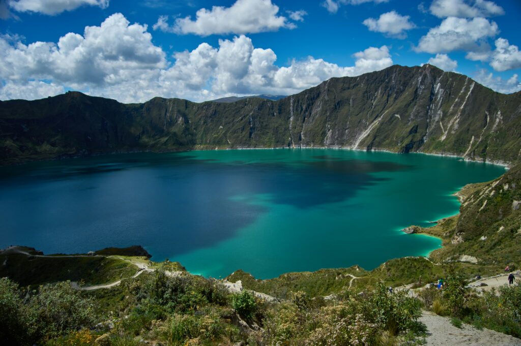
For the contemporary adventurer, understanding this deep history fundamentally changes the experience of exploring the region. The modern Quilotoa Loop encompasses a challenging 45-kilometre circuit that traverses the rugged topography shaped by the 1280 eruption. Navigating this terrain on two wheels requires immense respect for the altitude, as the route transitions between smooth, winding asphalt and demanding dirt tracks that descend steeply into the Toachi River Canyon before climbing back up to the crater rim.
As you pedal through the quiet indigenous villages of Tigua, Zumbahua, and Chugchilán, you are riding through valleys filled with hundreds of metres of ancient pyroclastic flow deposits. The terraced fields where locals grow potatoes and pasture sheep are fed by nutrient-rich volcanic soil born from prehistoric ash falls.
Approaching the summit from the south, the dramatic views of the surrounding Western Cordillera serve as a reminder of the sheer scale of the Andean volcanic arc. When you finally reach the edge and look down at the quiet emerald water, you are not just looking at a beautiful landscape; you are looking directly into the heart of a sleeping giant, witnessing the remarkable ways in which human culture, geography, and deep time intersect in the high Andes.
The Ecuadorian Coast.
Where you’ll find the very best food
Frequently asked questions about the history of Quilotoa Lake
Bus travel to the crater is highly feasible for independent travellers. From the terminal in Latacunga, regular daily buses head up into the mountains toward the village of Zumbahua. From Zumbahua, you can easily catch a local truck or a connecting bus for the final short stretch up to the summit rim at Quilotoa.
The water is entirely unsafe to drink and swimming is strongly discouraged. Because of the active underwater fumaroles on the lake floor, the water is highly mineralised and acidic, maintaining a pH of around 4.5. This chemical composition prevents organic life from surviving and makes the water hazardous for consumption.
The primary obstacle is the extreme altitude, with the crater rim sitting at nearly 4,000 metres above sea level. Cyclists tackling the loop face thin air, unpredictable high-altitude weather patterns, and incredibly steep, unpaved gravel gradients when dropping into and climbing out of the Toachi River Canyon.
The communities surrounding the loop are predominantly Kichwa-speaking farmers and artisans who retain a deep spiritual connection to the landscape. Independent travellers should respect local autonomy, support the local economy by purchasing authentic goods like Tigua folk paintings directly from the creators, and always ask for permission before taking photographs of residents.
Yes, the loop is well-served by a network of small, independent eco-lodges in villages such as Chugchilán and Isinlíví that cater directly to hikers and cyclists. However, because these locations are remote, travellers must carry sufficient cash in US dollars, as automated teller machines are virtually non-existent once you leave Latacunga.
The brilliant, shifting shades of green and turquoise are a result of dissolved volcanic minerals and specialised algae suspended in the water. As the angle of the equatorial sun changes from morning to afternoon, the light scatters through the chemical mix differently, altering the visible appearance of the lagoon.
Ecuador.
Pure wonder on the equator.


