Unearthing the raw history and volcanic soul of Isla Isabela
Isla Isabela history guide / Volcanic origins, Charles Darwin at Tagus Cove, and the dark legacy of the Wall of Tears
Explore the wild past of the largest island in the Galápagos
BEN FINCH
Shaped like a seahorse straddling the equatorial line, Isla Isabela stands as a massive, brooding monument to geological violence and human resilience. While most modern travellers arrive drawn by the promise of turquoise lagoons, white-sand beaches, and fearless wildlife, the island’s true identity was forged in centuries of isolation, privateer strategy, and hard-won survival. Beneath the pristine surface celebrated in natural history documentaries lies a rich human story that mirrors the volatility of the earth beneath it.
At Wheely Tyred, we believe that understanding a place requires looking far beyond its scenic vistas. To truly appreciate Isabela, one must explore its deep geological beginnings, its era as a pirate sanctuary, the brief visit of Charles Darwin, and the harrowing human suffering that built its most famous historical landmark.
Raw geology, buccaneer coves, and human resilience
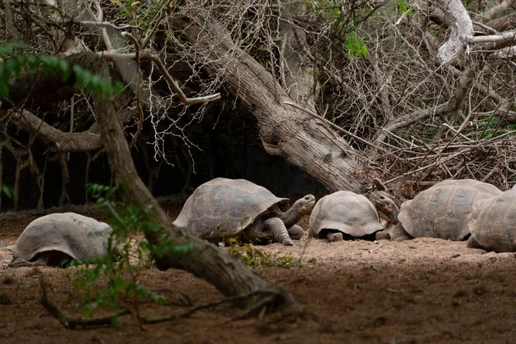
Isla Isabela is defined by its dramatic volcanic landscape and a complex human past far removed from standard travel itineraries. Beyond the turquoise waters and endemic wildlife lies an island shaped by pirate hideouts, Charles Darwin’s early observations, and the quiet weight of historical endurance.
- Volcanic scale: Home to six coalesced shield volcanoes, Isabela accounts for over half the landmass of the entire Galápagos archipelago, with five calderas still actively steaming
- Pirate refuge: Tagus Cove provided a sheltered deep-water anchorage for seventeenth-century buccaneers and whalers seeking fresh water, ship repairs, and giant tortoises
- Darwin’s salty discovery: Parched after climbing a steep tuff cone above Tagus Cove in 1835, Charles Darwin scrambled down to drink from a crater lake, only to find the water far saltier than the ocean
- Pioneer endurance: Early nineteenth-century settlers in Puerto Villamil scraped out an existence by trekking into active volcanic craters to hand-mine raw sulfur and harvest coastal salt
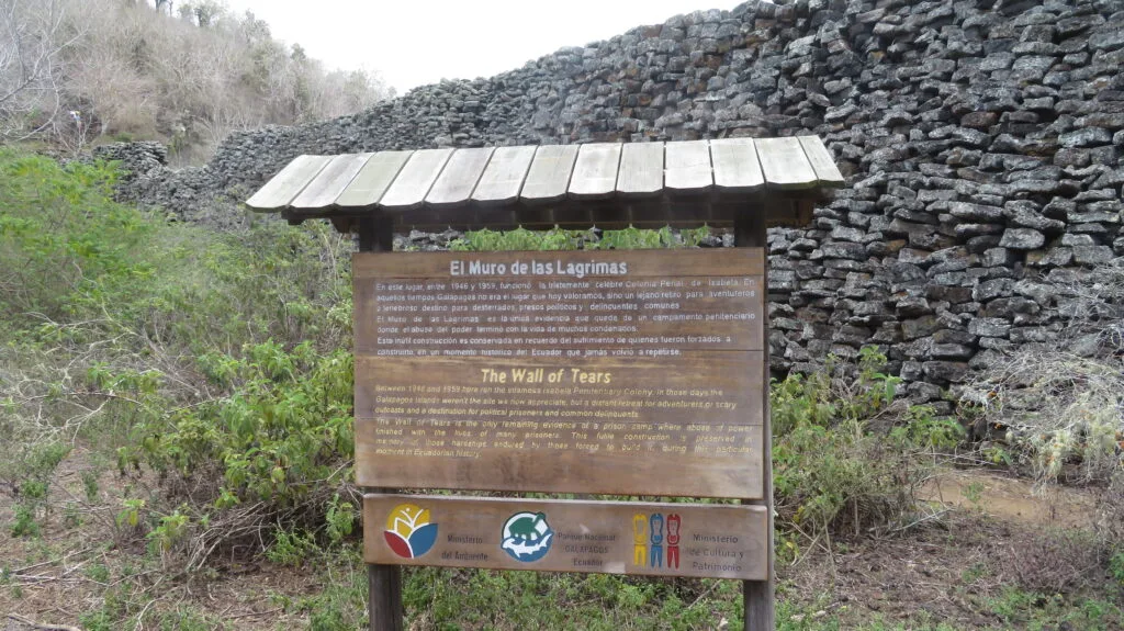
- The Wall of Tears: Standing five metres tall in the dry coastal scrub, El Muro de las Lágrimas remains a sombre monument built stone by stone by prisoners in a brutal 1940s penal colony
- Ecological rebirth: Through Project Isabela, the island underwent one of the most ambitious island conservation programmes in history, eradicating thousands of introduced herbivores to restore native giant tortoise habitats
- Slow exploration: The unpaved sandy tracks of Puerto Villamil and quiet coastal footpaths make Isabela best experienced on foot or by bicycle at a relaxed, unhurried pace
Isla Isabela.
Escape the tourist traps and explore
The geological birth of a volcanic titan
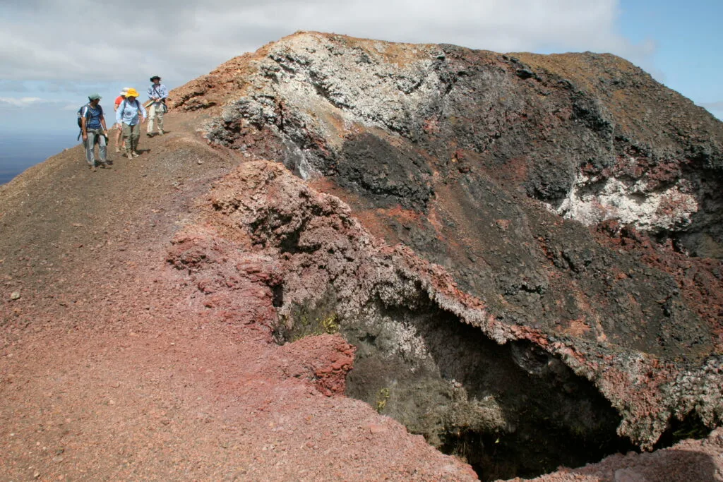
To understand the story of Isla Isabela, one must begin with the fiery earth itself. Formed approximately one million years ago, Isabela is geologically young yet immense in scale. It was created not from a single eruption, but from the dramatic merger of six distinct shield volcanoes: Ecuador, Wolf, Darwin, Alcedo, Sierra Negra, and Cerro Azul. Over hundreds of thousands of years, flows of dark basaltic lava spilled from these vents, slowly expanding into the ocean until the individual volcanic islands fused into a single massive landmass.
Today, Isabela accounts for over half of the total land area of the entire Galápagos archipelago, stretching over one hundred kilometres from end to end. Five of its six volcanoes remain active, making it one of the most volcanically volatile places on Earth. For thousands of centuries, this landscape remained untouched by human influence, shaped only by subterranean heat, shifting tectonic plates, and the hardy ocean-going pioneers that drifted across Pacific currents to establish fragile footholds on the fresh black lava.
Buccaneers, privateers, and secret anchorages
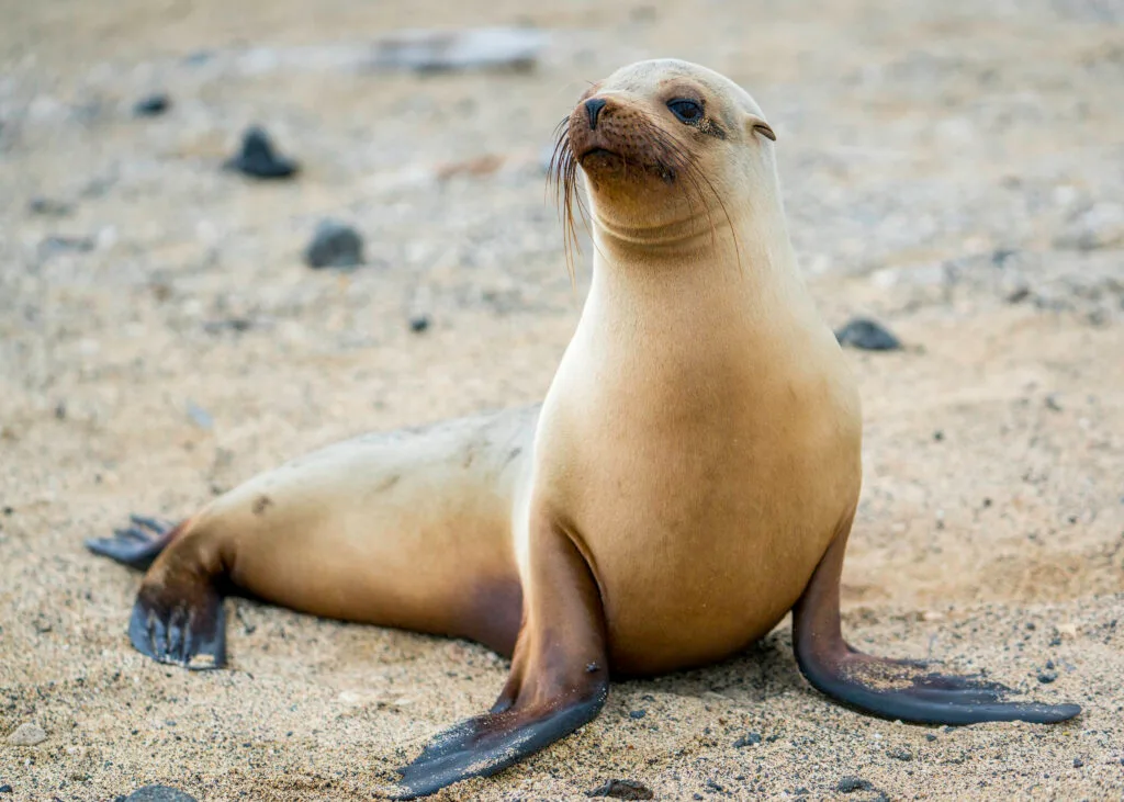
Human activity on Isabela began long before scientific surveys mapped the Pacific Ocean. During the seventeenth and eighteenth centuries, the archipelago’s absolute remoteness made it an ideal hideout for English buccaneers and privateers raiding Spanish treasure ships along the South American coast.
In 1684, the English navigator and pirate Ambrose Cowley charted the archipelago and christened the largest island Albemarle Island in honour of Christopher Monck, the second Duke of Albemarle. The sheltered inlets of Isabela, particularly the deep harbour at Tagus Cove on the northwestern coast, provided a perfect concealed sanctuary. Surrounded by steep volcanic tuff cones, ships could drop anchor undetected, repair damaged hulls, and replenish crucial provisions.
It was during this maritime era that humanity first began to leave a destructive mark on Isabela’s native ecosystem. Privateers and later commercial whaling vessels discovered that the island’s giant tortoises could survive for months in a ship’s hold without food or water, providing crews with fresh meat on long voyages. Thousands of tortoises were harvested from the slopes of Isabela’s volcanoes, permanently altering populations that had evolved in total isolation for millennia.
The Galápagos.
Ecuador’s Enchanted Isles
Charles Darwin and the salty disappointment at Tagus Cove

In late September 1835, HMS Beagle sailed into the calm waters of Tagus Cove, bringing a twenty-six-year-old Charles Darwin to the shores of Isabela. Though Darwin spent less time on Isabela than on neighbouring Santiago or San Cristóbal, his brief period ashore provided one of the most vivid human moments of his entire Galápagos expedition.
Eager to explore the interior, Darwin landed at Tagus Cove and began scrambling up the steep, cindery slopes of a volcanic tuff cone under the blazing equatorial sun. Hot, parched, and covered in fine volcanic dust, he spotted a brilliant circular sheet of water sitting inside a deep crater. Believing he had found a fresh mountain spring, Darwin hurried down to drink, only to discover to his immense disappointment that the water was “as salt as brine”—even more saline than the ocean he had just left. That dramatic crater basin is known today as Darwin Lake.
During his walks along the shoreline, Darwin also had his first close encounters with Isabela’s yellow-brown land iguanas. In his field journal, he famously noted that they were “hideous animals, but from their low facial angle have a singularly stupid appearance”. Beyond these memorable observations, the active volcanic fumaroles and fresh lava flows of Isabela gave Darwin critical evidence supporting his early geological theories about island formation and ocean floor uplift—concepts that laid the foundation for his wider scientific breakthroughs.
Pioneer survival on the sulfur slopes
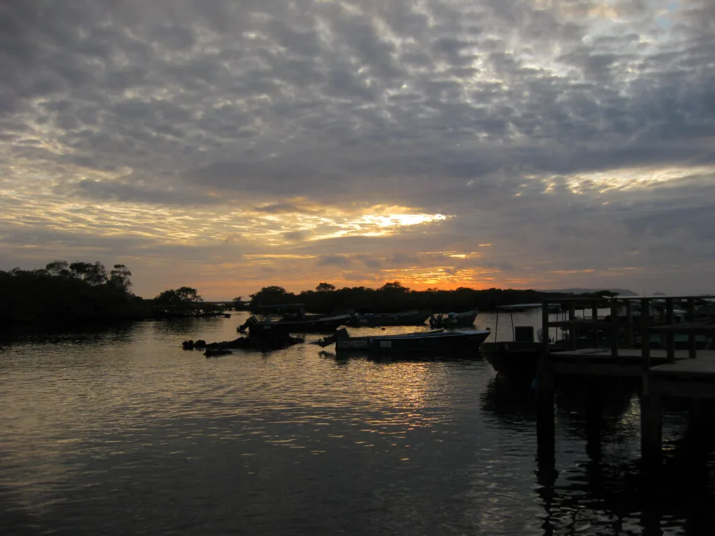
Permanent colonisation of Isabela did not begin until the late nineteenth century. In 1893, Antonio Gil and a small group of Ecuadorian settlers established the coastal settlement of Puerto Villamil on the island’s southern edge. Living on an island with no permanent rivers or freshwater streams, these early pioneers faced extraordinary daily challenges.
Survival required immense physical labour and resourcefulness. The settlers established an extractive economy, turning to the interior volcanoes for commodities that could be sold to the mainland. Men hiked for days up the treacherous, heat-blasted slopes of the Sierra Negra and Alcedo volcanoes to mine raw sulfur directly from active steam vents and fumaroles, hauling heavy sacks of the yellow mineral back down to the coast by hand or on muleback.
Others harvested wild cattle, produced lime by burning coral, or collected salt from coastal flats. Life in early Puerto Villamil was defined by profound isolation, scorching temperatures, and a total reliance on passing supply vessels, creating a community of tough, self-sufficient islanders whose descendants still inhabit the region today.
The Ecuadorian Sierra.
Get lost in the hills
The haunting legacy of the penal colony
The mid-twentieth century brought a dark and painful chapter to Isabela’s history. In 1944, the Ecuadorian government established a high-security penal colony on the outskirts of Puerto Villamil, taking advantage of the island’s total geographical isolation to house political prisoners and dangerous convicts.
The conditions within the colony were notoriously harsh. Prisoners were subjected to extreme heat, strict rations, and heavy manual labour designed to break their spirits. The ultimate symbol of this cruelty was the construction of El Muro de las Lágrimas (the Wall of Tears). Inmates were forced to cut sharp, heavy blocks of black basaltic lava from nearby fields and haul them under the sun to build a massive stone wall.
The wall served no actual defensive or structural purpose; its construction was simply a punitive exercise in forced labour. Hundreds of prisoners suffered and died from heat exhaustion, accidents, and mistreatment during its construction. Today, the wall stands five to six metres high and roughly one hundred metres long, rising silently from the dry scrubland as a sombre monument to human suffering amidst the natural beauty of the island.
The Ecuadorian Amazon.
The most biodiverse place in the world
Restoration and the conservation renaissance
Read this far?
The penal colony was officially closed in 1959, the same year the Ecuadorian government created the Galápagos National Park, marking a dramatic shift from human exploitation to strict environmental preservation. However, centuries of human presence had left deep ecological scars, particularly through the introduction of invasive species like feral goats, pigs, and donkeys.
By the late twentieth century, tens of thousands of feral goats had stripped the vegetation from Isabela’s northern volcanoes, pushing native species like the giant tortoise and the rare pink land iguana to the brink of starvation and extinction. In response, conservationists launched Project Isabela in the late 1990s—the largest and most ambitious island restoration project ever attempted on Earth.
Through meticulous ground and aerial operations, invasive herbivores were completely eradicated from northern Isabela. The ecological recovery that followed was astonishing. Native plant species regenerated rapidly, tortoise populations began to rebound naturally, and fragile endemic ecosystems stabilised.
Today, Isabela is celebrated as a world-class model of ecological recovery. For the independent explorer, travelling across its lava fields or standing before the Wall of Tears offers a powerful reminder that history is not just written in books, but etched into the very soil and stone beneath our feet.
Affiliate Disclaimer: Some of the links on Wheely Tyred are affiliate links. If you click through and make a booking or purchase, we may earn a small commission at no extra cost to you. We only recommend gear, tours, stays, and services we genuinely use, trust, and stand behind — our editorial independence always comes first. These commissions help keep our independent cycling guides and travel stories free to read. You can also buy me a coffee here — thanks for supporting the ride!
The Ecuadorian Coast.
Where you’ll find the very best food
Frequently asked questions about the history of Isla Isabela
Most travellers arrive via a two-hour public inter-island ferry ride from Puerto Ayora on Santa Cruz Island or take a small inter-island flight into the airstrip just outside Puerto Villamil. Once on the island, paved roads are minimal, making walking or renting a sturdy bicycle the most rewarding way to explore the coastal trails.
Built between 1944 and 1959 by inmates of a high-security Ecuadorian penal colony, this massive lava-rock wall served no structural or defensive purpose. It was constructed purely as forced hard labour under harsh equatorial conditions. Today, it stands as a poignant historical site accessible via an easy five-kilometre bicycle ride or walk from Puerto Villamil through coastal wetlands.
Yes, Tagus Cove on the northwestern coast is a historic visitor site accessible via marine itineraries. While you cannot drink from Darwin Lake due to its extreme salinity and protected status, a marked trail leads up the volcanic tuff cone, offering sweeping views across the saltwater crater lake and surrounding lava fields.
Five of Isabela’s six shield volcanoes—including Sierra Negra, Alcedo, and Wolf—remain volcanically active. Sierra Negra last erupted in 2018. Guided day treks along the six-mile caldera rim of Sierra Negra allow independent travellers to observe active steam vents, recent basalt flows, and vast highland vistas firsthand.
Base yourself in the low-key coastal settlement of Puerto Villamil. From town, you can rent a bicycle to ride the wetlands trail, walk along miles of open sand beaches, swim in the calm mangrove waters of Concha de Perla, or arrange local water-taxi rides to nearby snorkelling spots like Los Túneles.
Centuries of human visits introduced feral goats and donkeys that multiplied rapidly, stripping the highland vegetation and driving native giant tortoises and land iguanas toward starvation. Executed in the late 1990s and early 2000s, Project Isabela systematically eradicated these invasive herbivores, allowing endemic plant species and tortoise populations to make a historic natural recovery.
Ecuador.
Pure wonder on the equator.