
High-altitude wilderness / A guide to Parque Nacional Cajas, Ecuador
Parque Nacional Cajas, Ecuador, hiking guide and independent travel tips
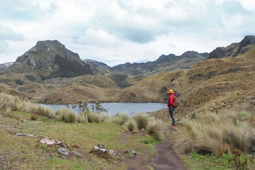
Silent tarns, paper-tree forests, and the raw beauty of the páramo

BEN FINCH
Just 30 kilometres west of the colonial city of Cuenca lies one of South America’s most arresting mountain landscapes: Parque Nacional Cajas. Spanning over 28,000 hectares across Azuay Province, this high-altitude reserve rests between 3,100 metres and 4,450 metres above sea level. It is a realm defined by windswept moorlands, jagged glacial valleys, and more than two hundred shimmering glacial lakes.
For independent travellers who prefer setting their own pace rather than following a tour leader’s raised umbrella, Cajas presents an ideal outdoor destination. Here, you can wander quietly along ancient Andean paths, observe rare birdlife amongst dwarf forests, and experience the stillness of the high highlands on your own terms.
Wild peaks, mirror lakes, and ancient trails
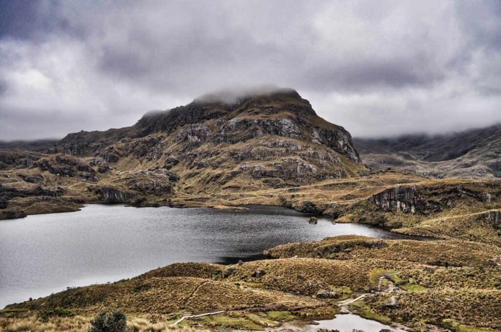
Rising above the cloud line west of Cuenca, Parque Nacional Cajas is a raw expanse of high-altitude wetland, glacial tarns, and gnarled paper-tree forests. It offers independent travellers an unfiltered taste of the high Andes, free from rigid group schedules.
- Glacial tarns and high moorland: Spanning over 28,000 hectares, the park protects more than two hundred glacial lakes set against the golden, windswept grasslands of the Andean páramo ecosystem
- Enchanted Polylepis forests: Twisted groves of Polylepis—known locally as quinoa or paper trees—thrive at elevations up to 4,500 metres, creating surreal, fairytale-like woodland pockets hidden within sheltered ravines
- Ancient trade corridors: Long before becoming a national park, this landscape was navigated by the Cañari and Inca civilisations, forming part of the sacred Qhapaq Ñan network connecting the Andes to the coast
- The Continental Divide at Tres Cruces: Reaching 4,167 metres above sea level, the Tres Cruces pass marks the high ridge where rainfall splits towards either the Pacific Ocean or the Amazon Basin
- Diverse trail options: From the gentle 4-kilometre loop around Laguna La Toreadora to the steep ascent up Cerro San Luis (4,264 metres), hikers can select routes tailored to their energy and time
- Abundant high-altitude birdlife: The lower cloud forests near Laguna Llaviucu host extraordinary species, including the giant hummingbird, grey-breasted mountain toucan, and soaring Andean condors
Cajas National Park.
The most beautiful national park
Understand the Páramo / High-altitude ecology and cultural roots
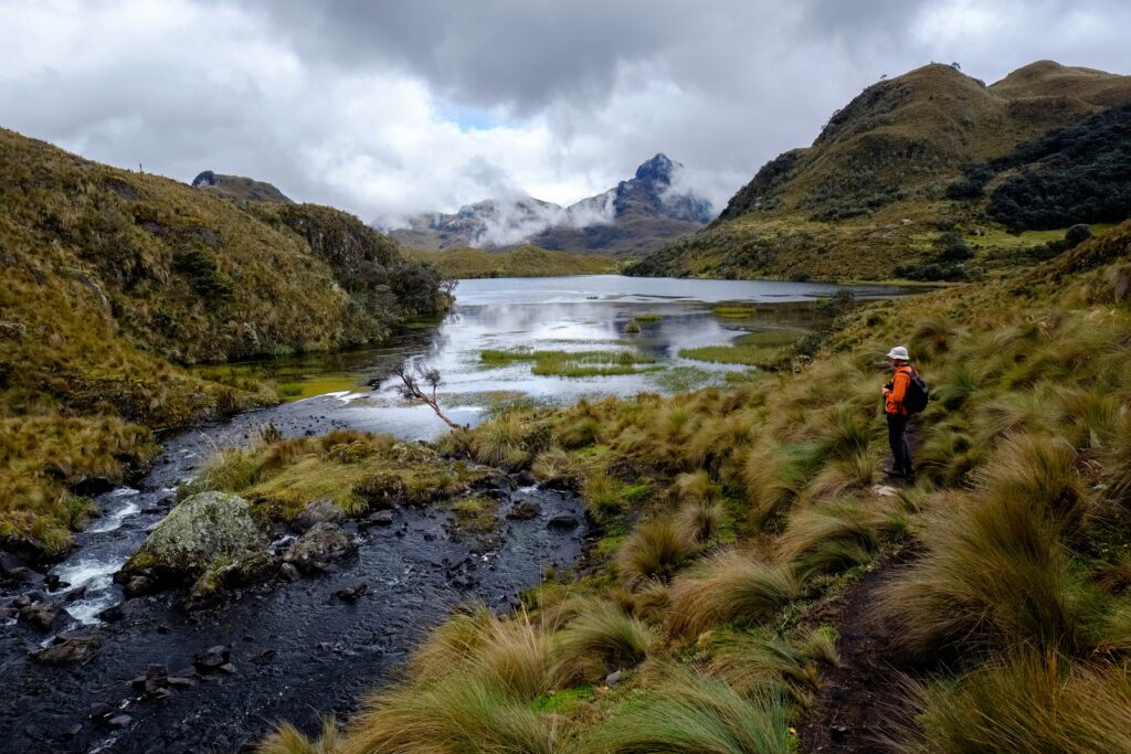
The name Cajas originates from the Quichua word cassa, which translates to gateway to the snowy mountains. Long before modern conservationists established the park in 1996, this region held immense spiritual and practical importance.
Archaeologists have identified 28 historic sites within its boundaries, reflecting use by the indigenous Cañari people and later integration into the extensive Inca road system, the Qhapaq Ñan. The park served as a vital trade corridor connecting the Andean highlands with the Pacific coastal plains.
Ecologically, Parque Nacional Cajas protects a crucial expanse of Andean páramo—a high-elevation wetland ecosystem found almost exclusively in northern South America. The terrain resembles a vast tundra, blanketed in golden paja straw grass, giant rosette plants, and dense cushion flora. These unique plants function as a massive sponge, absorbing moisture from mountain mist and rain to feed the major rivers supplying drinking water to Cuenca.
Tucked into sheltered ravines grow ancient groves of Polylepis trees, known locally as quinoa or paper trees due to their papery, peeling reddish-brown bark. Recognised as one of the highest-altitude tree species on Earth, Polylepis trees thrive at elevations up to 4,500 metres.
Stepping into a Polylepis forest feels like entering a fairytale landscape, where gnarled trunks twist through fog, and moss-draped branches filter the sharp Andean light.
Key attractions and trails in Parque Nacional Cajas
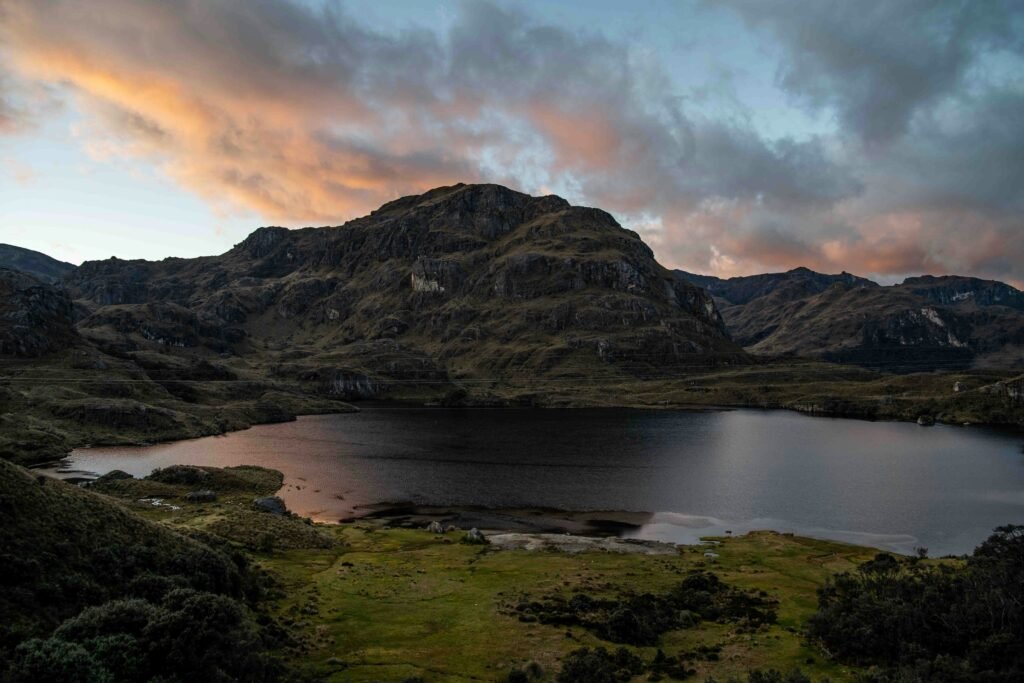
Whether you have two hours or a full day to explore, Cajas offers several well-marked routes that cater to different fitness levels and interests.
- Laguna La Toreadora (Route 1): 3,930 m / 4 km loop through paper trees
- Tres Cruces Pass: 4,167 m / Continental Divide viewpoint
- Laguna Llaviucu (Uku Trail): 3,100 m / 1.7 km birdwatching lake loop
- Cerro San Luis Summit: 4,264 m / Panoramic high-mountain peak
Laguna La Toreadora and Route 1
Laguna La Toreadora serves as the primary gateway for most park visitors. Located beside the main visitor centre at 3,930 metres elevation, this glacial lake is framed by rolling hills and high-altitude wetland.
Route 1 is a classic 4-kilometre loop that encircles the lake. The path leads walkers across wooden boardwalks, over gentle streams, and directly through an enchanting Polylepis forest. Taking roughly two hours to complete, it offers a gentle introduction to hiking in thin air while showcasing the core features of the páramo landscape.
The Ecuadorian Sierra.
Get lost in the hills
Tres Cruces Pass / The Continental Divide
Further west along the main highway sits Tres Cruces at an elevation of 4,167 metres. This sweeping viewpoint marks the Continental Divide. Rain falling on the western slope drains down towards the Pacific Ocean, while water falling on the eastern slope flows into the Amazon Basin, eventually reaching the Atlantic Ocean thousands of kilometres away.
The pass takes its name from three wooden crosses erected in memory of travellers who historically lost their lives attempting to cross the mountains in harsh weather. Local tradition encourages visitors to place a stone at the base of the apacheta stone mounds here as a symbol of respect and safe passage through the park.
Laguna Llaviucu and the Uku Trail
For a completely different ecological perspective, head to Laguna Llaviucu in the lower eastern sector of the park at 3,100 metres elevation. Surrounded by lush cloud forest rather than open moorland, Llaviucu is a paradise for birdwatchers.
The Uku Trail is an easy 1.7-kilometre loop around the water’s edge. With patience, you may spot the giant hummingbird (Patagona gigas)—the largest hummingbird species in the world—alongside the rare violet-throated metaltail, Andean ducks, grey-breasted mountain toucans, and soaring Andean condors.
Cerro San Luis summit
For trekkers seeking sweeping vistas across the entire lake-dotted plateau, the ascent of Cerro San Luis (4,264 metres) is a rewarding challenge. Starting near Laguna La Toreadora, this 2.2-kilometre trail climbs steeply up a rocky ridge. On clear mornings, the summit delivers panoramic views across dozens of interconnected glacial tarns stretching to the horizon.
The Galápagos.
Ecuador’s Enchanted Isles
Practical logistics for the independent traveller
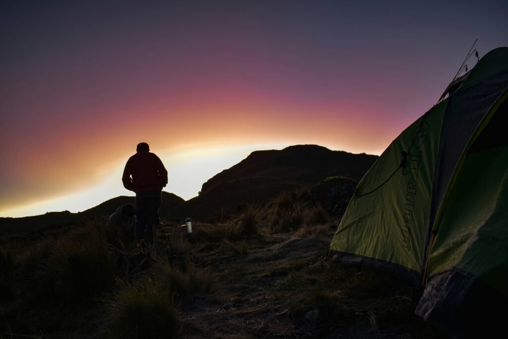
Exploring Parque Nacional Cajas without a pre-packaged tour group is straightforward, affordable, and gives you total control over your itinerary.
Reaching Cajas from Cuenca
Public transport connects Cuenca directly to the national park every day:
- Departure Points: Buses operated by Occidental depart regularly from Terminal Terrestre in the east or Terminal Feria Libre in the west of Cuenca
- Travel Time & Cost: The journey takes between 45 and 50 minutes and costs approximately 2 US dollars each way
- Drop-off Locations: Simply inform the driver if you wish to get off at Laguna Llaviucu (the lower park entrance) or Laguna La Toreadora (the main visitor centre)
- Return Journey: To return to Cuenca, flag down any eastbound public bus passing the visitor centre along the main road
Entry regulations and registration
Entry to Parque Nacional Cajas is free of charge. However, environmental management enforces a strict limit of 92 simultaneous visitors inside the park at any time to preserve fragile habitats.
All visitors must sign in at the ranger station upon arrival, presenting identification such as a passport. Arriving early around 8:00 AM ensures immediate registration before daily capacity limits are reached.
Weather preparation and altitude strategy
Weather in the high Andes is notoriously changeable, and it is common to experience four seasons in a single morning. Temperatures typically range from 2 to 12 degrees Celsius, and cold rain or fog can sweep across trails with minimal warning.
The Ecuadorian Amazon.
The most biodiverse place in the world
Essential packing & safety checklist
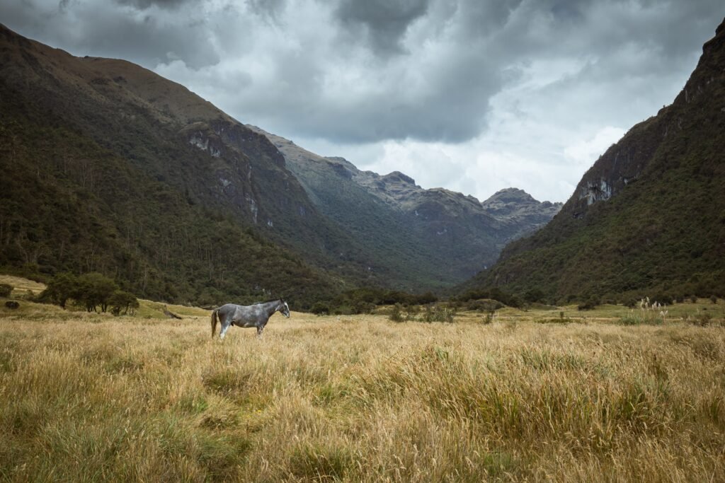
Clothing & gear
- Waterproof rain jacket & pants
- Sturdy waterproof hiking boots
- Thermal base layers & beanie
- Lightweight dry bags for pack
Altitude & health
- Acclimatise in Cuenca (2,500 m) for 2 days
- Drink plenty of water; carry snacks
- Pack sunscreen & polarised sunglasses
- Register at ranger station upon arrival
Because the altitude ranges from 3,100 metres to over 4,400 metres, altitude sickness is a real consideration. Spend at least two days acclimatising in Cuenca (2,560 metres) before attempting longer hikes in Cajas. Walk at a steady, measured pace, stay hydrated, and carry extra layers to adjust as weather conditions shift.
Why self-guided exploration delivers the best experience
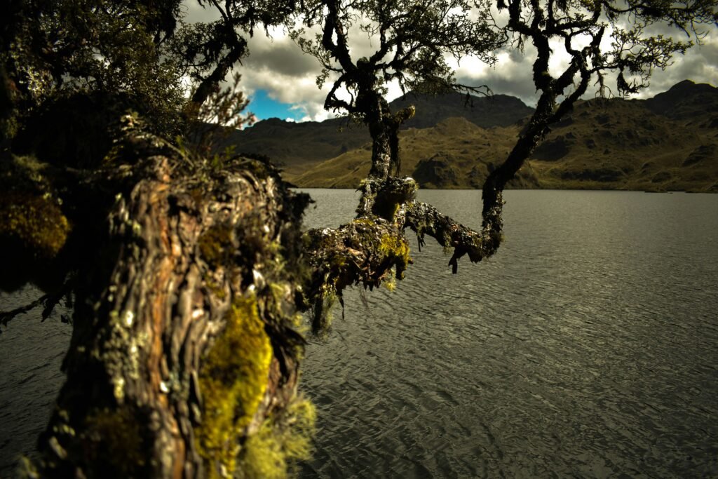
Group excursions frequently rush travellers through set locations, offering brief photo stops before herding everyone back onto a coach. By contrast, travelling independently allows you to experience Cajas as it should be felt—quietly and without distraction.
When you set your own schedule, you can pause beside a silent tarn as morning fog lifts, spend an extra hour watching hummingbirds in the cloud forest, or simply sit on a ridge admiring the vast Andean horizon. Autonomy turns a standard day trip into a memorable journey of discovery.
The Ecuadorian Coast.
Where you’ll find the very best food
Navigate the High Andes on your own terms
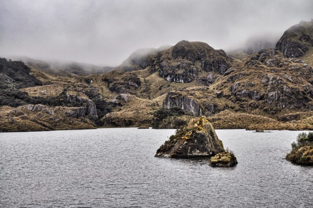
Parque Nacional Cajas rewards those willing to trade paved predictability for raw, unpredictable mountain beauty. Stepping onto the spongy turf of the páramo, away from standard tour itineraries, brings an immediate sense of quiet isolation. The true magic of this landscape lies not in ticking off tourist checkpoints, but in lingering by a silent tarn as misty clouds roll over jagged peaks.
Navigating Cajas independently allows you to embrace the elements at your own rhythm. Whether taking slow, deliberate steps up to the summit of Cerro San Luis or wandering quietly through ancient Polylepis groves, travelling without a rigid schedule grants the freedom to listen, observe, and adjust to the mountain weather as it shifts around you.
With straightforward public bus connections from Cuenca and free entry for self-guided explorers, Cajas remains one of Ecuador’s most accessible high-altitude wildernesses. Pack warm base layers, respect the altitude, and leave plenty of room in your day to simply pause and take in the scale of the high Andes.
At Wheely Tyred, we believe that authentic travel comes from backing your own curiosity and exploring destinations on your own terms. Parque Nacional Cajas is a reminder of how vast and humbling the natural world remains when you step off the beaten track.
Affiliate Disclaimer: Some of the links on Wheely Tyred are affiliate links. If you click through and make a booking or purchase, we may earn a small commission at no extra cost to you. We only recommend gear, tours, stays, and services we genuinely use, trust, and stand behind — our editorial independence always comes first. These commissions help keep our independent cycling guides and travel stories free to read. Thanks for supporting the ride!
Frequently asked questions about visiting Parque Nacional Cajas
Public buses operated by Occidental depart regularly from Cuenca’s Terminal Terrestre or Terminal Feria Libre directly to the park. The journey takes around 45 to 50 minutes and costs approximately 2 US dollars each way. To return, simply flag down any eastbound public bus passing the main road outside the visitor centre.
Entry to the national park is entirely free, but all visitors must register with a passport or official photo identification at the ranger station upon arrival. To protect the fragile páramo environment, the park enforces a strict limit of 92 visitors inside at any one time, so arriving around 8:00 AM is recommended.
The park ranges between 3,100 and 4,450 metres above sea level, so spend at least two days acclimatising in Cuenca before undertaking major hikes. Mountain weather shifts rapidly, requiring layered thermal clothing, sturdy waterproof hiking boots, and reliable rain gear regardless of conditions in the city.
The páramo acts as a massive natural sponge. Its spongy soil, cushion plants, and paja grasses absorb moisture from high-altitude mist and rain, gradually releasing it into the river systems that supply drinking water to the city of Cuenca.
Route 1 around Laguna La Toreadora offers an accessible two-hour, 4-kilometre walk starting right near the main visitor centre. Alternatively, the 1.7-kilometre Uku Trail around Laguna Llaviucu sits at a lower altitude (3,100 metres) and provides a gentler walk surrounded by lush cloud forest and birdlife.
Tres Cruces (4,167 metres) takes its name from wooden crosses erected in memory of travellers who perished while navigating the treacherous mountain pass in centuries past. Today, it offers sweeping views across the Continental Divide, where tradition encourages travellers to add a stone to the roadside cairns (apachetas) for safe passage.
Ecuador.
Pure wonder on the equator.


