
Uncovering the secret side of Isla Isabela / 5 hidden gems in the Galápagos
An independent explorer’s guide to the archipelago’s largest island
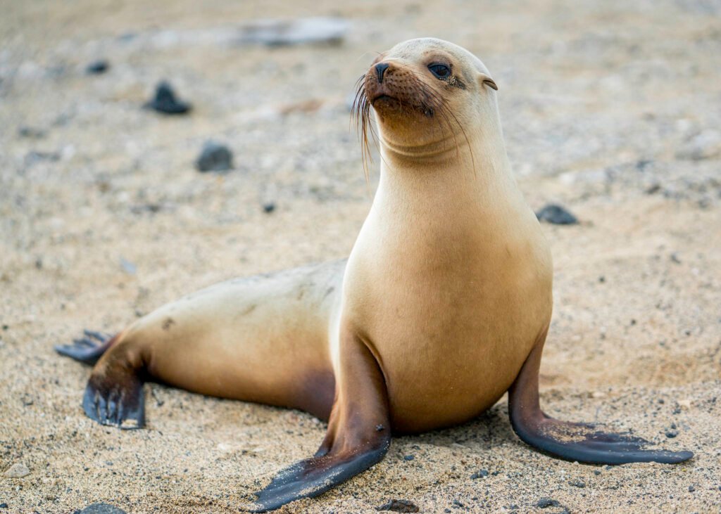
Lava walls, secluded mangrove lagoons and highland caves

BEN FINCH
The Galápagos Archipelago is frequently presented as an exclusive realm of scheduled expedition cruises and tightly regimented group itineraries. Yet on Isla Isabela, the seahorse-shaped giant of the archipelago, a vastly different experience awaits those who choose to travel independently. Spanning over four thousand square kilometres, Isabela possesses vast tracts of volcanic wilderness, coastal wetlands, and highland cloud forests that remain blissfully quiet once the day-tour boats depart.
While iconic sites such as Los Túneles and Las Tintoreras draw steady crowds, the true soul of Isabela lies along its dusty sandy tracks, hidden lava tubes, and secluded brackish lagoons. Exploring at your own pace—whether on foot or on two wheels—reveals an island where giant tortoises roam across ancient lava fields, marine iguanas bask undisturbed on mangrove roots, and human history leaves a haunting imprint on the landscape. Here are five of the finest hidden gems on Isla Isabela for travellers seeking depth, solitude, and authentic discovery.
Isla Isabela at a glance
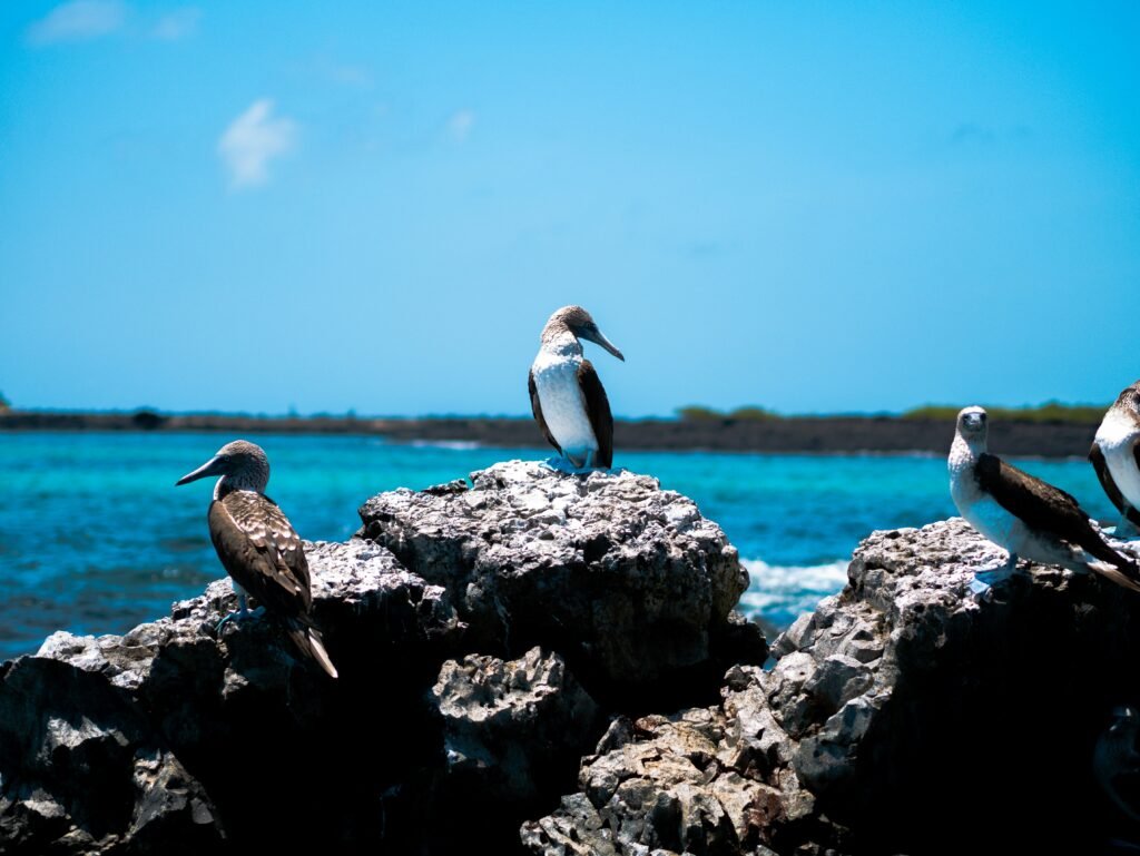
Exploring the Galápagos Islands on your own terms reveals a side of the archipelago that rigid tour itineraries miss entirely. Here is a summary of how to navigate Isla Isabela independently, from raw lava fields and penal colony history to quiet coastal wetlands.
- El Muro de las Lágrimas: A poignant historical monument built by penal colony inmates, paired with a climb up nearby Cerro Orchilla for wide coastal vistas
- Complejo de Humedales: A delicate network of mangrove channels, lava tubes at El Túnel del Estero, and brackish lagoons home to American flamingos
- Cueva de Sucre: An underground lava tube nestled in the damp highland Scalesia forests near Tomás de Berlanga, offering a cool, misty respite from the coast
- Trillizos Volcano & Minas de Azufre: Sunken volcanic craters, petrified lichens, and steaming yellow sulfur vents tucked away on the quiet western slopes of Volcán Sierra Negra
- Concha de Perla: A pristine, mangrove-fringed tide pool steps from the pier in Puerto Villamil, ideal for self-guided snorkelling alongside sea lions, turtles, and rays
- Independent Mobility: A network of unpaved tracks perfect for exploring by mountain bike within a 20-kilometre radius, connecting coastal lagoons to highland farms and trailheads
Isla Isabela.
Escape the tourist traps and explore
1. El Muro de las Lágrimas (The Wall of Tears) & Cerro Orchilla
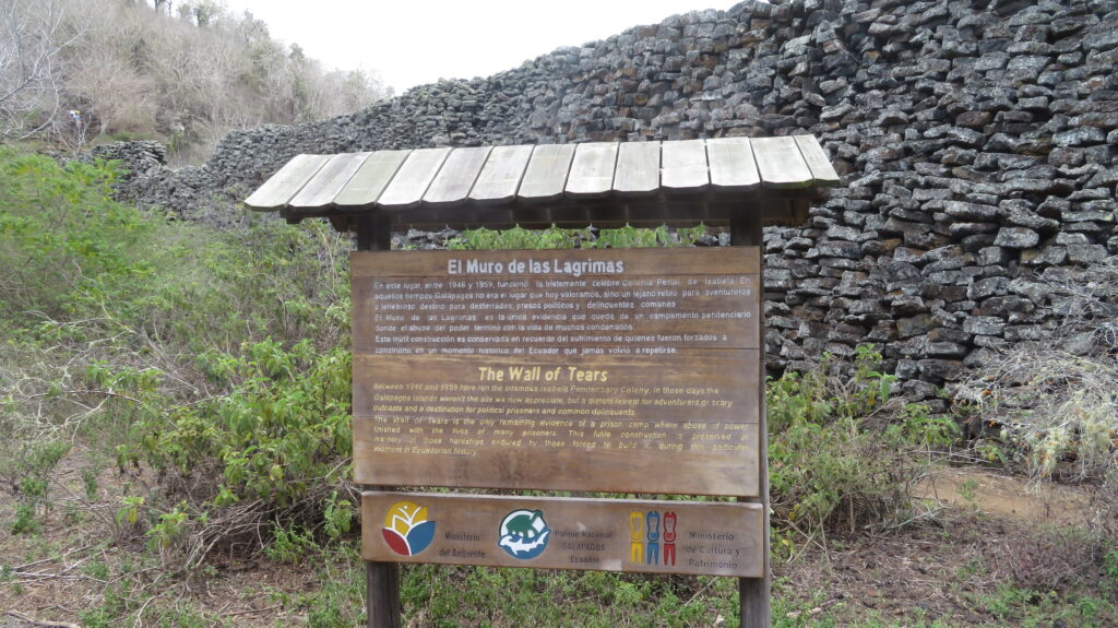
Stretching six kilometres west of Puerto Villamil along a sandy coastal track, El Muro de las Lágrimas stands as a stark monument to a dark chapter in Ecuadorian history. Between 1946 and 1959, Isabela hosted a penal colony where inmates were forced to construct a massive stone wall using razor-sharp basalt blocks. The wall, measuring roughly one hundred metres long and eight metres high, served no functional purpose other than to break the spirits of the prisoners under the punishing equatorial sun.
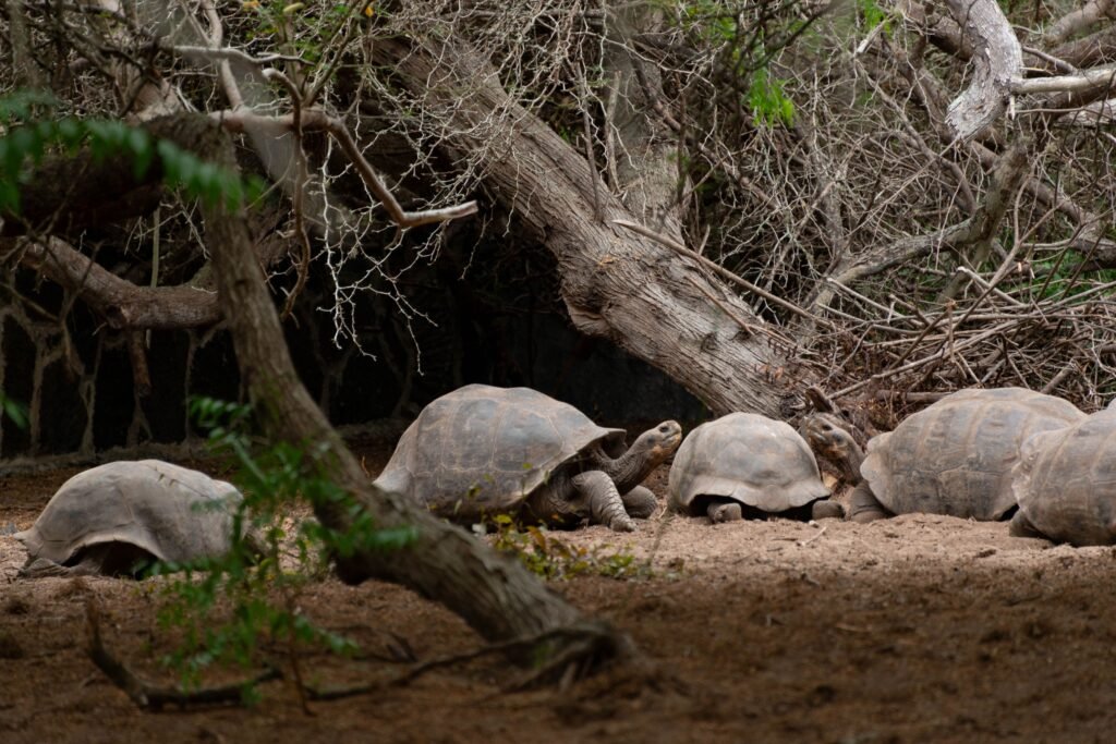
The journey to the wall is as compelling as the destination itself. As you navigate the gravel path, giant Galápagos tortoises frequently cross the trail or rest beneath the shade of manzanillo trees. Just before reaching the wall, a narrow footpath branches off to Cerro Orchilla, a sharp volcanic hill equipped with a timber staircase. Climbing to the top rewards you with a sweeping panoramic view across the entire southern coastline of Isabela, the sprawling wetlands, and the distant peaks of Sierra Negra.
2. Complejo de Humedales & El Túnel del Estero
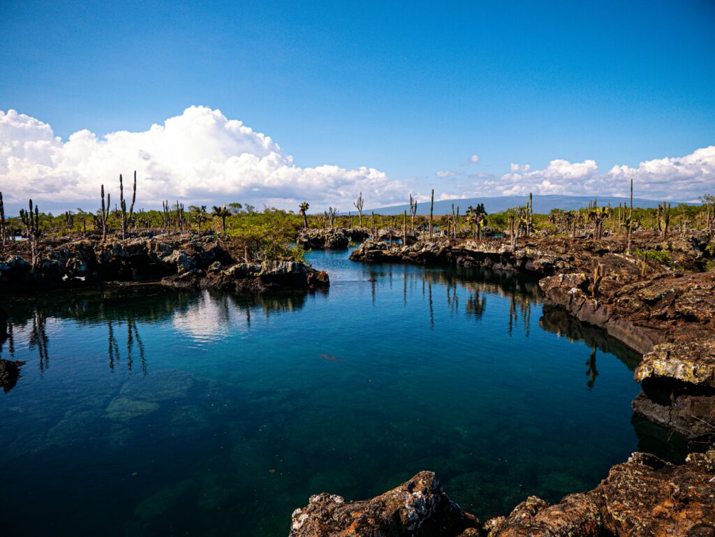
En route to the Wall of Tears lies the Complejo de Humedales, an intricate network of coastal mangroves, brackish lagoons, and lava formations that most guided tour groups pass by in motorised taxis. Taking time to wander the interconnected footpaths reveals an extraordinary micro-ecosystem teeming with endemic wildlife.
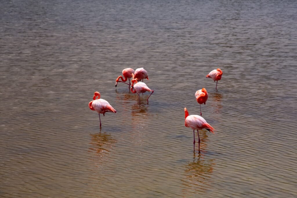
Among the standout stops within the complex is El Túnel del Estero, a cavernous lava tube where ocean tides surge beneath a canopy of red and black mangroves. Nearby, shallow lagoons such as Poza de los Diablos host vibrant populations of American flamingos filter-feeding in the mineral-rich waters.
Pristine, secluded beaches such as Playa del Amor offer quiet spots to watch marine iguanas congregating on black basalt reefs, entirely away from the busier town beach at Puerto Villamil.
The Galápagos.
Ecuador’s Enchanted Isles
3. Cueva de Sucre & The Highland Scalesia Forests
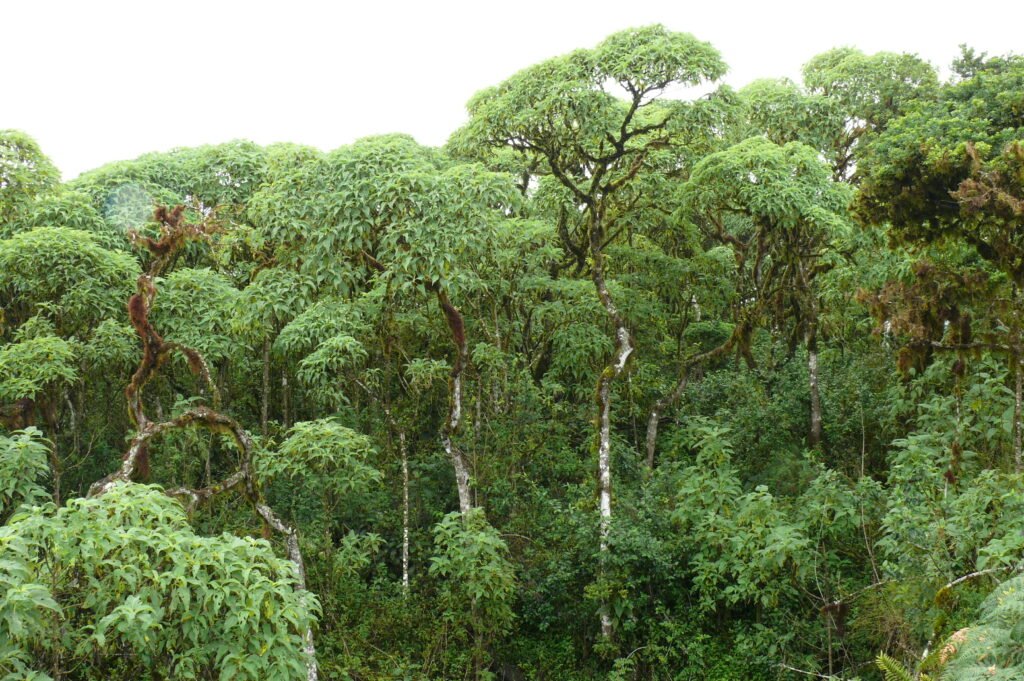
While the majority of visitors remain firmly anchored to the coast, Isabela’s agricultural highlands offer a dramatically different landscape dominated by mist-shrouded Scalesia trees, guava orchards, and fertile volcanic soil. Located roughly fourteen kilometres inland from Puerto Villamil near the hamlet of Tomás de Berlanga, Cueva de Sucre provides a fascinating glimpse into the island’s subterranean geology.
This subterranean lava tube formed thousands of years ago as cooling surface lava crusted over while molten rock continued to flow beneath. A rustic trail leads down into the subterranean chamber, where native ferns cling to damp rock walls and natural skylights illuminate the geological strata. The surrounding area features lush walking paths through endemic Scalesia forest, offering a tranquil climate markedly cooler than the sun-bleached coast.
4. Trillizos Volcano & Minas de Azufre (The Sulfur Mines)
For those looking to venture well off the established tourist circuit, the western slopes of Volcán Sierra Negra conceal two of the island’s most extraordinary geological features: Trillizos Volcano and the Minas de Azufre. While standard day hikes focus on the main caldera rim of Sierra Negra, these deeper trails require a bit more legwork but reward explorers with stark, lunar landscapes virtually free of other humans.
Trillizos consists of three sunken volcanic craters where adventurous visitors can descend into ancient basaltic fissures adorned with petrified lichens and quartz formations created over six hundred thousand years ago. Further along the volcanic rift, Minas de Azufre features active fumaroles venting steam and bright yellow sulfur crystals into the cool highland air.
The contrast between the brilliant yellow mineral deposits and the dark volcanic tephra creates an ethereal, otherworldly atmosphere that highlights the living, volatile nature of the Galápagos geology.
The Ecuadorian Sierra.
Get lost in the hills
5. Concha de Perla & Poza de los Flamingos
Positioned just a short stroll from the main pier in Puerto Villamil, Concha de Perla is a natural, mangrove-enclosed tide pool that offers some of the best independent snorkelling in the entire archipelago. Reached via a wooden boardwalk that weaves through a dense canopy of red mangroves, the pool is fed directly by the ocean while remaining protected from open swell.
Because no guide or organised boat trip is required to visit, you can arrive early in the morning when the water is crystal clear. Swimming alongside playful Galápagos sea lion pups, green sea turtles, spotted eagle rays, and the occasional Galápagos penguin provides an intimate wildlife encounter on your own schedule.
On the way back into town, a stop at Poza de los Flamingos—a quiet marshland sanctuary situated right at the edge of Puerto Villamil—allows you to observe these elegant birds wading against the backdrop of the volcanic highlands.
The Ecuadorian Amazon.
The most biodiverse place in the world
Exploring Isabela on two wheels and beyond
Read this far?
Isla Isabela is uniquely suited to independent exploration, with a network of unpaved coastal tracks and rural gravel roads that reward self-reliant travellers. Renting a sturdy mountain bike in Puerto Villamil opens up seamless day trips within a twenty-kilometre radius of town.
The coastal trail running west through the Complejo de Humedales to El Muro de las Lágrimas is a classic six-kilometre ride each way, allowing you to stop at secluded beaches and lagoon vistas whenever you choose. Heading inland, an eighteen-kilometre climb up the rural road toward Tomás de Berlanga leads into the cool highlands, connecting cyclists to Campo Duro, Cueva de Sucre, and the trailhead for Volcán Sierra Negra.
Beyond the immediate cycling range, regional day trips by local passenger boat or boat-taxi open access to Floreana Island to the south or the wild, uninhabited coastlines of western Isabela, ensuring that your journey through this magnificent archipelago remains rich, varied, and entirely under your control.
Affiliate Disclaimer: Some of the links on Wheely Tyred are affiliate links. If you click through and make a booking or purchase, we may earn a small commission at no extra cost to you. We only recommend gear, tours, stays, and services we genuinely use, trust, and stand behind — our editorial independence always comes first. These commissions help keep our independent cycling guides and travel stories free to read. You can also buy me a coffee here — thanks for supporting the ride!
The Ecuadorian Coast.
Where you’ll find the very best food
Frequently asked questions about the best hidden gems on Isla Isabela
Renting a mountain bike in Puerto Villamil is the most flexible way to explore the island’s coastal paths and highland roads at your own pace. Unpaved trails lead directly to coastal sites like El Muro de las Lágrimas and the Complejo de Humedales, while local passenger boats and water taxis connect you to regional day trips.
No, several of Isabela’s finest sites can be visited completely independently without a guide or paid tour group. You can walk or cycle to Concha de Perla, the Complejo de Humedales, Poza de los Flamingos, and El Muro de las Lágrimas whenever you choose.
Pack plenty of drinking water, sunscreen, and a hat, as shade along the dusty gravel track is limited. Giant tortoises frequently cross the path, so keep a respectful distance. Avoid taking shelter under or touching the poisonous manzanillo (poison apple) trees along the trail.
Early morning is ideal. Arriving before any crowds ensures clearer water and gives you the quietest conditions to swim alongside inquisitive Galápagos sea lion pups, green sea turtles, and spotted eagle rays.
Yes, as you travel inland toward Tomás de Berlanga and Cueva de Sucre, the landscape transforms from arid coastal scrub to humid, mist-covered Scalesia forest. Temperatures are noticeably cooler in the highlands, so packing a light windbreaker or rain jacket is advisable.
Most key land attractions lie comfortably within a 20-kilometre radius of town. The coastal trail west to El Muro de las Lágrimas is a manageable six-kilometre ride each way, while the climb inland toward Tomás de Berlanga and the Volcán Sierra Negra trailhead covers roughly 18 kilometres on unpaved roads.
Ecuador.
Pure wonder on the equator.


