
Riding the avenue of the volcanoes / The deep history and cycling landscape of Cotopaxi
A comprehensive Cotopaxi history and cycling guide for adventure travellers seeking paths less trodden
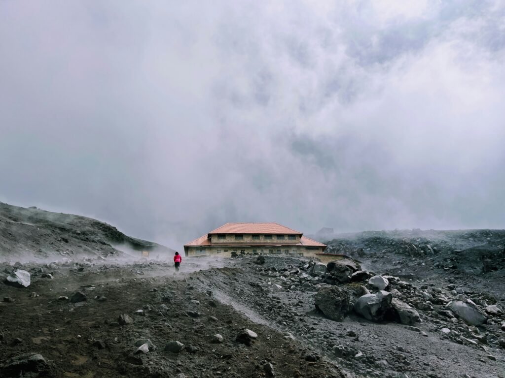
Where ancient volcanic fire meets the thin air of the Ecuadorian highlands

BEN FINCH
Rising to an imposing altitude of 5,897 metres above sea level, the perfectly symmetrical, snow-capped cone of Cotopaxi dominates the skyline of the central Ecuadorian Andes. It is the second-highest summit in Ecuador, surpassed only by Chimborazo, and stands as one of the most active stratovolcanoes on Earth. For cyclists and adventure travellers, the vast, undulating landscapes of Cotopaxi National Park offer a sensory experience unlike any other, characterised by vast expanses of high-altitude tropical alpine tundra, sweeping lava fields, and deep canyons carved out by centuries of cataclysmic mudflows.
To truly appreciate the routes that traverse this otherworldly terrain, one must first understand the profound history that clings to every volcanic stone and gravel trail. The landscape is not merely a playground for endurance athletes; it is a living historical monument shaped by ancient indigenous civilisations, European scientific pioneers, and the terrifying, transformative power of the earth itself. Every pedal stroke across the high-elevation grasslands passes through layers of history that date back long before the arrival of the Spanish crown.
The moon’s cradle and the ash fields
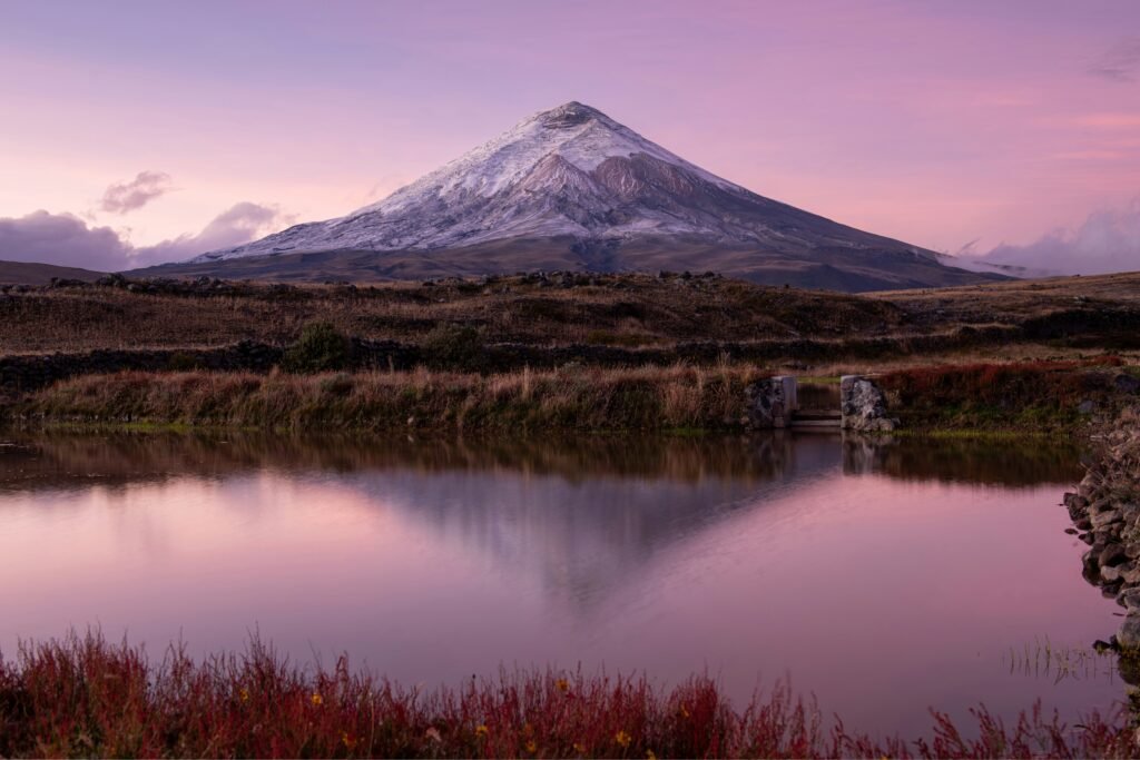
The vast, volcanic high-plains of Cotopaxi National Park preserve centuries of tectonic shifts, indigenous mythologies, and pioneering scientific expeditions. Traversing this high-altitude landscape on two wheels reveals how deeply the physical geography of the Andes intersects with human history and independent exploration.
- The neck of the moon: The volcano’s name stems from a pre-Inca linguistic blend, combining the Kichwa word for throat (coto) with the Aymara word for moon (paxi), describing the visual phenomenon of the crescent moon resting directly above the crater rim
- The 1877 cataclysm: A historic eruption instantly liquefied massive sections of the summit glacier, sending high-velocity mudflows known as lahars over 100 kilometres away, permanently reshaping the valleys that independent travellers navigate today
- Whymper’s high bivouac: In 1880, British mountaineer Edward Whymper completed the third recorded ascent of the volcano, spending a perilous night camped directly on the lip of the active crater to conduct vital barometric and physiological experiments
- Limpiopungo Lagoon: Tucked into the high valley between Cotopaxi and the eroded remnants of the extinct Rumiñahui volcano, this serene body of water serves as a vital refuge for wild horses and endemic avian species, including the endangered Andean condor
- The Cotopaxi 360 loop: Based on the traditional Vuelta al Cotopaxi route, this gruelling multi-day bikepacking circuit demands high-endurance navigation across shifting volcanic ash, remote double-track trails, and isolated communal lands
- The páramo ecosystem: This unique, high-altitude tropical alpine tundra features spongy, tufted grasses and volatile microclimates, requiring specialised wide tyres and careful physical preparation to manage the thin air above 3,500 metres
Cotopaxi.
The iconic volcano
Ancient lore and the neck of the moon
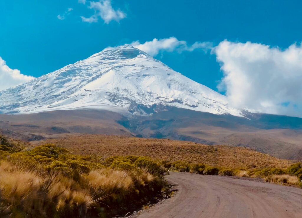
The human relationship with Cotopaxi began millennia ago with the pre-Inca civilisations of the Interandian valley, notably the Panzaleo people. To these early agricultural communities, the volcano was far more than a feature of physical geography. It was a sentient deity, a source of vital life-giving rainwater, a guarantor of agricultural fertility, and a sacred dwelling place for the gods.
The name Cotopaxi itself is deeply rooted in indigenous linguistics, emerging from a blending of regional tongues. In the native Kichwa language, coto translates to throat or neck, whilst in Aymara, paxi means moon. Combined, the phrase translates beautifully to the neck of the moon. This poetic descriptor refers to the visual phenomenon of the crescent moon resting gracefully directly above the perfectly circular crater rim, giving the illusion of the celestial body being cradled by the mountain peak.
In regional mythology, the peaks of the Andes were locked in perpetual, human-like conflicts. Local folklore depicts a dramatic love triangle between the towering, ice-clad Taita Chimborazo, the fiery female deity Mama Tungurahua, and the elegant, powerful Cotopaxi. The outbursts of smoke and ash that have historically characterised Cotopaxi were often interpreted by local populations as expressions of rage and jealousy over romantic rejection. This mythological framework allowed the early inhabitants of the high plains to rationalise the unpredictable and often devastating behaviour of the mountain they both feared and revered.
The day the glaciers melted
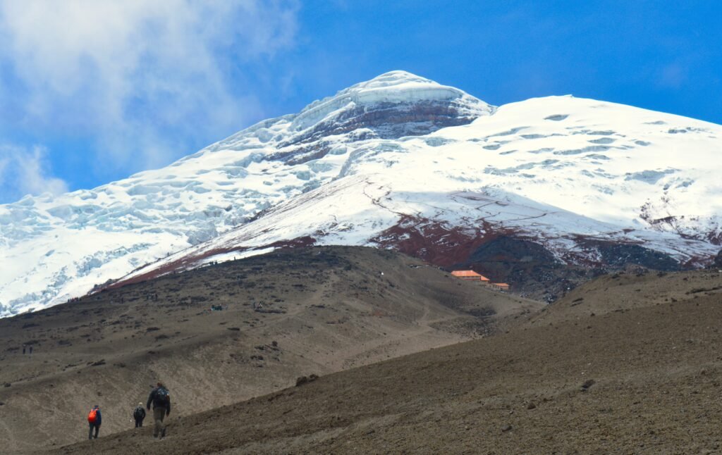
The documented eruptive history of Cotopaxi comprises more than eighty distinct historical events, with the first recorded observation by European chroniclers occurring in 1534. This specific eruption coincided precisely with the arrival of the Spanish conquistadors, led by Pedro de Alvarado and Sebastián de Benalcázar, who were engaged in a brutal campaign against the remaining Inca forces. The sudden, terrifying darkening of the skies and the rain of volcanic ash profoundly altered the psychological landscape of the conflict, as both the native armies and the foreign invaders interpreted the volcanic unrest as a manifestation of divine displeasure.
However, the most catastrophic eruptions occurred during the eighteenth and nineteenth centuries, specifically in 1742, 1744, 1768, and 1877. Unlike many global volcanoes where the primary hazard stems from direct lava flows, the danger of Cotopaxi has historically been tied to secondary phenomena known as lahars. When the volcano erupts, the immense internal thermal energy instantly liquefies vast sections of the massive summit glacier. This sudden release of millions of tonnes of meltwater combines with volcanic ash, loose scree, and boulders to create high-velocity mudslides that cascade down the mountain flanks.
The eruption of 26 June 1877 remains etched into the history of the region. The resulting lahars travelled down all sides of the mountain, racing more than 100 kilometres away from the source. These devastating torrents completely levelled the colonial settlement of Latacunga, filling the surrounding valleys with thick volcanic deposits and draining out into both the Pacific Ocean and the western Amazon basin. The modern gravel tracks that cyclists navigate today within the national park cross directly over these ancient lahar paths, where giant chunks of andesite rock stand as silent reminders of the cataclysms that fundamentally reshaped the topography of the Interandian valley.
The Ecuadorian Sierra.
Get lost in the hills
Whymper and the scientific pioneers
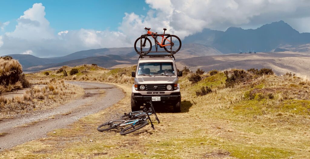
Long before Cotopaxi became a premier destination for mountain biking and bikepacking, it attracted the attention of global explorers and intellectuals. The Prussian polymath Alexander von Humboldt arrived in Ecuador in 1802, conducting an extensive survey of the regional geography and geology. It was Humboldt who famously coined the phrase the Avenue of the Volcanoes to describe the two parallel mountain ranges that line the Ecuadorian highlands. Although Humboldt attempted to ascend Cotopaxi, the treacherous conditions and primitive equipment of the era prevented him from reaching the summit crater.
The honour of the first highly detailed, successful scientific exploration of the summit went to the legendary British mountaineer, artist, and author Edward Whymper in 1880. Having achieved global fame and endured immense tragedy during his pioneering ascents in the Swiss Alps, notably the Matterhorn, Whymper turned his attention to the great Andes of the equator. Accompanied by the skilled Italian alpine guides Jean-Antoine Carrel and Louis Carrel, Whymper achieved the third recorded summit of Cotopaxi.
Proving his commitment to rigorous scientific inquiry, Whymper did not merely touch the summit and descend; he and his team spent an entire night camped directly on the lip of the active crater. Whymper utilised this high-altitude bivouac to conduct groundbreaking barometric experiments and document the nature of gaseous volcanic emissions. His detailed written accounts and intricate sketches, published in his seminal work concerning the equatorial Andes, provided the global scientific community with its first true understanding of high-altitude physiology and active volcanic architecture. Today, the spirit of Whymper lives on in every adventurer who tests their physical limits against the thin air and demanding ascents of the park.
The Galápagos.
Ecuador’s Enchanted Isles
Two wheels on lunar dirt
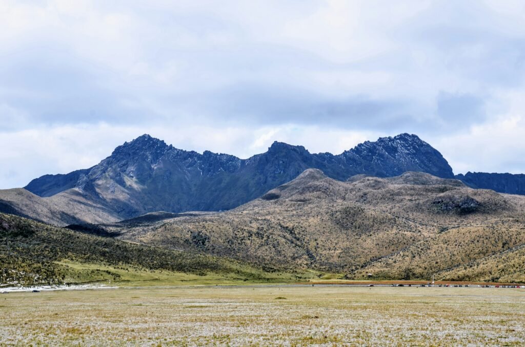
For the modern touring cyclist, exploring Cotopaxi National Park offers a thrilling communion with this dramatic history. The unique geographic positioning of the Cordillera Central provides an unusually high number of clear, crisp mornings, allowing riders to look up at the glistening white snow mantle contrasting sharply with the deep blue equatorial sky.
Riding through the park requires a distinct appreciation of altitude, as the lowest points of the central plateau rest well above 3,500 metres. The terrain presents a remarkable variety of surface textures. Cyclists will encounter everything from well-maintained, smooth volcanic dirt roads to technical, single-track pathways that cut through the tufty páramo grass. In many areas, the surroundings take on a distinctly lunar appearance, where dark, hard-packed volcanic earth winds through fields littered with ancient ejecta and strange rock formations.
One of the most notable geographic features accessible by bicycle is the Limpiopungo Lagoon, a serene, shallow body of water located in the high-altitude valley between Cotopaxi and the eroded remnants of the extinct Rumiñahui volcano. The dirt tracks encircling the lagoon offer a relatively level riding experience, allowing cyclists to focus on the spectacular avian biodiversity, including Andean gulls, wild ducks, and occasional sightings of the majestic, endangered Andean condor. The surrounding plains are also home to herds of wild horses that gallop across the yellow grasslands, creating an atmosphere of untamed freedom that perfectly matches the ethos of Wheely Tyred.
The Ecuadorian Amazon.
The most biodiverse place in the world
The ultimate challenge of the páramo
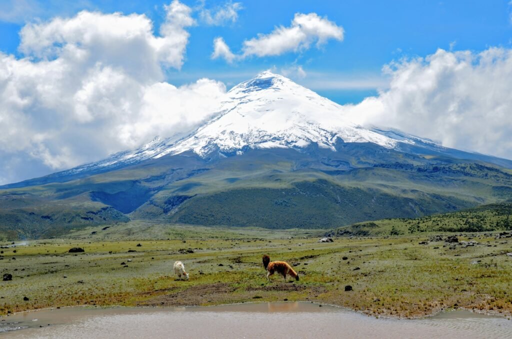
For those seeking a comprehensive multi-day cycling adventure, the Cotopaxi 360 loop represents the pinnacle of Ecuadorian bikepacking. Based on the historic cross-country racing route known as the Vuelta al Cotopaxi, this challenging circuit forms a complete loop around the circumference of the volcano. The route knits together a complex network of forest access roads, remote double-track trails, and demanding single-track paths that push both human endurance and equipment to their absolute limits.
Navigating the loop requires a specialised approach to cycling technique. The unique tropical tundra, known locally as the páramo, features thick, spongy clumps of grass that can easily snag flat pedals and disrupt a rider’s momentum. Wide tyres with front suspension are highly recommended to cope with the unorthodox surfaces and patches of deep, shifting volcanic ash that can appear unexpectedly after heavy winds. Cyclists must also be prepared for rapidly shifting weather conditions, where bright equatorial sunshine can transform into dense, freezing mountain fog or driving rain within a matter of minutes.
The route also provides an invaluable cultural window into rural Ecuadorian life. As cyclists move away from the heavily visited northern gates and venture into the more isolated southern and eastern tracts of the park, they will encounter remote indigenous communities where traditional farming practices persist. Passing through these communal lands requires respect and humility, where a polite request for passage in the local tongue reinforces the bond between the adventurous traveller and the communities that have called these volcanic slopes home for generations.
Affiliate Disclaimer: Some of the links on Wheely Tyred are affiliate links. If you click through and make a booking or purchase, we may earn a small commission at no extra cost to you. We only recommend gear, tours, stays, and services we genuinely use, trust, and stand behind — our editorial independence always comes first. These commissions help keep our independent cycling guides and travel stories free to read. Thanks for supporting the ride!
The Ecuadorian Coast.
Where you’ll find the very best food
Frequently asked questions about the history of Cotopaxi
The name is a pre-Hispanic linguistic combination of Kichwa and Aymara terms that translates to the neck of the moon. In regional indigenous mythology, the volcano was revered as a sentient deity and a provider of vital agricultural rainwater. Local folklore often rationalised its violent eruptions as expressions of anger and jealousy within a dramatic love triangle involving the neighbouring peaks of Chimborazo and Tungurahua.
The major eruptions of the eighteenth and nineteenth centuries, particularly the cataclysm of 26 June 1877, generated massive, high-velocity mudslides called lahars. The immense thermal energy of the eruption instantly melted the summit glaciers, sending torrents of meltwater, ash, and boulders down the mountain flanks. These flows carved deep canyons, buried colonial settlements like Latacunga, and left behind the vast fields of andesite boulders that define the modern topography of the national park.
British mountain explorer, author, and artist Edward Whymper achieved the first highly detailed scientific exploration of the summit in 1880. Accompanied by Italian alpine guides Jean-Antoine and Louis Carrel, Whymper summited the peak and established a camp directly on the edge of the active crater rim. This overnight stay allowed the team to conduct groundbreaking atmospheric experiments and document the nature of volcanic gas emissions for the global scientific community.
Independent cycle tourists will encounter a highly varied and physically demanding mix of surfaces within the park. The route network includes everything from well-maintained, hard-packed volcanic dirt roads to technical single-track pathways. Many sectors feature sections of deep, shifting volcanic ash, loose scree, and rugged tracks littered with ancient volcanic rock fragments that require careful line selection and technical handling.
The páramo is a specialised high-altitude tropical alpine tundra that sits well above 3,500 metres. For cyclists, the primary challenges are the thin, low-oxygen air and the unique vegetation, which is dominated by thick, spongy clumps of native grass that can easily disrupt momentum. Additionally, the weather in the páramo is notoriously volatile; bright equatorial sunshine can give way to freezing mountain fog, dense mist, or driving rain within minutes, demanding excellent navigation and high-quality layering.
As cyclists move into the more isolated southern and eastern tracts of the Cotopaxi loop, the route passes through traditional communal lands managed by indigenous farming communities. Independent travellers should approach these areas with humility and respect, keeping to established tracks and offering a polite greeting in the local tongue. Recognising that these high-altitude pastures are working agricultural environments helps ensure that the bond between adventurous travellers and local families remains strong.
Ecuador.
Pure wonder on the equator.


