
Exploring the High Andes / The ultimate guide to Cotopaxi
Top Sights in Cotopaxi National Park, Ecuador, for independent travellers
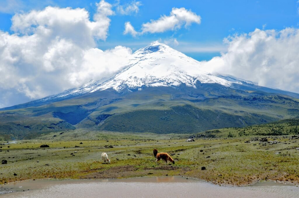
High altitudes, active volcanoes, and untamed horizons

BEN FINCH
Stepping out into the Ecuadorian highlands feels like entering a world operating on an entirely different scale. The Avenue of the Volcanoes, a dramatic double chain of peaks splitting the country down the middle, reaches its undeniable crescendo in Cotopaxi National Park. For those who choose to travel freely, charting courses based on curiosity rather than a tour guide’s rigid schedule, this region offers an unmatched sense of raw liberty. There are no crowded tour buses to wait for, no forced itineraries, and no packed crowds moving in lockstep behind a raised umbrella. Instead, the vast Andean grassland opens up to reveal a landscape shaped by fire, ice, and ancient history.
To truly understand this high-altitude playground, one must appreciate its monumental landmarks. While many visitors rush through on whirlwind day trips from the capital, taking the time to breathe the thin mountain air and explore the major sights independently reveals the true magic of the páramo. The unique alpine tundra ecosystem serves as the backdrop for iconic geographical features, colonial-era haciendas, and pre-Columbian historical sites. Whether you are looking up at a glacier from a rugged mountain refuge or watching a wild horse navigate the marshes of a glacial lagoon, Cotopaxi rewards the deliberate traveller who values deep knowledge and self-paced exploration.
The untamed horizons of the Avenue of Volcanoes
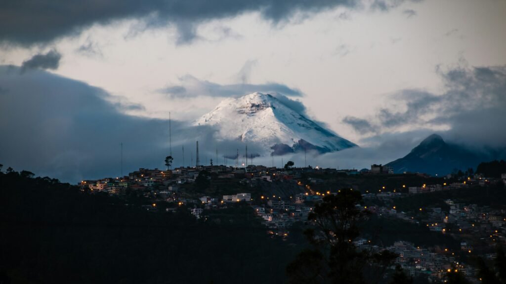
For those who map their journeys by curiosity rather than tour itineraries, Cotopaxi’s high-altitude plains offer a masterclass in raw, independent exploration. Here, the thin Andean air meets a landscape sculpted by ancient ice and living fire, perfectly suited for the deliberate traveller.
- Volcán Cotopaxi: A soaring, symmetrical giant rising 5,897 metres above sea level, standing as one of the world’s highest active stratovolcanoes and a sacred guardian in indigenous mythology
- Laguna de Limpiopungo: A high-valley wetland mirror at 3,800 metres, offering a quiet boardwalk loop where independent walkers can spot wild horses and rare Andean condors
- Refugio José Rivas: A starkly perched, red-roofed mountain shelter at 4,864 metres that challenges autonomous hikers with a gruelling, self-paced scramble over loose volcanic scree
- Pucará de Salitre: A secluded, pre-Columbian Inca military fortress on the park’s eastern fringe, offering solitary exploration among ancient stone foundations and panoramic valley views
- Volcán Rumiñahui: A jagged, extinct peak reaching 4,722 metres, highly valued by self-reliant trekkers as a rugged acclimatisation climb far from the crowded mainstream paths
- Laguna de Quilotoa: A breathtaking emerald-green crater lake nestled within an ancient collapsed caldera, shifting brilliantly from turquoise to jade under the highland sun
- Highland Dirt Tracks: A rewarding network of unpaved trails and cobblestone roads connecting the northern and southern park gates, ideal for independent cyclists and self-sufficient route planning
Cotopaxi.
The iconic volcano
Volcán Cotopaxi
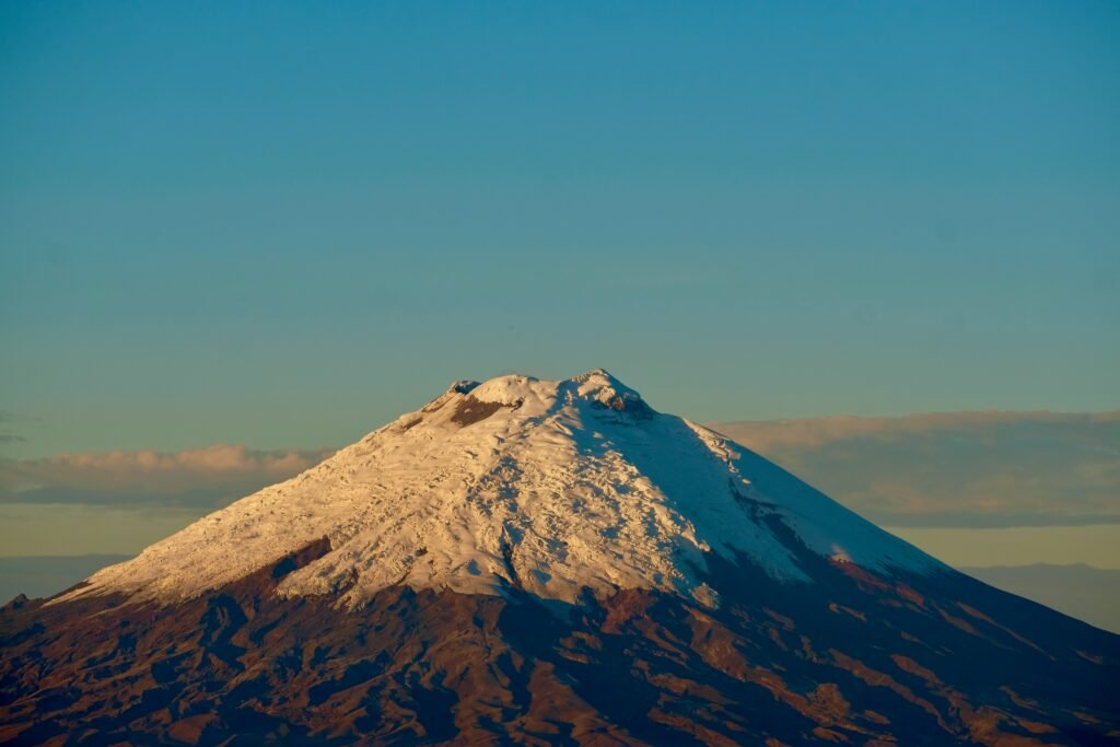
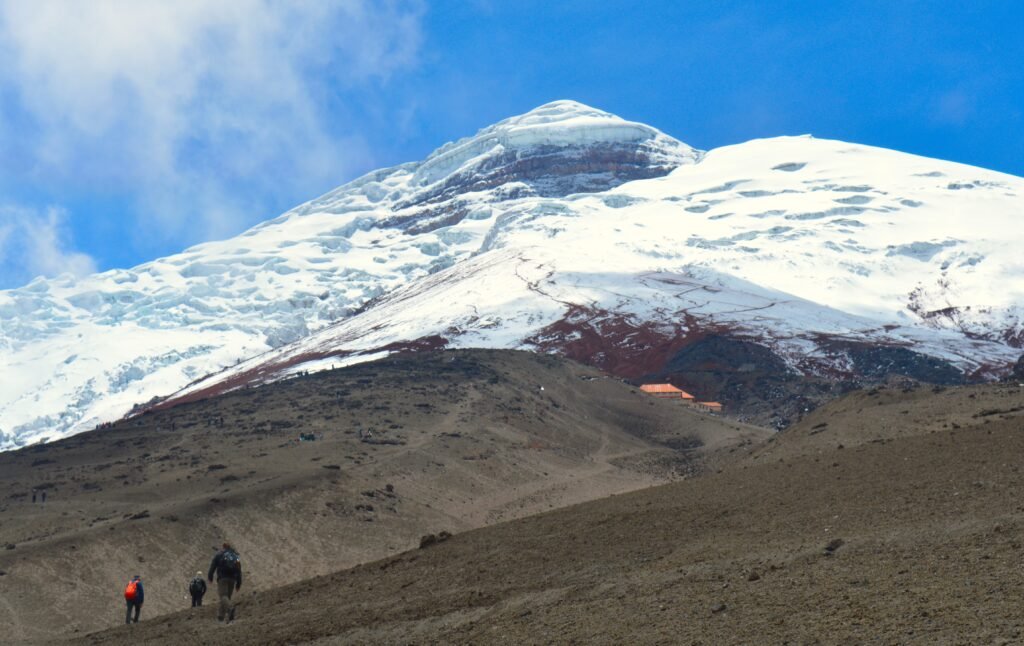
The undeniable centrepiece of the entire region is the symmetrical masterpiece that is Volcán Cotopaxi. Rising to an astonishing 5,897 metres above sea level, it stands proudly as the second-highest summit in Ecuador and one of the highest active volcanoes anywhere on Earth. Its snow-capped cone cuts a striking silhouette against the Andean sky, looking almost perfectly painted from a distance. For centuries, this active stratovolcano has been both feared and revered, occupying a central place in indigenous mythology and regional history as a sacred guardian of the mountains.
For the independent explorer, witnessing the volcano from its base provides a profound sense of perspective. The lower slopes are blanketed in dark volcanic ash, old lahars, and specialised alpine flora that manage to survive the harsh conditions. Watching the weather systems roll across the permanent ice cap reveals how quickly the mountain can shift from serene clarity to a wild, wind-whipped tempest. Understanding the sheer scale of this geological giant requires standing in its shadow, away from the chatter of large groups, simply absorbing the silent power of a mountain that continues to simmer beneath its icy exterior.
Laguna de Limpiopungo
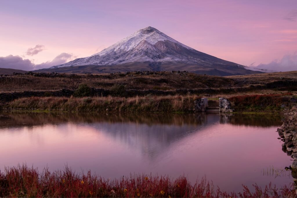
Nestled in a high valley at the foot of the volcano sits Laguna de Limpiopungo, a shallow, glacial mirror that sits 3,800 metres above sea level. This stunning body of water collects the runoff from the surrounding peaks, creating a vital wetland oasis within the otherwise arid páramo ecosystem. On clear mornings, the water surface transforms into a pristine reflection of the massive volcanic cone looming directly above it, offering one of the most spectacular vistas in South America.
A long boardwalk skirts the edge of the lake, allowing visitors to quietly wander through the reeds and marshlands without disturbing the local wildlife. The area is a haven for ornithologists and nature lovers alike, serving as a habitat for the Andean gull, various species of ducks, and the rare, endangered Andean condor soaring high on the thermal currents. The surrounding grasslands are also home to herds of wild horses and the clever colpeo, also known as the Andean fox. Walking this loop at your own pace allows you to fully take in the intricate details of high-altitude biodiversity, far removed from the hurried schedules of mainstream tourism.
The Ecuadorian Sierra.
Get lost in the hills
Refugio José Rivas
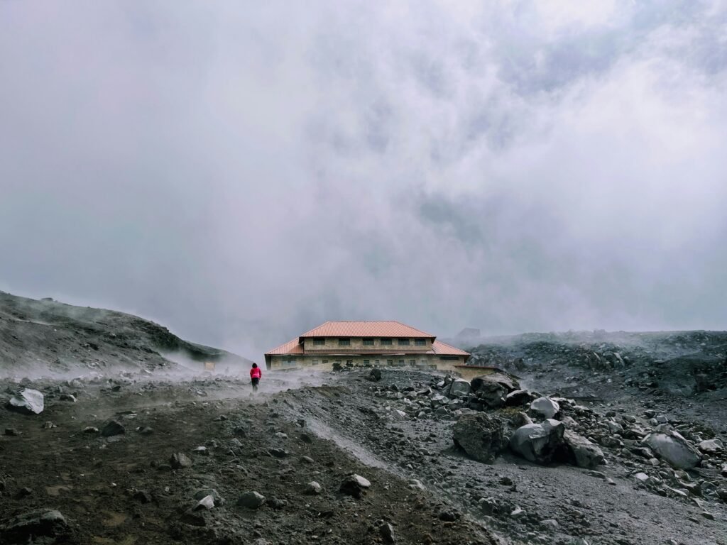
Perched precariously on the northern face of the volcano is Refugio José Rivas, a bright red-roofed mountain shelter sitting at an altitude of 4,864 metres. Built originally in 1971, this legendary mountain hut serves as the primary base camp for mountaineers attempting to summit the volcano, as well as an essential destination for day hikers looking to test their lungs against extreme elevation.
Reaching the refuge requires a short but gruelling climb from the designated upper car park. While the distance is only about one kilometre, the steep incline over loose volcanic scree, combined with the thin air, makes every step an exercise in mindful endurance. Independent travellers can take all the time they need, pacing their breathing and watching the panoramic views of the park expand with every metre gained. Once at the refuge, the warm interior provides a welcoming respite from the biting alpine winds. From this vantage point, you are just a short hike away from the lower edge of the permanent glacier, where the ice meets the bare rock in a stark display of glacial geology.
Pucará de Salitre
Located on the eastern edge of the national park, well away from the standard tourist loops, lies Pucará de Salitre. This fascinating archaeological site consists of the stone foundations of an ancient Inca military fortress, or pucará. Constructed late in the pre-Columbian era, this strategic outpost was designed to monitor movement across the highlands and secure control over the routes leading down into the Amazon basin.
Left abandoned shortly after the arrival of Spanish conquistadors, the ruins now stand as a silent testament to the vast administrative reach of the Inca Empire. The site features distinctive oval defensive walls and stone foundations that hint at the soldiers and strategists who once manned this remote outpost. Because it sits off the beaten track, visitors who make the journey here are often completely alone, free to run their hands over the weathered stones and contemplate the deep human history that predates the modern national park. The elevated position offers a spectacular, unobstructed view of the surrounding plains, making it easy to see why ancient military strategists chose this precise location.
The Galápagos.
Ecuador’s Enchanted Isles
Volcán Rumiñahui
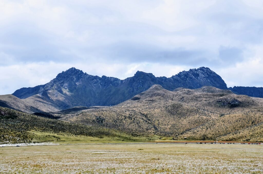
Flanking the western side of the national park is Volcán Rumiñahui, a heavily eroded extinct volcano whose jagged, craggy peaks present a dramatic contrast to the smooth cone of Cotopaxi. Named after the famous Inca general who led the resistance against Spanish colonisation, this mountain rises to 4,722 metres and features three distinct summits that challenge experienced hikers and scramblers.
Rumiñahui is highly valued by independent adventurers as a premier acclimatisation trek. The trail climbs steadily from the shores of Laguna de Limpiopungo, leading through thick pajonal grasses before giving way to rugged, rocky ridges. Unlike its snow-capped neighbour, Rumiñahui is a mountain of dark rock and dramatic cliffs, offering a completely different perspective on the geological forces that carved the Ecuadorian highlands. Climbing its ridges offers a superb view of the entire valley floor and a rare look at the untamed, less-visited corners of the reservation.
Laguna de Quilotoa
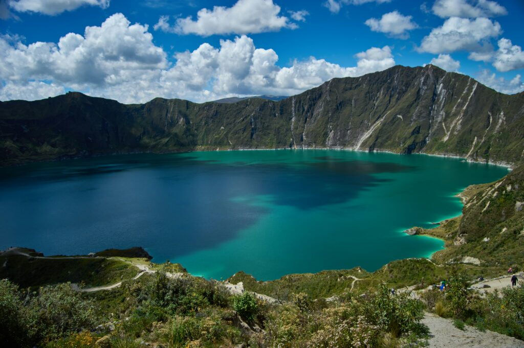
While technically located just outside the strict boundaries of the national park within the broader province, Laguna de Quilotoa is a monumental landmark that forms an essential pillar of any comprehensive highland itinerary. This jaw-dropping emerald-green crater lake was formed roughly 800 years ago when a massive volcanic eruption caused the volcano to collapse into itself, leaving behind a caldera that eventually filled with mineral-rich water.
The resulting lake shifts in colour from brilliant turquoise to deep jade depending on the angle of the sun and the mineral concentration. Independent travellers can stand on the dramatic rim, nearly 4,000 metres above sea level, and look down into the massive bowl. The sheer scale of the crater is humbling, and exploring the paths that wind along the edge allows you to experience the dramatic topography at your own leisure. It serves as a stark reminder of the immense volcanic power that continues to define the entire landscape of the central Ecuadorian Andes.
The Ecuadorian Amazon.
The most biodiverse place in the world
Local routes and regional journeys
For those looking to explore the terrain under their own steam, the network of dirt tracks and cobblestone paths surrounding the national park provides an exceptional playground for independent route-planning.
Within a 20-kilometre radius of the park gates, excellent dirt roads connect the southern control entrance near Lasso to the northern control entrance near Machachi, allowing you to trace the lower contours of the mountain away from highway traffic.
Notable short rides include the undulating trail leading to the ancient ruins of Pucará de Salitre or the circular tracks looping past the internal natural springs and the quiet shores of Santo Domingo Lake.
For rewarding day trips beyond the immediate park boundaries, the vibrant agricultural hub of Machachi to the north offers a wonderful look at traditional highland farming culture, whilst a journey further south to Latacunga provides a perfect jumping-off point to explore the wider Quilotoa Loop and sample regional culinary specialities like chugchucaras.
Affiliate Disclaimer: Some of the links on Wheely Tyred are affiliate links. If you click through and make a booking or purchase, we may earn a small commission at no extra cost to you. We only recommend gear, tours, stays, and services we genuinely use, trust, and stand behind — our editorial independence always comes first. These commissions help keep our independent cycling guides and travel stories free to read. Thanks for supporting the ride!
The Ecuadorian Coast.
Where you’ll find the very best food
Frequently asked questions about the top sights in Cotopaxi
The region features an excellent network of unpaved dirt tracks and cobblestone paths within a 20-kilometre radius of the peaks. These routes connect the southern control entrance near Lasso to the northern control entrance near Machachi, allowing autonomous travellers—particularly cyclists and trekkers—to bypass heavy highway traffic and explore the lower contours of the mountain at their own pace.
Sitting at a demanding 4,864 metres, the mountain shelter is reached via a short but gruelling one-kilometre hike from the upper car park. The trail features a steep incline over loose volcanic scree, which requires independent hikers to pace their breathing carefully against the thin air while navigating the exposed mountainside.
At locations like Laguna de Limpiopungo, the unique alpine tundra ecosystem (páramo) supports a rich variety of high-altitude species. Mindful, self-guided observers can expect to see Andean gulls, various duck species, herds of wild horses, the clever colpeo (Andean fox), and the endangered Andean condor soaring on thermal currents.
No, the emerald crater lake is technically situated outside the strict boundaries of the national park within the broader Cotopaxi province. However, it remains an essential landmark for independent travellers in the region and serves as a natural extension of a highland itinerary, easily reached via the town of Latacunga.
To the north of the park, the agricultural hub of Machachi provides an authentic glimpse into traditional highland farming culture. Further south, the town of Latacunga acts as a perfect jumping-off point for exploring the wider region and sampling local culinary specialities, such as chugchucaras.
Ecuador.
Pure wonder on the equator.


